File:Create-buildings-with-area-selector-plugin-2.gif
Jump to navigation
Jump to search
No higher resolution available.
Create-buildings-with-area-selector-plugin-2.gif (800 × 509 pixels, file size: 611 KB, MIME type: image/gif, looped, 90 frames, 9.0 s)
Note: Due to technical limitations, thumbnails of high resolution GIF images such as this one will not be animated.
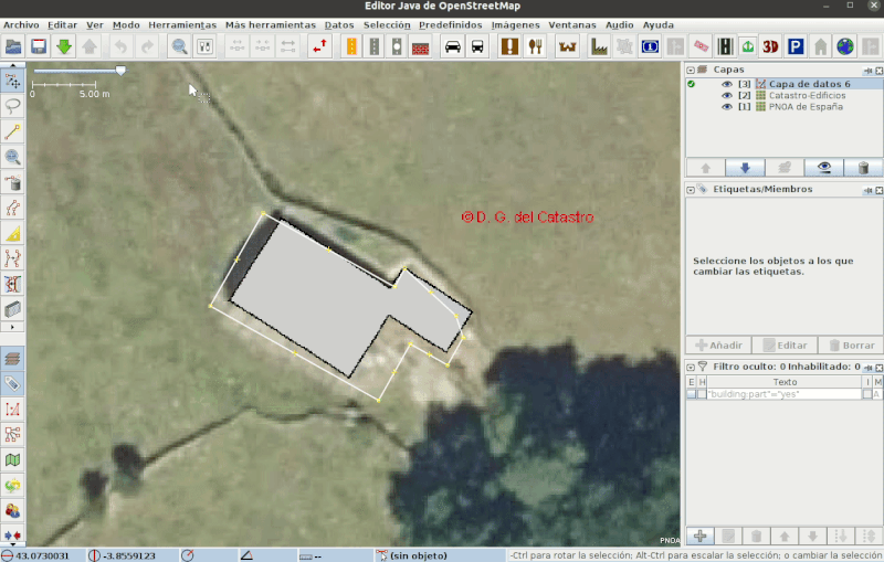
Corregir geometría de una planta de edificios con el pluging Area selector.
Licensing
![]()
This file is a screenshot of the software JOSM, with imagery in background. It may include OpenStreetMap data, in such case ODbL license also applies.
See also Spanish Cadastre/Buildings Import/Proposal.
![]()
"JOSM" (Java OpenStreetMap Editor – josm.openstreetmap.de) is free software released under the terms of the GNU General Public License as published by the Free Software Foundation; either version 2 of the license, or any later version.
Imagery in background: Plan Nacional de Ortofotografía Aérea (PNOA), © Instituto Geográfico Nacional (IGN) de España https://pnoa.ign.es/
Data displayed: INSPIRE Services of Cadastral Cartography of the General Directorate of Cadastre in Spain.See also Spanish Cadastre/Buildings Import/Proposal.
File history
Click on a date/time to view the file as it appeared at that time.
| Date/Time | Thumbnail | Dimensions | User | Comment | |
|---|---|---|---|---|---|
| current | 19:25, 5 February 2021 | | 800 × 509 (611 KB) | Corso (talk | contribs) | |
| 19:09, 5 February 2021 |  | 1,255 × 798 (1.44 MB) | Corso (talk | contribs) |
You cannot overwrite this file.
File usage
The following page uses this file: