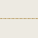
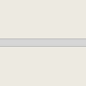
Administrative Boundary There are 4 administrative boundary that has been mapped (add and/or update) during this project.
City/Regency Boundary
Municipality Boundary
Village Boundary
Community Group (RW) Boundary
No.
Object Name
Object Type
Description
Key
Value
OSM Rendering
1.
City/Regency Boundary
A Boundary for City/Regency areas
admin_level
5
2.
Municipality Boundary
A boundary for Municipality areas
admin_level
6
3.
Village Boundary
A boundary for Village areas
admin_level
7
4.
Community Group Boundary
A boundary for Community Group areas
admin_level
9
Critical Facilities There are 11 critical facilities that become priority objects for PDC-InaWARE Indonesia Project:
Finance
Communication
Transportation
Water Supply System
Electrical Power System
Fuel Storage
Public Institution
Sport Facilities
Health Facilities
Emergency Services
Government Establishments Finance
No.
Object Name
Object Type
Description
Key
Value
OSM Rendering
Sample Picture
1.
Bank
A place that provides financial services for people, such as money deposit, money saving and credit for financial services.
amenity
bank
Communication
No.
Object Name
Object Type
Description
Key
Value
OSM Rendering
Sample Picture
1.
Communication Tower
Tower to provide and deliver communication signal
man_made
communications_tower
Transportation Water Supply Systems
No.
Object Name
Object Type
Description
Key
Value
OSM Rendering
Sample Picture
1.
Fire Hydrants
An active fire protection measure, and a source of water provided in most urban, suburban and rural areas with municipal water service to enable firefighters to tap into the municipal water supply to assist in extinguishing a fire.
emergency fire_hydrant
2.
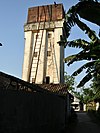
Water Towers
An elevated storage container for drinking water.
man_made
water_tower
3.
Pumping Station
A station that manage and deliver water from river/land
man_made
watermill
Electrical Power Systems
No.
Object Name
Object Type
Description
Key
Value
OSM Rendering
Sample Picture
1.
Generators
A device used to convert power from one form to another.
power
generator
2.
Tower
tower that used to support an overhead power line.
power
tower
3.
Substations
a large facilities (up to several acres) for very high voltage transmission lines or just small buildings or kiosks near the street for low voltage distribution lines.
power
substation
4.
Power Plant
A place/industrial facility where power is generated.
power
plant
Fuel Storage
No.
Object Name
Object Type
Description
Key
Value
OSM Rendering
Sample Picture
1.
Gas Station
Petrol station; gas station; marine fuel; …
amenity
fuel
Public Institution
No.
Object Name
Object Type
Description
Key
Value
OSM Rendering
Sample Picture
1.
Kindergarten
Place for kids to learn (5-6 years old)
amenity kindergarten
2.
Sekolah Dasar (SD) / Madrasah Ibtidaiyah (MI)
Elementary School
3.
Sekolah Menengah Pertama (SMP) / Madrasah Tsanawiyah (MTs)
Junior High School
File:Gerbang depan smpn 1 depok.jpg
4.
Sekolah Menengah Atas (SMA) / Madrasah Aliyah (MA)
Senior High School
5.
College
A place for further education, usually a post-secondary education institution
amenity college File:Sekolah Tinggi Teknik PLN.jpeg
6.
University
An educational institution designed for instruction, examination, or both, of students in many branches of advanced learning.
amenity university
7.
Mosque / Mushala
Place of worship for moslem
8.
Church / Capel
Place of worship for christian
9.
Hindu Temple
Place of worship for hindu
10.
Buddhist Temple
Place of worship for buddhist
11.
Supermarket
A large store for groceries and other goods.
shop
supermarket
12.
Pasar
A place where trade is regulated and traditionally, e.g. a square.
amenity
marketplace
Sport Facilities
No.
Object Name
Object Type
Description
Key
Value
OSM Rendering
Sample Picture
1.
Stadion
A building which was built as stadium. Mostly for sport activities and big events
leisure
stadium
2.
Sports Centre
TA distinct facility where a range of sports take place within an enclosed area.
leisure
sports_centre
3.
Pitch
An area designed for playing a particular sport, normally designated with appropriate markings.
leisure
pitch
Health Facilities
No.
Object Name
Object Type
Description
Key
Value
OSM Rendering
Sample Picture
1.
Clinic
A medium-sized medical facility or health centre.
amenity clinic
3.
Hospital
institutions for health care providing treatment by specialised staff and equipment, and typically providing nursing care for longer-term patient stays.
amenity hospital
Emergency Services
No.
Object Name
Object Type
Description
Key
Value
OSM Rendering
Sample Picture
1.
Police Station
A station from which the police operates.
amenity
police
2.
Fire Station
A station from which the fire brigade operates.
amenity
fire_station
Government Establishment
No.
Object Name
Object Type
Description
Key
Value
OSM Rendering
Sample Picture
1.
Kantor RW
Community Group Office
File:Kantor rw.png
2.
Kantor Desa/Kelurahan
Village Government Office
3.
Kantor Kecamatan
Subdistrict Government Office
4.
Kantor Bupati/Walikota
District Government Office
File:Kantor Bupati Malang Kepanjen.jpg
5.
Kantor Gubernur
Province Government Office
File:800px-Kangubsumbar.jpg
6.
Government Office
An office of a (supra)national, regional or local government agency or department
office
government
7.
Kedutaan Besar
A representation of a country in another country.
amenity
embassy
Required Key and Value for Any Building Objects for Critical Facilities
No.
Information
Key
Value
Description
1.
Building Type
building
User Defined meaning that the value is determined by the user in accordance with the information of the building.
For example our object is school then we can add tag building=school here
2.
Building levels
building:levels
User Defined meaning that the value is determined by the user in accordance with the information of the building.
For example our object has 3 floors then we can add tag building:levels=3 here
3.
Building Structure
building:structure
reinforced_masonry
unreinforce_masonry
platered
confined_masonry
brick
wood
the value is determined by the user in accordance with the information about the building structure. For example, the building has reinforced masonry structure then we can add tag building:structure=reinforced_masonry here
4.
Building Addresss
addr:full
User Defined meaning that the value is determined by the user in accordance with the information of the building.
For example, our building located at Jalan MH.Thamrin then we can add tag addr=Jalan M.H Thamrin here
5.
Building's Name
name
User Defined meaning that the value is determined by the user in accordance with the information of the building.
For example our building name Kafe Enak then we can add tag name=Kafe Enak here
6.
Building Wall
building:walls
Determined by what wall that the building has. For example the building builded with brick wall so we can add tag building:walls=brick here
7.
Building Roof
building:roof
tile
tin
asbestos
concrete
Determined by what roof that the building has. For example the building has tile roff so we can add tag building:roof=tile here
8.
Roof Access
access:roof
If the building has an access to the roof then we have to add tag access:roof=yes here
Roads, Railway and Waterway There are 11 categories of road that has been mapped (add and/or edit) in this project.
Motorway
Trunk
Primary
Secondary
Tertiary
Residental
Pedestrian
Path
Services
Living Street
Unclassified
No.
Object Name
Object Type
Description
Key
Value
OSM Rendering
Sample Picture
1.
Motorway
Free Way. Only for cars and it is paid road
highway
motorway
2.
Trunk
Roads that connected administrative area. It can be city level, regency level or province level.
highway
trunk
3.
Primary Road
Primary way in the mapping area.
highway
primary
4.
Secondary Road
Secondary way in the mapping area. Connected with primary way
highway
secondary
5.
Tertiary Road
Tertiary way in the mapping area. Connected with secondary way
highway
tertiary
6.
Residential
Ways that located in residential area
highway
residential
7.
Pedestrian
Ways for pedestrian. Any vehicles can not passing this way. Usually found in tourism area or shopping area
highway
pedestrian
8.
Path
Way that can only passing by motorcycle and by foot. It width around < 1.5 meter.
highway
path
9.
Service Way
Service way. Usually found in commercial building, mall and rest area.
highway
services
File:Jakarta7.JPG
10.
Living Street
Small way in residential area. it's width around 1.5 - 2 meter.
highway
living_street
centerr
11.
Track
Small way. Usually for hiking route or found in rice fields.
highway
track
12.
Unclassified way
Unknwon way based on its category.
highway
road
13.
Railway
Path / way for train
railway
rail
14.
River
The linear flow of a river, in flow direction.
waterway
river
15.
Reservoir
an artificial lake is used to store water.
landuse
reservoir
16.
River Bank
A wide river as defined by its area.
waterway
riverbank


