Tag:historic=tomb
Jump to navigation
Jump to search
 |
| Description |
|---|
| A structure where somebody has been buried. |
| Group: historic |
| Used on these elements |
| Useful combination |
| See also |
| Status: approved |
| Tools for this tag |
|
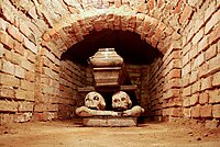
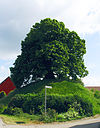
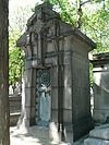
This tag is for mapping tombs; i.e., built structures, sometimes underground, where people have been buried.
How to map
Place a node ![]() in the middle of the tomb or map the outline
in the middle of the tomb or map the outline ![]() of the tomb.
of the tomb.
Detailed tagging
To add further detail you can use the key tomb=* with the following values:
| Tag | Description | Photo |
|---|---|---|
| tomb=loculi | 
| |
| tomb=tumulus | 
| |
| tomb=rock-cut | 
| |
| tomb=hypogeum | 
| |
| tomb=war_grave | A single |

|
| tomb=mausoleum | 
| |
| tomb=columbarium | 
| |
| tomb=crypt | 
| |
| tomb=pyramid | 
| |
| tomb=sarcophagus | 
| |
| tomb=vault | 
| |
| tomb=turbe | A |
 
|
| tomb=table | A table-shaped tomb built above the grave and supported by a series of pillars. |  
|
| Do not use this tag because a cenotaph is not a kind of tomb. Use historic=memorial or historic=monument instead. | 
| |
| Do not use this tag because a tombstone is not a kind of tomb. it is a part of a tomb. | 
|
This table is a wiki template with a default description in English. Editable here.
See also
- buried:wikidata=* - the buried person
- historic:civilization=* - the culture which has built the grave
- historic=archaeological_site
- historic=cemetery - To map a historic cemetery
- cemetery=grave - a grave is a place dug into the ground for the burial of a corpse.
- Proposed features/tombs - proposal for this tag
- JOSM/Plugins/Tomb Plugin
- man_made=tomb – a tomb without historical value
Maps
- Open Burial Map: The "All OSM keys" source displays tombs with buried=*, buried:wikidata=* or subject:wikidata=*