Tag:man_made=water_well
 |
| Description |
|---|
| A structural facility to access ground water, created by digging or drilling. |
| Group: man made |
| Used on these elements |
| Useful combination |
|
| Status: de facto |
| Tools for this tag |
|
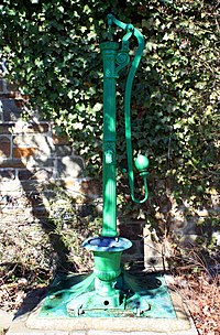
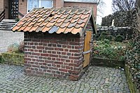
A ![]() water well is a structural facility created to access ground water from an aquifer. It is a vertical or sometimes horizontal excavation, shaft or structure created in the ground by digging, driving, boring or drilling. The subsurface water is usually drawn by pumping or raising containers, such as buckets.
water well is a structural facility created to access ground water from an aquifer. It is a vertical or sometimes horizontal excavation, shaft or structure created in the ground by digging, driving, boring or drilling. The subsurface water is usually drawn by pumping or raising containers, such as buckets.
How to map
Place a node ![]() at the location of the water well or draw an area
at the location of the water well or draw an area ![]() and use man_made=water_well. You can also name it with name=*.
and use man_made=water_well. You can also name it with name=*.
| Key | Value | Description |
|---|---|---|
| name | A name | Name |
| operator | Operator name | Operator of the Well |
| drinking_water | yes/no | Indication whether a feature provides drinking water |
| ref | A reference | Number |
| pump | powered/manual/no | Whether the well has a pump and how this is powered |
| pump_mechanism | - | Available pump mechanism on the well |
| pump:style | modern/historic | |
| pump:status | ok/locked/broken/missing_beam | The condition of the pump |
| mechanical_driver | electric_motor,combustion_engine... | Available driver to operate the pump |
| handle | lever,wheel... | Available handle to operate a manual pumping mean on the well |
Rendering
| OSM Carto | OSMC Reitkarte | Humanitarian_map_style | OpenCycleMap |
|---|---|---|---|
| Ticket #1224 | ? |
Examples
| Image | Tags | OSM Carto | Humanitarian map style |
|---|---|---|---|

3433501037 |
man_made=water_well
|
||
 |
man_made=water_well
pump=manual
|
||

3063462382 |
man_made=water_well
name=Studnia zamkowa
|
||

3645853312 |
man_made=water_well
pump=no
|
||

3888332160 |
man_made=water_well |
||

228637693 |
man_made=water_well
pump=no
|
||

267472342 |
man_made=water_well
pump=no
|
||

|
man_made=water_well | ||

|
Shadoof / Sweep Well |
Possible tagging mistakes
See also
- pump=* – Specifies how the water is drawn from the well
- pump_mechanism=* – Precise pumping mechanisms classification
- mechanical_driver=* – Precise motion source classification for pumps
- man_made=spring_box – A structure built for catching groundwater from a natural spring for water supply
- man_made=water_works – Water treatment for drinking water
- man_made=water_tower – Storage container for drinking water
- man_made=wastewater_plant – Sewage treatment for wastewater
- man_made=petroleum_well – Oil well
- man_made=pumping_station
- man_made=windpump – Pump that is operated with wind force
- amenity=fountain – A fountain for cultural / decorative / recreational purposes.
- amenity=watering_place – Water for animals
- amenity=drinking_water – Drinking water for humans
- natural=spring – Water flows to the surface of the earth from underground
- place_of_worship=holy_well – A well or spring considered sacred in some religions
- Proposed_features/water_network
- Water wells in Berlin


