Template:Zh-hans:Map Features:information
Jump to navigation
Jump to search
Information
| 键 | 值 | 要素 | 描述 | 渲染 | 图片示例 |
|---|---|---|---|---|---|
| information | office | 可以获取有关城镇或地区信息的办公室。 |  | ||
| information | visitor_centre | 可以获取特定景点或名胜古迹信息的地方。 |  | ||
| information | board | 信息牌,详情见board_type=* |  | ||
| information | terminal | 提供信息的电子屏幕,通常可以联网。参见internet_access=* |  | ||
| information | audioguide | 可以使用耳机或手机获取信息的地方。 |  | ||
| information | map | 地图板。要指定类型或详细信息,参见Tag:information=map中的map_type=*和map_size=*。如要描述地图所示的是什么路线,请使用access键,例如hiking=yes、bicycle=yes或ski=yes。 |   | ||
| information | tactile_map | 为盲人提供的触觉地图 |  | ||
| information | tactile_model | 为盲人提供的建筑物或环境模型 |  | ||
| information | guidepost | 路标/指南/指路牌通常可在远足或自行车路线上找到,用以指示不同方向的目的地。如要描述路牌所示的是什么路线,请使用access键,例如hiking=yes、bicycle=yes或ski=yes。 |  | ||
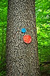
| information | trail_blaze | 标示道路位置的标记。可能是符号、短杆或涂漆的标记。参见trailblazed=*。 注意:当前使用2种标记变体。 用于显示路线方向的标志,而不提供有关目的地或特定路线的任何信息(路标之间的标记)建议使用route_marker。(如果标记是如示例中所示的自行车路线,请与bicycle=yes组合使用)。 |
   | ||
| information | stele | 提供信息的石碑。 |  | ||
| information | user defined | 根据Taginfo的所有常用值 |
此表是一个wiki模板。 点击此处进行编辑.
[Create]  Template documentation


