Template:Fi:Map Features:landuse
Jump to navigation
Jump to search
Maankäytön luokittelu / landuse
Erilaisia luokituksia alueille. Koska harvoilla paikkakunnilla on saatavilla tarpeeksi hyviä ilmakuvia talojen paikantamiseksi, voi alueita merkata pääasiallisen käyttötarkoituksen mukaan.
| Key | Value | Element | Description | Rendering | Photo | |
|---|---|---|---|---|---|---|
Common landuse key values - developed land | ||||||
| landuse | commercial | Alueella pääasiallisesti toimistoja |  |
 | ||
| landuse | construction | Rakennustyömaa |  |
 | ||
| landuse | education | An area predominately used for educational purposes/facilities. |  | |||
| landuse | fairground | A site where a fair takes place |  | |||
| landuse | industrial | Teollisuusalue |  |
 | ||
| landuse | residential | Alueella pääasiallisesti asutusta |  |
 | ||
| landuse | retail | Alueella pääasiallisesti kauppoja |  |
 | ||
| landuse | institutional | Land used for institutional purposes, see The meaning of this tag is ambiguous and unclear by some. Consider using another tag that better describes the object. For instance landuse=civic_admin. |
 | |||
| Key | Value | Element | Description | Rendering | Photo | |
Common landuse key values - rural and agricultural land | ||||||
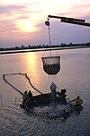
| landuse | aquaculture | Warning: currently, there is no convention on the exact meaning of this tag. Therefore, it makes sense to treat it like "boundary of aquaculture" (without implication of water body), which means, water body should be tagged by its own, using natural=water etc. |
 | |||
| landuse | allotments | Siirtolapuutarha |  |
 | ||
| landuse | farmland | An area of farmland used for tillage (cereals, vegetables, oil plants, flowers). |  |
 | ||
| landuse | farmyard | Maatilojen piha-alueet. |  |
 | ||
| landuse | paddy | An area of land where the surface and shape of the land is made suitable for growing rice. |  | |||
| landuse | animal_keeping | An area of land that is used to keep animals, particularly horses and livestock. |  | |||
| landuse | flowerbed | An area designated for flowers |  |
 | ||
| landuse | forest | Talousmetsä. Suomessakin moni metsä on hoidettua talousmetsää vaikkei olisi siistiä puurivistöä aluskasvillisuudesta paljaana ja kangasmetsän aluskasvillisuus on matalaa muutoinkin. Tuntomerkkejä:
Erityisesti (joissain) taajamissa on viime aikoina kuitenkin pyritty luonnontilaistamaan metsäalueita. |
 |
 | ||
| landuse | logging | An area where some or all trees have been cut down |  | |||
| landuse | greenhouse_horticulture | Area used for growing plants in greenhouses |  |
 | ||
| landuse | meadow | A meadow or pasture: land primarily vegetated by grass and non-woody plants, mainly used for hay or grazing |  |
 | ||
| landuse | orchard | intentional planting of trees or shrubs maintained for food production |  |
 | ||
| landuse | plant_nursery | intentional planting of plants maintaining for the production of new plants |  |
 | ||
| landuse | vineyard | Viinitarha |  |
 | ||
| Key | Value | Element | Description | Rendering | Photo | |
Common landuse key values - waterbody | ||||||
| landuse | basin | An area artificially graded to hold water.
Together with basin=* for stormwater/rainwater infiltration/detention/retention basins. |
 |
 | ||
| Tekojärvi |  |
 | ||||
| landuse | salt_pond | A place where salt (saline) water is evaporated to extract its salt. |  |
 | ||
| Key | Value | Element | Description | Rendering | Photo | |
Other landuse key values | ||||||
| landuse | brownfield | Tulossa olevaa rakentamista, missä vanhat talot on jo purettu. |  |
 | ||
| landuse | cemetery | Hautausmaa. Voit lisätä religion=* -tagilla tiedon uskontokunnasta. |  |
 | ||
| Protected areas (deprecated) Alternate tagging of same thing: boundary=protected_area, protected_area=* | ||||||
| landuse | depot | An area used as a depot for e.g. vehicles (trains, buses or trams). Consider using rather standard landuse tags like landuse=railway, landuse=commercial, landuse=industrial, with subtag like industrial=depot. |  | |||
| landuse | garages | One level buildings with boxes commonly for cars, usually made of brick and metal. Usually this area belong to garage cooperative with own name, chairman, budget, rules, security, etc. |  |
 | ||
| landuse | grass | An area of mown and managed grass not otherwise covered by a more specific tag. Some view this as not a landuse, see the main page landuse=grass for discussion. |  |
 | ||
| landuse | greenfield | Tulossa olevaa rakentamista, missä ei ole aiemmin ollut rakennuksia. |  |

| ||
| landuse | landfill | Kaatopaikka |  |
 | ||
| landuse | military | Puolustusvoimien suljettu alue |  |
 | ||
| landuse | port | coastal industrial area where commercial traffic is handled. Consider using landuse=industrial + industrial=port for this type of industrial area. |  | |||
| landuse | quarry | Avolouhos |  |
 | ||
| landuse | railway | Rautatiealue, ratapihat yms. mihin ulkopuolisilla ei ole asiaa. |  |
 | ||
| landuse | recreation_ground | Ulkoilualue, sisältää yleensä jonkinlaisia kuntoilurakennelmia. |  |
 | ||
| landuse | religious | An area used for religious purposes |  |
 | ||
| landuse | village_green | Englantilainen erikoisuus, tietynlainen "kylän puisto". Ei käytössä Suomessa. |  |
 | ||
| landuse | greenery | Used for any area covered with landscaping or decorative greenery, regardless of it being on a roundabout, along a street or in a park/garden, This tag has been used for vegetation that is hard to classify, either because its kind or because its diversity. |  | |||
| landuse | winter_sports | An area dedicated to winter sports (e.g. skiing) |  | |||
| landuse | user defined | All commonly used values according to Taginfo | ||||
This table is a wiki template with a default description in English. Editable here.