Template:NL:Map Features:landuse
This template defines Dutch values for Template:Map_Features:landuse.
Grondgebruik
Gebruik natural=* voor niet door mensen bewerkte oppervlakten.
| Key | Waarde | Element | Omschrijving | Resultaat | Foto | |
|---|---|---|---|---|---|---|
Common landuse key values - developed land | ||||||
| landuse | commercial | Commercieel
Vooral diensten en handel, de tertiaire sector |
 |
 | ||
| landuse | construction | Bouwterrein
Hier wordt gebouwd of wordt een gebied "bouwrijp" gemaakt. Als het bouwen klaar is, krijgt het terrein een andere functie en verdwijnt "construction" als "tag". |
 |
 | ||
| landuse | education | Educatie
Aanvulling op amenity=* tags voor educatieve instellingen; met name nuttig wanneer er meerdere instellingen op eenzelfde locatie zijn. |
 | |||
| landuse | fairground | A site where a fair takes place |  | |||
| landuse | industrial | Industriegebied |  |
 | ||
| landuse | residential | Woningen en appartementen (hoofdzakelijk). |  |
 | ||
| landuse | retail | Winkelgebied |  |
 | ||
| landuse | institutional | Land used for institutional purposes, see The meaning of this tag is ambiguous and unclear by some. Consider using another tag that better describes the object. For instance landuse=civic_admin. |
 | |||
| Key | Waarde | Element | Omschrijving | Resultaat | Foto | |
Common landuse key values - rural and agricultural land | ||||||
| landuse | aquaculture | Aquacultuur | 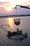 | |||
| landuse | allotments | Volkstuinen |  |
 | ||
| landuse | farmland | Akker |  |
 | ||
| landuse | farmyard | Boerenerf |  |
 | ||
| landuse | paddy | An area of land where the surface and shape of the land is made suitable for growing rice. |  | |||
| landuse | animal_keeping | An area of land that is used to keep animals, particularly horses and livestock. |  | |||
| landuse | flowerbed | Bloembed |  |
 | ||
| landuse | forest | Bosbouw |  |
 | ||
| landuse | logging | An area where some or all trees have been cut down |  | |||
| landuse | greenhouse_horticulture | Glastuinbouw
Afzonderlijke kassen zijn te labelen met building=greenhouse. |
 |
 | ||
| landuse | meadow | Hooiland of Graasweide |  |
 | ||
| landuse | orchard | Boomgaard |  |
 | ||
| landuse | plant_nursery | Plantenkwekerij |  |
 | ||
| landuse | vineyard | Wijngaard |  |
 | ||
| Key | Waarde | Element | Omschrijving | Resultaat | Foto | |
Common landuse key values - waterbody | ||||||
| landuse | basin | Waterbekken (zie ook water=basin) |  |
 | ||
| Verouderde tag voor een stuwmeer. Zie hiervoor water=reservoir. |  |
 | ||||
| landuse | salt_pond | Zoutwinning |  |
 | ||
| Key | Waarde | Element | Omschrijving | Resultaat | Foto | |
Other landuse key values | ||||||
| landuse | brownfield | Braakliggend terrein |  |
 | ||
| landuse | cemetery | Begraafplaats.
Zie ook amenity=grave_yard voor kerkhoven. |
 |
 | ||
| Protected areas (deprecated) Alternate tagging of same thing: boundary=protected_area, protected_area=* | ||||||
| landuse | depot | An area used as a depot for e.g. vehicles (trains, buses or trams). Consider using rather standard landuse tags like landuse=railway, landuse=commercial, landuse=industrial, with subtag like industrial=depot. |  | |||
| landuse | garages | Garageboxen
Aantal garages op een rij, meestal achter of temidden van huizen en eventueel toegankelijk via een highway=service |
 |
 | ||
| landuse | grass | Grasveld
Met landbouwfunctie (grazen en maaien) eerder landuse=meadow. |
 |
 | ||
| landuse | greenfield | Ontwikkelingsgebied |  |

| ||
| landuse | landfill | Vuilstortplaats |  |
 | ||
| landuse | military | Militair terrein. Zie ook military=* en military_service=*. |  |
 | ||
| landuse | port | coastal industrial area where commercial traffic is handled. Consider using landuse=industrial + industrial=port for this type of industrial area. |  | |||
| landuse | quarry | Groeve /Mijnbouw |  |
 | ||
| landuse | railway | Spoorwegemplacement, spoorbedding
In het algemeen ontoegankelijk voor het publiek. |
 |
 | ||
| landuse | recreation_ground | Recreatiegebied |  |
 | ||
| landuse | religious | Religieus |  |
 | ||
| landuse | village_green | Brink (dorpsplein)
Grasvlakte waar kermis, markt of demonstraties gehouden worden (bijvoorbeeld het Malieveld te Den Haag). Zie forumdiscussies [1][2] |
 |
 | ||
| landuse | greenery | Used for any area covered with landscaping or decorative greenery, regardless of it being on a roundabout, along a street or in a park/garden, This tag has been used for vegetation that is hard to classify, either because its kind or because its diversity. |  | |||
| landuse | winter_sports | An area dedicated to winter sports (e.g. skiing) |  | |||
| landuse | zelf gedefinieerd | Zie ook Taginfo[3] voor meer informatie. | ||||
This table is a wiki template with a default description in English. Editable here.