Template:IT:Map Features:properties
(Redirected from Template:It:Map Features:properties)
Properties (proprietà)
| Chiave | Valore | Elemento | Spiegazione | Foto |
|---|---|---|---|---|
| area | yes | Per indicare che un elemento (normalmente lineare) costituito da un linea chiusa rappresenta un'area (disegnata con colore pieno). Non andrebbe aggiunto a elementi che sono già definiti come aree. | 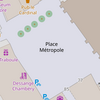 | |
| brand | user defined | Brand of the feature. |  | |
| bridge | yes / aqueduct / viaduct / cantilever / movable / covered / … | Ponte o cavalcavia, da usare assieme all'attributo layer. |  | |
| capacity | amount | Used for specifying capacity of a facility. |  | |
| charge | Importo | Utilizzato per specificare quanto viene addebitato per l'uso/accesso ad un impianto. Vedi toll=* o fee=*. | ||
| clothes | see key's page | Tagged on shops and other features to denote if they sell clothes or not and what type of clothes they sell. |  | |
| covered | yes | Indica che un oggetto è coperto da un altro oggetto, quando l'uso di layer non è appropriato. Può essere usato anche per contrassegnare oggetti interrati, come elettrodotti, condotte dell'acqua o cisterne. |  | |
| crossing | no / traffic_signals / uncontrolled / island / unmarked | Descrizione supplementare per nodi che sono già etichettati con highway=crossing o railway=crossing. |  | |
| crossing:island | yes / no | Specifies whether a pedestrian crossing has a refuge island |  | |
| cutting | yes / left / right | Un Taglio nella terra/roccia (solitamente artificiale) o trincea in cui passa una strada o una ferrovia. Tipicamente usato in zone collinari per diminuire le pendenze. [1] |  | |
| disused | yes | Per caratteristiche che sono utili alla navigazione, ma sono al momento non più utilizzate o abbandonate. Quando un oggetto è etichettato disused=yes, anche tutte quelle etichette che per tale motivo non ne descrivono più lo stato attuale devono essere precedute da disused: (es: disused:amenity=pub). |  | |
| drinking_water | yes / no | Describes whether a drinking water is available |  | |
| drive_through | yes / no | Drive-through: indica che un servizio (es.: farmacia, banca, bancomat, fast food, cassetta delle lettere) può essere usufruito passando con l'automobile davanti ad uno sportello, senza posteggiare. |  | |
| drive_in | yes / no | Drive-in: indica che in un locale pubblico (es.: ristorante, cinema) si può ricevere il servizio restando nell'automobile posteggiata. Da non confondere con drive_through=*. |  | |
| electrified | contact_line / rail | Indica le infrastrutture per la fornitura di energia ai veicoli elettrici su binari. |  | |
| ele | Numero | Altitudine in metri sul livello del mare, riferiti al sistema geodetico WGS84. | 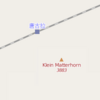 | |
| embankment | yes | Terrapieno/Argine. |  | |
| end_date | Data | Data in cui è stato eliminato l'elemento. |  | |
| est_width | Numero | Una stima grossolana della larghezza di una via, in metri. | 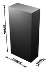 | |
| fee | yes / no | Used for specifying whether fee is charged for use/access to a facility. See also toll=*. | 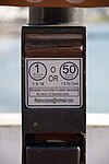 | |
| fire_object:type | poo / szo | Oggetti potenzialmente pericolosi e socialmente rilevanti. | ||
| fire_operator | Nome | Caserma dei pompieri, che serve l'oggetto. | ||
| fire_rank | 1bis / 2 to 5 | Classificazione per il fuoco, definito per un oggetto particolare. | ||
| frequency | Numero | Frequenza in Hz |  | |
| hazard | see hazard | Indicates of the hazards. |  | |
| hot_water | yes / no | Describes whether a hot water is available | ||
| inscription | Definito dall'utente. | Il testo completo delle iscrizioni, che si trovano su edifici, monumenti ed altri oggetti. |  | |
| internet_access | yes / wired / wlan / terminal / no | Specifica se un oggetto mappato (edificio, esercizio commerciale, ristorante, ecc.) offre un accesso pubblico a internet (gratuito o a pagamento). |  | |
| layer | da -5 a 5 | Utilizzato per definire l'altezza relativa (non assoluta!) di diverse linee o di una superficie. 0: livello del terreno; -1: sotto il livello del terreno; 1 (non +1): sopra il livello del terreno.
Indica una separazione fisica, non va usato per influenzare l'ordine con cui vengono renderizzati elementi allo stesso livello. |
 | |
| leaf_cycle | evergreen / deciduous / semi_evergreen / semi_deciduous / mixed | Descrive la fenologia (ciclo) delle foglie (sempreverdi, decidue, parzialmente sempreverdi, parzialmente decidue, miste). |  | |
| leaf_type | broadleaved / needleleaved / mixed / leafless | Descrive il tipo di fogliame(latifoglie,conifere, miste, spoglio). |  | |
| location | underground / overground / underwater / roof / indoor | Posizione dell'oggetto (sottoterra, sopra il suolo, sott'acqua, terrazzo, al coperto) |  | |
| narrow | yes | Indica i tratti in cui una via (corso d'acqua navigabile, strada, pista ciclabile) si restringe (relativamente ai rimanenti tratti). |  | |
| nudism | yes / obligatory / designated / no / customary / permissive | Indica se l'oggetto descritto prevede la possibilità del nudismo. |  | |
| opening_hours | 24/7 o mo md hh:mm-hh:mm. (leggere la descrizione della sintassi) | Descrive quando un oggetto è aperto. |  | |
| opening_hours:drive_through | 24/7 or mo md hh:mm-hh:mm. (read described syntax) | opening_hours describes when something is open for drive-through services. |  | |
| operator | Definito dall'utente | Gestore, può essere usato per citare una compagnia o una azienda che è responsabile per un oggetto o che lo gestisce. | ||
| power_supply | yes / no | Describes whether a power supply is available | 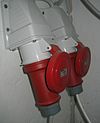 | |
| produce | User Defined | Describes a feature's agricultural output produced though a natural process of growing or breeding. |  | |
| rental | see key's page | Tagged on shops and other features to denote if they rent something or not and what they rent. |  | |
| sauna | yes / no | Describes whether a sauna is available |  | |
| service_times | Vedi opening_hours | Tempi di servizio di una determinata caratteristica per esempio una messa. |  | |
| shower | yes / no | Describes whether a shower is available |  | |
| sport | soccer / tennis / basketball / baseball / multi / ... | Describes which sports are placed on a facility such as a pitch or stadium. |  | |
| start_date | Data | Data in cui è stato creato l'elemento. |  | |
| tactile_paving | yes /no | Indica se un luogo specifico può essere rilevato o seguito con il bastone di un cieco. |  | |
| tidal | yes | Area invasa dalla marea. |  | |
| toilets | yes / no | Describes whether a toilets is available |  | |
| topless | yes / no | Indicates if the described object provides the possibility of female topless practice |  | |
| tunnel | yes | Galleria/Tunnel, da usare assieme all'attributo layer. |  | |
| toilets:wheelchair | yes / no | Indica se è presente una toilette accessibile alle sedie a rotelle. | 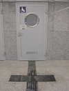 | |
| wheelchair | yes / no / limited | Indica se un determinato elemento è predisposto per essere usufruito anche con sedie a rotelle. |  | |
| width | Numero | Larghezza di una via, in metri. |  | |
| Si usa con le etichette landuse=forest, landuse=wood e natural=wood per specificare il tipo di alberi (coniferous per le conifere, deciduous per le caducifoglie, mixed per un misto di entrambe). Ragionevolmente andrebbe usato principalmente per le aree. |  |
This table is a wiki template with a default description in English. Editable here.
