Ca:Elements cartogràfics
Si comprens l'article original en anglès, si us plau, ajuda a completar aquesta traducció al català. Llegeix les instruccions sobre com traduir aquest wiki.
Jemily1 està treballant ara en aquesta traducció.
L'OpenStreetMap representa elements cartogràfics físics existents sobre el terreny (p. ex., carreteres o edificis) usant etiquetes adjuntes a la seva estructura de dades bàsica (nodes, vies i relacions). Cada etiqueta descriu un atribut geogràfic de l'element cartogràfic que es mostra per aquest node, via o relació específica.
El sistema d'etiquetatge lliure de l'OpenStreetMap permet que el mapa inclogui un nombre il-limitat d'atributs que descriuen cada element cartogràfic. La comunitat acorda unes certes combinacions de claus i valors per a les etiquetes més comunament usades, que actuen com a estàndars informals. Malgrat tot, els usuaris poden crear noves etiquetes per millorar l'estil del mapa o per recolzar anàlisi que es basen en atributs prèviament no cartografiats dels elements cartogràfics. Es poden trobar descripcions curtes de les etiquetes que es relacionen amb temes o interessos particulars usant les pàgines d'elements cartogràfics.
La majoria d'elements cartogràfics poden descriure's usant únicament un petit nombre d'etiquetes, tal com una senda a peu amb una etiqueta de classificació com highway=footway i potser també un nom amb name=*. Tanmateix, atès que aquest és un mapa global i inclusiu, pot haver-hi molts tipus d'elements cartogràfics diferents a l'OpenStreetMap, la majoria de les quals es descriuen mitjançant etiquetes.
Per a detalls de més etiquetes i canvis proposats de les etiquetes existents, vegeu Elements cartogràfics proposats, Elements cartogràfics inactius i Elements cartogràfics obsolets. Si no trobes una etiqueta adequada a la llista, sent.te lliure de crear alguna cosa adequada sempre que els valors de les etiquetes siguin verificables. Amb el temps, és possible que el nom de l'etiqueta canviï per ajustar-se a un consens més ampli. Malgrat tot, moltes bones etiquetes es van usar primer i es van documentar més tard.
Elements cartogràfics principals
Aerialway (transport aeri per cable)
| Clau | Valor | Element | Comentaris | Representació | Fotografia | Taginfo |
|---|---|---|---|---|---|---|
| Tipus | ||||||
| aerialway | cable_car |  |
 |
| ||
| aerialway | gondola |  |
 |
| ||
| aerialway | chair_lift |  |
 |
| ||
| aerialway | mixed_lift |  |
 |
| ||
| aerialway | drag_lift | Implica automàticament oneway=yes (de pujada). |
 |
 |
| |
| aerialway | t-bar | Implica automàticament oneway=yes (de pujada). |
 |
 |
| |
| aerialway | j-bar | Implica automàticament oneway=yes (de pujada). |
 |
 |
| |
| aerialway | platter | Implica automàticament oneway=yes (de pujada). |
 |
 |
| |
| aerialway | rope_tow | Implica automàticament oneway=yes (de pujada). |
 |
 |
| |
| aerialway | magic_carpet | 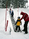 |
| |||
| aerialway | zip_line |  |
 |
| ||
| Equipaments | ||||||
| aerialway | pylon | Pilona que suporta els cables del remuntador. |  |
| ||
| aerialway | station | Estació de pujada o baixada del remuntador. | 
|
 |
| |
| Altres | ||||||
| Obsolet. Utilitzeu aerialway=zip_line. Implica automàticament oneway=yes (de baixada). |
 |
| ||||
| aerialway | goods | Remuntador de mercaderies. Normalment no és permès l'ús a persones. |  |
 |
| |
| aerialway | Definit per l'usuari | Visiteu la pàgina de Taginfo per a altres valors d'ús comú. | ||||
This table is a wiki template with a default description in English. Editable here.
Aeroway (vies aeroportuàries)
| Clau | Valor | Element | Comentaris | Renderització | Fotografia |
|---|---|---|---|---|---|
| aeroway | aerodrome | Aeroport. Per a aeròdrom i bases aèries, vegeu military=airfield. |  | ||
| aeroway | airstrip | A field or area where light aircraft can land and take off from. |  | ||
| aeroway | apron | Plataforma: zona d'estacionament d'avions. |  |
 | |
| aeroway | control_center | Centre de control: controla una regió de l'espai aeri entre aeroports. |  | ||
| aeroway | fuel | Fuelling station for aircraft. |  | ||
| aeroway | gate | Portes d'embarcament. Afegir ref=* per indicar-ne el número. |
 |
 | |
| aeroway | hangar | Hangar. Garatge per a avions. |  | ||
| aeroway | helipad | Helisuperfície. Àrea o plataforma condicionada per a l'envol i l'aterratge d'helicòpters sense més infraestructures. |  | ||
| aeroway | heliport | Heliport. Aeroport per a helicòpters. |  | ||
| aeroway | highway_strip |  | |||
| aeroway | holding_position | A point behind which aircraft are considered clear of a crossing way |  | ||
| aeroway | jet_bridge | Passenger boarding bridge |  | ||
| aeroway | model_runway | Take-off and landing runway for model aircraft |  | ||
| aeroway | navigationaid | Ajuda visual a la navegació aèria. |  | ||
| airmark | beacon | Radiobalisa. Ajuda a la navegació per ràdio. |  | ||
| aeroway | parking_position | A location where an aeroplane can park |  | ||
| aeroway | runway | Pista d'aterrament/enlairament d'avions. |  |
 | |
| aeroway | stopway | Stopway is a rectangular surface beyond the end of a runway used during an aborted takeoff. |  | ||
| aeroway | taxilane | Carrer de rodada: marquen camins dins la palaforma. | |||
| aeroway | taxiway | Pista de rodada: comuniquen les pistes amb la plataforma. |  |
 | |
| aeroway | terminal | Terminal (normalment de passatgers) en un aeroport. |  |
 | |
| aeroway | tower | See also aeroway=control_tower or combination of man_made=tower + service=aircraft_control for similar schemes. |
 | ||
| aeroway | windsock | Mànega de vent. |  | ||
| aeroway | Definit per l'usuari. | Vegeu la pàgina de Taginfo per a altres valors d'ús comú. |
This table is a wiki template with a default description in English. Editable here.
Amenity (infraestructures)
| Clau | Valor | Element | Comentaris | Renderització | Fotografia | |
|---|---|---|---|---|---|---|
Manutenció | ||||||
| amenity | bar | Lloc de consum de begudes alcohòliques. Vegeu amenity=bar i amenity=pub per saber la diferència. |  | |||
| amenity | biergarten | Terrassa de bars i restaurants, o berenadors (on se serveix menjar/beguda a l'aire lliure). |  | |||
| amenity | cafe | Cafè, lloc per a prendre cafè. |  | |||
| amenity | fast_food | Restaurant de menjar ràpid. |  | |||
| amenity | food_court | Lloc comú de menjar de diversos establiments que serveixen menjar. |  | |||
| amenity | ice_cream | Gelateria. Utilitzeu-la en compte de shop=ice_cream. |  | |||
| amenity | pub | Establiment que ven cervesa i begudes alcohòliques. Pot oferir menjars o allotjament (Regne Unit). Vegeu amenity=bar i amenity=pub per saber la diferència. |  | |||
| amenity | restaurant | Restaurant. Podeu afegir el tipus de cuina cuisine=*. |  | |||
Educació | ||||||
| amenity | college | Centres d'estudis de grau mitjà. |  | |||
| amenity | dancing_school | A dancing school or dance studio |  | |||
| amenity | driving_school | Driving School which offers motor vehicle driving lessons |  | |||
| amenity | first_aid_school | A place where people can go for first aid courses. | ||||
| amenity | kindergarten | Guarderia, parvulari, llar d'infants. |  | |||
| amenity | language_school | Language School: an educational institution where one studies a foreign language. |  | |||
| amenity | library | Biblioteca. |  | |||
| amenity | surf_school | A surf school is an establishment that teaches surfing. |  | |||
| amenity | toy_library | A place to borrow games and toys, or play with them on site. | 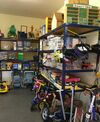 | |||
| amenity | research_institute | An establishment endowed for doing research. |  | |||
| amenity | training | Public place where you can get training. |  | |||
| amenity | music_school | A music school, an educational institution specialized in the study, training, and research of music. |  | |||
| amenity | school | Col·legi o institut. |  | |||
| amenity | traffic_park | Juvenile traffic schools |  | |||
| amenity | university | Universitat. Campus o edificis. |  | |||
Transport | ||||||
| amenity | bicycle_parking | Aparcament per a bicicletes |  | |||
| amenity | bicycle_repair_station | General tools for self-service bicycle repairs, usually on the roadside; no service |  | |||
| amenity | bicycle_rental | Lloguer de bicicletes. |  | |||
| amenity | bicycle_wash | Clean a bicycle |  | |||
| amenity | boat_rental | Rent a Boat |  | |||
| amenity | boat_sharing | Share a Boat |  | |||
| amenity | bus_station | Estació d'autobusos. No confongueu amb una parada de bus, què és highway=bus_stop. |  | |||
| amenity | car_rental | Lloguer de cotxes. | ||||
| amenity | car_sharing | Lloc per a compartir cotxe. |  | |||
| amenity | car_wash | Lloc on renten cotxes. Autorentat |  | |||
| amenity | compressed_air | A device to inflate tires/tyres (e.g. motorcar, bicycle) |  | |||
| amenity | vehicle_inspection | Government vehicle inspection |  | |||
| amenity | charging_station | Charging facility for electric vehicles |  | |||
| amenity | driver_training | A place for driving training on a closed course |  | |||
| amenity | ferry_terminal | Terminal de ferri. Embarcament i desembarcament. |  | |||
| amenity | fuel | Gasolinera/benzinera. També estadions de gas butà/natural per a taxis, querosè per a aviació, combustible per a vaixells... |  | |||
| amenity | grit_bin | Contenidor de grava o una mescla de grava i sal. Serveix per estendre-ho sobre la neu o glaç i evitar relliscades. |  | |||
| amenity | motorcycle_parking | Parking for motorcycles |  | |||
| amenity | parking | Aparcament. |  | |||
| amenity | parking_entrance | An entrance or exit to an underground or multi-storey parking facility. Group multiple parking entrances together with a relation using the tags type=site and site=parking | Underground |
 | ||
| amenity | parking_space | A single parking space within a car park. Parking spaces should be mapped within an amenity=parking area. Group multiple parking spaces together with a relation using the tags type=site and site=parking |  |
 | ||
| amenity | taxi | Parada de taxis. |  | |||
| amenity | weighbridge | A large weight scale to weigh vehicles and goods |  | |||
Financer | ||||||
| amenity | atm | Caixer automàtic. |  | |||
| amenity | payment_terminal | Self-service payment kiosk/terminal | 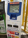 | |||
| amenity | bank | Banc. Si té caixer automàtic, useu amenity=atm en un node diferent. |  | |||
| amenity | bureau_de_change | Casa de canvi de divises o xecs de viatge. |  | |||
| amenity | money_transfer | A place that offers money transfers, especially cash to cash |  | |||
| amenity | payment_centre | A non-bank place, where people can pay bills of public and private services and taxes. |  | |||
Salut | ||||||
| amenity | baby_hatch | Lloc on donar anònimament un nadó en adopció. |  | |||
| amenity | clinic | A medium-sized medical facility or health centre. | 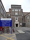 | |||
| amenity | dentist | Dentista. Lloc de pràctica o cirurgia. |  | |||
| amenity | doctors | Doctor en medicina. Lloc de pràctica o cirurgia. | 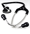 | |||
| amenity | hospital | Hospital. Habitualment s'utilitza en combinació amb emergency=* per distingir entre els que tenen o no recepció d'urgències. |  | |||
| amenity | nursing_home | Discouraged tag for a home for disabled or elderly persons who need permanent care. Use amenity=social_facility + social_facility=nursing_home now. |  | |||
| amenity | pharmacy | Farmàcia. Per deixar clar si serveixen medicaments amb recepta mèdica, habitualment s'afegeix dispensing=yes que és el tipus més habitual. dispensing=no podria indicar una parafarmàcia. |  | |||
| amenity | social_facility | Infraestructura per a donar serveis socials. |  | |||
| amenity | veterinary | Veterinari |  | |||
Entreteniment | ||||||
| amenity | arts_centre | Centre d'arts. |  | |||
| amenity | brothel | Puticlub o bordell. |  | |||
| amenity | casino | A gambling venue with at least one table game(e.g. roulette, blackjack) that takes bets on sporting and other events at agreed upon odds. |  | |||
| amenity | cinema | Cinema. |  | |||
| amenity | community_centre | Lloc per a esdeveniments locals i festivitats. |  | |||
| amenity | conference_centre | A large building that is used to hold a convention |  | |||
| amenity | events_venue | A building specifically used for organising events |  | |||
| amenity | exhibition_centre | An exhibition centre | ||||
| amenity | fountain | Font ornamental. |  | |||
| amenity | gambling | A place for gambling, not being a shop=bookmaker, shop=lottery, amenity=casino, or leisure=adult_gaming_centre.
Games that are covered by this definition include bingo and pachinko. |
 | |||
| amenity | love_hotel | A love hotel is a type of short-stay hotel operated primarily for the purpose of allowing guests privacy for sexual activities. |  | |||
| amenity | music_venue | An indoor place to hear contemporary live music. |  | |||
| amenity | nightclub | Discoteca. |  | |||
| amenity | planetarium | A planetarium. |  | |||
| amenity | public_bookcase | Un moble a la via pública amb llibres. Per a agafar-ne un i deixar-ne un altre. |  | |||
| amenity | social_centre | Centre social per a activitats públiques, gratuïtes o sense afany de lucre. |  | |||
| amenity | stage | A raised platform for performers. |  | |||
| amenity | stripclub | Local de strippers. |  | |||
| amenity | studio | Estudi de ràdio o televisió. |  | |||
| amenity | swingerclub | A club where people meet to have a party and group sex. |  | |||
| amenity | theatre | Teatre (també òpera o sarsuela). |  | |||
Public Service | ||||||
| amenity | courthouse | Jutjats. |  | |||
| amenity | fire_station | Parc de bombers. |  | |||
| amenity | police | Comissaria de policia. |  | |||
| amenity | post_box | Bústia de correus. | 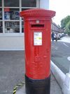 | |||
| amenity | post_depot | Post depot or delivery office, where letters and parcels are collected and sorted prior to delivery. |  | |||
| amenity | post_office | Oficina de correus. |  | |||
| amenity | prison | Presó, centre penitenciari. |  | |||
| amenity | ranger_station | National Park visitor headquarters: official park visitor facility with police, visitor information, permit services, etc |  | |||
| amenity | townhall | Ajuntament. | 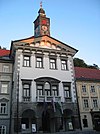 | |||
Facilities | ||||||
| amenity | bbq | Barbacoa pública per cuinar a l'aire lliure. Es pot afegir el tipus de combustible fuel=wood/gas/electric. |  | |||
| amenity | bench | Banc per a asseure i descansar. |  | |||
| amenity | dog_toilet | Area designated for dogs to urinate and excrete. |  | |||
| amenity | dressing_room | Area designated for changing clothes. |  | |||
| amenity | drinking_water | Font d'aigua potable. |  | |||
| amenity | give_box | A small facility where people drop off and pick up various types of items in the sense of free sharing and reuse. |  | |||
| amenity | lounge | A comfortable waiting area for customers, usually found in airports and other transportation hubs. Typically has extra amenities or sustenance. |  | |||
| amenity | mailroom | A mailroom for receiving packages or letters. |  | |||
| amenity | parcel_locker | Machine for picking up and sending parcels |  | |||
| amenity | shelter | Refugi per al mal temps per a senderistes i ciclistes. Generalment en vies i camins d'alta muntanya. |  | |||
| amenity | shower | Dutxa o bany públic. |  | |||
| amenity | telephone | Telèfon públic. Podeu afegir operator=*. |  | |||
| amenity | toilets | Urinaris públics (poden ser de pagament) |  | |||
| amenity | water_point | Lloc on es pot obtenir una gran quantitat d'aigua potable. |  | |||
| amenity | watering_place | Font per a que beguin els animals. |  | |||
Waste Management | ||||||
| amenity | sanitary_dump_station | A place for depositing human waste from a toilet holding tank. |  | |||
| amenity | recycling | Centres de reciclatge, punts verds, recollida de vidre... |  | |||
| amenity | waste_basket | Paperera | 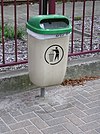 | |||
| amenity | waste_disposal | Cub d'escombraries. També el destinat per a caravanes. |  | |||
| amenity | waste_transfer_station | A waste transfer station is a location that accepts, consolidates and transfers waste in bulk. | ||||
Altres | ||||||
| amenity | animal_boarding | A facility where you, paying a fee, can bring your animal for a limited period of time (e.g. for holidays) |  | |||
| amenity | animal_breeding | A facility where animals are bred, usually to sell them |  | |||
| amenity | animal_shelter | A shelter that recovers animals in trouble |  | |||
| amenity | animal_training | A facility used for non-competitive animal training |  | |||
| amenity | baking_oven | An oven used for baking bread and similar, for example inside a building=bakehouse. |  | |||
| amenity | clock | Un rellotge públic, en un lloc visible. |  | |||
| amenity | crematorium | Crematori. |  | |||
| amenity | dive_centre | A dive center is the base location where sports divers usually start scuba diving or make dive guided trips at new locations. |  | |||
| amenity | funeral_hall | A place for holding a funeral ceremony, other than a place of worship. |  | |||
| amenity | grave_yard | Cementeri petit, com els que hi ha al costat d'algunes esglésies. Per a cementiris més grans, utilitzeu landuse=cemetery. |  |
 | ||
| amenity | hunting_stand | Cabina generalment elevada per a caçar. | 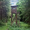 | |||
| amenity | internet_cafe | A place whose principal role is providing internet services to the public. |  | |||
| amenity | kitchen | A public kitchen in a facility to use by everyone or customers |  | |||
| amenity | kneipp_water_cure | Outdoor foot bath facility. Usually this is a pool with cold water and handrail. Popular in German speaking countries. |  | |||
| amenity | lounger | An object for people to lie down. |  | |||
| amenity | marketplace | Mercat |  | |||
| amenity | monastery | Monastery is the location of a monastery or a building in which monks and nuns live. |  | |||
| amenity | mortuary | A morgue or funeral home, used for the storage of human corpses. |  | |||
| amenity | photo_booth | Cabina de fotografia instantània, fotomaton. |  | |||
| amenity | place_of_mourning | A room or building where families and friends can come, before the funeral, and view the body of the person who has died. |  | |||
| amenity | place_of_worship | Lloc de culte. Iglésies, mesquites o temples de qualsevol religió. Es combina amb religion=* + denomination=*. |  | |||
| amenity | public_bath | A location where the public may bathe in common, etc. japanese onsen, turkish bath, hot spring |  | |||
| Edifici d'ús públic. | ||||||
| amenity | refugee_site | A human settlement sheltering refugees or internally displaced persons |  | |||
| amenity | vending_machine | Màquina expenedora de menjar, tiquets o qualsevol article. |  | |||
| amenity | Definit per l'usuari. | Vegeu la pàgina de Taginfo per a altres valors d'ús comú. | ||||
This table is a wiki template with a default description in English. Editable here.
Barreras
Estos se utilizan para describir las barreras y los obstáculos que normalmente se encuentran al viajar. Ver la página ES:Barreras para una introducción sobre su uso.
Barreras lineares
Esta tabla es una wiki plantilla con una descripción predeterminada en español. Editable aquí. Si en el campo descripción el texto está en inglés o no hay, es debido a que la página de esa etiqueta no está bien documentada.
Control de acceso en vías
Esta tabla es una wiki plantilla con una descripción predeterminada en español. Editable aquí. Si en el campo descripción el texto está en inglés o no hay, es debido a que la página de esa etiqueta no está bien documentada.
Boundary (fronteres, límits)
| Clau | Valor | Element | Comentaris | Renderització | Fotografia | |
|---|---|---|---|---|---|---|
Boundary types | ||||||
| boundary | aboriginal_lands | A boundary representing official reservation boundaries of recognized aboriginal / indigenous / native peoples. |  |
 | ||
| boundary | administrative | Límits administratius. S'utilitza sempre amb admin_level=* per a distingir entre comunitat autònoma, província, municipi, parròquia... |  |
 | ||
| boundary | border_zone | A border zone is an area near the border where special restrictions on movement apply. Usually a permit is required for visiting. |  | |||
| boundary | A census-designated boundary delineating a statistical area, not necessarily observable on the ground. |  | ||||
| boundary | forest | A delimited forest is a land which is predominantly wooded and which is, for this reason, given defined boundaries. It may cover different tree stands, non-wooded areas, highways… but all the area within the boundaries are considered and managed as a single forest. |  | |||
| boundary | forest_compartment | A forest compartment is a numbered sub-division within a delimited forest, physically materialized with visible, typically cleared, boundaries. |  | |||
| boundary | hazard | A designated hazardous area, with a potential source of damage to health, life, property, or any other interest of value. |  | |||
| boundary | health | Health division boundaries. Some mappers use health_level=* instead of admin_level=* to specify level in the health system hierarchy. | ||||
| boundary | historic | A historic administrative boundary (use judiciously). |  | |||
| boundary | local_authority | Describes the territory of a local authority. | ||||
| boundary | low_emission_zone | A geographically defined area which seeks to restrict or deter access by certain polluting vehicles with the aim of improving the air quality. |  | |||
| boundary | maritime | Fronteres marítimes |  | |||
| boundary | marker | A boundary marker, border marker, boundary stone, or border stone is a robust physical marker that identifies the start of a land boundary or the change in a boundary, especially a change in direction of a boundary. See also historic=boundary_stone |  | |||
| boundary | national_park | Límit de Parc Nacional. Àrea protegida pel seu valor ecològic o bellesa. |  |
 | ||
| boundary | place | boundary=place is commonly used to map the boundaries of a place=*, when these boundaries can be defined but these are not administrative boundaries. | ||||
| boundary | political | Circumscripció electoral. | ||||
| boundary | postal_code | Postal code boundaries. Some mappers use postal_code_level=* instead of admin_level=* to specify level in the postal hierarchy. | ||||
| boundary | protected_area | Paratge Natural. Àrea protegida pel seu valor ecòlogic o bellesa però menys que Parc Nacional. |  | |||
| boundary | religious_administration | A religious administration boundary, eg. of a catholic diocese or parish. Use religion=* and denomination=* to specify the church to which the boundary applies. Some mappers use religious_level=* instead of admin_level=* to specify level in the church hierarchy. | ||||
| boundary | special_economic_zone | A government-defined area in which business and trade laws are different. |  | |||
| boundary | statistical | An official boundary recognised by government for statistical purposes. |
 | |||
| boundary | disputed | An area of landed claimed by two or more parties (use with caution). See also Disputed territories. |  | |||
| boundary | timezone | Boundaries of time zone |  | |||
| boundary | Definit per l'usuari. | Vegeu la pàgina de Taginfo per a altres valors d'ús comú. | ||||
Attributes | ||||||
| admin_level | (number) | Defines level of the division described by the boundary in the hierarchy system to which the division belongs. Usually in the range 1 to 10 (except for several countries, where it is in the range 1 to 11 – Bolivia, Germany, Mozambique, Netherlands, Philippines, Poland, Turkmenistan, Venezuela – see boundary). |  | |||
| health_level | (number) | Used by some mappers instead of admin_level=* in conjunction with boundary=health and is usually in the range 1 to 10. | ||||
| postal_code_level | (number) | Used by some mappers instead of admin_level=* in conjunction with boundary=postal_code and is usually in the range 1 to 10. | ||||
| religious_level | (number) | Used by some mappers instead of admin_level=* in conjunction with boundary=religious_administration and is usually in the range 1 to 10. | ||||
| border_type | * | Serveix per distingir entre límits del mateix tipus que no siguin administratius, funcionen com aquests últims. Vegeu la pàgina de l'etiqueta. | ||||
| start_date | (date) | Useful if the boundary is very recent (or if it will become effective in a near future). |  | |||
This table is a wiki template with a default description in English. Editable here.
Edificis
A continuació es detallen els valors que poden acompanyar la clau building per descriure el tipus d'edifici. Vegeu Edificios per a més informació i man_made=* per a altres estructures.
| Clau | Valor | Comentaris | Foto |
|---|---|---|---|
Residencial | |||
| building | apartments | 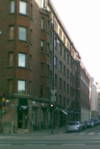 | |
| building | barracks | Buildings built to house military personnel or laborers. |  |
| building | bungalow |  | |
| building | cabin |  | |
| building | detached |  | |
| building | annexe | An annexe is a small self contained apartments, collages, or small residential building on the same property as the main residential unit. |  |
| building | dormitory | Un edifici compartit, però les habitacions no (per exemple: una Nota: ¿Podria usar-se millor Hall of Residence ( |
 |
| building | farm | Edifici residencial a una granja. Per als altres edificis usi building=farm_auxiliary, building=barn, … Si la seva casa de pagès s'assembla a una casa residencial normal, aleshores pot etiquetar-la també com building=house. Vegi també landuse=farmyard. |  |
| building | ger | A permanent or seasonal round yurt or ger. |  |
| building | hotel |  | |
| building | house | Una unitat que s'utilitzi com a habitatge unifamiliar. Els habitatges que formen un apariament o un grup adossat (building=terrace), han de compartir al menys dos nodes entre elles, definint la paret mitgera entre les propietats. |  |
| building | houseboat |  | |
| building | residential | Etiqueta genèrica per referir-se a un edifici destinat principalment a fins residencials. Quan disposi de més detall consideri etiquetar una o més zones com building=apartments, building=house, building=terrace o building=detached. |  |
| building | semidetached_house | A residential house that shares a common wall with another on one side. Typically called a "duplex" in American English. |  |
| building | static_caravan |  | |
| building | stilt_house | A building raised on piles over the surface of the soil or a body of water |  |
| building | terrace | Adossats, àrea que descriu una filera d'habitatges unifamiliars pegats unes a les altres que, normalment, cadascuna té la seva pròpia entrada. Podria definir cada habitatge amb building=house. |  |
| building | tree_house | An accommodation, often designed as a small hut, sometimes also as a room or small apartment. Built on tree posts or on a natural tree. A tree house has no contact with the ground. Access via ladders, stairs or bridgeways. | 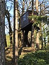 |
| building | trullo | A stone hut with a conical roof. |  |
Commercial | |||
| building | commercial | Un edifici comercial sense una activitat específica, no necessàriament oficines. Consideri etiquetar l'àrea amb landuse=commercial. Si fonamentalment es tracta de comerços utilitzi retail=*. |  |
| building | industrial | Edifici on té lloc algun procés industrial. Usi building=warehouse si el propòsit és d'emmagatzematge i/o distribució. Tot l'àrea, inclòs l'edifici, podria ser marcat com landuse=industrial, al costat de industrial=* per especificar el tipus d'indústria. |  |
| building | kiosk |  | |
| building | office | Un edifici d'oficines. Usi office=* per especificar el tipus d'oficina. Consideri etiquetar l'àrea amb landuse=commercial. Si fonamentalment es tracta de comercis utilitzi retail=*. | 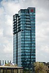 |
| building | retail | Un edifici usat principalment per a venda de productes al públic. Podria usar shop=* per identificar els béns. Tot l'àrea, inclòs l'edifici, podria ser marcat amb landuse=retail. |  |
| building | supermarket | Supermercat, gran àrea de venda auto-servei. |  |
| building | warehouse | Edifici destinat principalment a l'emmagatzematge de productes com a part d'un sistema de distribució. |  |
Religiós | |||
| building | religious | Edifici religiós sense especificar. Si és possible, utilitzeu valors més concrets. |  |
| building | cathedral | Edifici construït com a |
 |
| building | chapel | Edifici construït com a |
 |
| building | church | Un edifici on tenen lloc cerimònies o culte religiós. Per als terrenys que són en l'actualitat en ús, així com el propi edifici, usi amenity=place_of_worship, religion=*, denomination=* i landuse=religious. |  |
| building | kingdom_hall | A building that was built as a |
 |
| building | monastery | Edifici construït com a |
 |
| building | mosque |  | |
| building | presbytery | A building where priests live and work. |  |
| building | shrine | Edifici construït com a |
 |
| building | synagogue | Edifici construït com a |
 |
| building | temple | Edifici que va ser construït com a |
 |
Cívic/infraestructures | |||
| building | bakehouse | Edifici per enfornar pa, fleca. Sovint s'utilitza juntament amb un altre node de tipus amenity=baking_oven i oven=wood_fired. |  |
| building | bridge | Edifici usat com a pont. Pot representar també una casa de guarda d'un pont llevadís. Miri també bridge=yes per a highway=*. No ho usi per marcar ponts (el seu contorn), per a aquest propòsit usa man_made=bridge. |  |
| building | civic | Edifici per a equipament o activitats d'oci de caràcter cívic. Com per exemple centre comunitari, biblioteca, lavabos públics, centre esportiu, piscina, ajuntament etc. S'usa al costat de amenity=* o leisure=* per facilitar més detall. Vegeu també building=public. |  |
| building | college | A college building. Use amenity=college on the whole college area to represent the college as an institution. |  |
| building | fire_station | A building constructed as fire station, i.e. to house fire fighting equipment and officers, regardless of current use. Add amenity=fire_station on the grounds for an active fire station. |  |
| building | government | Edifici governamental en general, incloent secretaries municipals i provincials, agències i departaments governamentals, ajuntaments i parlaments regionals. |  |
| building | gatehouse | An entry control point building, spanning over a highway that enters a city or compound. |  |
| building | hospital | Un edifici que forma part d'un |
 |
| building | kindergarten | Per a qualsevol edifici genèric d'una guarderia o parvulari. Els edificis amb ús específic (gimnàs, menjador, etc) s'haurien etiquetar amb el seu ús. Usi amenity=kindergarten per al perímetre del recinte del parvulari. |  |
| building | museum | A building which was designed as a museum. |  |
| building | public | Edifici públic. No usi amenity=public_building. |  |
| building | school | Edifici d'ús genèric a una |
 |
| building | toilets | Edifici de lavabos. |  |
| building | train_station | Edifici que és o forma part d'una |
 |
| building | transportation | Edifici relacionat amb el transport públic. Probablement voldràs etiquetar-lo també amb el tipus de transport en concret, per exemple public_transport=station. Observa que hi ha una etiqueta específica per a estació de tren, building=train_station. |  |
| building | university | Un edifici que és o forma part d'una universitat. Tot l'àrea, inclòs l'edifici, acostuma a ser marcat amb amenity=university. |  |
Agricultural/plant production | |||
| building | barn |  | |
| building | conservatory | Edifici o espai amb parets i sostre de vidre o lona a manera de galeria o porxo tancat, utilitzat com a |
 |
| building | cowshed |  | |
| building | farm_auxiliary | Edifici auxiliar d'una granja que no és un habitatge. Usa 'farm' o 'house' per a l'habitatge de la granja. |  |
| building | greenhouse |  | |
| building | slurry_tank | A circular building built to hold a liquid mix of primarily animal excreta (also known as slurry). |  |
| building | stable |  | |
| building | sty |  | |
| building | livestock | A building for housing/rising other livestock (apart from cows, horses or pigs covered above), or when the livestock changes. | |
Sports | |||
| building | grandstand | Tribuna, l'estand principal, generalment amb teulada, que ofereix la millor vista als espectadors en hipòdroms o camps esportius. |  |
| building | [[ Too many Data Items entities accessed. | pavilion ]] | Pavelló esportiu amb vestuaris, àrees d'emmagatzematge i possibilitat de crear espai per a funcions i esdeveniments. Eviti utilitzar aquest terme per a altres estructures conegudes com a pavellons pels arquitectes (vegeu |
 |
| building | riding_hall | Edifici construït com a pista d'equitació. |  |
| building | sports_hall | Un edifici construït com a pavelló esportiu. |  |
| building | sports_centre | A building that was built as a sports centre. |  |
| building | stadium | L'edifici d'un |
 |
Storage | |||
| building | allotment_house | A small outbuilding for short visits in a allotment garden. | |
| building | boathouse | A boathouse is a building used for the storage of boats. |  |
| building | hangar |  | |
| building | hut |  | |
| building | shed | estructura simple, d'una única planta, en un jardí posterior o en una parcel·la, que s'utilitza per a l'emmagatzematge, per a les afeccions, o com un taller. |
 |
Cars | |||
| building | carport | Una cotxera és una estructura utilitzada per oferir protecció limitada als vehicles, generalment cotxes, dels elements. A diferència de moltes estructures, una cotxera no té quatre parets, per regla general en té una o dues. | 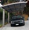 |
| building | garage |  | |
| building | garages | Edifici amb un gran nombre de places d'aparcament per a diferents propietaris o per llogar. Pot tenir diversos pisos. Vegeu building=garage. |  |
| building | parking | Estructura construïda expressament per aparcar vehicles. |  |
Power/technical buildings | |||
| building | digester | Un digestor és un bioreactor per a la producció de biogàs a partir de biomassa. |  |
| building | service | Edifici de servei, normalment és petit i equipat amb alguna maquinària com ara bombes o transformadors. |  |
| building | tech_cab | Small prefabricated cabin structures for the air-conditioned accommodation of different technology. |  |
| building | transformer_tower | Torre transformador, edifici característic, alt, en què hi ha instal·lat un transformador de distribució que es connecta a una línia elèctrica aèria de mitja tensió. Molt sovint la línia ha estat enterrada, però l'edifici continua treballant com a subestació, si aquest és el cas, es podrien usar també les etiquetes power=substation i substation=minor_distribution. |  |
| building | water_tower | Torre per emmagatzemar aigua. |  |
| building | storage_tank | Storage tanks are containers that hold liquids |  |
| building | silo | A silo is a building for storing bulk materials |  |
Altres | |||
| building | beach_hut | A small, usually wooden, and often brightly coloured cabin or shelter above the high tide mark on popular bathing beaches. |  |
| building | bunker |  | |
| building | castle | A building constructed as a castle. Can be further specified with historic=castle + castle_type=*. |  |
| building | construction | Usat per a edificis en construcció. Per indicar el destí final de l'edifici usi construction=*. |  |
| building | container | For a container used as a permanent building. Do not map containers placed temporarily, for example used in shipping or construction. |  |
| building | guardhouse | Poste de garde. |  |
| building | military | A military building. Also use military=*. | |
| building | outbuilding | A less important building near to and on the same piece of land as a larger building. |  |
| building | pagoda | A building constructed as a pagoda. |  |
| building | quonset_hut | A lightweight prefabricated structure in the shape of a semicircle. |  |
| building | roof | Estructura que consisteix en una teulada subjectada amb pilars i amb els laterals oberts (per exemple: el que cobreix els sortidors a les gasolineres o un refugi contra la pluja). |  |
| building | ruins |  | |
| building | ship | A decommissioned ship/submarine which stays in one place. |  |
| building | tent | For a permanently placed tent. Do not map tents placed temporarily. |  |
| building | tower | A tower-building. | 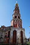 |
| building | triumphal_arch | A free-standing monumental structure in the shape of an archway with one or more arched passageways. |  |
| building | windmill | A building constructed as a traditional windmill, historically used to mill grain with wind power. | 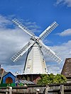 |
| building | yes | S'usa si no és possible determinar un valor més concret per a l'edifici. | |
| building | user defined | Els valors més comuns segons Taginfo, generalment tipus d'edificacions. | |
Atributs addicionals
| Clau | Valor | Element | Comentaris | Foto |
|---|---|---|---|---|
| building:architecture | <architectural style> | Architectural style of a building |  | |
| building:colour | <RGB hex triplet> | <W3C colour name> | Indicates colour of the building |  | |
| building:fireproof | yes | no | |||
| building:flats | <number> | The number of residential units (flats, apartments) in an apartment building (building=apartments), residential building (building=residential), house (building=house), detached house (building=detached) or similar building. | ||
| building:levels | <number> | Nombre de pisos o plantes d'un edifici. |  | |
| building:material | <material type> | Outer material for the building façade |  | |
| building:min_level | <number> | For describing number of values, "filling" space between ground level and bottom level of building or part of building |  | |
| building:part | As building | To mark a part of a building, which has attributes, different from such ones at other parts | 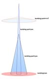 | |
| building:soft_storey | yes | no | reinforced | A building where any one level is significantly more flexible (less stiff) than those above and below it | ||
| construction_date | <date> | The (approximated) date when the building was finished. |  | |
| entrance | yes | main | exit | service | emergency | Entrada a un edifici. Ha de ser un node al perímetre de l'edifici. Molt útil en aplicacions d'encaminament juntament amb addr=*. substitueix l'etiqueta en desús building=entrance. |  | |
| height | <number> | Altura de l'edifici en metres | 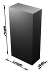 | |
| max_level | <number> | Nivell màxim (pisos) de l'edifici, tal i com s'utilitza a l'esquema de etiquetatge d'interior senzill. | ||
| min_level | <number> | Nivell mínim (pisos) de l'edifici, tal i com s'utilitza a l'esquema de etiquetatge d'interior senzill. | ||
| non_existent_levels | <number> | Nivells interiors (pisos) que no existeixen a l'edifici, tal i com s'utilitza a l'esquema de etiquetatge dinterior senzill. | ||
| start_date | <date> | The (approximated) date when the building was finished. |  |
This table is a wiki template with a default description in English. Editable here.
Oficios
Un lugar donde se producen o procesan productos personalizados. Consulte la página Oficios para obtener más información sobre el uso de estas etiquetas.
Esta tabla es una wiki plantilla con una descripción predeterminada en español. Editable aquí. Si en el campo descripción el texto está en inglés o no hay, es debido a que la página de esa etiqueta no está bien documentada.
Emergencias
Se utiliza para describir la ubicación de las instalaciones y equipos de emergencia. Consulte la página ES:Emergencias para obtener una introducción sobre su uso.
Rescate médico
Esta tabla es una wiki plantilla con una descripción predeterminada en español. Editable aquí. Si en el campo descripción el texto está en inglés o no hay, es debido a que la página de esa etiqueta no está bien documentada.
Bomberos
Esta tabla es una wiki plantilla con una descripción predeterminada en español. Editable aquí. Si en el campo descripción el texto está en inglés o no hay, es debido a que la página de esa etiqueta no está bien documentada.
Salvavidas
Esta tabla es una wiki plantilla con una descripción predeterminada en español. Editable aquí. Si en el campo descripción el texto está en inglés o no hay, es debido a que la página de esa etiqueta no está bien documentada.
Punto de encuentro
Esta tabla es una wiki plantilla con una descripción predeterminada en español. Editable aquí. Si en el campo descripción el texto está en inglés o no hay, es debido a que la página de esa etiqueta no está bien documentada.
Otra estructura
Esta tabla es una wiki plantilla con una descripción predeterminada en inglés. Editable aquí. Si en el campo descripción el texto está en inglés o no hay, es debido a que la página de esa etiqueta no está bien documentada.
Geologico
Esto se utiliza para describir la composición geológica de un área. Consulte la página Geológico para obtener una introducción sobre su uso.
Esta tabla es una wiki plantilla con una descripción predeterminada en español. Editable aquí. Si en el campo descripción el texto está en inglés o no hay, es debido a que la página de esa etiqueta no está bien documentada.
=== Highway ===
Apartat en construcció.Per elements linials (vies), l'etiqueta "highway" pren aquests valors.En cas de dubte consulta l'apartat Normalització ,especialment referit a Catalunya
| Clave | Valor | Elemento | Comment | Renderizacion | Foto | |
|---|---|---|---|---|---|---|
Carreteras | ||||||
|
This group lists the 7 main tags for the road network, from most to least functionally important for motor vehicle traffic. | ||||||
| highway | motorway | Autopistas[1] y Autovías[2], desde la señal de inicio de autopista/autovía (S-1/S-1a) hasta la señal de fin de autopista/autovía (S-2/S-2a). Constan de hitos kilométricos S-570, y su identificación se encuadra en señales S-410/S-410a de fondo azul. |  |
|||
| highway | trunk | Carreteras nacionales (en tramos que no sean autopista/autovía). Se caracterizan porque su identificación empieza con N- (N-1, N-6, N-110, etc) y se encuadra en una señal S-420, con fondo rojo. Tienen hitos kilométricos S-572. ->*discussion[3]. |  |
|||
| highway | primary | Carreteras autonómicas de primer nivel. La identificación comienza por las iniciales de la provincia o comunidad autónoma correspondiente, y se encuadra en una señal S-430 de fondo naranja. ->*discussion[4]. |  |
|||
| highway | secondary | Carreteras autonómicas de segundo nivel. La identificación comienza por las iniciales de la provincia o comunidad autónoma correspondiente, y se encuadra en una señal S-430 de fondo verde. |  |
|||
| highway | tertiary | Carreteras autonómicas de tercer nivel. La identificación comienza por las iniciales de la provincia o comunidad autónoma correspondiente, y se encuadra en una señal S-430 de fondo amarillo. |  |
|||
| highway | unclassified | Vies públiques menors, aptes per a cotxes i sovint asfaltades, que solen comunicar pobles i llogarrets i no són només d'us agrícola o residencial. |  |
|||
| highway | residential | Calles dentro de un núcleo urbano, excluyendo las travesías (que tendrán una denominación más alta). |  |
|||
Link roads | ||||||
| highway | motorway_link | Enlaces a autopistas y autovías: Rampas de acceso/salida, nudos de autopista, o cualquier carretera que enlaza una autopista/autovía con otro tipo de vía. |  |
 | ||
| highway | trunk_link | Rampas de entrada/salida a carreteras nacionales, o vías que conectan carreteras nacionales con otro tipo de vías. En caso de duda entre motorway_link y trunk_link, usar motorway_link. |  |
 | ||
| highway | primary_link | Vías que conectan carreteras secundarias con cualquier otro tipo de vía. |  |
 | ||
| highway | secondary_link | The link roads (sliproads/ramps) leading to/from a secondary road from/to a secondary road or lower class highway. |  |
 | ||
| highway | tertiary_link | The link roads (sliproads/ramps) leading to/from a tertiary road from/to a tertiary road or lower class highway. |  |
|||
Special road types | ||||||
| highway | living_street | Calles residenciales cuya prioridad la tienen los peatones, conocidas también como zonas 20 (max. 20 km/h). |  |
 | ||
| highway | service | Vías de servicio; accesos a parkings, gasolineras y edificios de uso público; pistas de frenado de emergencia; zonas de descanso en autopistas; balanzas para pesaje de camiones; vías de peaje o fronteras; por extensión, cualquier vía cuya principal finalidad no sea la del tránsito de vehículos. |  |
 | ||
| highway | pedestrian | Calles peatonales (incluso si se permite el paso de vehículos de emergencias y servicios). |  |
 | ||
| highway | track | Caminos forestales, caminos sin pavimentar para uso agrícola, y en general cualquier camino sin pavimentar no apto para la circulación de tráfico rodado. También, carreteras con el pavimento en muy malas condiciones. |  |
|||
| highway | bus_guideway | A busway where the vehicle guided by the way (though not a railway) and is not suitable for other traffic. Please note: this is not a normal bus lane, use access=no, psv=yes instead! |  |
 | ||
| highway | escape | For runaway truck ramps, runaway truck lanes, emergency escape ramps, or truck arrester beds. It enables vehicles with braking failure to safely stop. |  | |||
| highway | raceway | Pista de carreras |  |
 | ||
| highway | road | Una carretera con clasificación desconocida. Esta es una etiqueta temporal para marcar una carretera hasta que haya sido debidamente investigada. Una vez que ha sido objeto de reconocimiento, la clasificación debe ser actualizada para el valor apropiado. |  |
 | ||
| highway | busway | A dedicated roadway for bus rapid transit systems |  | |||
Paths | ||||||
| highway | footway | For designated footpaths; i.e., mainly/exclusively for pedestrians. This includes walking tracks and gravel paths. If bicycles are allowed as well, you can indicate this by adding a bicycle=yes tag. Should not be used for paths where the primary or intended usage is unknown. Use highway=pedestrian for pedestrianised roads in shopping or residential areas and highway=track if it is usable by agricultural or similar vehicles. For ramps (sloped paths without steps), combine this tag with incline=*. |  |
 | ||
| highway | bridleway | For horse riders. Pedestrians are usually also permitted, cyclists may be permitted depending on local rules/laws. Motor vehicles are forbidden. |  |
 | ||
| highway | steps | For flights of steps (stairs) on footways. Use with step_count=* to indicate the number of steps |  |
 | ||
| highway | corridor | For a hallway inside of a building. |  | |||
| highway | path | A non-specific path. Use highway=footway for paths mainly for walkers, highway=cycleway for one also usable by cyclists, highway=bridleway for ones available to horse riders as well as walkers and highway=track for ones which is passable by agriculture or similar vehicles. |  |
 | ||
| highway | via_ferrata | A via ferrata is a route equipped with fixed cables, stemples, ladders, and bridges in order to increase ease and security for climbers. These via ferrata require equipment : climbing harness, shock absorber and two short lengths of rope, but do not require a long rope as for climbing. | 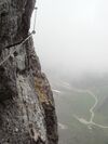 | |||
When sidewalk/crosswalk is tagged as a separate way | ||||||
| footway | sidewalk | Sidewalk that runs typically along residential road. Use in combination with highway=footway or highway=path |  |
 | ||
| footway | crossing | Crosswalk that connects two sidewalks on the opposite side of the road. Often recognized by painted markings on the road, road sign or traffic lights. Use in combination with highway=footway or highway=path. Useful information is presence of tactile_paving=*, wheelchair=* suitability and kerb=* represented as a node on the crosswalk way. |  |
 | ||
| footway | traffic_island | The way between two crossings, safespot for pedestrians, has micromapping characteristics as a detailed alternative to =*. Use in combination with highway=footway or highway=path. |  |
|||
When sidewalk (or pavement) is tagged on the main roadway (see Sidewalks) | ||||||
| sidewalk | both | left | right | no | Specifies that the highways has sidewalks on both sides, on one side or no sidewalk at all |  | |||
When cycleway is drawn as its own way (see Bicycle) | ||||||
| highway | cycleway | For designated cycleways. Add foot=*, though it may be avoided if default-access-restrictions do apply. |  |
 | ||
Cycleway tagged on the main roadway or lane (see Bicycle) | ||||||
| cycleway | lane | A lane is a route that lies within the roadway |  | |||
| cycleway | Deprecated variant for ways with oneway=yes where it is legally permitted to cycle in both directions. Replaced by oneway:bicycle=no. |  | ||||
| cycleway | Deprecated variant for ways with oneway=yes that have a cycling lane going the opposite direction of normal traffic flow (a "contraflow" lane). Replaced by oneway:bicycle=no + cycleway:left=lane/cycleway:right=lane + cycleway:left:oneway=-1/cycleway:right:oneway=-1. |  | ||||
| cycleway | track | A track provides a route that is separated from traffic. In the United States, this term is often used to refer to bike lanes that are separated from lanes for cars by pavement buffers, bollards, parking lanes, and curbs. Note that a cycle track may alternatively be drawn as a separate way next to the road which is tagged as highway=cycleway. |  | |||
| cycleway | Deprecated variant for ways with oneway=yes that have a cycling track going the opposite direction of normal traffic flow. Replaced by oneway:bicycle=no + cycleway:left=track/cycleway:right=track + cycleway:left:oneway=-1/cycleway:right:oneway=-1. |  | ||||
| cycleway | share_busway | There is a bus lane that cyclists are permitted to use. |  | |||
| cycleway | Deprecated variant for ways with oneway=yes that have a bus lane that cyclists are also permitted to use, and which go in the opposite direction to normal traffic flow (a "contraflow" bus lane). Replaced by oneway:bicycle=no + cycleway:left=share_busway/cycleway:right=share_busway + cycleway:left:oneway=-1/cycleway:right:oneway=-1. |  | ||||
| cycleway | shared_lane | Cyclists share a lane with motor vehicles, there are markings reminding about this. In some places these markings are known as "sharrows" ('sharing arrows') and this is the tag to use for those. |  | |||
Busways tagged on the main roadway or lane (see Bus lanes) | ||||||
| lane | Deprecated variant to tag bus lanes. Replaced by bus/psv lane tagging lanes:bus=* / lanes:psv=*) / bus:lanes=* / psv:lanes=* |  | ||||
| opposite | Deprecated variant for ways with oneway=yes where buses are legally permitted to travel in both directions. Replaced by oneway:bus=no | |||||
| opposite_lane | Deprecated variant for ways with oneway=yes that have a bus lane which go in the opposite direction to normal traffic flow (a "contraflow" bus lane). Replaced by oneway:bus=no and lanes:bus=* / lanes:psv=*) / bus:lanes=* / psv:lanes=* | |||||
Street parking tagged on the main roadway (see Street parking) | ||||||
| parking:left / :right / :both (hereafter: parking:side) |
lane | street_side | on_kerb | half_on_kerb | shoulder | no | separate | yes | Primary key to record parking along the street. Describes the parking position of parked vehicles in the street. |  | |||
| parking:sideorientation=* | parallel | diagonal | perpendicular | To specify the orientation of parked vehicles if there is street parking. | ||||
Lifecycle (see also lifecycle prefixes) | ||||||
| highway | proposed | For planned roads, use with proposed=* and a value of the proposed highway value. | ||||
| highway | construction | For roads under construction. Use construction=* to hold the value for the completed road. |  |
 | ||
Attributes | ||||||
| abutters | commercial | industrial | mixed | residential | retail etc. | See Key:abutters for more details. |  | |||
| bicycle_road | yes | A bicycle road is a road designated for bicycles. If residential streets get the status of bicycle roads, normally, by special signs, motor traffic is admitted with limited speed, often only for residents. |  | |||
| bus_bay | both | left | right | A bus bay outside the main carriageway for boarding/alighting |  | |||
| change | yes | no | not_right | not_left | only_right | only_left | Specify the allowed/forbidden lane changes |  | |||
| destination | <place name of destination> | Destination when following a linear feature |  | |||
| embankment | yes | dyke | A dyke or a raised bank to carry a road, railway, or canal across a low-lying or wet area. |  | |||
| embedded_rails | yes | <type of railway> | A highway on which non-railway traffic is also allowed has railway tracks embedded in it but the rails are mapped as separate ways. |  | |||
| ford | yes | The road crosses through stream or river, vehicles must enter any water. |  | |||
| frontage_road | yes | A frontage road. | ||||
| ice_road | yes | A highway is laid upon frozen water basin, definitely doesn't exist in summer. |  | |||
| incline | Number % | ° | up | down | Incline steepness as percents ("5%") or degrees ("20°"). Positive/negative values indicate movement upward/downwards in the direction of the way. |  | |||
| junction | roundabout | This automatically implies oneway=yes, the oneway direction is defined by the sequential ordering of nodes within the Way. This applies on a way, tagged with highway=* already. | 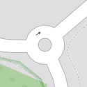 |
 | ||
| lanes | <number> | The number of traffic lanes for general purpose traffic, also for buses and other specific classes of vehicle. |  | |||
| lane_markings | yes | no | Specifies if a highway has painted markings to indicate the position of the lanes. |  | |||
| lit | yes | no | Street lighting |  | |||
| maxspeed | <number> | Specifies the maximum legal speed limit on a road, railway or waterway. |  | |||
| motorroad | yes | no | The motorroad tag is used to describe highways that have motorway-like access restrictions but that are not a motorway. |  | |||
| mountain_pass | yes | The highest point of a mountain pass. |  | |||
| mtb:scale | 0-6 | Applies to highway=path and highway=track. A classification scheme for mtb trails (few inclination and downhill). |  | |||
| mtb:scale:uphill | 0-5 | A classification scheme for mtb trails for going uphill if there is significant inclination. |  | |||
| mtb:scale:imba | 0-4 | The IMBA Trail Difficulty Rating System shall be used for bikeparks. It is adapted to mtb trails with artificial obstacles. | ||||
| mtb:description | Text | Applies to highway=path and highway=track. A key to input variable infos related to mtbiking on a way with human words | ||||
| oneway | yes | no | reversible | Oneway streets are streets where you are only allowed to drive in one direction. | 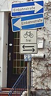 | |||
| oneway:bicycle | yes | no | | Used on ways with oneway=yes where it is legally permitted to cycle in both directions. |  | |||
| overtaking | yes | no | caution | both | forward | backward | Specifying sections of roads where overtaking is legally forbidden. Use overtaking:forward=yes/no/caution and overtaking:backward=yes/no/caution when it depends on driving direction. |  | |||
| parallel | diagonal | perpendicular | marked | no_parking | no_stopping | fire_lane. | Deprecated variant to map parking along streets. See section on street parking above or the street parking page for more details. | |||||
| free | ticket | disc | residents | customers | private | Deprecated variant to map parking conditions along streets. See section on street parking above or the street parking page for more details. |  | ||||
| passing_places | yes | A way which has frequent passing places (See also: highway=passing_place) |  | |||
| priority | forward | backward | Traffic priority for narrow parts of roads, e.g. narrow bridges. |  | |||
| priority_road | designated | yes_unposted | end | Specifying roads signposted as priority roads. |  | |||
| sac_scale | strolling | hiking | mountain_hiking | demanding_mountain_hiking | alpine_hiking | demanding_alpine_hiking | difficult_alpine_hiking | Applies to highway=path and highway=footway. A classification scheme for hiking trails. |  | |||
| service | alley | driveway | parking_aisle etc. | See Key:service for more details. |  | |||
| shoulder | no | yes | right | both | left | Presence of shoulder in highway | ||||
| side_road | yes | A side road. | ||||
| smoothness | excellent | good | intermediate | bad | very_bad | horrible | very_horrible | impassable | Specifies the physical usability of a way for wheeled vehicles due to surface regularity/flatness. See Key:smoothness for more details. | 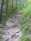 | |||
| surface | paved | unpaved | asphalt | concrete | paving_stones | sett | cobblestone | metal | wood | compacted | fine_gravel | gravel | pebblestone | plastic | grass_paver | grass | dirt | earth | mud | sand | ground | See Key:surface for more details. |  | |||
| tactile_paving | yes | no | A paving in the ground to be followed with a blindman's stick. |  | |||
| tracktype | grade1 | grade2 | grade3 | grade4 | grade5 | To describe the quality of the surface. See Key:tracktype for more information. | 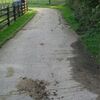 | |||
| traffic_calming | bump | hump | table | island | cushion | yes | etc. | Features used to slow down traffic. See Key:traffic calming for more details. |  | |||
| trail_visibility | excellent | good | intermediate | bad | horrible | no | Applies to highway=path, highway=footway, highway=cycleway and highway=bridleway. A classification for hiking trails visibility |  | |||
| trailblazed | yes | no | poles | cairns | symbols | Applies to highway=*. Describing trail blazing and marking. See Key:trailblazed for more information. | 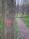 | |||
| trailblazed:visibility | excellent | good | intermediate | bad | horrible | no | Applies to trailblazed=*. A classification for visibility of trailblazing. See Key:trailblazed:visibility for more information. | ||||
| turn | left | slight_left | through | right | slight_right | merge_to_left | merge_to_right | reverse | The key turn can be used to specify the direction in which a way or a lane will lead. |  | |||
| width | <number> | The width of a feature. |  | |||
| winter_road | yes | A highway functions during winter, probably can't be driven in summer. |  | |||
Other highway features | ||||||
| highway | bus_stop | A small bus stop. Optionally one may also use public_transport=stop_position for the position where the vehicle stops and public_transport=platform for the place where passengers wait. |  | |||
| highway | crossing | A.k.a. crosswalk. Pedestrians can cross a street here; e.g., zebra crossing |  | |||
| highway | cyclist_waiting_aid | Street furniture for cyclists that are intended to make waiting at esp. traffic lights more comfortable. |  | |||
| highway | elevator | An elevator or lift, used to travel vertically, providing passenger and freight access between pathways at different floor levels. |  | |||
| highway | emergency_bay | An area beside a highway where you can safely stop your car in case of breakdown or emergency. |  | |||
| highway | emergency_access_point | Sign number which can be used to define your current position in case of an emergency. Use with ref=NUMBER_ON_THE_SIGN. See also emergency=access_point |  | |||
| highway | give_way | A "give way," or "Yield" sign |  | |||
| emergency | phone | A calling device can be used to tell on your current position in case of an emergency. Use with ref=NUMBER_ON_THE_SIGN |  | |||
| highway | ladder | A vertical or inclined set of steps or rungs intended for climbing or descending of a person with the help of hands. |  | |||
| highway | milestone | Highway location marker | ||||
| highway | mini_roundabout | Similar to roundabouts, but at the center there is either a painted circle or a fully traversable island. In case of an untraversable center island, junction=roundabout should be used.
Rendered as anti-clockwise by default direction=anticlockwise. To render clockwise add the tag direction=clockwise. |
 |
|||
| highway | motorway_junction | Indicates a junction (UK) or exit (US). ref=* should be set to the exit number or junction identifier. (Some roads – e.g., the A14 – also carry junction numbers, so the tag may be encountered elsewhere despite its name) | 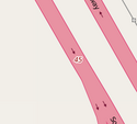 |
 | ||
| highway | passing_place | The location of a passing space |  | |||
| highway | platform | A platform at a bus stop or station. |  |
 | ||
| highway | rest_area | Place where drivers can leave the road to rest, but not refuel. | 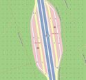 |
 | ||
| highway | services | Vías de servicio; accesos a parkings, gasolineras y edificios de uso público; pistas de frenado de emergencia; zonas de descanso en autopistas; balanzas para pesaje de camiones; vías de peaje o fronteras; por extensión, cualquier vía cuya principal finalidad no sea la del tránsito de vehículos. |  |
 | ||
| highway | speed_camera | A fixed road-side or overhead speed camera. |  | |||
| highway | speed_display | A dynamic electronic sign that displays the speed of the passer-by motorist. |  | |||
| highway | stop | A stop sign |  | |||
| highway | street_lamp | A street light, lamppost, street lamp, light standard, or lamp standard is a raised source of light on the edge of a road, which is turned on or lit at a certain time every night |  | |||
| highway | toll_gantry | A toll gantry is a gantry suspended over a way, usually a motorway, as part of a system of electronic toll collection. For a toll booth with any kind of barrier or booth see: barrier=toll_booth |  | |||
| highway | traffic_mirror | Mirror that reflects the traffic on one road when direct view is blocked. |  | |||
| highway | traffic_signals | Lights that control the traffic |  | |||
| highway | trailhead | Designated place to start on a trail or route |  | |||
| highway | turning_circle | A turning circle is a rounded, widened area usually, but not necessarily, at the end of a road to facilitate easier turning of a vehicle. Also known as a cul de sac. |  |
 | ||
| highway | turning_loop | A widened area of a highway with a non-traversable island for turning around, often circular and at the end of a road. |  | |||
| highway | User Defined | All commonly used values according to Taginfo | ||||
- Per una aclaració sobre els senyals de trànsit, mira:
[5] (BOE, oficial, domini públic, blanc i negre, a partir de la pàgina 66)
Histórico
Esto se usa para describir varios lugares históricos. Por ejemplo: sitios arqueológicos, naufragios, ruinas, castillos y edificios antiguos. Consulte la página titulada ES:Key:historic para obtener una introducción sobre su uso.
Esta tabla es una wiki plantilla con una descripción predeterminada en español. Editable aquí. Si en el campo descripción el texto está en inglés o no hay, es debido a que la página de esa etiqueta no está bien documentada.
Uso del suelo
Esto se utiliza para describir el propósito para el cual se está utilizando un área de tierra. Ver la página ES:Uso del suelo para una introducción sobre su uso.
Uso común de tierra - tierra urbanizada
Esta tabla es una wiki plantilla con una descripción predeterminada en español. Editable aquí. Si en el campo descripción el texto está en inglés o no hay, es debido a que la página de esa etiqueta no está bien documentada.
Uso común de tierra - tierra rural y agricultura
Esta tabla es una wiki plantilla con una descripción predeterminada en español. Editable aquí. Si en el campo descripción el texto está en inglés o no hay, es debido a que la página de esa etiqueta no está bien documentada.
Uso común de tierra - cuerpos de agua
Esta tabla es una wiki plantilla con una descripción predeterminada en español. Editable aquí. Si en el campo descripción el texto está en inglés o no hay, es debido a que la página de esa etiqueta no está bien documentada.
Otros valores de uso común de tierra
Esta tabla es una wiki plantilla con una descripción predeterminada en español. Editable aquí. Si en el campo descripción el texto está en inglés o no hay, es debido a que la página de esa etiqueta no está bien documentada.
Ocio
Se utiliza para etiquetar instalaciones deportivas y de ocio. Consulte la página titulada Ocio para obtener una introducción sobre su uso.
Esta tabla es una wiki plantilla con una descripción predeterminada en español. Editable aquí. Si en el campo descripción el texto está en inglés o no hay, es debido a que la página de esa etiqueta no está bien documentada.
Construcciones
Una etiqueta para identificar estructuras hechas por el hombre (artificiales) que se agregan al paisaje. Consulte man made=* para obtener una introducción sobre su uso.
Esta tabla es una wiki plantilla con una descripción predeterminada en español. Editable aquí. Si en el campo descripción el texto está en inglés o no hay, es debido a que la página de esa etiqueta no está bien documentada.
Militar
Esto se usa para instalaciones y en terrenos utilizados por los militares. Estos pueden incluir la Armada, el Ejército, la Fuerza Aérea y la Infantería de Marina. Consulte la página titulada Military para obtener una introducción sobre su uso.
Esta tabla es una wiki plantilla con una descripción predeterminada en español. Editable aquí. Si en el campo descripción el texto está en inglés o no hay, es debido a que la página de esa etiqueta no está bien documentada.
Natural
Esto se utiliza para describir las características naturales y físicas de la tierra. También se incluyen características que han sido modificadas por humanos.
Vegetación o superficie relacionada
Esta tabla es una wiki plantilla con una descripción predeterminada en español. Editable aquí. Si en el campo descripción el texto está en inglés o no hay, es debido a que la página de esa etiqueta no está bien documentada.
Relacionados con el agua
Esta tabla es una wiki plantilla con una descripción predeterminada en español. Editable aquí. Si en el campo descripción el texto está en inglés o no hay, es debido a que la página de esa etiqueta no está bien documentada.
Relacionados con el accidente geográfico
Esta tabla es una wiki plantilla con una descripción predeterminada en español. Editable aquí. Si en el campo descripción el texto está en inglés o no hay, es debido a que la página de esa etiqueta no está bien documentada.
Relacionados con animales
Esta tabla es una wiki plantilla con una descripción predeterminada en español. Editable aquí. Si en el campo descripción el texto está en inglés o no hay, es debido a que la página de esa etiqueta no está bien documentada.
Office (Oficines)
| Clu | Valor | Element | Comentaris | Renderització | Count |
|---|---|---|---|---|---|
| office | accountant | Comptabilitat, auditoria, gestoria. |
| ||
| office | advertising_agency | An advertising agency or ad agency or advert agency is a service based business dedicated to creating, planning, and handling advertising (and sometimes other forms of promotion) for its clients. |
| ||
| office | architect | Estudi d'arquitectura. |
| ||
| office | association | An office of a non-profit organization, society, such as a student, sport, consumer, automobile, bike association, etc. |
| ||
| office | charity | An office of a charitable organization. |
| ||
| office | company | Oficines d'una companyia. |
| ||
| office | consulting | An office for a consulting firm, providing expert professional advice to other companies or organisations. |
| ||
| office | cooperative | An office of a cooperative (an autonomous association of persons or organizations). |
| ||
| office | coworking | Coworking is a style of work that involves a shared working environment, often an office, and independent activity. |
| ||
| office | diplomatic | An embassy, diplomatic mission, consulate or liaison office of a foreign government or parastatal entity in a host country. |
| ||
| office | educational_institution | An office of an educational institution. |
| ||
| office | employment_agency | Oficina d'ocupació. |
| ||
| office | engineer | An office of an engineer. |
| ||
| office | energy_supplier | An office of a energy supplier. |
| ||
| office | estate_agent | Immobiliària. |
| ||
| office | financial | An office of a company in the financial sector. |
| ||
| office | forestry | An office of a place that manages the planting, managing, and caring of forests. |
| ||
| office | foundation | An office of a foundation. |
| ||
| office | geodesist | An office of scientists studying Earth shape. |
| ||
| office | government | Oficina governamental. |
| ||
| office | graphic_design | An office for a graphic designer. |
| ||
| office | guide | An office for tour guides, mountain guides, dive guides, etc. |
| ||
| See healthcare=* for healthcare facilities, office=insurance or office=company for a healthcare company. |
| ||||
| office | insurance | Corredoria d'assegurances. |
| ||
| office | it | Oficina de Tecnologia de la Informació (analistes, telecomunicacions, informàtics). |
| ||
| office | landscape_architect | An office of a landscape architect. |
| ||
| office | lawyer | Despatx d'advocats. |
| ||
| office | logistics | An office of a forwarder or hauler. |
| ||
| office | moving_company | An office of a moving service or relocation company. |
| ||
| office | newspaper | Redacció d'un diari. |
| ||
| office | ngo | ONG, organització no governamental. |
| ||
| office | notary | See office=lawyer above. |
| ||
| See office=religion below. |
| ||||
| office | political_party | An office of a political party. |
| ||
| office | private_investigator | An office of a person who can undertake in investigatory law services. |
| ||
| office | property_management | Office of a company which manages a real estate property. |
| ||
| office | publisher | An office of a company which publishes books or music. |
| ||
| office | quango | Organització gairebé no governamental. (!) |
| ||
real_estate_agent |
Use office=estate_agent instead. |
| |||
| office | religion | An office of an religion instance, such as a parish office. Additionally, you may use religion=* and denomination=*. |
| ||
| office | research | Investigació i desenvolupament. I+D. |
| ||
| office | security | An office for private security guards. |
| ||
| office | surveyor | An office of a person doing technical surveys, such as land surveys or risk and damage evaluations of properties and equipment. |
| ||
|
| |||||
| office | tax_advisor | Specialist preparing tax declarations for companies and individuals. |
| ||
| office | telecommunication | Companyia de telecomunicacions. |
| ||
| office | translator | An office of a translator |
| ||
| office | travel_agent | Agència de viatges. |
| ||
| office | union | An office of a trade union, an association of workers forming a bargaining unit. |
| ||
| office | visa | An office of an organisation offering visa assistance |
| ||
| office | water_utility | An office of a water utility company or water board. |
| ||
| office | yes | Generic tag for unspecified office type. |
| ||
| office | Definit per l'usuari | Visiteu la pàgina de Taginfo per a altres valors d'ús comú. |
This table is a wiki template with a default description in English. Editable here.
Lugares
Se usa principalmente para proporcionar detalles sobre asentamientos. Véase la página titulada Lugares para una introducción sobre su uso.
Lugares declarados administrativamente
Esta tabla es una wiki plantilla con una descripción predeterminada en español. Editable aquí. Si en el campo descripción el texto está en inglés o no hay, es debido a que la página de esa etiqueta no está bien documentada.
Asentamientos poblados, urbanos
Esta tabla es una wiki plantilla con una descripción predeterminada en español. Editable aquí. Si en el campo descripción el texto está en inglés o no hay, es debido a que la página de esa etiqueta no está bien documentada.
Asentamientos poblados, urbanos y rurales
Esta tabla es una wiki plantilla con una descripción predeterminada en español. Editable aquí. Si en el campo descripción el texto está en inglés o no hay, es debido a que la página de esa etiqueta no está bien documentada.
Otros lugares
Esta tabla es una wiki plantilla con una descripción predeterminada en español. Editable aquí. Si en el campo descripción el texto está en inglés o no hay, es debido a que la página de esa etiqueta no está bien documentada.
Atributos adicionales
Esta tabla es una wiki plantilla con una descripción predeterminada en español. Editable aquí. Si en el campo descripción el texto está en inglés o no hay, es debido a que la página de esa etiqueta no está bien documentada.
Energía
Estos se utilizan para mapear los sistemas de generación y distribución de energía eléctrica. Consulte la página titulada ES:Energía para obtener una introducción sobre su uso.
Esta tabla es una wiki plantilla con una descripción predeterminada en español. Editable aquí. Si en el campo descripción el texto está en inglés o no hay, es debido a que la página de esa etiqueta no está bien documentada.
Transporte público
Recursos relacionados al transporte público. Ver la página titulada Transporte público para una introducción de su uso.
Esta tabla es una wiki plantilla con una descripción predeterminada en español. Editable aquí. Si en el campo descripción el texto está en inglés o no hay, es debido a que la página de esa etiqueta no está bien documentada.
Ferrocarriles
Esta etiqueta incluye todo tipo de vías férreas, desde vías férreas principales muy utilizadas hasta vías férreas abandonadas. Consulte la página titulada Ferrocarriles para obtener una introducción sobre su uso.
Vías ferroviarias
Esta tabla es una wiki plantilla con una descripción predeterminada en español. Editable aquí. Si en el campo descripción el texto está en inglés o no hay, es debido a que la página de esa etiqueta no está bien documentada.
Valores adicionales
Esta tabla es una wiki plantilla con una descripción predeterminada en español. Editable aquí. Si en el campo descripción el texto está en inglés o no hay, es debido a que la página de esa etiqueta no está bien documentada.
Paradas ferroviarias
Esta tabla es una wiki plantilla con una descripción predeterminada en español. Editable aquí. Si en el campo descripción el texto está en inglés o no hay, es debido a que la página de esa etiqueta no está bien documentada.
Otros valores ferroviarios relacionados
Esta tabla es una wiki plantilla con una descripción predeterminada en español. Editable aquí. Si en el campo descripción el texto está en inglés o no hay, es debido a que la página de esa etiqueta no está bien documentada.
Route (Rutes)
| Clau | Valor | Element | Comentaris | Renderització | Foto |
|---|---|---|---|---|---|
| route | bicycle | Per a rutes en bicicleta, consulteu Cycle_routes. |  | ||
| route | bus | Línia d'autoabús. Vegeu Bus. |  | ||
| route | canoe | Signed route for canoeing through a waterway. | 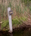 | ||
| route | detour | Ruta fixa de desviament. Ejemplos Bedarfsumleitung a Alemanya i uitwijkroute a Holanda. | 
| ||
| route | ferry | Ruta que fa un ferri de terminal a terminal. Assegureu-vos d'afegir un node per tessel·la (nivell d'escala 12) o millor un cada pocs kilomètres per poder baixar-los amb els editors fora de línia en peticions bbox. |  |
 | |
| route | foot | Walking Route - is used for routes which are walkable without any limitations regarding fitness, equipment or weather conditions. |  | ||
| route | hiking | Per a rute a peu, consulteu hiking. |  | ||
| route | horse | Riding routes |  | ||
| route | inline_skates | Inline has more information on the subject. | |||
| route | light_rail | Route of a light rail line. |  | ||
| route | mtb | Per a rutes en bicleta de muntanya, consulteu Mountainbike. |  | ||
| route | piste | Proposta per a rutes amb raquetes o esquí nòrdic, de travessa, o de fons. |  | ||
| route | railway | Trams de via fèrria amb nom propi (Ex: Túnel del Canal), consulteu Railways. |  | ||
| route | road | Rutes de carretera. |  | ||
| route | running | For running (jogging) routes. |  | ||
| route | ski | For ski tracks (e.g., XC-Ski Trails User:Langläufer/Loipemap). |  | ||
| route | subway | Route of a metro service |  | ||
| route | train | Rutes ferroviàries. Ex:Transiberià, Transcantàbric. C8A. Vegeu Railways. |  | ||
| route | tracks | Railroad track as rail infrastructure. |  | ||
| route | tram | Per a rutes de tramvia, consulteu Trams. |  | ||
| route | trolleybus | The route of a trolleybus service. |  | ||
| route | Definit per l'usuari | Consulteu la pàgina de Taginfo |
This table is a wiki template with a default description in English. Editable here.
Comercios
La etiqueta de tienda se utiliza como un lugar de negocios que ha almacenado productos para la venta. Consulte la página titulada ES:Key:shop para obtener una introducción sobre su uso.
Alimentos, bebidas
Esta tabla es una wiki plantilla con una descripción predeterminada en español. Editable aquí. Si en el campo descripción el texto está en inglés o no hay, es debido a que la página de esa etiqueta no está bien documentada.
Grandes almacenes, centro comercial
Esta tabla es una wiki plantilla con una descripción predeterminada en español. Editable aquí. Si en el campo descripción el texto está en inglés o no hay, es debido a que la página de esa etiqueta no está bien documentada.
Ropa, zapatos, accesorios
Esta tabla es una wiki plantilla con una descripción predeterminada en español. Editable aquí. Si en el campo descripción el texto está en inglés o no hay, es debido a que la página de esa etiqueta no está bien documentada.
Tiendas de rebajas, caridad
Esta tabla es una wiki plantilla con una descripción predeterminada en español. Editable aquí. Si en el campo descripción el texto está en inglés o no hay, es debido a que la página de esa etiqueta no está bien documentada.
Salud y belleza
Esta tabla es una wiki plantilla con una descripción predeterminada en inglés. Editable aquí. Si en el campo descripción el texto está en inglés o no hay, es debido a que la página de esa etiqueta no está bien documentada.
Hazlo tu mismo, hogar, materiales de construcción, jardinería
Esta tabla es una wiki plantilla con una descripción predeterminada en inglés. Editable aquí. Si en el campo descripción el texto está en inglés o no hay, es debido a que la página de esa etiqueta no está bien documentada.
Muebles e interior
Esta tabla es una wiki plantilla con una descripción predeterminada en inglés. Editable aquí. Si en el campo descripción el texto está en inglés o no hay, es debido a que la página de esa etiqueta no está bien documentada.
Electrónica
Esta tabla es una wiki plantilla con una descripción predeterminada en inglés. Editable aquí. Si en el campo descripción el texto está en inglés o no hay, es debido a que la página de esa etiqueta no está bien documentada.
Aire libre y deportes, vehículos
Esta tabla es una wiki plantilla con una descripción predeterminada en inglés. Editable aquí. Si en el campo descripción el texto está en inglés o no hay, es debido a que la página de esa etiqueta no está bien documentada.
Arte, música, aficiones, hobbies
Esta tabla es una wiki plantilla con una descripción predeterminada en inglés. Editable aquí. Si en el campo descripción el texto está en inglés o no hay, es debido a que la página de esa etiqueta no está bien documentada.
Papelería, regalos, libros, periódicos
Esta tabla es una wiki plantilla con una descripción predeterminada en inglés. Editable aquí. Si en el campo descripción el texto está en inglés o no hay, es debido a que la página de esa etiqueta no está bien documentada.
Otros
Esta tabla es una wiki plantilla con una descripción predeterminada en inglés. Editable aquí. Si en el campo descripción el texto está en inglés o no hay, es debido a que la página de esa etiqueta no está bien documentada.
Deporte
Esto se usa para proporcionar información sobre qué deportes se practican en una instalación como un campo o un estadio. Está destinado a ser utilizado junto con etiquetas landuse=* o leisure=*. Véase la página titulada Deporte para una introducción de su uso.
Esta tabla es una wiki plantilla con una descripción predeterminada en español. Editable aquí. Si en el campo descripción el texto está en inglés o no hay, es debido a que la página de esa etiqueta no está bien documentada.
Sport (esports)
| Clave | Valor | Elemento | Comentario | Ejemplo |
|---|---|---|---|---|
| sport | 10pin | Bolera americana | ||
| sport | athletics | Atletisme | ||
| sport | baseball | Beisbol | ||
| sport | basketball | Bàsquetbol | ||
| sport | bowls | Bitlles | ||
| sport | climbing | Escalada | ||
| sport | cricket | Cricket | ||
| sport | cricket_nets | Redes de entrenamiento de cricket | ||
| sport | croquet | Croquet | ||
| sport | cycling | Ciclisme | ||
| sport | dog_racing | Canòdrom | ||
| sport | equestrian | Equitació | ||
| sport | football | Futbol americà | ||
| sport | golf | Golf | ||
| sport | gymnastics | Gimnàsia | ||
| sport | hockey | Hoquei | ||
| sport | horse_racing | Hipòdrom | ||
| sport | motor | Motor | ||
| sport | multi | Poliesportiu | ||
| sport | pelota | Pilota basca | ||
| sport | racquet | Esports de raqueta (excepte tennis) | ||
| sport | rugby | Rugbi | ||
| sport | skating | Patinatge | ||
| sport | skateboard | Monopatí | ||
| sport | soccer | Futbol | ||
| sport | swimming | Natació | ||
| sport | skiing | Esquí | ||
| sport | table_tennis | Tennis de taula | ||
| sport | tennis | Tennis |
Turismo
Esto se usa para mapear lugares y cosas de interés específico para turistas. Por ejemplo, pueden ser lugares de interés para visitar, lugares donde alojarse y cosas y lugares que brindan apoyo. Véase la página Turismo para una introducción sobre su uso.
Esta tabla es una wiki plantilla con una descripción predeterminada en español. Editable aquí. Si en el campo descripción el texto está en inglés o no hay, es debido a que la página de esa etiqueta no está bien documentada.
Cursos de agua
Etiquetas usadas para describir tipos diferentes de cursos de agua como ríos, arroyos, canales, etc. La dirección de la línea debe ser la misma que el sentido de flujo del agua. Mire la página titulada ES:Cursos de agua para una introducción a su uso.
Cursos de agua naturales
Esta tabla es una wiki plantilla con una descripción predeterminada en español. Editable aquí. Si en el campo descripción el texto está en inglés o no hay, es debido a que la página de esa etiqueta no está bien documentada.
Cursos de agua artificiales
Esta tabla es una wiki plantilla con una descripción predeterminada en español. Editable aquí. Si en el campo descripción el texto está en inglés o no hay, es debido a que la página de esa etiqueta no está bien documentada.
Instalaciones
Esta tabla es una wiki plantilla con una descripción predeterminada en español. Editable aquí. Si en el campo descripción el texto está en inglés o no hay, es debido a que la página de esa etiqueta no está bien documentada.
Barreras
Esta tabla es una wiki plantilla con una descripción predeterminada en español. Editable aquí. Si en el campo descripción el texto está en inglés o no hay, es debido a que la página de esa etiqueta no está bien documentada.
Otros
Esta tabla es una wiki plantilla con una descripción predeterminada en español. Editable aquí. Si en el campo descripción el texto está en inglés o no hay, es debido a que la página de esa etiqueta no está bien documentada.
Atributos adicionales
Esta tabla es una wiki plantilla con una descripción predeterminada en español. Editable aquí. Si en el campo descripción el texto está en inglés o no hay, es debido a que la página de esa etiqueta no está bien documentada.
Características Adicionales
Direcciones
Se usa para proporcionar información postal a edificios o instalaciones. Ver las páginas tituladas Direcciones y addr=* para una introducción sobre su uso.
Para casas individuales
This table is a wiki template with a default description in English. Editable here.
Para países que usen divisiones territoriales
This table is a wiki template with a default description in English. Editable here.
Para interpolaciones
This table is a wiki template with a default description in English. Editable here.
Anotaciones
Para proporcionar más información sobre los valores de las etiquetas para otros mapeadores y, en algunos casos, también para los usuarios. Vea la página titulada Anotaciones para una introducción sobre su uso.
Esta tabla es una wiki plantilla con una descripción predeterminada en español. Editable aquí. Si en el campo descripción el texto está en inglés o no hay, es debido a que la página de esa etiqueta no está bien documentada.
Nombres
La etiqueta nombre es la principal etiqueta para denominar un elemento. Véase Nombres para más información sobre cómo utilizar esta etiqueta.
Esta tabla es una wiki plantilla con una descripción predeterminada en español. Editable aquí. Si en el campo descripción el texto está en inglés o no hay, es debido a que la página de esa etiqueta no está bien documentada.
Propiedades
Se usa para proporcionar información adicional de carácter general sobre otro elemento.
Esta tabla es una wiki plantilla con una descripción predeterminada en español. Editable aquí. Si en el campo descripción el texto está en inglés o no hay, es debido a que la página de esa etiqueta no está bien documentada.
Referencias
Reference es la etiqueta para referenciar un elemento.
Esta tabla es una wiki plantilla con una descripción predeterminada en español. Editable aquí. Si en el campo descripción el texto está en inglés o no hay, es debido a que la página de esa etiqueta no está bien documentada.
Restricciones
Se usa para definir las restricciones que se aplican al elemento asociado. Ver Restricciones para más detalles.
Tipos de vehículos
Esta tabla es una wiki plantilla con una descripción predeterminada en español. Editable aquí. Si en el campo descripción el texto está en inglés o no hay, es debido a que la página de esa etiqueta no está bien documentada.
Otros
Esta tabla es una wiki plantilla con una descripción predeterminada en español. Editable aquí. Si en el campo descripción el texto está en inglés o no hay, es debido a que la página de esa etiqueta no está bien documentada.


