TEST INSTANCE: Use wiki.openstreetmap.org for real work
Ko:Map Features
오픈스트리트맵은 기본 데이터 구조(노드, 길, 관계)에 태그를 붙여서 지상에 있는 물리적인 지물(건물이나 도로 등)을 표현합니다. 각 태그들은 특정한 노드, 길, 관계로 보이는 지물의 지리적인 속성을 표현합니다.
오픈스트리트맵의 자유로운 태그 시스템으로 모든 지물마다 속성을 제한 없이 포함할 수 있도록 해 줍니다. 커뮤니티는 가장 일반적으로 사용되는 태그에 대한 특정 키와 값 조합에 동의하며, 이는 비공식적인 표준 역할을 합니다. 하지만, 이용자들은 지도를 발전시키거나 이전에는 없었던 속성이 필요한 분석을 뒷받침하기 위해 새로운 태그를 만들어낼 수 있습니다. 특정한 주제나 관심사와 관련된 태그의 짧은 설명은 지물 문서에서 찾을 수 있습니다.
highway=footway와 같은 분류 태그가 있는 경로와 name=*을 사용하는 이름과 같은 소수의 태그만으로 대부분의 기능을 설명할 수 있습니다. 그러나 오픈스트리트맵은 전 세계를 아우르는 지도이기 때문에 오픈스트리트맵에는 거의 대부분 태그로 나타낼 수 있는 지물 유형이 수없이 있을 수 있습니다.
여기에는 기존 태그에 대한 제안된 변경, 비활성 지물 및 더 이상 쓰지 않는 지물이 있습니다. 이 목록에서 알맞은 태그를 찾을 수 없다면, 새로운 태그 값을 사용해야 하는 이유를 입증해서 자유롭게 새로운 태그를 만드세요. 시간이 지남에 따라 폭넓은 합의에 따라 태그가 바뀔 수도 있습니다. 그러나 많은 좋은 태그는 먼저 쓰다가 나중에 문서화되었습니다. 태그 체계의 최신 업데이트는 변경 기록을 보십시오.
영어본 내용과 영어본에서 바로 번역된 문서는 OSM 공통의 내용을 다룰 뿐 한국의 실정과 조금 다를 수도 있습니다.
주요 지물
공중 케이블
이 태그는 사람이나 화물을 공중 케이블을 사용해 운반할 때 사용하는 여러 종류의 대중 교통에 사용됩니다. 예를 들어 케이블카, 체어 리프트, 드래그 리프트 등이 있습니다. 이 태그를 사용하는 법을 더 자세히 알고 싶다면 Ko:Aerialway 문서를 참조하세요.
| 종류 | 태그 | 요소 | 설명 | 표시 | 이미지 | Taginfo |
|---|---|---|---|---|---|---|
| 공중 케이블의 종류 | ||||||
| aerialway | cable_car | 케이블카, 한 쌍의 선에 객실을 매달고 사람이나 짐을 운반하는 장치. |  |
 |
| |
| aerialway | gondola | 곤돌라, 하나의 선에 객실을 매단 리프트의 일종. |  |
 |
| |
| aerialway | chair_lift | 체어리프트, 주로 스키장에서 사람들을 실어나르는 장치. |  |
 |
| |
| aerialway | mixed_lift | 체어리프트와 곤돌라를 혼합한 새로운 종류의 리프트. |  |
 |
| |
| aerialway | drag_lift | 산 위로 사람들을 끌어 올리는 장치 |  |
 |
| |
| aerialway | t-bar | T자형 스키 리프트. |  |
 |
| |
| aerialway | j-bar | J자형 스키 리프트. |  |
 |
| |
| aerialway | platter | aerialway=drag_lift의 종류. |  |
 |
| |
| aerialway | rope_tow | aerialway=drag_lift의 종류. 스키어들이 잡고 슬로프 위로 오르는 회전 로프. |  |
 |
| |
| aerialway | magic_carpet | 매직 카펫, 무빙워크와 비슷한 스키 리프트의 일종. | 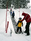 |
| ||
| aerialway | zip_line | 짚라인, 객실 없이 선에 연결된 벨트를 잡고 이동하는 장치. |  |
 |
| |
| 장비 | ||||||
| aerialway | pylon | 리프트나 케이블카의 선을 지탱하는 철탑. |  |
| ||
| aerialway | station | '리프트나 케이블카에 탑승하거나 빠져나올 수 있는 곳. | 
|
 |
| |
| 기타 | ||||||
| 더는 사용하지 않습니다. aerialway=zip_line을 사용해 주세요. 이 태그는 oneway=yes를 포함하고 있습니다. 내려가는 방향으로 그려 주세요. |  |
| ||||
| aerialway | goods | 화물 전용의 리프트. |  |
 |
| |
| aerialway | 사용자 정의 | Taginfo 문서에서 자주 사용하는 값을 확인할 수 있습니다. | ||||
This table is a wiki template with a default description in English. Editable here.
항공 관련
주로 비행기나 헬리콥터의 운항에 사용하는 공항, 비행장입니다. 이 태그를 사용하는 법을 더 자세히 알고 싶다면 Ko:Aeroway 문서를 참조하세요.
| 키 | 값 | 요소 | 설명 | 표시 | 이미지 |
|---|---|---|---|---|---|
| aeroway | aerodrome | 공항, 비행장 |  | ||
| aeroway | airstrip | A field or area where light aircraft can land and take off from. |  | ||
| aeroway | apron | 계류장. 비행기가 멈추거나, 비행기를 타고 내리는 영역. |  |
 | |
| aeroway | control_center |  | |||
| aeroway | fuel | Fuelling station for aircraft. |  | ||
| aeroway | gate | 탑승객이 탑승하기 전에 기다리는 게이트 번호. |  |
 | |
| aeroway | hangar | 기체를 넣기 위해 넓은 영역을 차지하는 큰 공항 건물. |  | ||
| aeroway | helipad | 헬리콥터가 착륙하는 영역 또는 플랫폼. |  | ||
| aeroway | heliport | 헬리콥터용으로 지어진 특별한 이착륙장. |  | ||
| aeroway | highway_strip |  | |||
| aeroway | holding_position | A point behind which aircraft are considered clear of a crossing way |  | ||
| aeroway | jet_bridge | Passenger boarding bridge |  | ||
| aeroway | model_runway | Take-off and landing runway for model aircraft |  | ||
| aeroway | navigationaid | 항공기에게 시각적으로 안내를 도와주는 시설. |  | ||
| airmark | beacon |  | |||
| aeroway | parking_position | A location where an aeroplane can park |  | ||
| aeroway | runway | 이착륙장의 활주로. |  |
 | |
| aeroway | stopway | Stopway is a rectangular surface beyond the end of a runway used during an aborted takeoff. |  | ||
| aeroway | taxilane | 계류장 등에 있는 경로. | |||
| aeroway | taxiway | 공항의 유도로. |  |
 | |
| aeroway | terminal | 공항의 승객용 건물. |  |
 | |
| aeroway | tower | See also aeroway=control_tower or combination of man_made=tower + service=aircraft_control for similar schemes. |
 | ||
| aeroway | windsock | 파일럿이 풍향과 풍속을 볼 수 있게 해 주는 지물. |  | ||
| aeroway | 사용자 정의 | Taginfo 문서에서 자주 사용하는 값을 확인할 수 있습니다. |
This table is a wiki template with a default description in English. Editable here. 한국어 번역은 여기에 있습니다.
시설
화장실, 공중전화, 은행, 약국, 카페, 주차장, 학교 등, 관광객이나 거주민이 사용하는 시설을 지도에 나타낼 때 사용합니다. 자세한 사용법은 Amenities 문서를 참조하세요.
| 범례 | 값 | 요소 | 설명 | 표시 | 사진 | |
|---|---|---|---|---|---|---|
음식 | ||||||
| amenity | bar | 주점은 허가 하에 알코올 음료를 판매하는 상업 시설입니다. 주점은 시끄럽고 활기찬 분위기의 공간으로, 파티와 비슷하며 일반적으로 음식은 판매하지 않습니다. 주점과 바, 또는 식당과의 차이는 amenity=pub;bar;restaurant를 참조하세요. |  | |||
| amenity | bbq | BBQ 혹은 바비큐는 음식을 조리할 때 쓰는 고정 그릴입니다. 주로 야외(공원이나 해변 등)에 설치되며, 누구나 이용할 수 있습니다. 연료는 fuel=* 태그로 나타낼 수 있습니다(예시: fuel=wood;electric;charcoal). 근처에 식탁과 의자가 있다면 tourism=picnic_site 태그를 붙이세요. 캠프파이어나 불구덩이는 이 태그 대신 leisure=firepit 태그를 사용하세요. |  | |||
| amenity | biergarten | 비어 가든(Biergarten 또는 beer garden)은 알코올 음료와 음식이 준비되어 있는 야외 공간입니다. 자세한 설명은 amenity=pub;bar;restaurant를 참조하세요. 비어 가든은 일반적으로 맥주 홀, 펍, 바, 식당 근처에 위치해 있습니다. 이런 경우, amenity=pub;bar;restaurant 태그에 biergarten=yes를 같이 붙이세요. |  | |||
| amenity | cafe | 카페는 일반적으로 간단한 음식과 음료(주로 커피와 차)를 제공하는 비공식적인 공간입니다. 커피숍이라고도 하며, 외국에서는 coffeehouse, bistro, sidewalk cafe라고도 합니다. 음식이나 음료의 종류는 cuisine=*과 diet:*=*로 나타낼 수 있습니다. amenity=restaurant;bar;fast_food 태그도 참조하세요. |  | |||
| amenity | drinking_water | 식수대(Drinking water)는 사람들이 텀블러 등에 물을 담거나 직접 마실 수 있도록 하는 곳입니다. 여기서 제공되는 물은 주로 식수용으로만 쓰입니다. 영어로는 Drinking water, drinking fountain, 또는 bubbler 등으로 불리기도 합니다. |  | |||
| amenity | fast_food | 패스트 푸드 가게입니다(amenity=restaurant도 참고하십시오). 음식이나 음료의 종류는 cuisine=*과 diet:*=*로 나타낼 수 있습니다. |  | |||
| amenity | food_court | 푸드코트는 다양한 식당 카운터가 있으며, 음식을 먹는 공간은 공유하는 곳입니다. 일반적으로 마트나 공항에서 찾아볼 수 있습니다. |  | |||
| amenity | ice_cream | 아이스크림 가게입니다. 아이스크림이나 언 요거트를 판매합니다. |  | |||
| amenity | pub | 펍. 맥주나 기타 알코올 음료를 판매하는 장소입니다. 영국에서는 음식이나 숙박을 제공하기도 합니다. 자세한 설명, 그리고 바와 펍의 차이는 amenity=bar와 amenity=pub을 참조하세요. |  | |||
| amenity | restaurant | 패스트 푸드 가게를 제외한 음식점입니다(패스트 푸드 가게는 amenity=fast_food를 참고하십시오). 음식이나 음료의 종류는 cuisine=*과 diet:*=*로 나타낼 수 있습니다. |  | |||
교육 | ||||||
| amenity | college | (4년제가 아닌 혹은 종합대학이 아닌) 대학교 캠퍼스 또는 건물. | 
|
 | ||
| amenity | kindergarten | 유치원. 아직 초등학교를 다니기에 어린 아이들을 가르치는 시설입니다. | 
|
 | ||
| amenity | library | 도서관. 지자체나 교육 시설 등에서 설립한 책 대여 및 독서 공간입니다. |  | |||
| amenity | public_bookcase | 길거리에 있는 책장. 책을 넣고 뺄 수 있습니다. |  | |||
| amenity | school | 학교와 학교 부지. | 
|
 | ||
| amenity | music_school | 음악 학원, 음악 학교. | ||||
| amenity | driving_school | 운전 학원, 운전 교습소. | ||||
| amenity | language_school | 어학원, 어학당. | ||||
| amenity | university | (4년제 또는 종합)대학교 또는 대학교 부지. | 
|
 | ||
교통 | ||||||
| amenity | bicycle_parking | 자전거 주차장. |  | |||
| amenity | bicycle_repair_station | 직접 자전거를 수리할 수 있는 공간. |  | |||
| amenity | bicycle_rental | 자전거 대여소. 자전거를 빌릴 수 있는 곳입니다. |  | |||
| amenity | boat_sharing | 보트를 공유하는 공간. |  | |||
| amenity | bus_station | 버스 터미널. 여러 노선 버스가 지나가는 큰 정류장입니다. public_transport=station 태그를 사용할 수도 있습니다. |  | |||
| amenity | car_rental | 자동차 대여소. 흔히 렌터카로 불리는 곳입니다. 자동차를 빌릴 수 있는 곳입니다. | ||||
| amenity | car_sharing | 차를 공유하는 공간. |  | |||
| amenity | car_wash | 세차장. |  | |||
| amenity | charging_station | 충전소. 전기 자동차를 충전시킬 수 있는 곳입니다. |  | |||
| amenity | ferry_terminal | 페리 터미널/정류장. 사람이나 차 등이 페리에 타는 곳입니다. |  | |||
| amenity | fuel | 주유소. 도로변에 있는 주유소에는 highway=service 태그가 붙어 있기도 합니다. |  | |||
| amenity | grit_bin | 제설함. 모래 또는 소금과 모래의 혼합물을 저장해 놓는 통입니다. |  | |||
| amenity | motorcycle_parking | 오토바이 주차장. 오토바이 전용 주차장입니다. |  | |||
| amenity | parking | 주차장. 주로 차를 세우는 곳입니다. 점 또는 영역(access 태그 없음)에는 주차장 아이콘이 붙습니다. 영역에는 색이 칠해집니다. 주차장 도로는 highway=service와 service=parking_aisle을 사용하세요. |  | |||
| amenity | parking_entrance | 주차장 출입구. 지하주차장이나 다층 주차장에 존재합니다. type=site와 site=parking을 이용하면 여러 주차장 입구를 하나로 묶을 수 있습니다. amenity=parking과 섞어 쓰지 마세요. |  | |||
| amenity | parking_space | 단일 주차 공간입니다. type=site와 site=parking을 이용하면 여러 주차 공간을 하나로 묶을 수 있습니다. amenity=parking과 섞어 쓰지 마세요. |  | |||
| amenity | taxi | 택시 정류장. 택시가 승객을 기다리는 공간. |  | |||
경제 | ||||||
| amenity | atm | ATM 기기. |  | |||
| amenity | bank | 은행. ATM기가 설치된 은행의 경우 ATM기는 따로 노드로 표기해 주시기 바랍니다. |  | |||
| amenity | bureau_de_change | 환전소. 외국 화폐나 수표를 현지 화폐로 바꿔주는 곳입니다. |  | |||
보건, 의료 | ||||||
| amenity | baby_hatch | 급할 경우 아기를 익명으로 보내서 안전하게 보호하고 입양시킬 수 있게끔 마련한 곳입니다. |  | |||
| amenity | clinic | 진료소. 의원보다는 크고 병원보다는 작은 의료 시설입니다. 일상적인 건강 관련 문제를 상담할 수 있습니다. | 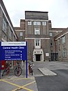 | |||
| amenity | dentist | 치과 의원. 이, 잇몸, 턱 등을 다루는 의료 기관입니다. |  | |||
| amenity | doctors | 의원. 한 의사가 운영하는 소규모 의료 기관입니다. | 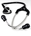 | |||
| amenity | hospital | 병원. 아픈 사람들을 집중적으로 치료하는 곳입니다. 응급실이나 그에 준하는 시설이 있을 시 emergency=* 태그를 붙여 나타냅니다. |  | |||
| amenity | nursing_home | 지속적인 돌봄이 필요한 장애인이나 노인을 위한 거주 공간입니다(요양원). 자세한 정보는 social_facility=*를 참조하세요. |  | |||
| amenity | pharmacy | 약국. 치료에 필요한 약을 제조, 유통하는 곳입니다. dispensing=yes dispensing=no 혹은 omitted |
 | |||
| amenity | social_facility | 사회적 서비스를 제공하는 공간. |  | |||
| amenity | veterinary | 동물병원. 수의사들이 진료하는 공간. |  | |||
| healthcare | blood_donation | 혈액, 혈장, 혈소판, (혹은 아마도) 줄기세포를 뽑아내는 곳(헌혈의 집). |  | |||
오락, 예술, 문화 | ||||||
| amenity | arts_centre | 미술관(예술관). 다양한 예술품이 전시되어 있는 곳. |  | |||
| amenity | brothel | 사창가. |  | |||
| amenity | casino | 카지노. 테이블 게임(룰렛이나 블랙잭 등)을 갖추었으며, 배팅을 할 수 있는 공간. |  | |||
| amenity | cinema | 영화관. |  | |||
| amenity | community_centre | 커뮤니티 센터. 지역 행사나 축제에 사용되는 공간. |  | |||
| amenity | fountain | 분수. 문화적/장식용/오락용 분수가 있음. |  | |||
| amenity | gambling | 도박장. shop=bookmaker(마권 판매소), shop=lottery(복권 판매소), amenity=casino(카지노), leisure=adult_gaming_centre(성인게임 센터)와는 다릅니다.
여기서는 빙고나 빠칭코 등을 취급합니다. |
 | |||
| amenity | nightclub | 나이트 클럽. |  | |||
| amenity | planetarium | 천체 투영관(플라네타리움). |  | |||
| amenity | social_centre | 비영리 단체의 본부 및 지부. |  | |||
| amenity | stripclub | 스트립바. 스트립쇼나 랩 댄스를 제공하는 공간(성 매매는 amenity=brothel을 사용하세요). |  | |||
| amenity | studio | TV/라디오 스튜디오. |  | |||
| amenity | swingerclub | 집단 성교(난교)를 위해 만나는 장소. |  | |||
| amenity | theatre | 극장/공연장. 희극이나 오페라, 콘서트 등을 선보이는 곳입니다. 영화관은 amenity=cinema 태그를 사용하세요. |  | |||
그 외 | ||||||
| amenity | animal_boarding | 동물 돌봄 시설. (일반적으로 명절 때) 돈을 내고 동물을 잠시 맡겨 놓는 곳. |  | |||
| amenity | animal_shelter | 동물 보호소. |  | |||
| amenity | baking_oven | 빵 같은 것을 구울 때 사용하는 오븐. 보통 빵 굽는 건물(building=bakehouse) 안에 있음. |  | |||
| amenity | bench | 벤치. |  | |||
| amenity | clock | 시계(시계탑 포함). |  | |||
| amenity | courthouse | 법원. |  | |||
| amenity | coworking_space | 공유 사무실. 개인이나 여러 명이 공유하는 사무실(유료). |  | |||
| amenity | crematorium | 화장장. |  | |||
| amenity | crypt | (교회) 묘지의 지하실. 사르코파구스(석관의 일종), 관 또는 유물 등이 들어가 있습니다. |  | |||
| amenity | dive_centre | 다이브 센터. 스포츠 다이버들이 스쿠버 다이빙을 시작하는 장소입니다. |  | |||
| amenity | dojo | Training place for any of the Japanese arts. |  | |||
| amenity | embassy | 대사관. |  | |||
| amenity | fire_station | 소방서. 소방대가 상주하면서 출동을 대기하는 장소입니다. |  | |||
| Deprecated. For campfires and firepits, see Tag:leisure=firepit |  | |||||
| amenity | game_feeding | Game feeding place |  | |||
| amenity | grave_yard | A (smaller) place of burial, often you'll find a church nearby. Large places should be landuse=cemetery instead. | 
|
 | ||
| Do no use, leisure=fitness_centre is preferred! A place which houses exercise equipment for the purpose of physical exercise. | ||||||
| amenity | hunting_stand | A hunting stand | 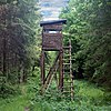 | |||
| amenity | internet_cafe | PC방, 인터넷 카페. 인터넷 서비스 제공이 주된 역할인 업장입니다. |  | |||
| amenity | kneipp_water_cure | Outdoor foot bath facility. Usually this is a pool with cold water and handrail. Popular in German speaking countries. |  | |||
| amenity | marketplace | 시장. 상품 및 서비스가 매일 또는 주기적으로 거래되는 장소입니다. |  | |||
| amenity | photo_booth | Photo Booth – A stand to create instant photo. |  | |||
| amenity | place_of_worship | A church, mosque, or temple, etc. Note that you also need religion=*, usually denomination=* and preferably name=* as well as amenity=place_of_worship. See the article for details. |  | |||
| amenity | police | A police station |  | |||
| amenity | post_box | A box for the reception of mail. Alternative mail-carriers can be tagged via operator=* | 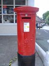 | |||
| amenity | post_office | 우체국. 우편 전달을 맡는 곳입니다. |  | |||
| amenity | prison | 교도소. |  | |||
| 이 태그는 쓰지 마십시오. office=government를 참고하십시오. | ||||||
| amenity | ranger_station | National Park Visitor Headquarters |  | |||
| amenity | recycling | 재활용 시설. Recycling facilities (bottle banks, etc.). Combine with recycling_type=container for containers or recycling_type=centre for recycling centres. |  | |||
| amenity | shelter | A small shelter against bad weather conditions. To additionally describe the kind of shelter use shelter_type=*. |  | |||
| amenity | shower | Public shower or bath. |  | |||
| amenity | table | A public table to sit down and eat or just relax |  | |||
| amenity | telephone | 공중 전화기. |  | |||
| amenity | toilets | 공중 화장실. 지역에 따라 사용료를 내야 할 수도 있습니다. |  | |||
| amenity | townhall | Building where the administration of a village, town or city may be located, or just a community meeting place | 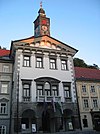 | |||
| amenity | vending_machine | 자판기. 음료수, 신문, 휴지 등 갖가지 물품들을 팝니다. 판매 물품의 종류는 vending=*을 사용하여 나타내주십시오. |  | |||
| amenity | waste_basket | A single small container for depositing garbage that is easily accessible for pedestrians. | 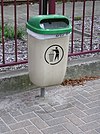 | |||
| amenity | waste_disposal | A place where canal boaters, caravaners, etc. can dispose of rubbish (trash/waste). |  | |||
| amenity | waste_transfer_station | A waste transfer station is a location that accepts, consolidates and transfers waste in bulk. | ||||
| amenity | watering_place | Place where water is contained and animals can drink |  | |||
| amenity | water_point | Place where you can get large amounts of drinking water |  | |||
| amenity | user defined | All commonly used values according to Taginfo | ||||
This table is a wiki template with a default description in English. 영문판은 여기서, 한국어판은 여기서 편집하실 수 있습니다.
영어 원본의 내용을 이해할 수 있다면 번역 완료에 힘을 모아 주십시오. 번역 방법에 대해서는 위키 번역 방법에 대한 설명을 읽어주시길 바랍니다. 만약 이 문서의 번역이 충분하다고 판단되면 이 틀을 지워주시길 바랍니다.
이 즈음에는 맡아서 번역을 하는 사람이 없기 때문에, 당신이 이 작업을 해 줄 수 있습니다.
Barrier
These are used to describe barriers and obstacles that are usually involved by traveling. See the page Barriers for an introduction on its usage.
Linear barriers
This table is a wiki template with a default description in English. Editable here.
Access control on highways
This table is a wiki template with a default description in English. Editable here.
경계선
행정구역을 비롯한 다양한 경계를 기술하는 데 사용하는 태그입니다. 자세한 정보는 경계선 문서를 참고하세요.
| 키 | 값 | 요소 | 설명 | 렌더링 예시 | 사진 | |
|---|---|---|---|---|---|---|
| boundary | aboriginal_lands | 호주 원주민, 인디언과 같은 원주민들을 위한 공식적인 보호 구역을 나타냅니다. |  | |||
| boundary | administrative | 행정 구역을 나타냅니다. 행정 구역이란 행정적인 목적을 위해 정부나 다른 단체에 의해 분할된 구역입니다. 행정 구역이 나타낼 수 있는 범위는 작게는 구나 동부터 크게는 국가까지입니다. admin_level=* 태그로 구역의 수준을 나타낼 수 있습니다. 한국의 법정동, 법정리는 행정적인 목적으로 만들어진 구역이 아니므로, Tag:boundary=legal로 나타내야 합니다.
일종의 지리적 논리에 반하는 aboriginal_lands(원주민 보호 지역)이 이 구역 "내부"에 있을 수 있습니다. 이를 기술하는 한가지 방법은 미국의 경우처럼 aboriginal_lands(원주민 보호 지역)이 이를 둘러싼 국가의 행정구역과 병렬적인 주권(parallel sovereignty)을 가지는 것입니다. |
 |
 | ||
| boundary | legal | 법정동, 법정리의 경계를 나타냅니다. | ||||
| boundary | historic | 과거에 역사적으로 존재했던 행정구역 경계로, start_date=*와 end_date=* 태그로 행정구역으로서 효력을 발휘하던 시기를 나타냅니다. 일시적으로 오픈스트리트맵에서 유지되고 있습니다. admin_level=* 태그가 추가로 필요합니다. | ||||
| boundary | maritime | 해양 경계를 나타냅니다. | ||||
| boundary | marker | 경계 표식(en), 국경 표식, 경계석, 또는 국경석은 국경을 세운 시점이나, 국경이 변경된 시점을 나타내는 물리적인 표식입니다. Tag:boundary=marker 문서와 오픈스트리트맵 포럼을 참고하세요. |  | |||
| boundary | national_park | 뛰어난 자연 경관 영역을 나타냅니다. 보존을 하기 위한 영역과 레크리에이션을 위한 영역이 있습니다. (Other languages). | 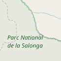 |
 | ||
| boundary | political | 선거구를 나타냅니다. | ||||
| boundary | postal_code | 우편번호 구역을 나타냅니다. | ||||
| boundary | protected_area | 국립공원, 해상보호구역, 유적, 자연보호구역, 문화재, 등과 같이 보호되는 구역을 나타냅니다. | ||||
| boundary | religious_administration | 종교의 관할 구역(교구)을 나타냅니다. admin_level=* 태그가 추가로 필요합니다.Talk:Key:boundary#Religious authority boundaries도 참고하세요. | ||||
| boundary | 사용자 지정 | Taginfo에서 일반적으로 사용되는 모든 값을 확인할 수 있습니다. | ||||
속성 | ||||||
| admin_level | 숫자 | boundary=administrative(행정 경계)의 계층을 나타냅니다. 1부터 10까지의 숫자를 사용할 수 있습니다(단, 볼리피아, 독일, 모잠비크, 네덜란드, 필리핀, 폴란드, 투르크메니스탄, 베네수엘라에서는 11까지 사용). 경계선 문서를 참고하세요. | ||||
| border_type | * | admin_level 태그만으로는 국경의 유형을 충분히 나타낼 수 없을 때 사용합니다. 해상 경계에 사용하기도 합니다. | ||||
| start_date | 날짜 | 경계선의 적용 날짜를 나타냅니다. 기존의 경계선을 그대로 보존하는 동시에 옛 경계(역사적인 경계) 또는 매우 최근에 지정된 경계선, 곧 새롭게 지정될 경계선을 그릴 때 유용합니다. | ||||
| end_date | 날짜 | 경계선의 효력이 종료된 날짜를 나타냅니다. 모든 옛날 경계선 및 곧 폐기될 경계선에는 이 태그가 붙어야 합니다. | ||||
| fire_boundary | yes | Karta01 프로젝트에서 소방본부의 관할 영역을 나타낼 때 사용합니다. | ||||
This table is a wiki template with a default description in English. Editable here. 한국어 번역본은 여기에서 볼 수 있습니다.
건물
개별 건물 또는 서로 연결된 건물을 나타내는 데 사용합니다. 자세한 태그 사용법은 건물 문서를 참조하고, 다양한 다른 구조물을 나타내는 방법은 man_made=*를 참조하세요. 건물 태그는 건물이 물리적으로 존재한다는 것을 나타내기 위한 것입니다. 건물의 기능(경찰서, 교회, 시청, 박물관 등)을 나타내려면 amenity=*(시설), tourism=*(관광), shop=*(상점) 등의 태그를 덧붙여야 합니다.
예를 들어 대형 슈퍼마켓을 오픈스트리트맵에 추가하고 싶다면 building=supermarket 태그를 붙이는 것만으로는 부족합니다. 해당 태그는 건물이 슈퍼마켓 용도로 사용된다는 것을 의미할 뿐입니다. 영업 중인 슈퍼마켓을 나타내고 싶으시다면 반드시 shop=supermarket 태그를 같이 붙여야 합니다. 반대로 shop=*/amenity=* 태그는 그 자체로 건물을 의미하지 않습니다. 건물을 나타내고 싶으시다면 building=* 태그를 꼭 같이 붙여 주세요.
| 키 | 값 | 요소 | 설명 | 사진 | ||
|---|---|---|---|---|---|---|
주거 건물 | ||||||
| building | apartments | 여러 가구가 모여 있는 건물입니다. 주로 복층입니다. 1층에 상점이 있을 수 있습니다. | 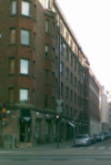 | |||
| building | bungalow | 혼자 동떨어져 있는 단층 주택. |  | |||
| building | cabin | A 오두막은 대충 지어진 작은 집입니다. 외장재를 나무로 한 경우가 많고, 주로 시골에서 찾아볼 수 있습니다. |  | |||
| building | detached | 한 가구가 사는, 홀로 동떨어진 주거 건물입니다. |  | |||
| building | dormitory | 주로 대학생들을 위한 공유 건물입니다(영국 영어에서 dormitory는 하나의 방에 여러 사람이 사는, 한국에서 일반적으로 의미하는 기숙사를 의미하지 않습니다). 이 태그 대신 building=residential + residential=university 태그를 달면 단순히 대학생들을 위한 주거 건물이라는 정보만을 전달합니다. |  | |||
| building | farm | 농장 안에 있는 주거 건물(농가)입니다. 주거 건물 외의 농장 건물은 building=farm_auxiliary(주거 용도가 아닌 농가), building=barn(큰 헛간) 문서 등을 참조하세요. 만약 농가가 일반적인 주거 건물과 같아 보인다면, building=house 태그를 붙여도 됩니다. 농가 주변 영역을 나타내는 방법은 landuse=farmyard 문서를 참조하세요. |  | |||
| building | ger | 영구적, 혹은 계절에 따라 움직이는 유르트 혹은 게르(몽골 유목민들의 건물)입니다. |  | |||
| building | hotel | 숙박을 위한 방을 여러 개 갖추고 있는 건물입니다. 놀이 시설과 주차장까지 아우르는 영역을 포함하는 tourism=hotel 태그 안쪽에 있는 경우가 많습니다. |  | |||
| building | house | 한 가구(한 가족 또는 부엌 등의 시설을 공유하는 사람 몇 명)가 생활하는 주거 건물입니다. 한쪽 벽을 공유하는 집이나 줄지은 테라스형 집을 나타낼 때는 반드시 이웃 집과 두 개 이상의 점을 공유하도록 해 공유 벽을 나타내야 합니다. |  | |||
| building | houseboat | 집으로 사용하는 보트입니다. |  | |||
| building | residential | 주거용으로 사용하는 건물을 일반적으로 나타내는 태그입니다. 'apartments'(아파트), 'terrace'(줄지어 붙어 있는 주택), 'house'(단독주택), 'detached'(외딴 집), 'semidetached_house'(땅콩집) 태그를 사용하면 더 자세한 정보를 전달할 수 있습니다. |  | |||
| building | semidetached_house | 한쪽 벽을 옆 집과 공유하는 단독주택(땅콩집). 미국식 영어로는 "duplex"라고 합니다. |  | |||
| building | static_caravan | 한 곳에서 가만히 있어 움직이지 않는 이동식 주택. |  | |||
| building | terrace | 일렬로 붙어 있는 단독주택(미국식 영어로는 "row-house" 또는 "townhouse"라고 함). 각 가구마다 별도의 입구를 갖습니다. 'house' 태그로 각 주택을 따로따로 정의하는 방법도 고려해 보세요. |  | |||
상업 건물 | ||||||
| building | commercial | 상업 활동을 위한 건물을 일반적으로 나타내는 태그. 꼭 사무실 건물일 필요는 없습니다. 상업 시설이 실제로 영업하고 있다는 사실을 나타내려면 상업 건물을 둘러싸는 영역을 만든 후, 해당 영역에 landuse=commercial 태그를 붙이세요. 상점이 모여 있는 건물에는 'retail' 태그를 사용하세요. |  | |||
| building | industrial | 산업 목적으로 사용하는 건물입니다. 물건을 저장하고 분배하는 장소로 사용하는 건물에는 'warehouse'(창고) 태그를 붙이세요. 산업 시설이 실제로 영업하고 있다는 사실을 나타내려면 산업 건물을 둘러싸는 영역을 만든 후, 해당 영역에 landuse=industrial 태그와 기타 적당한 태그(man_made=works - 공장)를 붙이세요. |  | |||
| building | kiosk | 작은 방 한 칸으로 이루어진 소매 건물입니다. |  | |||
| building | office | 사무(오피스) 건물입니다. 어떤 업종의 사무실인지를 나타내려면 office=* 태그를 사용하세요. 사무실이 실제로 영업하고 있다는 사실을 나타내려면 상업 건물을 둘러싸는 영역을 만든 후, 해당 영역에 landuse=commercial 태그를 붙이세요. 상점이 모여 있는 건물에는 landuse=retail 태그를 사용하세요. | 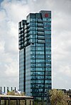 | |||
| building | retail | 일반인에게 상품을 판매하는 용도로 사용하는 건물. 판매하는 상품의 종류를 나타내려면 shop=* 또는 amenity=*(술집, 카페, 식당 등) 태그를 사용하세요. 건물을 둘러싸는 영역을 만든 후, landuse=retail 태그를 붙이는 것도 좋습니다. |  | |||
| building | supermarket | 대형 슈퍼마켓 건물. |  | |||
| building | warehouse | 상품을 저장하거나 배분하기 위해 지어진 건물. |  | |||
종교 건물 | ||||||
| building | cathedral | 대성당 목적으로 지어진 건물. 건물이 현재까지도 성당으로 사용되고 있다면 성당 건물에 amenity=place_of_worship, religion=*(종교), denomination=*(종파), 그리고 건물을 둘러싸는 영역에 landuse=religious 태그를 붙여 주세요. |  | |||
| building | chapel | 소예배당, 예배실 목적으로 지어진 건물. 건물이 현재까지도 예배실로 사용되고 있다면 성당 건물에 amenity=place_of_worship, religion=*(종교), denomination=*(종파), 그리고 건물을 둘러싸는 영역에 landuse=religious 태그를 붙여 주세요. |  | |||
| building | church | 교회 목적으로 지어진 건물. 건물이 현재까지도 교회로 사용되고 있다면 성당 건물에 amenity=place_of_worship, religion=*(종교), denomination=*(종파), 그리고 건물을 둘러싸는 영역에 landuse=religious 태그를 붙여 주세요. |  | |||
| building | monastery |  | ||||
| building | mosque | 모스크 목적으로 지어진 건물. 건물이 현재까지도 모스크로 사용되고 있다면 성당 건물에 amenity=place_of_worship, religion=*(종교), denomination=*(종파), 그리고 건물을 둘러싸는 영역에 landuse=religious 태그를 붙여 주세요. |  | |||
| building | presbytery | 사제가 거주하거나 일하는 건물(사제관). | ||||
| building | religious | 종교 건물을 일반적으로 나타내는 태그. 가능하다면 이보다 더 구체적인 태그를 사용하세요. |  | |||
| building | shrine | 성지나 기도, 기원을 목적으로 지어진 건물. 건물이 현재까지도 성지로 사용되고 있다면 건물에 amenity=place_of_worship, religion=*(종교), denomination=*(종파), 그리고 건물을 둘러싸는 영역에 landuse=religious 태그를 붙여 주세요. 작은 구조물에는 historic=wayside_shrine 태그를 붙이세요. |  | |||
| building | synagogue | 시너고그(유대교 회당) 목적으로 지어진 건물. 건물이 현재까지도 시너고그로 사용되고 있다면 성당 건물에 amenity=place_of_worship, religion=*(종교), denomination=*(종파), 그리고 건물을 둘러싸는 영역에 landuse=religious 태그를 붙여 주세요. |  | |||
| building | temple | 불교 사찰 목적으로 지어진 건물. 건물이 현재까지도 사찰로 사용되고 있다면 성당 건물에 amenity=place_of_worship, religion=*(종교), denomination=*(종파), 그리고 건물을 둘러싸는 영역에 landuse=religious 태그를 붙여 주세요. |  | |||
| building | kingdom_hall |  | ||||
시민/공공 시설 | ||||||
| building | bakehouse | 제빵 건물. 주로 amenity=baking_oven과 oven=wood_fired 태그가 붙은 점과 함께 사용됩니다. |  | |||
| building | civic | 시민 시설과 관련된 건물(amenity=community_centre(커뮤니티 센터), amenity=library(도서관), amenity=toilets(화장실), leisure=sports_centre(스포츠 센터), leisure=swimming_pool(수영장), amenity=townhall(마을 회관) 등)을 일반적으로 나타낼 때 사용합니다. 더 자세한 정보를 나타내고 싶으시다면 amenity=*나 leisure=* 태그를 사용하세요. building=public(공공 건물) 태그도 참고하시면 좋습니다. |  | |||
| building | fire_station | 현재 목적과 관계없이 소방서 용도로 지어진 건물. 실제 운영 중인 소방서를 나타내려면 amenity=fire_station 태그를 추가로 붙이세요. |  | |||
| building | government | 통치 관련 건물(중앙 정부 또는 지방 정부, 국회, 법원)을 일반적으로 나타낼 때 사용합니다. |  | |||
| building | hospital | 병원 목적으로 지어진 건물. 실제 운영 중인 병원을 나타내려면 amenity=hospital 태그를 추가로 붙이세요. |  | |||
| building | public | 공공 목적(마을 회관, 경찰서, 법원 등)으로 지어진 건물. |  | |||
| building | toilets | 화장실 건물. |  | |||
| building | train_station | 철도역 목적으로 지어진 건물. 열차가 지나가지 않아 버려진 건물이나 다른 용도로 사용하는 건물에도 붙일 수 있는 태그입니다. |  | |||
| building | transportation | 대중교통 관련 목적으로 지어진 건물. public_transport=station(역)와 같은 태그를 추가로 붙일 수 있습니다. 철도역 건물에는 이 태그 대신 building=train_station 태그를 붙인다는 점을 참고하세요. |  | |||
| building | kindergarten | 유치원(어린이집) 목적으로 지어진 건물. 실제 운영 중인 유치원을 나타내려면 amenity=kindergarten 태그를 추가로 붙이세요. |  | |||
| building | school | 학교 목적으로 지어진 건물. 실제 운영 중인 학교를 나타내려면 amenity=school 태그를 추가로 붙이세요. |  | |||
| building | university | 종합대학교 건물. 실제 운영 중인 학교를 나타내려면 amenity=university 태그를 추가로 붙이세요. |  | |||
| building | college | 단과대학교 건물. 실제 운영 중인 학교를 나타내려면 amenity=college 태그를 추가로 붙이세요. |  | |||
농업/식물 생산 | ||||||
| building | barn | 창고와 실내 작업장으로 사용하는 농업 건물. |  | |||
| building | conservatory | 실내 정원 또는 일광욕실(겨울 정원, sunroom)로 사용되는, 유리/방수포 지붕과 벽이 있는 건물. |  | |||
| building | cowshed | 외양간. 소를 키우는 건물. |  | |||
| building | farm_auxiliary | 거주 목적으로 사용하지 않는 농장 건물(거주용 농가에는 'farm'이나 'house'를 사용하세요). |  | |||
| building | greenhouse | 온실은 유리나 플라스틱으로 이루어진 건물로, 식물을 재배하는 데 사용됩니다. 여러 온실이 모여 있는 곳에는 영역을 그린 후 landuse=greenhouse_horticulture 태그를 붙일 수 있습니다. |  | |||
| building | slurry_tank | 주로 동물의 배설물(슬러리라고도 함)로 이루어진 액체 혼합물을 수용하기 위해 지어진 원형 건물. |  | |||
| building | stable | 마굿간. 말을 키우는 건물. |  | |||
| building | sty | 돼지우리. 돼지를 키우는 건물. |  | |||
스포츠 | ||||||
| building | grandstand | 지붕이 있는 야외 관중석(그랜드스탠드). |  | |||
| building | pavilion | 경기장에 딸린 부속 건물로, 주로 탈의실이나 창고, 행사 공간이 있습니다(영국 영어로 pavilion). 건축 용어로서 pavilion(전시회의 가설 건물, 또는 공원 내 공연장)에 이 태그를 적용하면 안됩니다( |
 | |||
| building | riding_hall | 승마장 목적으로 지어진 건물. |  | |||
| building | sports_hall | 스포츠 센터 목적으로 지어진 건물. |  | |||
| building | stadium | 대형 경기장(스타디움) 목적으로 지어진 건물. 현재 사용 목적과는 관련이 없습니다. |  | |||
저장소 | ||||||
| building | hangar | 격납고. 비행기나 헬리콥터, 우주선을 보관하는 건물. 적절하다면 aeroway=hangar 태그도 추가로 붙여 주세요. |  | |||
| building | hut | 오두막. 대강 지어진 작은 건물. hut에는 오두막이라는 뜻과 작은 창고(헛간)라는 뜻이 모두 있습니다(참고). 후자에는 building=shed 태그를 붙이세요. |  | |||
| building | shed | A 헛간. 단순한 모양새의 단층 건물로, 주로 창고나 작업장으로 사용합니다. |  | |||
자동차 | ||||||
| building | carport | 간이 차고. 지붕으로만 이루어진 차고. 간이 차고는 일반적인 건물과는 달리 벽이 한 쪽 또는 두 쪽밖에 없습니다. | 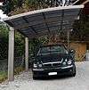 | |||
| building | garage | 차고. 자동차나 그 비슷한 것을 한 대 이상 보관하기 위한 건물. 차고가 여러 개 붙어 있는 대형 건물에는 building=garages 태그를 붙이세요. 비행기 격납고에는 building=hangar 태그를 붙이세요. |  | |||
| building | garages | 차량 수납 공간(차고 문)이 여러 개 있는 건물. 각 공간의 주인은 보통 서로 다릅니다. building=garage 태그도 참고하세요. |  | |||
| building | parking | 자동차를 주차하기 위한 목적으로 지어진 건물. |  | |||
전기/기술 건물 | ||||||
| building | digester | 디제스터(대형 침지기(浸漬器), digester). 생물체(바이오매스)로부터 생물 가스를 생산하는 반응로. |  | |||
| building | service | 특정 기계 설비(펌프나 변압기 등)가 있는, 작은 무인 건물. |  | |||
| building | transformer_tower | 변압기탑. 배전 변압기가 들어 있으며, 중간 전압 송전선에 직접 연결되는 매우 높은 건물입니다. 건물과 연결된 전력선은 보통 나중에 지하화되는 경우가 많지만 건물은 여전히 변전소 역할을 할 수 있습니다. 현재도 건물이 변전소 역할을 한다면 power=substation + substation=minor_distribution 태그를 함께 붙이세요. |  | |||
| building | water_tower | 급수탑. |  | |||
기타 | ||||||
| building | military | 군사 건물. military=*도 참고하세요. | ||||
| building | bunker | 벙커. 단단한 군사 건물. military=bunker도 참고하세요. |  | |||
| building | bridge | 다리(구름다리 포함) 목적으로 지어진 건물(의 일부). 출입구(정문 등)를 감싸는 건물을 나타내려면 building=gatehouse 태그를 쓰세요. highway=*(도로) 지물에 붙는 bridge=yes 태그도 참고하세요 . 해당 태그를 (건물의 일부가 아닌, 통행 목적의)교량이나 영역을 나타내는 데 쓰면 안됩니다. 그 목적으로는 man_made=bridge 태그를 쓰십시오.. |  | |||
| building | castle | 성. historic=castle + castle_type=* 태그를 추가로 붙이면 더 많은 정보를 나타낼 수 있습니다. |  | |||
| building | construction | 공사 중인 건물. 지어지고 있는 건물의 목적을 나타내려면 construction=* 태그를 사용하세요. |  | |||
| building | container | 영구적인 건물로 사용하는 컨테이너. 임시로 갖다 놓은 컨테이너(화물선에 선적될 컨테이너나 공사 현장의 컨테이너 등)를 오픈스트리트맵에 추가하지 마세요. |  | |||
| building | tent | 영구적으로 설치된 텐트. 임시로 설치된 텐트를 오픈스트리트맵에 추가하지 마세요. |  | |||
| building | gatehouse | 출입구(정문 등)나 도로를 감싸고 있는 건물. 경비, 통제, 조망, 숙소 등 다른 쓰임새로 함께 쓰고 있는 문루(門樓)일 때입니다. 보기:남대문(건물이 아니면서 단지 크기만 하고 다른 쓰임새가 없는 경우에는 아닙니다. 보기:절의 일주문) |  | |||
| building | roof | 비를 피하는 쉼터나 주유소에 주로 있는, 지붕으로만 이루어진 구조물. |  | |||
| building | ruins | 버려지고 수리가 잘 되지 않는 집이나 건물에 주로 사용하는 태그. 그러나 일각에서는 가짜 폐허(영국 풍경 정원(English landscape garden)에 인위적으로 조성된 폐허 등)가 아닌 건물에 해당 태그를 사용하는 것이 잘못되었다고 주장하기도 합니다. 수명 태그 체계를 참고하세요. |  | |||
| building | tree_house | 나무 기둥이나 자연목 위에 지어진, 작은 오두막. 지면과는 떨어져 있으며, 사다리, 계단 또는 다리를 통해 접근할 수 있습니다. | 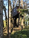 | |||
| building | yes | 구체적인 값을 알 수 없을 때 사용하는 태그. | ||||
| building | 사용자 정의 | 많이 사용된 building 태그를 Taginfo에서 찾을 수 있습니다. | ||||
부가 속성 | ||||||
| entrance | yes | main(정문) | exit(출구) | service(직원용) | emergency(비상구) | 건물의 입구. 폐기된 building=entrance 태그를 대체합니다. |  | |||
| height | 숫자 | 건물의 높이(미터 단위). | 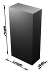 | |||
| building:flats | 숫자 | 주거 단지(아파트 등)의 동 번호. | ||||
| building:levels | 숫자 | 눈에 보이는 건물의 층수(단순 3D 건물 체계). |  | |||
| building:max_level | 숫자 | 건물의 최고 층수(단순 3D 건물 체계). | ||||
| building:min_level | 숫자 | 건물의 최저 층수(단순 3D 건물 체계). | ||||
| non_existent_levels | 숫자 | 실제로 존재하지 않는 층수 목록(4층이나 13층 등, 단순 3D 건물 체계). | ||||
| start_date | 날짜 | 건물이 완공된 (대략적인) 날짜. |  | |||
| building:fireproof | yes | no | 건물이 화재에 잘 견디도록 설계되었는지의 여부를 나타내기 위한 태그. | ||||
| soft_storey | yes | no | reinforced(보강됨) | 건물에 유난히 유연하거나 약한 층이 있는지의 여부를 나타내기 위한 태그. | ||||
This table is a wiki template with a default description in English. Editable here. 한국어판은 여기서 편집하실 수 있습니다.
영어 원본의 내용을 이해할 수 있다면 번역 완료에 힘을 모아 주십시오. 번역 방법에 대해서는 위키 번역 방법에 대한 설명을 읽어주시길 바랍니다. 만약 이 문서의 번역이 충분하다고 판단되면 이 틀을 지워주시길 바랍니다.
이 즈음에는 맡아서 번역을 하는 사람이 없기 때문에, 당신이 이 작업을 해 줄 수 있습니다.
Craft
This is used as a place that produces or processes customised goods. See the page Crafts for more information on the usage of these tags.
This table is a wiki template with a default description in English. Editable here.
긴급 시설
긴급 설비 및 장비가 있는 장소를 묘사하는 데 사용하는 태그입니다. 자세한 사용법은 Key:emergency 문서를 참고하세요.
의료 구제
소방관
인명 구조원
기타 시설
기타 구조물
영어 원본의 내용을 이해할 수 있다면 번역 완료에 힘을 모아 주십시오. 번역 방법에 대해서는 위키 번역 방법에 대한 설명을 읽어주시길 바랍니다. 만약 이 문서의 번역이 충분하다고 판단되면 이 틀을 지워주시길 바랍니다.
이 즈음에는 맡아서 번역을 하는 사람이 없기 때문에, 당신이 이 작업을 해 줄 수 있습니다.
Geological
This is used to describe the geological makeup of an area. See the page Geological for an introduction on its usage.
This table is a wiki template with a default description in English. Editable here.
영어 원본의 내용을 이해할 수 있다면 번역 완료에 힘을 모아 주십시오. 번역 방법에 대해서는 위키 번역 방법에 대한 설명을 읽어주시길 바랍니다. 만약 이 문서의 번역이 충분하다고 판단되면 이 틀을 지워주시길 바랍니다.
이 즈음에는 맡아서 번역을 하는 사람이 없기 때문에, 당신이 이 작업을 해 줄 수 있습니다.
- REDIRECT Template:Map Features:healthcare
도로
도로는 차도나 보도에서 사용합니다. 사용 방법은 도로 문서를 참고하시기 바랍니다. 교통수단의 종류, 시간, 날짜, 혼잡도와 용도 별 접근 제한에 관해서는 제한 문서를 참고하시기 바랍니다.
한국(남한)의 길 체계를 오픈스트리트맵의 길 체계에 맞게 정리한 글은 한국의 도로 체계를 보시기 바랍니다.
| 키 | 값 | 요소 | 설명 | 렌더링 | 사진 | |
|---|---|---|---|---|---|---|
주요 도로 | ||||||
|
아래는 도로망을 위한 주요 태그들입니다. 주요 도로 순으로 나열되어 있습니다. | ||||||
| highway | motorway | 아무 차량이나 들어갈 수 없고, 중앙 분리대가 있으며, 비상용 갓길이 있는 2차로 이상의 도로입니다. 프리웨이나 아우토반 등이 이에 속합니다. |  |
|||
| highway | trunk | 국가 교통체계에서 motorways 다음으로 중요한 도로입니다(중앙 분리대가 필수적이지 않은 도로입니다). |  |
|||
| highway | primary | 국가 교통체계에서 trunk 다음으로 중요한 도로입니다(주로 대형 시내를 연결합니다). |  |
|||
| highway | secondary | 국가 교통체계에서 primary 다음으로 중요한 도로입니다(주로 시내를 연결합니다). |  |
|||
| highway | tertiary | 국가 교통체계에서 secondary 다음으로 중요한 도로입니다(주로 작은 마을과 작은 시내를 연결합니다). |  |
|||
| highway | unclassified | 국가 교통체계에서 가장 중요하지 않은 도로입니다. tertiary 보다는 덜 중요한 도로이지만, 소유지로의 출입과는 다른 목적을 갖고 있는 도로입니다. 일반적으로 마을과 촌락을 연결합니다. ('unclassified'는 영국에서 옛날부터 사용하던 명칭이며, 분류가 알려지지 않았다는 뜻이 아닙니다. (분류를 알 수 없는 도로는 highway=road를 사용하시기 바랍니다.) |  |
|||
| highway | residential | 마을(주거지) 사이를 연결하는 기능은 없으며 주택 접근 시 사용하는 도로입니다. 보동 주택과 같이 그립니다. |  |
|||
연결 도로 | ||||||
| highway | motorway_link | motorway끼리 또는 그 이하의 도로를 잇는 연결 도로(램프)입니다. 일반적으로 motorway와 동일한 통행 제한이 적용됩니다. |  |
 | ||
| highway | trunk_link | trunk끼리 또는 그 이하의 도로를 잇는 연결 도로입니다. | 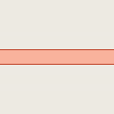 |
 | ||
| highway | primary_link | primary끼리 또는 그 이하의 도로를 잇는 연결 도로입니다. | 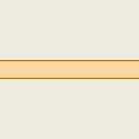 |
 | ||
| highway | secondary_link | secondary끼리 또는 그 이하의 도로를 잇는 연결 도로입니다. | 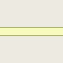 |
 | ||
| highway | tertiary_link | tertiary끼리 또는 그 이하의 도로를 잇는 연결 도로입니다. | 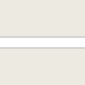 |
|||
비주요 도로 | ||||||
| highway | living_street | 생활 도로(living street) 혹은 주택가 도로. 법적으로 자동차보다 보행자가 우선되고, 속도가 매우 낮게 억제되어 어린이가 도로에서 놀 수 있는 주거 지역의 도로입니다. | 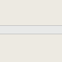 |
 | ||
| highway | service | 산업단지, 야영장, 업무 단지, 주차장, 골목길 등의 진입로 또는 안 길. service=*와 함께 사용하여 사용 유형을 표시하고 access=*와 함께 사용하여 누가 어떤 상황에서 사용할 수 있는지 표시할 수 있습니다. |  |
 | ||
| highway | pedestrian | 보행자만 이용할 수 있는 도로. 상업 및 일부 주거 지역에서 주로/우선적으로 보행자 전용으로 사용되는 도로로, 하루 중 매우 제한된 시간 동안만 자동차의 접근이 허용될 수 있습니다. 광장이나 플라자를 만들고 싶다면 닫힌 선을 그리고 highway=pedestrian와 area=yes 태그를 같이 붙이십시오. | 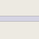 |
 | ||
| highway | track | '농업 및 임업용'으로 사용되는 도로. 도로의 품질(포장 정도)을 나타내려면 tracktype=* 태그를 사용하세요. 참고: 보통 농로나 임도는 비포장 도로인 경우가 많지만, 그렇다고 해서 이 태그만으로 도로의 포장 여부를 알 수는 없습니다. 일반적인 용도의 도로를 나타내려면 도로 단락을 참고하세요. | 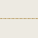 |
|||
| highway | bus_guideway | 가이드웨이 버스(철도처럼 노선 버스만 이용할 수 있는 도로를 별도로 깔아서 교통 체증의 영향을 받지 않도록 하는 대중교통 체계)용 도로. 일반적인 버스 전용차로에는 access=no + psv=yes 태그를 대신 붙이세요! |  |
 | ||
| highway | escape | 브레이크가 작동하지 않을 때 자동차를 멈출 수 있도록 고안한 비상 탈출 도로. 한국에서는 대관령 등지에 설치되어 있습니다. |  | |||
| highway | raceway | (자동차) 레이싱 트랙. | 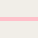 |
 | ||
| highway | road | 유형을 알 수 없는 도로/거리 등. 이 태그는 오솔길부터 고속도로까지의 모든 도로를 아우를 수 있습니다. 이 태그는 도로의 정확한 유형을 알아내기 전까지만 임시로 사용해야 합니다. 도로의 정확한 유형을 알고 있다면 절대 이 태그를 사용하지 말고, 더 구체적인 값을 highway=* 에 집어넣으세요. |  |
 | ||
| highway | busway | A dedicated roadway for bus rapid transit systems |  | |||
인도 등 | ||||||
| highway | footway | 보행자만 통행할 수 있는 인도로 설계된 도로. 자전거도 통행할 수 있다면 bicycle=yes 태그를 덧붙여 주세요. 도로의 주 목적 및 설계 의도를 알 수 없다면 이 태그를 사용하지 마세요. 상업 지구나 주거 지역의 보행자 도로에는 highway=pedestrian 태그를 붙이고, 경운기 등이 다니는 농로에는 highway=track을 붙이세요. |  |
 | ||
| highway | bridleway | 말이 다니는 길. highway=path + horse=designated와 의미가 같습니다. |  |
 | ||
| highway | steps | 인도 한가운데에 설치된 계단입니다. 계단의 단 수를 나타내려면 step_count=*를 사용하세요. |  |
 | ||
| highway | corridor | For a hallway inside of a building. |  | |||
| highway | path | 구체적인 용도가 명시되지 않은 오솔길. 사람이 주로 이용하는 길에는 highway=footway 태그를, 자전거가 다니는 도로에는 highway=cycleway 태그를, 말과 사람이 다니는 길에는 highway=bridleway 태그를, 농로 등으로 사용하는 길에는 highway=track 태그를 붙여 주세요. |  |
 | ||
| highway | via_ferrata | A via ferrata is a route equipped with fixed cables, stemples, ladders, and bridges in order to increase ease and security for climbers. These via ferrata require equipment : climbing harness, shock absorber and two short lengths of rope, but do not require a long rope as for climbing. | 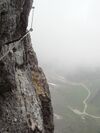 | |||
When sidewalk/crosswalk is tagged as a separate way | ||||||
| footway | sidewalk | Sidewalk that runs typically along residential road. Use in combination with highway=footway or highway=path |  |
 | ||
| footway | crossing | 횡단보도. 사람이 도로를 건널 때 사용하는 부분입니다. |  |
 | ||
| footway | traffic_island | The way between two crossings, safespot for pedestrians, has micromapping characteristics as a detailed alternative to =*. Use in combination with highway=footway or highway=path. |  |
|||
차도 옆에 붙어 있는 인도(인도 문서 참조). | ||||||
| sidewalk | both | left | right | no | Specifies that the highways has sidewalks on both sides, on one side or no sidewalk at all |  | |||
자전거 도로를 별개의 선으로 나타내기(자전거 문서 참조). | ||||||
| highway | cycleway | 자전거 전용도로를 나타냅니다. 기본 접근 제한이 적용되지 않는 경우에만 foot=* 태그를 덧붙이세요. |  |
 | ||
자전거 도로를 차도와 함께 나타내기(자전거 문서 참조) | ||||||
| cycleway | lane | 자전거 도로가 차도의 일부분(차로)을 차지한다는 사실을 나타냅니다. |  | |||
| cycleway | Deprecated variant for ways with oneway=yes where it is legally permitted to cycle in both directions. Replaced by oneway:bicycle=no. |  | ||||
| cycleway | oneway=yes(일방통행로) 태그가 붙은 선에 사용하며, 차도의 방향과 자전거 도로의 방향이 서로 반대 방향인 경우에 사용합니다. oneway:bicycle=no 태그와 함께 사용하세요. |  | ||||
| cycleway | track | 차도와 자전거 도로가 같은 노면을 공유하되, 서로 다른 포장재를 깔거나 봉(볼라드), 도로변 주차장, 연석 등으로 차도와 분리한 자전거 도로를 나타낼 때 사용합니다. 참고: 이 태그를 사용하는 대신 차도 옆에 별개의 선을 그린 후 highway=cycleway 태그를 붙일 수도 있습니다. |  | |||
| cycleway | oneway=yes(일방통행로) 태그가 붙은 선에 사용하며, 차도의 방향과 자전거 도로의 방향이 서로 반대 방향인 경우에 사용합니다. oneway:bicycle=no 태그와 함께 사용하세요. |  | ||||
| cycleway | share_busway | 버스 전용차로로 자전거가 통행할 수 있을 때 사용하는 태그입니다. |  | |||
| cycleway | 버스 전용차로로 자전거가 통행할 수 있는 일방통행로(oneway=yes)에 사용하며, 버스 전용차로의 방향과 자전거 도로의 방향이 서로 반대 방향인 경우에 사용합니다. oneway:bicycle=no 태그와 함께 사용하세요. |  | ||||
| cycleway | shared_lane | 자동차와 자전거가 같은 차로를 이용하라고 명시적으로 나와 있는 경우에 사용하는 태그입니다. |  | |||
Busways tagged on the main roadway or lane (see Bus lanes) | ||||||
| lane | 도로 양쪽에 버스 전용차로가 있다는 사실을 나타냅니다. |  | ||||
| opposite | Deprecated variant for ways with oneway=yes where buses are legally permitted to travel in both directions. Replaced by oneway:bus=no | |||||
| opposite_lane | Deprecated variant for ways with oneway=yes that have a bus lane which go in the opposite direction to normal traffic flow (a "contraflow" bus lane). Replaced by oneway:bus=no and lanes:bus=* / lanes:psv=*) / bus:lanes=* / psv:lanes=* | |||||
Street parking tagged on the main roadway (see Street parking) | ||||||
| parking:left / :right / :both (hereafter: parking:side) |
lane | street_side | on_kerb | half_on_kerb | shoulder | no | separate | yes | Primary key to record parking along the street. Describes the parking position of parked vehicles in the street. |  | |||
| parking:sideorientation=* | parallel | diagonal | perpendicular | To specify the orientation of parked vehicles if there is street parking. | ||||
수명 주기 (see also lifecycle prefixes) | ||||||
| highway | proposed | 계획 단계의 도로입니다. 도로의 종류(고속도로, 주거 도로, ...)는 proposed=* 태그로 나타낼 수 있습니다. | ||||
| highway | construction | 공사 중인 도로입니다. 도로의 종류(고속도로, 주거 도로, ...)는 construction=* 태그로 나타낼 수 있습니다. |  |
 | ||
속성 | ||||||
| abutters | commercial | industrial | mixed | residential | retail etc. | 자세한 내용은 Ko:Key:abutters를 참조하세요. |  | |||
| bicycle_road | yes | 자전거 전용도로. 주거 도로가 자전거 전용도로로 지정되어 있다면 거주자에 한해 자동차도 저속으로 통행할 수 있는 경우가 일반적입니다. |  | |||
| bus_bay | both | left | right | A bus bay outside the main carriageway for boarding/alighting |  | |||
| change | yes | no | not_right | not_left | only_right | only_left | Specify the allowed/forbidden lane changes |  | |||
| destination | <place name of destination> | Destination when following a linear feature |  | |||
| embankment | yes | dyke | A dyke or a raised bank to carry a road, railway, or canal across a low-lying or wet area. |  | |||
| embedded_rails | yes | <type of railway> | A highway on which non-railway traffic is also allowed has railway tracks embedded in it but the rails are mapped as separate ways. |  | |||
| ford | yes | 강이나 하천을 가로지르는 도로에 사용합니다. |  | |||
| frontage_road | yes | A frontage road. | ||||
| ice_road | yes | 얼어붙은 저수지 위로 놓은 도로를 나타냅니다. 여름에는 존재할 수 없는 도로입니다. |  | |||
| incline | Number % | ° | up | down | 도로의 경사를 퍼센트("5%")나 각도("20°")로 나타냅니다. 양수 값은 선 방향으로 도로가 오르막길이라는 것을 의미하고, 음수 값은 내리막길이라는 것을 의미합니다. |  | |||
| junction | roundabout | oneway=yes(일방통행)의 의미를 함축하며, 통행 방향은 선 방향으로 결정됩니다. highway=*가 붙은 선에 사용하세요. | 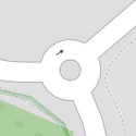 |
 | ||
| lanes | <number> | 버스, 승용차, 자전거를 비롯한 모든 차량이 통행할 수 있는 차로의 수를 나타냅니다. |  | |||
| lane_markings | yes | no | Specifies if a highway has painted markings to indicate the position of the lanes. |  | |||
| lit | yes | no | 도로에 조명(가로등 등)이 있는지를 나타냅니다. |  | |||
| maxspeed | <number> | Specifies the maximum legal speed limit on a road, railway or waterway. |  | |||
| motorroad | yes | no | 고속도로는 아니지만 고속도로와 유사한 통행 규제가 적용되는 도로(=자동차 전용도로)를 나타냅니다. |  | |||
| mountain_pass | yes | 언덕의 가장 높은 지점을 나타냅니다. |  | |||
| mtb:scale | 0-6 | Applies to highway=path and highway=track. A classification scheme for mtb trails (few inclination and downhill). |  | |||
| mtb:scale:uphill | 0-5 | MTB 노선의 분류 기준 중 오르막길 경사도를 나타낼 때 사용하는 태그입니다. |  | |||
| mtb:scale:imba | 0-4 | IMBA 노선 난이도 평가 체계를 나타낼 때 사용하는 태그입니다. 인공 장애물이 있는 MTB 노선에 사용합니다. | ||||
| mtb:description | Text | MTB 노선의 정보를 사람이 알아볼 수 있는 형태로 나타낼 때 사용하는 태그입니다. highway=path(오솔길)과 highway=track(농로/임도)에 사용합니다. | ||||
| oneway | yes | no | reversible | Oneway streets are streets where you are only allowed to drive in one direction. | 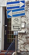 | |||
| oneway:bicycle | yes | no | | Used on ways with oneway=yes where it is legally permitted to cycle in both directions. |  | |||
| overtaking | yes | no | caution | both | forward | backward | 과적이 법적으로 허용/금지되는 부분을 나타내는 태그입니다. 방향별로 적용되는 규제가 다르다면 overtaking:forward=yes/no/caution(선 방향)과 overtaking:backward=yes/no/caution(선 반대 방향) 태그를 사용할 수 있습니다. |  | |||
| parallel | diagonal | perpendicular | marked | no_parking | no_stopping | fire_lane. | 주차 공간을 나타내는 태그입니다. 자세한 정보는 parking:lane=* 문서를 참고하세요. | |||||
| free | ticket | disc | residents | customers | private | 주차 가능 조건(시간대)를 나타내는 태그입니다. 자세한 정보는 parking:condition=* 문서를 참고하세요. |  | ||||
| passing_places | yes | 좁은 길에서 두 차량이 교행할 수 있는 공간을 나타내는 태그입니다. |  | |||
| priority | forward | backward | Traffic priority for narrow parts of roads, e.g. narrow bridges. |  | |||
| priority_road | designated | yes_unposted | end | Specifying roads signposted as priority roads. |  | |||
| sac_scale | strolling | hiking | mountain_hiking | demanding_mountain_hiking | alpine_hiking | demanding_alpine_hiking | difficult_alpine_hiking | 하이킹 노선의 분류 체계를 나타낼 때 사용하는 태그입니다. highway=path(오솔길)과 highway=footway(보도)에 사용합니다. |  | |||
| service | alley | driveway | parking_aisle etc. | 자세한 정보는 Ko:Key:service 문서를 참조하세요. |  | |||
| shoulder | no | yes | right | both | left | Presence of shoulder in highway | ||||
| side_road | yes | A side road. | ||||
| smoothness | excellent | good | intermediate | bad | very_bad | horrible | very_horrible | impassable | Specifies the physical usability of a way for wheeled vehicles due to surface regularity/flatness. See Key:smoothness for more details. | 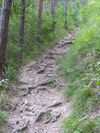 | |||
| surface | paved | unpaved | asphalt | concrete | paving_stones | sett | cobblestone | metal | wood | compacted | fine_gravel | gravel | pebblestone | plastic | grass_paver | grass | dirt | earth | mud | sand | ground | 자세한 정보는 Ko:Key:surface 문서를 참조하세요. |  | |||
| tactile_paving | yes | no | 도로에 시각 장애인을 위한 촉각 포장이 있는지를 나타냅니다. |  | |||
| tracktype | grade1 | grade2 | grade3 | grade4 | grade5 | 노면의 질을 나타내는 태그입니다. 자세한 정보는 Ko:Key:tracktype 문서를 참고하세요. | 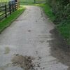 | |||
| traffic_calming | bump | hump | table | island | cushion | yes | etc. | 교통을 억제하기 위한 목적으로 설치되는 지물. 자세한 내용은 Ko:Key:traffic calming 문서를 참조하세요. |  | |||
| trail_visibility | excellent | good | intermediate | bad | horrible | no | 하이킹 노선의 가시성을 나타내기 위한 태그입니다. highway=path(오솔길), highway=footway(보도), highway=cycleway(자전거 도로), highway=bridleway(승마로)에 사용합니다. |  | |||
| trailblazed | yes | no | poles | cairns | symbols | Applies to highway=*. Describing trail blazing and marking. See Key:trailblazed for more information. | 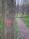 | |||
| trailblazed:visibility | excellent | good | intermediate | bad | horrible | no | Applies to trailblazed=*. A classification for visibility of trailblazing. See Key:trailblazed:visibility for more information. | ||||
| turn | left | slight_left | through | right | slight_right | merge_to_left | merge_to_right | reverse | The key turn can be used to specify the direction in which a way or a lane will lead. |  | |||
| width | <number> | The width of a feature. |  | |||
| winter_road | yes | 겨울에만 이용할 수 있고 여름에는 이용하지 못하는 도로를 나타냅니다. |  | |||
기타 도로 지물 | ||||||
| highway | bus_stop | A small bus stop. Optionally one may also use public_transport=stop_position for the position where the vehicle stops and public_transport=platform for the place where passengers wait. |  | |||
| highway | crossing | A.k.a. crosswalk. Pedestrians can cross a street here; e.g., zebra crossing |  | |||
| highway | cyclist_waiting_aid | Street furniture for cyclists that are intended to make waiting at esp. traffic lights more comfortable. |  | |||
| highway | elevator | 엘리베이터. |  | |||
| highway | emergency_bay | An area beside a highway where you can safely stop your car in case of breakdown or emergency. |  | |||
| highway | emergency_access_point | 등산로나 기타 오지에 설치된, 고유한 일련번호가 적인 표지판. 길을 잃었거나 문제가 생겼을 때 표지판의 일련번호를 불러 주면 응급 요원들이 현재 위치를 찾을 수 있습니다. ref='일련번호' 태그와 함께 사용하세요. |  | |||
| highway | give_way | A "give way," or "Yield" sign |  | |||
| emergency | phone | 비상시에 사용할 수 있는 전화기. ref='일련번호' 태그와 함께 사용하세요. |  | |||
| highway | ladder | A vertical or inclined set of steps or rungs intended for climbing or descending of a person with the help of hands. |  | |||
| highway | milestone | Highway location marker | ||||
| highway | mini_roundabout | 회전교차로와 비슷하지만, 교차로 가운데에 페인트로 그려진 원이 있거나 가로지를 수 있는(순회 가능) 공간이 있습니다. 교차로 가운데에 화단 등으로 이루어진 섬이 있다면, 이 태그 대신 junction=roundabout 태그를 사용하세요. 기본값은 반시계 방향(direction=anticlockwise)입니다. 시계 방향을 나타내고 싶으시다면 direction=clockwise 태그를 추가하세요. |  |
|||
| highway | motorway_junction | 고속도로의 나들목이나 분기점을 나타냅니다. 나들목의 고유 번호(ref=*)를 반드시 명시해야 합니다. | 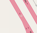 |
 | ||
| highway | passing_place | 좁은 길에서 두 차량이 교행할 수 있는 공간을 나타내는 태그입니다. |  | |||
| highway | platform | A platform at a bus stop or station. |  |
 | ||
| highway | rest_area | 운전자가 잠시 쉬었다 갈 수 있는 장소(졸음쉼터, 간이 휴게소 등)입니다. 주유는 불가능합니다. | 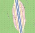 |
 | ||
| highway | services | 음식 등을 취급하는 휴게소입니다. 주로 고속도로에 있습니다. |  |
 | ||
| highway | speed_camera | 고정된 과속 단속 카메라입니다. |  | |||
| highway | speed_display | A dynamic electronic sign that displays the speed of the passer-by motorist. |  | |||
| highway | stop | 정지 표지판. |  | |||
| highway | street_lamp | 도로변에 설치된 가로등. 특정 시간대에 켜집니다. |  | |||
| highway | toll_gantry | A toll gantry is a gantry suspended over a way, usually a motorway, as part of a system of electronic toll collection. For a toll booth with any kind of barrier or booth see: Lua error in mw.title.lua at line 230: too many expensive function calls. |  | |||
| highway | traffic_mirror | Mirror that reflects the traffic on one road when direct view is blocked. |  | |||
| highway | traffic_signals | 신호등. |  | |||
| highway | trailhead | Designated place to start on a trail or route |  | |||
| highway | turning_circle | 도로가 끝나는 지점의 둥근 부분. 영어(또는 프랑스어)에서는 cul de sac이라고도 합니다. |  |
 | ||
| highway | turning_loop | A widened area of a highway with a non-traversable island for turning around, often circular and at the end of a road. |  | |||
| highway | 사용자 지정 | 자주 사용되는 값을 Taginfo에서 볼 수 있습니다. | ||||
Historic
This is used to describe various historic places. For example: archaeological sites, wrecks, ruins, castles and ancient buildings. See the page titled Historic for an introduction on its usage.
This table is a wiki template with a default description in English. Editable here.
토지 이용
토지의 사용 목적을 나타내기 위한 태그들을 나열한 것입니다. 자세한 정보는 토지 이용 문서를 참고하세요.
| 키 | 값 | 요소 | 설명 | 렌더링 | 사진 | |
|---|---|---|---|---|---|---|
자주 사용하는 키 값 - 개발지 | ||||||
| landuse | commercial | 상업 시설과 사무실이 대부분을 차지하는 영역. 상품을 판매하는 상업 영역에는 이 태그 대신 landuse=retail 태그를 붙여야 합니다. 상업 시설에서는 현장 서비스를 판매하는 곳이나 개인 의원, 정신/신체적 의료 서비스를 제공하는 비정부 시설 등이 있을 수 있습니다. 상업 구역에는 일부 개인이나 기업만을 대상으로 영업하는 사무실 건물이나 오피스 단지 등이 포함됩니다. 상업 구역은 소매 영역에 비해 상대적으로 사람들이 적게 드나듭니다.
정부 서비스와 기업은 주로 상업적인 것으로 매핑되어 데이터 소비자에 의해 사용됩니다! 자세한 내용은 operator:type 태그를 참조하여 민간 또는 다른 사람들과 구별하기 위해 정부로 설정하세요. civic_admin은 포기된 제안이고, civic은 문서가 없으며, institutional은 모호하며, 셋 모두 지도 제작 커뮤니티에서 최소한의 지원만 있습니다. |
 |
 | ||
| landuse | construction | 건축물 또는 건축물의 개발·건설이 활발하게 진행되고 있는 부지로서 토지 또는 그 위에 있는 초목을 포함합니다. 버려진 건축물 공사 및 부지는 이 태그를 사용해서는 안 됩니다. |  |
 | ||
| landuse | education | 주로 교육 목적/시설로 사용되는 지역입니다. |  | |||
| landuse | fairground | fair가 열리는 현장. |  | |||
| landuse | industrial | 주로 작업장, 공장 또는 창고와 같은 산업용 토지. |  |
 | ||
| landuse | residential | 사람이 거주하는 영역. 홀로 떨어진 거주지 및 가구끼리 서로 가까이 붙어 있는 거주지(빌라, 아파트 등)을 포괄합니다. 토지의 절반 이상이 주거지로 이루어진 '다목적' 구역은 주거 구역으로 취급할 수 있습니다. 토지 이용과 자연 영역 문서의 질문 단락을 참고하세요. |
 |
 | ||
| landuse | retail | 상점과 같은 소매점이 대부분을 차지하는 영역. 소매 영역에서는 음식(식료품, 잡화 등), 옷, 약품, 문구, 가구, 도구를 비롯한 다양한 상품을 판매합니다. 소매 구역은 상업 영역에 비해 상대적으로 도보 통행량이 많습니다. 소매 영역은 서비스를 독점적으로 제공하거나 판매하지 않습니다. 서비스를 판매하는 구역에는 landuse=commercial 태그를 붙이세요.
일반적으로 모두가 소매 영역을 자유롭게 거닐 수 있습니다. 원래 소매는 상업의 부분 집합이지만 오픈스트리트맵에서는 상호배타적인 것으로 취급합니다. |
 |
 | ||
| landuse | institutional | 제도적 목적으로 사용되는 토지는 이 태그의 의미는 명확하지 않습니다. 대상을 더 잘 설명하는 다른 태그 사용을 고려해주세요. 예를 들자면 landuse=commercial. 토론은 대화 페이지를 참조해주세요. |
 | |||
| 키 | 값 | 요소 | 설명 | 렌더링 | 사진 | |
자주 사용하는 키 값 - 시골 및 농지 | ||||||
| landuse | allotments | 텃밭. 현지인이 채소나 꽃 등을 재배하는 작은 영역. |  |
 | ||
| landuse | farmland | 곡물, 채소, 유지(油脂) 식물, 꽃 등을 재배하는 경작지. |  |
 | ||
| landuse | farmyard | 농가, 가정집, 창고(광), 마구간, 외양간, 식량 저장고 등이 위치한 영역. 농장 건물 사이에 있는 공간도 포함합니다. |  |
 | ||
| landuse | Lua error in mw.title.lua at line 230: too many expensive function calls. | 땅거죽의 상태와 모양을 벼를 기르기 알맞게 한 논 영역 |  | |||
| landuse | animal_keeping | 동물, 특히 가축을 사육하는 데 사용되는 토지의 영역 |  | |||
| landuse | flowerbed | 꽃밭, 화원. 꽃을 재배하는 구역. | ||||
| landuse | forest | 인위적으로 관리하는 숲 또는 삼림 플랜테이션(다른 언어) 영역. 일부 기여자는 토지의 목적보다는 나무가 심어진 영역을 나타내는 데 이 태그를 사용하기도 합니다. 숲 문서를 참고하세요. |  |
 | ||
| landuse | meadow | 초원 및 녹초지. 나무 없이 풀만이 자라는 영역. 여기서 기른 풀은 주로 건초를 만드는 데 사용합니다. |  |
 | ||
| landuse | orchard | 과수원. 과일 나무를 재배하는 영역. |  |
 | ||
| landuse | vineyard | 포도밭, 포도원. 포도를 재배하는 영역. |  |
 | ||
| 키 | 값 | 요소 | 설명 | 렌더링 | 사진 | |
자주 사용하는 키 값 - 수역 | ||||||
| landuse | aquaculture | 경고: 이 태그의 엄밀한 의미는 아직 합의되지 않았습니다. 따라서 이 태그의 영역은 '양식장의 영역'(수역을 반드시 포함하지는 않음)을 나타내는 것으로 간주하고, 호수나 바다를 나타내려면 반드시 별도의 Lua error in mw.title.lua at line 230: too many expensive function calls. 태그를 붙여 주어야 합니다. |
현재 OSM Carto에서 표시되지 않습니다. | 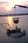 | ||
| landuse | basin | 웅덩이. 인공적으로 물을 가두어 둔 영역. 웅덩이의 물이 빗물인지 다른 물인지, 물을 계속 가두어 두는지 아니면 밖으로 내보내는지를 나타내려면 Lua error in mw.title.lua at line 230: too many expensive function calls. 태그를 덧붙이세요. 다른 언어. |
 |
 | ||
| landuse | reservoir (폐기됨) | 저수지(위키백과). 이 태그는 폐기되었으며, 대신 Lua error in mw.title.lua at line 230: too many expensive function calls. + Lua error in mw.title.lua at line 230: too many expensive function calls. 조합을 사용하세요. 자세한 정보는 Proposed features/Reservoir 제안을 참고하세요. |  |
 | ||
| landuse | salt_pond | 염전. 소금물(염수)을 가둔 후 증발시켜 소금을 얻는 곳. |  |
 | ||
| 키 | 값 | 요소 | 설명 | 렌더링 | 사진 | |
기타 토지 이용 | ||||||
| landuse | brownfield | 재개발 구역, 기존 건물을 해체한 상태에서 재개발이 예정된 토지를 나타냅니다. |  |
 | ||
| landuse | cemetery | 묘역. 묘지가 위치한 영역을 나타냅니다. religion=*(사용법은 여기를 참고) 태그로 묘지의 종교 양식을 나타낼 수 있습니다. 작은 묘역에는(교회 옆에 위치한 묘지 등) Lua error in mw.title.lua at line 230: too many expensive function calls. 태그를 대신 사용하세요. |  |
 | ||
| landuse | 보호 구역(폐기됨). Lua error in mw.title.lua at line 230: too many expensive function calls., Lua error in mw.title.lua at line 230: too many expensive function calls. 태그를 대신 사용하세요. | |||||
| landuse | depot | 차량(열차, 버스, 트램 등)을 보관하는 차고. 이 태그 대신 표준적인 Lua error in mw.title.lua at line 230: too many expensive function calls.(철도 영역), landuse=commercial(상업 영역), landuse=industrial(산업 영역) 태그를 붙이고, Lua error in mw.title.lua at line 230: too many expensive function calls. 태그를 추가로 붙이는 방식을 권장합니다. | 현재 OSM Carto에서 표시되지 않습니다. |  | ||
| landuse | garages | 자동차를 보관하는 1층짜리 건물이 모여 있는 곳. 차고 건물은 주로 벽돌이나 강철로 이루어져 있습니다. 이러한 차고 단지에는 대개 고유한 명칭, 회장, 예산, 규정, 보안 대책이 있습니다. |  |
 | ||
| landuse | grass | 다른 태그를 붙이기에는 애매한, 관리되는 잔디밭. 이를 토지 이용으로 보지 않는 사람도 있습니다. 토론을 보고 싶으시다면 Lua error in mw.title.lua at line 230: too many expensive function calls. 문서를 참고하세요. |  |
 | ||
| landuse | greenfield | 신규 개발 구역, 이전에 지어진 건물이 없으면서 새로운 개발이 예정된 토지. 곧 공사 영역으로 전환될 영역입니다. |  (렌더링되지 않음) |
 | ||
| landuse | greenhouse_horticulture | 식물을 키우는 온실 영역. |  |

| ||
| landuse | landfill | 쓰레기 매립지, 쓰레기장. 쓰레기를 버리는 장소. |  |
 | ||
| landuse | military | 군사 목적으로 사용하는 토지. |  |
 | ||
| landuse | plant_nursery | 묘목상. 판매할 묘목을 생산해 내기 위해 식물을 심어 놓은 영역. |  |
 | ||
| landuse | port | 항구. 이러한 유형의 산업 구역에는 landuse=industrial + Lua error in mw.title.lua at line 230: too many expensive function calls. 태그를 이 태그 대신 붙이는 것도 고려해 보세요. | 현재 OSM Carto에서 표시되지 않습니다. |  | ||
| landuse | quarry | 채석장. 지표면에서 광물을 채취하는 영역. |  |
 | ||
| landuse | railway | 철로 및 철도 관련 시설이 들어선 영역. 일반인이 접근할 수 없습니다. |  |
 | ||
| landuse | recreation_ground | 다양한 오락을 즐길 수 있는 열린 녹지. 운동 기구나 배드민턴 네트 등이 있을 수 있습니다. 주로 지자체에서 관리하지만, 특정 대학생이나 회사원만 이용할 수 있는 폐쇄형 공원도 있습니다. |  |
 | ||
| landuse | religious | 종교 목적으로 사용되는 영역. |  |
 | ||
| landuse | village_green | 마을 녹지. 마을 중심부에 위치한, 풀이 무성한 공공 토지입니다. 도시 내에 자리잡은 일반적인 녹지를 나타내는 태그가 아닙니다. 영국의 Commons Registration Act 1965 및 Commons Act 2006에 의해 정의됩니다. |  |
 | ||
| landuse | winter_sports | 겨울 스포츠(스키 등)용 영역. |  | |||
| landuse | 사용자 정의 | Taginfo에서 오픈스트리트맵에 사용된 모든 값을 볼 수 있습니다. | ||||
This table is a wiki template with a default description in English. Editable here.
여가
레저 시설이나 스포츠 시설을 나타내는 태그에 대해 다룹니다. 사용하는 방법은 Ko:여가 문서를 참조하세요.
| 키 | 값 | 요소 | 설명 | 렌더링 | 사진 |
|---|---|---|---|---|---|
| leisure | adult_gaming_centre | 도박 기계들이 설치되어 있는 장소입니다. |  | ||
| leisure | amusement_arcade | 돈을 지불하고 할 수 있는 게임을 갖춘 장소입니다. |  | ||
| leisure | bandstand | 연주대는 음악 밴드가 연주할 수 있는 열린 시설입니다. |  | ||
| leisure | bathing_place | Public place where you can freely bath in nature. |  | ||
| leisure | beach_resort | 관련 시설 경계 안쪽을 포함하는 관리되는 해변입니다. 입장료가 필요할 수 있습니다. |  | ||
| leisure | bird_hide | 특별히 새 같은 야생 동물을 관찰하기 위해 사용하는 장소입니다. | 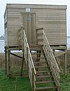 | ||
| leisure | bleachers | Raised, tiered rows of benches found at spectator events |  | ||
| leisure | bowling_alley | 볼링을 하기 위한 장비가 갖추어진 시설입니다. |  | ||
| leisure | common | 대중이 특정 여가 시설의 일반적인 사용권을 부여하는 땅을 나타냅니다.(공유지) | |||
| leisure | dance | 춤을 추는 장소입니다. |  | ||
| leisure | disc_golf_course | 디스크 골프 코스입니다. |  | ||
| leisure | dog_park | 담장을 설치하거나 설치하지 않음으로써 견주가 반려동물을 억제를 받지 않으면서 운동시킬 수 있도록 고안된 공간입니다. |  |
 | |
| leisure | escape_game | 플레이어가 가까운 목표부터 완수하는 전략이나 단서, 힌트를 이용하면서 퍼즐을 해결하는 신체적인 모험 게임입니다. |  | ||
| leisure | firepit | 캠프나 소풍 장소에 있는 취사장입니다. |  | ||
| leisure | fishing | 낚시를 하는 장소입니다. | 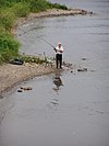 | ||
| leisure | fitness_centre | 피트니스 센터입니다. |  | ||
| leisure | fitness_station | 사람들이 특정한 운동(피트니스)을 연습할 수 있는 야외 시설입니다. |  | ||
| leisure | garden | 꽃과 여타 식물들이 구조적으로, 혹은 과학적인(심리학 등) 의도로 장식되어 자라는 장소입니다. |  |
 | |
| leisure | golf_course | 골프 코스입니다. |  |
 | |
| leisure | hackerspace | 공통 관심사(과학, 기술, ...)를 가진 사람들이 만나는 장소입니다. |  | ||
| leisure | horse_riding | 보통 여가 시간에 사람들이 승마를 연습하는 장소입니다. |  | ||
| leisure | ice_rink | 스케이트나 아이스 하키를 할 수 있는 장소입니다. |  |
 | |
| leisure | marina | 여가용 요트나 보터 보트를 정박시켜 두는 시설입니다. | 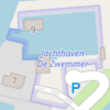 |
||
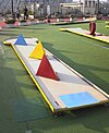
| leisure | miniature_golf | 미니 골프를 할 수 있는 장소나 영역입니다. |  |
 | |
| leisure | nature_reserve | 야생동물이나 동식물 군집, 지질학적이거나 여타 특별한 분야의 지물의 중요성으로 인해 보호받는 영역입니다. | 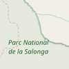 |
 | |
| leisure | outdoor_seating | Areas for outdoor gastronomy. |  | ||
| leisure | park | 주로 시군구에서 운영하는 공원입니다. |  |
 | |
| leisure | picnic_table | 음식을 먹거나 휴식을 취할 수 있는 벤치가 딸린 탁자입니다. |  | ||
| leisure | pitch | 보통 적절하게 선을 그어 놓아서 특정한 스포츠를 할 수 있도록 고안된 영역입니다. |  |
 | |
| leisure | playground | (학교)운동장, (공원)놀이터입니다. |  | ||
| leisure | resort | A place used for relaxation or recreation, attracting visitors for vacations, tourism and/or going swimming in a pool and/or a nearby body of water. |  | ||
| leisure | sauna | 고온건조 또는 고온다습한 경험을 하기 위해 고안된 작은 방이나 집, 혹은 하나 이상의 그러한 방과 보조 시설을 갖춘 시설입니다. |  | ||
| leisure | slipway | 배를 올려 놓는 영역(조선대)입니다. |  | ||
| leisure | sports_centre | 스포츠 센터는 닫힌 공간에서 스포츠를 하도록 고안된 시설입니다. |  |
 | |
| leisure | sports_hall | A sufficiently large single room that is suitable for practising sports indoors and does not have a "centre" character. |  | ||
| leisure | stadium | 좌석을 높게 쌓아 올린 주요 스포츠 시설입니다. |  |
 | |
| leisure | summer_camp | 어린이나 10대들이 여름철에 하는 (감독되는) 캠프를 위한 장소입니다. |  | ||
| leisure | swimming_area | 수영을 할 수 있도록 공식적으로 열려 있는 자연 공간입니다. |  | ||
| leisure | swimming_pool | 수영장입니다.(물을 넣는 공간만 태그를 달아야 함) |  |
 | |
| leisure | tanning_salon | Place where customers can use UV lamps to tan their skin. |  | ||
| leisure | track | 달리기나 사이클링용 트랙, 혹은 말이나 그레이하운드 같은 외부 동력을 사용하지 않는 경주에 사용하는 트랙입니다. |  |
 | |
| leisure | trampoline_park | An leisure facility consisting of many interlinked trampolines |  | ||
| leisure | water_park | 워터 슬라이드, 파도풀 같은 놀이용 수영장, 유수풀 같은 놀이기구가 있는 워터파크입니다. |  | ||
| leisure | wildlife_hide | 야생동물을 관찰하는 장소입니다. |  | ||
| leisure | 사용자 정의 | Taginfo 문서에서 자주 사용하는 값을 확인할 수 있습니다. |
This table is a wiki template with a default description in English. Editable here.
인공물
인공 구조물(인조 구조물)을 표현하는 태그입니다. 자세한 사용법은 man made=* 문서를 참고하세요.
This table is a wiki template with a default description in English. Editable here. 한국어판은 여기에서 편집할 수 있습니다.
영어 원본의 내용을 이해할 수 있다면 번역 완료에 힘을 모아 주십시오. 번역 방법에 대해서는 위키 번역 방법에 대한 설명을 읽어주시길 바랍니다. 만약 이 문서의 번역이 충분하다고 판단되면 이 틀을 지워주시길 바랍니다.
이 즈음에는 맡아서 번역을 하는 사람이 없기 때문에, 당신이 이 작업을 해 줄 수 있습니다.
Military
This is used for facilities and on land used by the military. These may include the Navy, Army, Air Force and Marines. See the page titled Military for an introduction on its usage.
This table is a wiki template with a default description in English. Editable here.
영어 원본의 내용을 이해할 수 있다면 번역 완료에 힘을 모아 주십시오. 번역 방법에 대해서는 위키 번역 방법에 대한 설명을 읽어주시길 바랍니다. 만약 이 문서의 번역이 충분하다고 판단되면 이 틀을 지워주시길 바랍니다.
이 즈음에는 맡아서 번역을 하는 사람이 없기 때문에, 당신이 이 작업을 해 줄 수 있습니다.
Natural
This is used to describe natural and physical land features. These also include features that have been modified by humans.
Vegetation
This table is a wiki template with a default description in English. Editable here.
This table is a wiki template with a default description in English. Editable here.
This table is a wiki template with a default description in English. Editable here.
영어 원본의 내용을 이해할 수 있다면 번역 완료에 힘을 모아 주십시오. 번역 방법에 대해서는 위키 번역 방법에 대한 설명을 읽어주시길 바랍니다. 만약 이 문서의 번역이 충분하다고 판단되면 이 틀을 지워주시길 바랍니다.
이 즈음에는 맡아서 번역을 하는 사람이 없기 때문에, 당신이 이 작업을 해 줄 수 있습니다.
Office
An office is a place of business where administrative or professional work is carried out.
This table is a wiki template with a default description in English. Editable here.
Place
This is used mainly to give details about settlements. See the page titled Places for an introduction on its usage.
Administratively declared places
This table is a wiki template with a default description in English. Editable here.
Populated settlements, urban
This table is a wiki template with a default description in English. Editable here.
Populated settlements, urban and rural
This table is a wiki template with a default description in English. Editable here.
Other places
This table is a wiki template with a default description in English. Editable here.
Additional attributes
This table is a wiki template with a default description in English. Editable here.
Power
These are used to map electrical power generation and distributions systems. See Power for an introduction on its usage.
This table is a wiki template with a default description in English. Editable here.
Public transport
This is used for features related to public transport. For example: railway stations, bus stops and services. See the page titled Public transport for an introduction on its usage.
This table is a wiki template with a default description in English. Editable here.
| This table should not be a copy of a source of the English template! Only parameters are translated. See Template:Map Features:railway/doc for more information and a copyable version. |
| To add missing translations, go to Template:Map Features:railway/doc, copy missing parameters, paste into your language template and complete translations (the link to edit is at the bottom of the table). |
Railway
- 주요 문서: Railways
This tag includes all kinds of railways ranging from heavily used mainline railways to an abandoned rail line.
| Key | Value | Element | Comment | Rendering carto | Photo | |
|---|---|---|---|---|---|---|
Tracks | ||||||
| railway | abandoned | The course of a former railway which has been abandoned and the track removed. The course is still recognized through embankments, cuttings, tree rows, bridges, tunnels, remaining track ties, building shapes and rolling or straight ways. For demolished rails that are no longer identifiable, e.g. that have been built over, some use the highly questionable Lua error in mw.title.lua at line 230: too many expensive function calls.. | Not rendered by OSM Carto |  | ||
| railway | construction | Railway under construction. |  |
 | ||
| railway | disused | A section of railway which is no longer used but where the track and infrastructure remains in place. The track is likely overgrown with endemic vegetation, but could be brought back into useful service with only minor effort. |  |
 | ||
| railway | funicular | Cable driven inclined railways on a steep slope, with a pair of cars connected by one cable |  |
 | ||
| railway | light_rail | A higher-standard tram system, normally in its own right-of-way. Often it connects towns and thus reaches a considerable length (tens of kilometres). |  |
 | ||
| railway | miniature | Miniature railways are narrower than narrow gauge and carry passengers, frequently at an exact scale of "standard-sized" rail (for example "1/4 scale"). They can often be found in parks. |  |
 | ||
| railway | monorail | A railway with only a single rail. A monorail can run above the rail like in Las Vegas and Disneyland or can suspend below the rail like the Wuppertal Schwebebahn (Germany). |  |
 | ||
| railway | narrow_gauge | Narrow-gauge passenger or freight train tracks. Narrow gauge railways can have mainline railway service like the Rhaetian Railway in Switzerland or can be a small light industrial railway. Use Lua error in mw.title.lua at line 230: too many expensive function calls. to specify the actual width of rails in mm. |  |
 | ||
| This is the old tag for historic trains. Use Lua error in mw.title.lua at line 230: too many expensive function calls. for historical railway instead. |  |
 | ||||
| railway | rail | Full sized passenger or freight train tracks in the standard gauge for the country or state. |  |
 | ||
| railway | subway | A city passenger rail service running mostly grade separated (see Wikipedia:rapid transit). Often a significant portion of the line or its system/network is underground. |  |
 | ||
| railway | tram | One or two carriage rail vehicle tracks, usually sharing motor road, sometimes called "street running" (Other languages). |  |
 | ||
Additional track features or attributes | ||||||
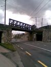
| bridge | yes | If the railway goes over a street, waterway or other railway on an elevated structure. |  |
 | ||
| cutting | yes | A section where the railway is significantly lower than ground level, but not underground. |  | |||
| electrified | contact_line rail yes no |
contact_line: a power line over the train head rail: a third rail near the track supplying the train with power yes: electrified track, but no details available no: track with no power supply. |
 | |||
| embankment | yes | A section where the railway is raised significantly higher than ground level. |  | |||
| embedded_rails | yes/<type of railway> | Specifies that a highway on which non-railway traffic is also allowed has railway tracks embedded in it but the rails are mapped as separate ways. |  | |||
| frequency | number [Hz] | The frequency with which a line is electrified. Use 0 for DC. Also see the voltage tag. |  | |||
| railway:track_ref | number | Track number |  | |||
| service | crossover | Relatively short lengths of track which switch traffic from one parallel line to another | ||||
| service | siding | Relatively short lengths of track, running parallel to (and connected to) a main route |  |
|||
| service | spur | Relatively short lengths of track, built to give one company or entity access to a main or branch line. |  |
 | ||
| service | yard | Tracks within railway company operated marshalling or maintenance yards. |  |
 | ||
| tunnel | yes | If the railway goes below ground. Most subways have this tag. |  | |||
| tracks | number | Number of parallel tracks in close proximity when mapped as one single way representing all tracks. If not given means unknown and defaults to 1. In many parts of the world the tracks are being drawn out separately so that there is more detail, in which case this tag isn't used. |  | |||
| usage | main branch industrial military tourism scientific test |
main line: heavy traffic branch line: connecting places with a mainline industrial: servicing large plants (iron, chemical etc.), surface mining, … military: servicing military area tourism: most mountain rails (rack-rails, funicular) and preserved railways scientific: rail transport at spaceports, large array telescopes, etc. test: track for testing new wheels, rails, tracks and rail technologies. |
||||
| voltage | number | The voltage with which a line is electrified. Also see the frequency tag. |  | |||
Stations and stops | ||||||
| railway | halt | A small station without switches |  | |||
| public_transport | stop_position | The position on the railway track where the train (its centre) stops at a platform. This is useful for routing on long platforms where also short trains stop and on long platforms where multiple trains stop behind each other. See also Lua error in mw.title.lua at line 230: too many expensive function calls.. |  | |||
| public_transport | platform | This is parallel to the rail line for showing where the actual platforms are. It is also to know where you can change platform and enter the station, so use footpaths to connect them. This is really useful for routing too. Use only if the platform is served by public transport. |  | |||
| railway | platform | This is parallel to the rail line for showing where the actual platforms are. It is also to know where you can change platform and enter the station, so use footpaths to connect them. This is really useful for routing too. Use in addition to public_transport=platform. |  | |||
| public_transport | station | Railway passenger-only station. |  | |||
| railway | station | Railway passenger and/or cargo station. Use in addition to public_transport=station. |  | |||
| railway | subway_entrance | The entrance to a subway station, usually going from surface to underground. |  | |||
| railway | tram_stop | A tram stop is a place where a passenger can embark / disembark a tram. |  | |||
Other railways | ||||||
| railway | buffer_stop | Stops the train at the end of a track. See buffer stop. | Not rendered by OSM Carto |  | ||
| railway | derail | A device used to prevent fouling of a rail track by unauthorized movements of trains or unattended rolling stock. See Derail (railroad). | Not rendered by OSM Carto |  | ||
| railway | crossing | A point where pedestrians may cross. |  | |||
| railway | level_crossing | A point where rails and roads cross. |  | |||
| railway | tram_level_crossing | A point where trams and roads cross. |  | |||
| railway | signal | Any kind of railway signal. | Not rendered by OSM Carto |  | ||
| railway | switch | Full connections between railways (aka 'points'). | Not rendered by OSM Carto |  | ||
| railway | railway_crossing | Crossing rails with no interconnection. | Not rendered by OSM Carto |  | ||
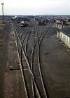
| landuse | railway | Ground used around railways and railway-stations. |  Except no border, as landuse=industrial Except no border, as landuse=industrial
|
 | ||
| railway | turntable | These are used for changing the direction that part of a train is pointing in. |  | |||
| railway | roundhouse | A semicircular building with many stalls for servicing engines. | Not rendered by OSM Carto |  | ||
| railway | traverser | These are used for changing trains between railways. Also known as transfer table. |  | |||
| railway | wash | A railroad carriage/car wash | Not rendered by OSM Carto | 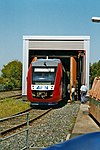 | ||
| railway | water_crane | A structure to deliver water to steam locomotives | Not rendered by OSM Carto | 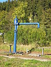 | ||
| railway | ventilation_shaft | A structure that allows ventilation in underground tunnels | Not rendered by OSM Carto |  | ||
| railway | user defined | All commonly used values according to Taginfo | – – – | – – – | ||
This table is a wiki template with a default description in English. Editable here.
노선(Route)
- 주요 문서: Ko:Relation:route
어떠한 종류의 노선이든 작성할 수 있기 위한 용도로 사용합니다.
| 키 | 값 | 요소 | 설명 | 렌더링 | 사진 |
|---|---|---|---|---|---|
| route | bicycle | Cycle routes 문서에 어떻게 태그를 붙이는지 설명하고 있습니다. |  | ||
| route | bus | 노선버스에 사용. Buses 문서 참조. |  | ||
| route | canoe | 수로를 지나는 카누의 노선. | 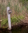 | ||
| route | detour | 항상 사용할 수 있는 우회로. 예를 들면, 독일의 Bedarfsumleitung과 네덜란드의 uitwijkroute 등등. | 
| ||
| route | ferry | 터미널에서 터미널을 잇는 페리. 페리의 항로는 적어도 줌 수준 12(www.openstreetmap.org/#map=<줌 수준>/<위도>/<경도>)에서 점 1개가 보이게 노선을 만들어 주십시오(대략 2~3km마다 점 1개). 그래야지 오프라인 에디터가 bbox 리퀘스트로 노선을 사용할 수 있습니다. |  |
 | |
| route | foot | Walking Route - is used for routes which are walkable without any limitations regarding fitness, equipment or weather conditions. |  | ||
| route | hiking | Hiking 문서에 어떻게 태그를 붙이는지 설명하고 있습니다. |  | ||
| route | horse | Riding 노선. |  | ||
| route | inline_skates | 자세한 내용은 Inline 문서를 참조하십시오. | |||
| route | light_rail | 경전철 노선. |  | ||
| route | mtb | Mountain biking 문서에 어떻게 태그를 붙이는지 설명하고 있습니다. |  | ||
| route | piste | 겨울 스포츠 시설 내부의 스키 활강용 노선. 예를 들어, snowshoe 또는 XC-Ski trails 등. |  | ||
| route | railway | 철로의 집합체. 주로 이름이 붙어 있는 경우(경부고속선, 호남선, 채널 터널 등)가 많습니다. |  | ||
| route | road | 다양한 도로 노선·장거리 노선에 사용합니다. |  | ||
| route | running | 달리기·조깅 노선. |  | ||
| route | ski | 스키 트랙. |  | ||
| route | subway | Route of a metro service |  | ||
| route | train | 철도 운행 계통. 예를 들어 수도권 전철 1호선, O-Train, 런던-파리 유로스타 등등. |  | ||
| route | tracks | Railroad track as rail infrastructure. |  | ||
| route | tram | 트램 노선. Trams 문서에 어떻게 태그를 붙이는지 설명하고 있습니다. |  | ||
| route | trolleybus | The route of a trolleybus service. |  | ||
| route | 사용자 정의 | Taginfo 문서에서 자주 사용하는 값을 확인할 수 있습니다. |
This table is a wiki template with a default description in English. Editable here. 한국어 번역은 여기에 있습니다.
| This table should not be a copy of a source of the English template. Only parameters are translated. See Template:Map Features:shop/doc for more information and a copyable version. |
| To add missing translations, go to Template:Map Features:shop/doc, copy missing parameters, paste into your language template and complete translations (the link to edit is at the bottom of the table). |
상점
상점 태그는 상품을 판매하는 장소에 사용합니다. 자세한 설명은 상점 문서를 참고하세요.
| 키 | 값 | 요소 | 설명 | 기본 레이어에서의 렌더링(osm-carto) | 사진 | |
|---|---|---|---|---|---|---|
음식, 음료 | ||||||
| shop | alcohol | 주류(술)을 판매하는 상점. 가게에서 마실 수는 없습니다. |  | |||
| shop | bakery | 빵집. 빵을 주로 판매하는 상점. |  | |||
| shop | beverages | 주류를 비롯한 다양한 음료수를 주로 판매하는 상점. Lua error in mw.title.lua at line 230: too many expensive function calls. 문서를 참고하세요. |  | |||
| shop | brewing_supplies | 맥주, 와인 및 양조주(허용되는 경우)를 집에서 직접 양조할 수 있는 용품을 판매하는 상점. |  | |||
| shop | butcher | 정육점. 고기를 판매하는 상점. |  | |||
| shop | cheese | 치즈를 판매하는 상점. |  | |||
| shop | chocolate | 초콜릿 가게. |  | |||
| shop | coffee | 커피점(카페). 커피를 주로 판매하는 가게. |  | |||
| shop | confectionery | 과자점. 사탕을 비롯한 다양한 과자류를 판매하는 상점. |  | |||
| shop | convenience | 작은 슈퍼마켓. 동네 슈퍼나 편의점에 사용할 수 있는 태그입니다. |  | |||
| shop | deli | 델리카트슨(고급 식품, 미식가 음식 - 주로 유럽 식품)을 취급하는 상점. 식료품점과 식당이 결합한 개념인 미국의 델리(deli)와는 다릅니다. |  | |||
| shop | dairy | 유제품 가게. 유제품을 주로 판매하는 상점. |  | |||
| shop | farm | 신선한 농산물을 판매하는 상점 또는 노점. |  | |||
| shop | frozen_food | 냉동 식품을 주로 판매하는 상점. |  | |||
| shop | greengrocer | 채소와 과일을 주로 판매하는 상점. |  | |||
| shop | health_food | 건강 식품(자연식, 비타민, 영양 보충제, 육류, 유제품 등)을 판매하는 상점. |  | |||
| shop | ice_cream | 아이스크림 가게. Lua error in mw.title.lua at line 230: too many expensive function calls. 문서도 참고하세요. |  | |||
| shop | 유기농 식품을 판매하는 상점. 이 태그 대신 다재다능한 Lua error in mw.title.lua at line 230: too many expensive function calls. 키를 shop=*(shop=supermarket 및 Lua error in mw.title.lua at line 230: too many expensive function calls. 포함)과 함께 사용하는 것도 고려해 보세요. |  | ||||
| shop | pasta | 신선한 파스타 및 라비올리(ravioli) 등을 판매하는 가게. |  | |||
| shop | pastry | 케이크, 비스킷, 파이와 같이 달콤한 빵을 주로 판매하는 상점. |  | |||
| shop | seafood | 어류/해산물을 주로 판매하는 상점. 어시장 등에 사용할 수 있습니다. |  | |||
| shop | spices | 향신료를 주로 판매하는 상점. |  | |||
| shop | tea | 차를 주로 판매하는 상점. |  | |||
| shop | wine | 와인(포도주)를 판매하는 상점. |  | |||
| shop | water | 식수를 주로 판매하는 상점. |  | |||
종합 상점, 백화점, 쇼핑몰 | ||||||
| shop | department_store | 백화점. 다양한 종류의 상품을 판매하며, 주로 여러 층으로 이루어져 있습니다(Lua error in mw.title.lua at line 230: too many expensive function calls. 문서도 참고하세요). |  | |||
| shop | general | 잡화점. 다양한 종류의 상품을 판매하는 상점입니다(음식을 판매한다면 Lua error in mw.title.lua at line 230: too many expensive function calls. 태그를 붙이는 것을 고려해 보세요). |  | |||
| shop | kiosk | 가판대. 잡지, 담배, 신문, 과자, 우표 등을 파는 작은 상점입니다. |  | |||
| shop | mall | 쇼핑몰. 하나의 건물에 여러 상점이 모여 있는 형태입니다. 쇼핑 센터라고도 합니다. |  | |||
| shop | supermarket | 식품을 비롯한 다양한 상품을 판매하는 대형 슈퍼마켓입니다. |  | |||
| shop | wholesale | 도매점, 창고형 매장, 창고형 할인점. 상품을 묶음으로 쌓아 두고 소매자에게 판매하는 상점. 상점의 종류는 Lua error in mw.title.lua at line 230: too many expensive function calls. 태그로 나타낼 수 있습니다. |  | |||
의류, 신발, 장신구 | ||||||
| shop | baby_goods | 아기 용품(옷, 유모차, 아기 침대, 장난감 등)을 주로 판매하는 상점. |  | |||
| shop | bag | 가방을 주로 판매하는 상점. |  | |||
| shop | boutique | 양품점, 양장점(부티크). 값비싼 옷이나 장신구 등을 판매하는 작은 쇼핑 아울렛. | 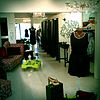 | |||
| shop | clothes | 겉옷 및 속옷을 주로 판매하는 상점(clothes 대신 fashion이라는 값을 사용하는 사람도 있습니다). |  | |||
| shop | fabric | 옷을 만드는 데 필요한 다양한 재료(옷감 등)를 판매하는 상점. |  | |||
| shop | 옷을 판매하는 상점. 이 태그는 폐기되었습니다. clothes 태그를 사용하세요. |  | ||||
| shop | fashion_accessories | 장신구를 주로 판매하는 상점. |  | |||
| shop | jewelry | 보석집. 보석상. |  | |||
| shop | leather | 가죽으로 된 상품을 주로 판매하는 상점. | ||||
| shop | sewing | 바느질 관련 도구(천, 실, 바늘, 재봉틀 등)를 주로 판매하는 상점.) |  | |||
| shop | shoes | 신발 가게. 신발을 주로 판매하는 상점. |  | |||
| shop | tailor | 양복점. 옷을 전문적으로 만들고, 수선하고, 바꾸는 곳. 남성 양복을 주로 취급합니다. |  | |||
| shop | watches | 시계를 주로 판매하는 상점. |  | |||
| shop | wool | 옷이나 기타 상품을 만드는 데 필요한 양모를 판매하는 상점. |  | |||
할인점, 자선 가게 | ||||||
| shop | charity | 자선 가게. 기증 받은 물건을 팔아 자선 기금을 모으는 상점. |  | |||
| shop | second_hand | 중고품을 사고 파는 상점. Lua error in mw.title.lua at line 230: too many expensive function calls. 문서도 참고하세요. |  | |||
| shop | variety_store | 잡화점. 비싸지 않은 물품을 다양하게 판매하는 상점. 모든 물건의 가격을 하나로 통일해서 판매하는 곳도 있습니다. |  | |||
건강 및 외모 | ||||||
| shop | beauty | 이발(커트)을 취급하지 않는 미장원, 온천, 손톱 미용실 등등을 나타냅니다. Lua error in mw.title.lua at line 230: too many expensive function calls.도 참고하세요. |  | |||
| shop | chemist | 개인 위생 용품, 화장품, 가정 청소용품을 주로 판매하는 상점. 처방약을 조제하는 상점(약국, 미국의 드럭 스토어)에는 Lua error in mw.title.lua at line 230: too many expensive function calls. 태그를 사용하세요. |  | |||
| shop | cosmetics | 화장품을 주로 판매하는 상점. |  | |||
| shop | - | 이 태그는 사용을 권장하지 않습니다. 대신 Lua error in mw.title.lua at line 230: too many expensive function calls.(처방전이 필요없는 일반의약품, 화장품, 가정 청소용품 등을 판매하는 경우)나 Lua error in mw.title.lua at line 230: too many expensive function calls.(처방전을 필요로 하는 전문의약품을 판매하는 경우) 태그를 사용하세요. | ||||
| shop | erotic | 성인용품(옷, 도구 등)을 주로 판매하는 상점. |  | |||
| shop | hairdresser | 이발소, 미용실. 이발(커트), 염색을 하는 곳. Lua error in mw.title.lua at line 230: too many expensive function calls.도 참고하세요. |  | |||
| shop | hairdresser_supply | 이발 용품을 판매하는 상점. |  | |||
| shop | hearing_aids | 보청기를 판매하는 상점. | 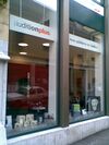 | |||
| shop | herbalist | 의료용 약초(허브)를 주로 판매하는 상점. Lua error in mw.title.lua at line 230: too many expensive function calls.과 Lua error in mw.title.lua at line 230: too many expensive function calls. 문서도 참고하세요. |  | |||
| shop | massage | 마사지 숍. |  | |||
| shop | medical_supply | 의약 용품을 판매하는 상점. |  | |||
| shop | nutrition_supplements | 영양 보충제(비타민, 미네랄, 약초 등)를 판매하는 상점. |  | |||
| shop | optician | 안경과 콘텍트 렌즈를 주로 판매하는 상점. 시력 검사 서비스를 제공하는 곳도 있습니다. |  | |||
| shop | perfumery | 향수를 주로 판매하는 상점. |  | |||
| shop | tattoo | 타투집. 타투를 취급하는 곳. |  | |||
DIY, 가정, 건축 재료, 정원 | ||||||
| shop | agrarian | 씨앗, 농약, 사료와 같은 농업 용품을 주로 판매하는 상점. |  | |||
| shop | appliance | 세탁기, 냉장고, 압력솥, 오븐, 팬과 같은 전기 용품(백색가전)을 주로 판매하는 상점. |  | |||
| shop | bathroom_furnishing | 화장실 가구나 용품을 주로 판매하는 상점. |  | |||
| shop | doityourself | 가정에서 DIY에 필요한 각종 도구를 판매하는 상점. |  | |||
| shop | electrical | 전자기기를 주로 판매하는 상점. |  | |||
| shop | energy | 에너지 생산 관련 기구나 도구(태양광 패널, 부탄가스)를 주로 판매하는 상점. |  | |||
| shop | fireplace | 전기 난로 및 히터와 연료를 판매하는 상점. |  | |||
| shop | florist | 부케를 주로 판매하는 상점. 꽃 화분을 판매하는 상점에는 Lua error in mw.title.lua at line 230: too many expensive function calls. 태그를 붙이세요. |  | |||
| shop | garden_centre | 꽃 화분을 주로 판매하는 상점. 나무도 취급할 수 있습니다. 부케를 판매하는 상점에는 Lua error in mw.title.lua at line 230: too many expensive function calls. 태그를 붙이세요. |  | |||
| shop | garden_furniture | 정원 도구(작은 창고, 야외 테이블, 대문, 울타리 등)를 주로 판매하는 상점. 여기에 식물까지 판매한다면 Lua error in mw.title.lua at line 230: too many expensive function calls. 태그를 붙일 수 있습니다. | ||||
| shop | gas | 가스(아르곤, 산소, 아세틸렌, 이산화탄소 등)을 가스통에 담아 판매하는 상점. |  | |||
| shop | glaziery | 유리창 및 문을 판매하고 시공하는 일을 주로 하는 상점. |  | |||
| shop | groundskeeping | 예초기, 톱, 소형 트랙터와 같은 정원 관리 도구를 주로 판매하는 상점. |  | |||
| shop | hardware | 나사못, 페인트와 같은 건축 도구를 주로 판매하는 상점. Lua error in mw.title.lua at line 230: too many expensive function calls. 문서도 참고하세요. |  | |||
| shop | houseware | 그릇, 칼, 부엌 용품과 같은 가정 용품을 주로 판매하는 상점. | 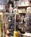 | |||
| shop | locksmith | 열쇠집. 열쇠를 취급하는 가게. Lua error in mw.title.lua at line 230: too many expensive function calls.와 Lua error in mw.title.lua at line 230: too many expensive function calls. 문서도 참고하세요. |  | |||
| shop | paint | 페인트를 주로 판매하는 상점. |  | |||
| shop | security | 도난 경보 시스템, 금고, 잠금장치와 같은 보안 용구를 주로 판매하는 상점. | ||||
| shop | trade | 목재, 시멘트와 같은 건축 용품을 주로 판매하는 상점. Lua error in mw.title.lua at line 230: too many expensive function calls. 문서도 참고하세요. |  | |||
| shop | 이 태그는 폐기되었습니다. 대신 Lua error in mw.title.lua at line 230: too many expensive function calls.을 사용하세요. | |||||
가구 및 인테리어 | ||||||
| shop | antiques | 골동품 상점. |  | |||
| shop | bed | 매트리스를 비롯한 침대 관련 용품을 주로 판매하는 상점. |  | |||
| shop | candles | 양초 및 관련 도구(양촛대 등)를 주로 판매하는 상점. |  | |||
| shop | carpet | 카펫을 주로 판매하는 상점. |  | |||
| shop | curtain | 커튼을 주로 판매하는 상점(Lua error in mw.title.lua at line 230: too many expensive function calls. 문서도 참고하세요. |  | |||
| shop | doors | 문을 주로 판매하는 상점. | ||||
| shop | flooring | 바닥재를 주로 판매하는 상점. |  | |||
| shop | furniture | 가구를 주로 판매하는 상점. |  | |||
| shop | household_linen | 가정용 리넨(타월, 냅킨, 시트, 담요 등)을 주로 판매하는 상점. |  | |||
| shop | interior_decoration | 인테리어 장식 용품을 주로 판매하는 상점. |  | |||
| shop | kitchen | 부엌을 판매하는 상점. 원하는 테마의 부엌을 고르고, 집에 그대로 설치할 수 있도록 해 줍니다. |  | |||
| shop | 이 태그 대신 Lua error in mw.title.lua at line 230: too many expensive function calls.을 사용하세요. | |||||
| shop | lighting | 조명을 주로 판매하는 상점. |  | |||
| shop | tiles | 타일을 주로 판매하는 상점. |  | |||
| shop | window_blind | 창문 블라인드를 주로 판매하는 상점. |  | |||
전자기기 | ||||||
| shop | computer | 컴퓨터, 주변 기기, 소프트웨어를 주로 판매하는 상점. |  | |||
| shop | electronics | 소비자 가전(TV, 라디오 등) 및 대형 가전(컴퓨터, 냉장고 등)을 주로 판매하는 상점. |  | |||
| shop | hifi | 하이파이(Hi-Fi) 및 고성능 음악 청취/영상 재생 환경을 주로 판매하는 상점. |  | |||
| shop | mobile_phone | 휴대전화 및 액세서리를 주로 판매하는 상점. |  | |||
| shop | radiotechnics | 전자 부품, 전파 측정기, 전원 공급기 등을 주로 판매하는 상점. |  | |||
| shop | vacuum_cleaner | 청소기 및 관련 용품을 주로 판매하는 상점. |  | |||
야외 활동 및 스포츠, 교통 수단 | ||||||
| shop | atv | ATV 및 ATV 장비를 판매 또는 대여, 수리하는 가게. |  | |||
| shop | bicycle | 자전거 및 자전거 용품을 판매 또는 대여, 수리하는 가게. |  | |||
| shop | boat | 보트 및 보트 용품을 판매 또는 대여, 수리하는 가게. |  | |||
| shop | car | 자동차 대리점. 자동차를 사거나 수리하는 곳. |  | |||
| shop | car_repair | 자동차 정비소, 자동차 수리점(특정 브랜드에 구애받지 않음). |  | |||
| shop | car_parts | 자동차 부품 및 액세서리, 엔진오일 등을 주로 판매하는 상점. |  | |||
| shop | caravan | 캐러밴이나 캠핑카 등을 판매하는 상점. |  | |||
| shop | fuel | 주유소(Lua error in mw.title.lua at line 230: too many expensive function calls.)가 아니면서 연료(휘발유, 경유, 나무, 석탄, 가스 등)를 판매하는 상점. 판매하는 연료의 종류는 fuel:*=yes/no로 나타낼 수 있습니다. |  | |||
| shop | fishing | 낚시 용품을 주로 판매하는 상점. |  | |||
| shop | golf | 골프 용품을 주로 판매하는 상점. |  | |||
| shop | hunting | 총과 총 관련 용품을 주로 판매하는 상점. |  | |||
| shop | jetski | 제트스키 및 관련 용품을 판매 또는 대여, 수리하는 가게. |  | |||
| shop | military_surplus | 중고 군사 용품을 판매하는 상점. |  | |||
| shop | motorcycle | 오토바이 및 관련 장구(옷, 헬멧)를 판매 및 대여하는 가게. |  | |||
| shop | outdoor | 아웃도어 용품점. 캠핑, 걷기, 등반을 비롯한 다양한 야외 활동에 필요한 도구(GPS 등)를 주로 판매하는 상점. |  | |||
| shop | scuba_diving | 스쿠버 다이빙 용품을 주로 판매하는 상점. |  | |||
| shop | ski | 스키 및 관련 용품을 판매 또는 대여, 수리하는 가게. |  | |||
| shop | snowmobile | 스노모빌 및 관련 용품을 판매 또는 대여, 수리하는 가게. |  | |||
| shop | sports | 스포츠 용품을 주로 판매하는 상점. |  | |||
| shop | swimming_pool | 수영장 용품을 주로 판매하는 상점. |  | |||
| shop | trailer | 트레일러 및 관련 장비를 판매 또는 대여, 수리하는 가게. |  | |||
| shop | tyres | 타이어를 주로 판매하는 상점. |  | |||
미술, 음악, 취미 | ||||||
| shop | art | 예술 작품(그림, 조각상 등)을 판매하는 상점. |  | |||
| shop | camera | 카메라와 렌즈를 주로 판매하는 상점. |  | |||
| shop | collector | 수집상. 우표, 동전, 캐릭터 인형과 같이 수집가들이 좋아할 만한 물건을 판매하는 상점. |  | |||
| shop | craft | 종이, 캔버스, 물감, 목재, 가공 도구 등을 판매하는 상점. Lua error in mw.title.lua at line 230: too many expensive function calls. 문서도 참고하세요. |  | |||
| shop | frame | 액자를 주로 판매하는 상점. |  | |||
| shop | games | 보드 게임, 카드 게임, 역할놀이(롤플레잉) 게임 등을 주로 판매하는 상점. |  | |||
| shop | model | 축소 모형을 주로 판매하는 상점. |  | |||
| shop | music | 음반(레코드판, CD 등)을 주로 판매하는 상점. |  | |||
| shop | musical_instrument | 악기, 악보 등을 주로 판매하는 상점. 특정 악기를 중점적으로 판매한다면 musical_instrument=* 태그를 덧붙이세요. |  | |||
| shop | photo | 사진 관련 용품을 주로 판매하는 상점. |  | |||
| shop | trophy | 트로피, 명판을 주로 판매하는 상점. |  | |||
| shop | video | 비디오/DVD 대여점. 비디오 테이프/DVD를 판매 및 대여하는 상점. |  | |||
| shop | video_games | 비디오 게임을 주로 판매하는 상점. |  | |||
문구, 선물, 책, 신문 | ||||||
| shop | anime | 애니메이션 관련 굿즈를 주로 판매하는 상점. |  | |||
| shop | books | 서점. 책을 주로 판매하는 상점(책을 빌려주는 도서관을 나타내려면 amenity=library 태그를 사용하세요). |  | |||
| shop | gift | 선물 가게. 선물, 연하장, 관광 기념품 등을 주로 판매하는 상점. |  | |||
| shop | lottery | 복권집. 복권을 주로 판매하는 상점. |  | |||
| shop | newsagent | 신문, 담배 등을 주로 판매하는 상점. |  | |||
| shop | stationery | 문방구, 문구점. 사무용품을 주로 판매하는 상점. |  | |||
| shop | ticket | 매표소. 콘서트, 행사, 대중교통 티켓(표)를 주로 판매하는 상점. |  | |||
기타 | ||||||
| shop | bookmaker | 마권, 스포츠토토를 판매하는 상점. |  | |||
| shop | cannabis | 비의료용 대마초를 합법적으로 판매하는 상점. |  | |||
| shop | copyshop | 인쇄집, 복사집. 복사 및 인쇄 서비스를 주로 제공하는 상점. |  | |||
| shop | dry_cleaning | 드라이클리닝 서비스를 제공하는 상점 및 가판대. 실제 세탁은 다른 곳에서 진행됩니다. |  | |||
| shop | e-cigarette | 전자담배를 주로 판매하는 상점. |  | |||
| shop | funeral_directors | 장례 서비스를 제공하는 곳. |  | |||
| shop | laundry | 세탁소. 셀프 빨래방도 여기에 포함됩니다. |  | |||
| shop | money_lender | 고이율로 돈을 빌려주는 대금업자. 일수꾼. |  | |||
| shop | outpost | 온라인으로 주문한 물건을 수령하는 곳. |  | |||
| shop | party | 파티 용품(코스튬) 등을 판매하는 상점. |  | |||
| shop | pawnbroker | 전당포. 물건을 맡아 두고 돈을 빌려주는 곳. Lua error in mw.title.lua at line 230: too many expensive function calls. 문서도 참고하세요. |  | |||
| shop | pest_control | 살충제 및 쥐덫 등을 판매하는 상점. |  | |||
| shop | pet | 동물 및 사료, 장난감을 판매하는 상점. |  | |||
| shop | pet_grooming | 동물(주로 개)의 털 손질을 해 주는 가게. |  | |||
| shop | pyrotechnics | 불꽃놀이 용품점. 폭죽을 판매하는 상점. |  | |||
| shop | religion | 종교 용품을 주로 판매하는 상점. religion=* 문서도 참고하세요. |  | |||
| shop | storage_rental | 창고 대여 서비스. |  | |||
| shop | tobacco | 담배 가게. 시가를 비롯한 각종 담배를 주로 판매하는 상점. |  | |||
| shop | toys | 장난감 가게. 장난감을 주로 판매하는 상점. |  | |||
| shop | travel_agency | 여행사. |  | |||
| shop | vacant | 문을 닫은 가게를 나타내는 태그입니다. Lua error in mw.title.lua at line 230: too many expensive function calls. 태그를 덧붙여 보다 자세한 정보를 다른 기여자들에게 전달해 주세요. 해당 개체를 보존했다가 새로운 상점이 같은 위치에 들어왔을 때 개체를 편집하기만 하면 됩니다. 혼란스러울 수도 있지만, 빈 자리는 가게가 아니며, 지도에 가게로 표시되어서는 안 됩니다. Lua error in mw.title.lua at line 230: too many expensive function calls. 태그를 대체재로 사용할 수 있습니다. |  | |||
| shop | weapons | 칼이나 총과 같은 무기를 주로 판매하는 상점. |  | |||
| shop | yes | 모든 유형의 상점을 아우르는 태그입니다. | ||||
| shop | 사용자 지정 | 오픈스트리트맵에 사용된 모든 값을 Taginfo에서 볼 수 있습니다. | ||||
This table is a wiki template with a default description in English. Editable here. 한국어 번역본은 여기에서 볼 수 있습니다.
Sport
This is used to provide information about which sports are placed on a facility such as a pitch or stadium. It is intended to be used in conjunction with tags landuse=* or leisure=*. See the page titled Sport for an introduction on its usage.
This table is a wiki template with a default description in English. Editable here. {{Ko:Map Features:telecom}}
Tourism
This is used to map places and things of specific interest to tourists. For example these may be places to see, places to stay and things and places providing support. See the page titled Tourism for an introduction on its usage.
This table is a wiki template with a default description in English. Editable here. {{Ko:Map Features:water}}
Waterway
This is used to described different types of waterways. When mapping the way of a river, stream, drain, canal, etc. these need to be aligned in the direction of the water flow. See the page titled Waterways for an introduction on its usage.
Natural watercourses
This table is a wiki template with a default description in English. Editable here.
Man-made waterways
This table is a wiki template with a default description in English. Editable here.
Facilities
This table is a wiki template with a default description in English. Editable here.
Barriers on waterways
This table is a wiki template with a default description in English. Editable here.
Other features on waterways
This table is a wiki template with a default description in English. Editable here.
덧붙는 속성
주소
건물이나 시설의 주소 정보를 나타낼 때 사용합니다. 자세한 사용법은 Addresses 문서와 Lua error in mw.title.lua at line 230: too many expensive function calls. 문서를 참조하세요.
| 키 | 값 | 요소 | 비고 | 표시 | 사진 | |
|---|---|---|---|---|---|---|
개별 집에 사용하는 태그 | ||||||
| addr:housenumber | 사용자 정의 | 건물번호(문자나 - 등이 섞여 있을 수 있음). 건물 하나에 주소가 여러 개인 경우에는 주소 문서를 참조하세요. Lua error in mw.title.lua at line 230: too many expensive function calls. 태그만 달지 마세요. 최소한 Lua error in mw.title.lua at line 230: too many expensive function calls.나 (도로가 없는 장소일 경우) Lua error in mw.title.lua at line 230: too many expensive function calls.를 같이 달아주세요. 아니면 associatedStreet 관계나 도로 관계를 이용해 해당 건물이 특정 도로에 속한다는 것을 나타내 주세요.) |
 | |||
| addr:housename | 사용자 정의 | 건물명. 몇몇 국가(잉글랜드 등)에서는 건물번호 대신 건물명을 사용합니다. |
 | |||
| addr:flats | 사용자 정의 | 대문 뒤에 있는 건물들의 번호(범위 또는 목록). | ||||
| addr:conscriptionnumber | 사용자 정의 | 건물번호가 도로를 기준으로 부여되지 않고 구역을 기준으로 부여되는 곳이 있습니다. 이 '징병 번호'는 오스트리아-헝가리 제국이 처음 도입했고, 여전히 유럽 일부 지역에서는 이 징병 번호를 사용하고 있습니다. 징병 번호를 사용하는 지역들 중 일부는 도로 기준 건물번호를 orientation numbers라고 하기도 합니다. |  | |||
| addr:street | 사용자 정의 | 도로명. highway=* 태그가 달린 선이나 Lua error in mw.title.lua at line 230: too many expensive function calls. 태그가 달린 다각형 근처에 도로명이 적힌 표지판이 있을 것입니다. 건물이 특정 도로에 속해 있다는 것을 나타내기 위해 이 태그 대신 associatedStreet 관계나 도로 관계를 사용하기도 합니다. 유효한 경계선 관계가 존재한다면, 원칙적으로는 주소를 나타내는 데 Lua error in mw.title.lua at line 230: too many expensive function calls. 키와 Lua error in mw.title.lua at line 230: too many expensive function calls. 키만 있으면 됩니다. 유효한 경계선 관계가 있는지 잘 모르겠다면, Lua error in mw.title.lua at line 230: too many expensive function calls., Lua error in mw.title.lua at line 230: too many expensive function calls., Lua error in mw.title.lua at line 230: too many expensive function calls. 키도 넣어주세요. |
 | |||
| addr:place | 사용자 정의 | 주소로서 영역(섬, 광장, 아주 작은 마을 등등, Lua error in mw.title.lua at line 230: too many expensive function calls. 태그를 붙일 만한 곳)의 이름. 도로(highway=*)를 대신해 쓰는 태그기 때문에 Lua error in mw.title.lua at line 230: too many expensive function calls.와 같이 사용할 수 없습니다. | ||||
| addr:postcode | 사용자 정의 | 건물/영역의 우편번호. 일부 매퍼들은 Lua error in mw.title.lua at line 230: too many expensive function calls.를 더 선호합니다. | ||||
| addr:city | 사용자 정의 | 건물/영역의 주소에 찍히는 도시를 나타냅니다. boundary=administrative가 올바르게 사용되었다면 일반적으로 이 태그는 필요 없습니다. 이 태그의 값은 Lua error in mw.title.lua at line 230: too many expensive function calls.와 똑같을 수도 있고 다를 수도 있습니다(일부 지역에서는 주소로서의 도시가 실제 도시 권역을 기준으로 하지 않고 우체국의 권역을 기준으로 하기도 합니다)! |  | |||
| addr:country | 사용자 정의 | ISO 3166-1 alpha-2에 따른 두 자리 국가 코드(대문자). boundary=administrative가 올바르게 사용되었다면 일반적으로 이 태그는 필요 없습니다. 독일: "DE", 스위스: "CH", 오스트리아: "AT", 프랑스: "FR", 이탈리아: "IT", 대한민국: "KR". 경고: ISO 3166-1에서 영국은 "UK"가 아니라 "GB" 입니다. 같이 보기: Lua error in mw.title.lua at line 230: too many expensive function calls. |
||||
| addr:full | 사용자 정의 | 특정 위치의 주소가 일반적인 주소의 구조와 들어맞지 않는 경우, 전체 주소(보통 여러 줄)를 한번에 나타낼 때 사용합니다. 예시: "작은시, 작은면, 작은마을에서 왼쪽 방향으로 5번째 집", 또는 특별한 배달용 이름이나 코드(관련 없는 도시명이나 우편번호가 들어가 있을 수 있음), 혹은 사서함이 주소에 들어가 있는 경우. 이 태그의 값은 소프트웨어가 읽어들이기 힘듭니다. "1200 West Sunset Boulevard Suite 110A"는 Lua error in mw.title.lua at line 230: too many expensive function calls. + Lua error in mw.title.lua at line 230: too many expensive function calls. + Lua error in mw.title.lua at line 230: too many expensive function calls.로 나타낼 수 있습니다. |
||||
일부 국가에서 사용하는 태그 | ||||||
| addr:hamlet | 사용자 정의 | 지물이 속한 마을. |  | |||
| addr:suburb | 사용자 정의 | 하나의 도시 안에 동일한 주소가 여러 개 존재한다면, 주소에 상세한 거주지의 명칭도 적어야 합니다. 호주에서의 suburb의 정의를 참조하세요. | ||||
| addr:subdistrict | 사용자 정의 | 지물이 속한 subdistrict(하위 구). | ||||
| addr:district | 사용자 정의 | 지물이 속한 district. 한국에서는 자치구(특별시/광역시 아래의 구)를 나타냅니다. | ||||
| addr:province | 사용자 정의 | 지물이 속한 province(도). 한국에서는 광역자치단체(특별시/광역시/도, 특별자치도, 특별자치시)를 나타냅니다. 캐나다에서는 도를 나타낼 때 대문자 2자로 된 약칭(BC, AB, ON, QC 등등)을 사용합니다. 러시아에서는 동일한 의미를 가진 addr:region을 광범위하게 사용합니다. | ||||
| addr:state | 사용자 정의 | 지물이 속한 state(주). 미국에서는 주를 나타낼 때 대문자 2자로 된 약칭(AK, CA, HI, NY, TX, WY 등)을 사용합니다. | ||||
보간용 태그 | ||||||
| addr:interpolation | all/even/odd/ alphabetic | 도로를 따라서 일렬로 세워져 있는 건물들의 건물번호가 모두 홀수 (혹은 짝수)라는 것을 나타내 줍니다. 자세한 설명은 여기를 참조하세요. |
 | |||
| addr:interpolation | 숫자 n | 도로를 따라서 일렬로 세워져 있는 건물들의 건물번호가 n씩 증가한다는 것을 나타내 줍니다. | ||||
| addr:inclusion | actual/estimate/potential | 주소 보간선을 그릴 때 시행한 조사의 정확도를 나타낼 때 사용하는 태그입니다(옵션). 자세한 설명은 여기를 참조하세요. |
||||
Annotations
Providing further information about tag values for other mappers and in some cases also for users. See the page titled Annotations for an introduction on its usage.
This table is a wiki template with a default description in English. Editable here.
이름
이름 태그는 요소의 이름을 나타낼 때 사용하는 핵심 태그입니다. 사용례는 이름 문서를 참고하세요.
| 키 | 값 | 요소 | 설명 |
|---|---|---|---|
| name | 사용자 정의 | 지물의 기본 이름. (참고:
| |
| name:<언어> | 사용자 정의 | 해당 언어로 나타낸 명칭(예시: name:fr=Londres). 하술된 변종 이름 태그에도 언어 접미어를 붙일 수 있습니다(다언어 명칭 문서 참고). | |
| name:left, name:right | 사용자 정의 | 중앙선을 기준으로 반쪽씩 서로 다른 이름이 붙어 있는 도로에 사용합니다(보통 지자체 경계에 걸친 도로가 이러합니다). | |
| int_name | 사용자 정의 | 국제적인 명칭(참고: 국제 명칭은 영어 명칭을 의미하지 않습니다. 영어 명칭은 name:en=... 태그에 입력하세요. | |
| loc_name | 사용자 정의 | 현지에서 부르는 이름. | |
| nat_name | 사용자 정의 | 해당 국가에서 부르는 이름. | |
| official_name | 사용자 정의 | 국가명에 사용하기 위해 만들어진 태그입니다. 다만 "name", "int_name", "loc_name" "official_name"과의 명확한 차이점은 아직 논란의 여지가 있습니다. 예시: Lua error in mw.title.lua at line 230: too many expensive function calls.("name" 태그에는 name=Andorra가 입력되어 있음) | |
| old_name | 사용자 정의 | 역사적인 명칭/옛날 명칭. | |
| reg_name | 사용자 정의 | 해당 광역(지자체 등)에서 부르는 명칭. | |
| short_name | 사용자 정의 | 원래 명칭의 준말. 닉네임이 아닙니다(닉네임에는 alt_name을 사용하세요). 검색의 용이함을 위해 도입되었습니다(Nominatim 등에서 사용). | |
| sorting_name | 사용자 정의 | name 태그의 값만으로 이름을 정렬할 수 없으며(유니코드 배열 순서만으로 이름을 정렬할 수 없거나, 정렬된 이름 목록에 여러 언어 또는 여러 문자 체계가 섞여 있는 경우), 다음과 같이 이름의 일부 부분을 무시해야 하는 경우에 사용합니다.
이러한 경우에는 전처리 알고리즘으로 처리하기 힘드므로 별도의 값을 지물에 추가해야 합니다. | |
| alt_name | 사용자 정의 | 지물의 또 다른 이름입니다. 상술된 키 중 적합한 것을 찾지 못했다면 alt_name을 사용할 수 있습니다(예시: name=Field Fare Road + Lua error in mw.title.lua at line 230: too many expensive function calls., name=University Centre + Lua error in mw.title.lua at line 230: too many expensive function calls.). 가끔씩 세미콜론을 이용해 태그 하나에 이름을 여러 개 집어넣는 경우도 있는데(Lua error in mw.title.lua at line 230: too many expensive function calls.), 선호되는 표기 방법은 아닙니다. | |
| 사용하지 마세요. 여러 값을 나타내기 위해 접미어를 붙이는 방식은 폐기되었습니다. |
This table is a wiki template with a default description in English. Editable here. 한국어판은 여기서 편집하실 수 있습니다.
References
This is used to add reference information for an element.
This table is a wiki template with a default description in English. Editable here.
| This table should not be a copy of a source of the English template! Only parameters are translated. See Template:Map Features:restrictions/doc for more information and a copyable version. |
| To add missing translations, go to Template:Map Features:restrictions/doc, copy missing parameters, paste into your language template and complete translations (the link to edit is at the bottom of the table). |
Restrictions
This is used to define restrictions that apply to the associated element. See the page titled Restrictions for an introduction on its usage.
| Key | Value | Element | Comment | Rendering | Photo | |
|---|---|---|---|---|---|---|
| Vehicle types | ||||||
| access | agricultural / delivery / designated / destination / forestry / no / official / permissive / private / yes | General access permission.
|
||||
| agricultural | yes / no | Access permission for agricultural vehicles, e.g. tractors. | ||||
| atv | For values see access above | Access restricted to wheeled vehicles 1.27m (50 inches) or less in width, for example |
||||
| bdouble | For values see access above | Access permission for |
||||
| bicycle | For values see access above + dismount | Access permission for bicycles. Usage of Lua error in mw.title.lua at line 230: too many expensive function calls. and Lua error in mw.title.lua at line 230: too many expensive function calls. will vary in different countries. If according to local traffic rules a bicycle is no longer seen as a bicycle when there's no one driving it, then there's no need for using Lua error in mw.title.lua at line 230: too many expensive function calls.. If the local legislation still sees an undriven bicycle as a bicycle then you may need to use both Lua error in mw.title.lua at line 230: too many expensive function calls. and Lua error in mw.title.lua at line 230: too many expensive function calls.. | ||||
| boat | For values see access above | Access permission for small boats and pleasure crafts, including yachts | ||||
| electric_bicycle | For values see access above | Access permission for electric bicycles (mostly defined as having a maximum speed of 25 km/h) | ||||
| emergency | yes | Access permission for emergency motor vehicles; e.g., ambulance, fire truck, police car |  | |||
| foot | For values see access above | Access permission for pedestrians. | ||||
| forestry | yes / no | Access permission for forestry vehicles, e.g. tractors. | ||||
| golf_cart | For values see access above | Access permission for golf carts and similar small, low-speed electric vehicles | ||||
| goods | For values see access above | Access permission for |
||||
| hazmat | For values see access above | Access permission for vehicles carrying hazardous materials. |  | |||
| hgv | For values see access above | Access permission for |
||||
| horse | For values see access above | Access permission for horse riders. | ||||
| inline_skates | yes / no | Access permission for |
||||
| lhv | For values see access above | Access permission for |
||||
| mofa | For values see access above | Access permission for |
||||
| moped | For values see access above | Access permission for |
||||
| motorboat | For values see access above | Access permission boats and yachts using motor | ||||
| motorcar | For values see access above | Access permission for (motor) cars | ||||
| motorcycle | For values see access above | Access permission for motorcycles | ||||
| motor_vehicle | For values see access above | Access permission for any motorized vehicle |  | |||
| psv | For values see access above | Access permission for Public Service Vehicles (UK), e.g. buses and coaches | ||||
| roadtrain | For values see access above | Access permission for |
 | |||
| ski | For values see access above | Access permission for |
||||
| speed_pedelec | For values see access above | Access permission for electric bicycles (mostly defined as having a maximum speed of 45 km/h) | ||||
| tank | For values see access above | Access permission for (military) tanks | ||||
| vehicle | For values see access above | Access permission for all vehicles | ||||
| 4wd_only | yes | A road signed as only suitable for 4WD (offroad) vehicles | ||||
| Other | ||||||
| charge | Number | Amount of toll or fee. See Lua error in mw.title.lua at line 230: too many expensive function calls. as well | ||||
| female | yes | Female-only or gender segregated (with Lua error in mw.title.lua at line 230: too many expensive function calls.) feature | ||||
| male | yes | Male-only or gender segregated (with Lua error in mw.title.lua at line 230: too many expensive function calls.) feature | ||||
| max_age | age | The legal maximum age | ||||
| maxaxleload | Weight | The legal maximum axleload – units other than tonnes should be explicit | ||||
| maxheight | Height | Height limit – units other than metres should be explicit | ||||
| maxlength | Length | Length limit – units other than metres should be explicit | ||||
| maxspeed | Speed | Maximum speed – units other than km/h should be explicit | ||||
| maxstay | Number | Maximum stay, in units given (hour/hours/day/days) | ||||
| maxweight | Weight | Weight limit – units other than tonnes should be explicit | ||||
| maxwidth | Width | Width limit – units other than metres should be explicit | ||||
| min_age | age | The legal minimum age | ||||
| minspeed | Speed | Minimum speed – units other than km/h should be explicit | ||||
| noexit | yes | A dead end road/cul de sac with only one access road | ||||
| oneway | yes / no / -1 | oneway=yes for traffic direction same as the sequence of nodes of the way. Lua error in mw.title.lua at line 230: too many expensive function calls. for bidirectional traffic. Lua error in mw.title.lua at line 230: too many expensive function calls. for traffic direction opposite to the sequence of nodes of the way (if the way cannot be reversed). Some road types are assumed to be one-way (e.g. Lua error in mw.title.lua at line 230: too many expensive function calls.), others are assumed to be two-way (most others). |
||||
| Relation:restriction | Used for a set of tags and members to represent a turn restriction. | |||||
| toll | yes | Toll or fee must be paid to access way. See also Lua error in mw.title.lua at line 230: too many expensive function calls. | ||||
| traffic_sign | city_limit | Start/end sign of city limits, in most countries implies a specific "city maxspeed". | ||||
| unisex | yes | Unisex feature | ||||
This table is a wiki template with a default description in English. Editable here.


