Mk:Map Features
OpenStreetMap нема строго дефинирани правила по кој се опишуваат Точки ![]() , Патишта
, Патишта ![]() или Релации
или Релации ![]() ). Можете да користите било било кој tag/ознака, но само ако вредноста може да се провери. Меѓутоа, препораке е да се користат општо прифатени тагови како би можел приказот на мапите да се унифицира, односно да биде ист за сите земји. На оваа страница ви ги претставуваме препораките на кој начин да се исцртуваат и опишуваат објектите(Features) на OSM картите.
). Можете да користите било било кој tag/ознака, но само ако вредноста може да се провери. Меѓутоа, препораке е да се користат општо прифатени тагови како би можел приказот на мапите да се унифицира, односно да биде ист за сите земји. На оваа страница ви ги претставуваме препораките на кој начин да се исцртуваат и опишуваат објектите(Features) на OSM картите.
Доколку во препораките не можете да го пронајдете тагот/ознаката за објектот кој сакате да го поставите на картата, или сакате да групирате патишта или точки во компоненти од повисоко ниво, погледнете во Релации или посетете ја страницата Предложени карактеристики на која можете да дознаете повеќе како да креирате нов објект или ознака.
- Доколку сакате да дознаете повеќе за типовите на објекти node/way/area (точка/пат/област), погледајте во Elements.
- Некои објекти на картите дополнително се објаснети, погледнете во Feature Index.
- Доколку сакате да предложите нова икона за објект, погледнете во Proposed Icons.
- Списокот на објекти кои претходно биле одобрени, а сега повеќе не се може да се види во Deprecated features.
- За општите правила на уредување и смерници, погледнете во Editing Standards and Conventions.
Забелешки околу прикажувањерто (рендерирањето):
- Користејќи ги овие ознаки (тагови) значи дека вашиот труд при едитирањето најверојатно ќе биде прикажан во различни прикази - реендери. Сепак тоа не е гаранција дека тагот кој е излистан тука ќе биде прикажан (нема да биде видлив на картата) со некој прикази на главната карта. За специфични информации како да се осигурате дека ознаките ќе се прикажат во Mapnik и Osmarender со плочки (tiles), погледнете во Symbol Rendering.
- Исто така можно е дека на главната карта ќе се прикажат и ознаки кој не се излистани тука. Оваа листа на ознаки не се ажурира со ознаките кои се имплементирани во реендерите.
- Колоната 'Rendering' во овие табели е само пример како изгледаат некој поединечни ознаки/тагови кога ќе се прикажат на картата. Тоа не го диктира начинот на кој истите ќе бидат прикажани или изрендеирани.
Табелите се групирани по теми, првите се најчесто користени.
Физички особини
Highway
Highway тагот најчесто се користи за означување на патишта. Најчесто тоа е и единствената ознака. Погледнете Highway tag usage и Road за упатства.
| Key | Вредност | Елемент | Коментар | Приказ | Фотографија | |
|---|---|---|---|---|---|---|
Патишта | ||||||
|
This group lists the 7 main tags for the road network, from most to least functionally important for motor vehicle traffic. | ||||||
| highway | motorway | Motorway служи за означување на автопат.
По Законот за Јавни Патишта на РМ [1] - Автопат е пат специјално проектиран и изграден само за сообраќај на моторни возила, означен со пропишан сообраќаен знак, со физички раздвоени коловози по насоки, кој има по најмалку две ленти за сообраќај и по една лента за принудно застанување во двете насоки. Не треба да се вкрстува со други патишта или железнички пруги а пристапот до него од јавните патишта е преку посебно изградени приклучоци. Автопатот треба да биде заштитен за пристап од надвор.Ова е пат со ограничен пристап ( нема велосипеди, спори возила...). Еквивалентен е на американските Freeway, германските Autobahn, итн... |
 |
|||
| highway | trunk | Експресен или брз пат кој не е автопат.
По Законот за Јавни Патишта на РМ [1] Експресен пат е пат специјално проектиран и изграден само за сообраќај на моторни возила, означен со пропишан сообраќаен знак, кој има по најмалку една ленти за секоја насока и една лента за застанување. Не треба да се вкрстува со други патишта или железнички пруги а пристапот до него од јавните патишта е преку посебно изградени приклучоци.Експресниот пат треб да биде заштитен за пристап од надвор. Во Македонија пример за ваков пат е делницата од патот A2 помеѓу Гостивар и Тетово. |
 |
|||
| highway | primary | Магистрален[1] пат кој поврзува поважни региони во државата и кој се надоврзува на соодветни патишта во соседните држави. |  |
|||
| highway | secondary | Регионален пат [1] кој поврзува подрачја на две или повеќе општини. |  |
|||
| highway | tertiary | Општински локалени патишта [1]. |  |
|||
| highway | unclassified | Некласифицирани патишта кои немаат административна класификација Ова е обично најнизок облик на мрежен пат. Некласифицирани патишта имаат пониска важност во патната мрежа од локалните патишта ( tertiary), не се патишта во населени места ( residential) или пак земјоделки патишта ( track). Некласифицирани патишта се сметаат како патишта кој се користат за сообраќај на моторни возила. Обично се тесни, неасфалтирани или пак имаат лош квалитет на подлогата и на нив се вози со многу мала брзина.
|
 |
|||
| highway | residential | Патишта односно улици кој се во или околу населени места. |  |
|||
Link roads | ||||||
| highway | motorway_link | Приклучен пат (излез) кој води кон и од автопат од друг автопат или од пат со понизок ранг, со исти рестрикции како и автопатот . |  |
 | ||
| highway | trunk_link | Приклучен пат (излез) кој води кон и од експресен пат или од пат со понизок ранг, со исти рестрикции како и експресниот пат. |  |
 | ||
| highway | primary_link | Приклучен пат (излез) кој води кон и од магистрален пат или пак од пат со понизок ранг. |  |
 | ||
| highway | secondary_link | Приклучен пат (излез) кој води кон и од регионален пат или пак од пат со понизок ранг. |  |
 | ||
| highway | tertiary_link | The link roads (sliproads/ramps) leading to/from a tertiary road from/to a tertiary road or lower class highway. |  |
|||
Special road types | ||||||
| highway | living_street | Улици каде пешаците имаат предност пред возилата, каде децата може да си играат на улица и имаат ниско ограничување на брзината. Обично тоа се улици со многу мал сообраќај и програмите за рутирање се трудат да ги заобиколат. |  |
 | ||
| highway | service | Патишта за пристап до згради, сервисни станици, плажи, кампови, индустриски погони, деловни згради, индустриски зони, итн. Исто така се користат и за пристап до простори за паркирање или за изнесување на отпад. Се користи заедно со service=*, на пр. service=parking_aisle како би ги означиле патиштата внатре во паркингот amenity=parking. |
 |
 | ||
| highway | pedestrian | Шеталишта - патишта прогласени за пешачки зони, плоштади и сл. Движењето на моторни возила на овие патишта е строго контролиран, обично за дотур на роба и е во строго определени термини и со посебен режим и дозвола. За означување на пешачки зони или плоштади додадете area=yes. |  |
 | ||
| highway | track | Патишта за земјоделcки цели (патишта од камен, макадам, калдрма или земја), патишта посипани со песок кои често пати поминуват низ шуми, итн..; обично се неасфалтирани патишта. За повеќе погледај Mk:Key:tracktype. |  |
|||
| highway | bus_guideway | A busway where the vehicle guided by the way (though not a railway) and is not suitable for other traffic. Please note: this is not a normal bus lane, use access=no, psv=yes instead! |  |
 | ||
| highway | escape | For runaway truck ramps, runaway truck lanes, emergency escape ramps, or truck arrester beds. It enables vehicles with braking failure to safely stop. |  | |||
| highway | raceway | A course or track for (motor) racing |  |
 | ||
| highway | road | Патишта кои сеуште не се класифицирани. Ова е привремена ознака за патот се додека тој правилно не се истражи. Кога ќе се најде неговата вистинска класификација патот треба соодветно да се ажурира со класификацијата на која припаѓа. |  |
 | ||
| highway | busway | A dedicated roadway for bus rapid transit systems |  | |||
Патеки | ||||||
| highway | footway | Пешачки патеки кои воглавно/исклучиво се користат од пешаци. Тоа се тротоари, пешачки патеки во паркови, шуми, патеки за планинарење и сл. Ако на нив е дозволено движење на велосипед додадете ознака bicycle=yes. Оваа ознака не би требало да се користи за патеки на кои не им ја знаеме нивната примарна намена. |  |
 | ||
| highway | bridleway | For horse riders. Pedestrians are usually also permitted, cyclists may be permitted depending on local rules/laws. Motor vehicles are forbidden. |  |
 | ||
| highway | steps | Скали на пешачки патеки. Користете step_count=* како би го означиле бројот на скалила. |  |
 | ||
| highway | corridor | For a hallway inside of a building. |  | |||
| highway | path | Патека која нема некој посебни карактеристика и која ја користат и делат различни категории. Подобро е да се користи highway=footway за патеки кој претежно се користат за пешачење, highway=cycleway за они кои се користат за возење на велосипеди, и highway=track за оние по кои поминуваат земјоделси или слични возила. |  |
 | ||
| highway | via_ferrata | A via ferrata is a route equipped with fixed cables, stemples, ladders, and bridges in order to increase ease and security for climbers. These via ferrata require equipment : climbing harness, shock absorber and two short lengths of rope, but do not require a long rope as for climbing. | 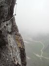 | |||
When sidewalk/crosswalk is tagged as a separate way | ||||||
| footway | sidewalk | Sidewalk that runs typically along residential road. Use in combination with highway=footway or highway=path |  |
 | ||
| footway | crossing | Crosswalk that connects two sidewalks on the opposite side of the road. Often recognized by painted markings on the road, road sign or traffic lights. Use in combination with highway=footway or highway=path. Useful information is presence of tactile_paving=*, wheelchair=* suitability and kerb=* represented as a node on the crosswalk way. |  |
 | ||
| footway | traffic_island | The way between two crossings, safespot for pedestrians, has micromapping characteristics as a detailed alternative to =*. Use in combination with highway=footway or highway=path. |  |
|||
When sidewalk (or pavement) is tagged on the main roadway (see Sidewalks) | ||||||
| sidewalk | both | left | right | no | Specifies that the highways has sidewalks on both sides, on one side or no sidewalk at all |  | |||
When cycleway is drawn as its own way (see Bicycle) | ||||||
| highway | cycleway | Велосипедски патеки кои воглавно/исклучиво се користат за возење на велосипед. Ако на нив е забрането движење на пешаци додадете foot=no. |  |
 | ||
Cycleway tagged on the main roadway or lane (see Bicycle) | ||||||
| cycleway | lane | A lane is a route that lies within the roadway |  | |||
| cycleway | Deprecated variant for ways with oneway=yes where it is legally permitted to cycle in both directions. Replaced by oneway:bicycle=no. |  | ||||
| cycleway | Deprecated variant for ways with oneway=yes that have a cycling lane going the opposite direction of normal traffic flow (a "contraflow" lane). Replaced by oneway:bicycle=no + cycleway:left=lane/cycleway:right=lane + cycleway:left:oneway=-1/cycleway:right:oneway=-1. |  | ||||
| cycleway | track | A track provides a route that is separated from traffic. In the United States, this term is often used to refer to bike lanes that are separated from lanes for cars by pavement buffers, bollards, parking lanes, and curbs. Note that a cycle track may alternatively be drawn as a separate way next to the road which is tagged as highway=cycleway. |  | |||
| cycleway | Deprecated variant for ways with oneway=yes that have a cycling track going the opposite direction of normal traffic flow. Replaced by oneway:bicycle=no + cycleway:left=track/cycleway:right=track + cycleway:left:oneway=-1/cycleway:right:oneway=-1. |  | ||||
| cycleway | share_busway | There is a bus lane that cyclists are permitted to use. |  | |||
| cycleway | Deprecated variant for ways with oneway=yes that have a bus lane that cyclists are also permitted to use, and which go in the opposite direction to normal traffic flow (a "contraflow" bus lane). Replaced by oneway:bicycle=no + cycleway:left=share_busway/cycleway:right=share_busway + cycleway:left:oneway=-1/cycleway:right:oneway=-1. |  | ||||
| cycleway | shared_lane | Cyclists share a lane with motor vehicles, there are markings reminding about this. In some places these markings are known as "sharrows" ('sharing arrows') and this is the tag to use for those. |  | |||
Busways tagged on the main roadway or lane (see Bus lanes) | ||||||
| lane | Deprecated variant to tag bus lanes. Replaced by bus/psv lane tagging lanes:bus=* / lanes:psv=*) / bus:lanes=* / psv:lanes=* |  | ||||
| opposite | Deprecated variant for ways with oneway=yes where buses are legally permitted to travel in both directions. Replaced by oneway:bus=no | |||||
| opposite_lane | Deprecated variant for ways with oneway=yes that have a bus lane which go in the opposite direction to normal traffic flow (a "contraflow" bus lane). Replaced by oneway:bus=no and lanes:bus=* / lanes:psv=*) / bus:lanes=* / psv:lanes=* | |||||
Street parking tagged on the main roadway (see Street parking) | ||||||
| parking:left / :right / :both (hereafter: parking:side) |
lane | street_side | on_kerb | half_on_kerb | shoulder | no | separate | yes | Primary key to record parking along the street. Describes the parking position of parked vehicles in the street. |  | |||
| parking:sideorientation=* | parallel | diagonal | perpendicular | To specify the orientation of parked vehicles if there is street parking. | ||||
Lifecycle (see also lifecycle prefixes) | ||||||
| highway | proposed | For planned roads, use with proposed=* and a value of the proposed highway value. | ||||
| highway | construction | Патоте е во изградба/реконструкција и движењето по него не е можно. |  |
 | ||
Attributes | ||||||
| abutters | commercial | industrial | mixed | residential | retail etc. | See Key:abutters for more details. |  | |||
| bicycle_road | yes | A bicycle road is a road designated for bicycles. If residential streets get the status of bicycle roads, normally, by special signs, motor traffic is admitted with limited speed, often only for residents. |  | |||
| bus_bay | both | left | right | A bus bay outside the main carriageway for boarding/alighting |  | |||
| change | yes | no | not_right | not_left | only_right | only_left | Specify the allowed/forbidden lane changes |  | |||
| destination | <place name of destination> | Destination when following a linear feature |  | |||
| embankment | yes | dyke | A dyke or a raised bank to carry a road, railway, or canal across a low-lying or wet area. |  | |||
| embedded_rails | yes | <type of railway> | A highway on which non-railway traffic is also allowed has railway tracks embedded in it but the rails are mapped as separate ways. |  | |||
| ford | yes | Патот се вкрстува со поток или река и возилата при премин мора да влезат во во вода! |  | |||
| frontage_road | yes | A frontage road. | ||||
| ice_road | yes | A highway is laid upon frozen water basin, definitely doesn't exist in summer. |  | |||
| incline | Number % | ° | up | down | Incline steepness as percents ("5%") or degrees ("20°"). Positive/negative values indicate movement upward/downwards in the direction of the way. |  | |||
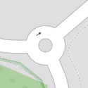
| junction | roundabout | Кружен тек.
Оваа ознака подразбира oneway=yes, едносмерен пат дефиниран со след на точки кои одат во смер обратен од движењето на стрелката на часовникот, а патот претходно треба да биде означен со highway=*. |
 |
 | ||
| lanes | <number> | The number of traffic lanes for general purpose traffic, also for buses and other specific classes of vehicle. |  | |||
| lane_markings | yes | no | Specifies if a highway has painted markings to indicate the position of the lanes. |  | |||
| lit | yes | no | Street lighting |  | |||
| maxspeed | <number> | Specifies the maximum legal speed limit on a road, railway or waterway. |  | |||
| motorroad | yes | no | The motorroad tag is used to describe highways that have motorway-like access restrictions but that are not a motorway. |  | |||
| mountain_pass | yes | The highest point of a mountain pass. |  | |||
| mtb:scale | 0-6 | Applies to highway=path and highway=track. A classification scheme for mtb trails (few inclination and downhill). |  | |||
| mtb:scale:uphill | 0-5 | A classification scheme for mtb trails for going uphill if there is significant inclination. |  | |||
| mtb:scale:imba | 0-4 | The IMBA Trail Difficulty Rating System shall be used for bikeparks. It is adapted to mtb trails with artificial obstacles. | ||||
| mtb:description | Text | Applies to highway=path and highway=track. A key to input variable infos related to mtbiking on a way with human words | ||||
| oneway | yes | no | reversible | Oneway streets are streets where you are only allowed to drive in one direction. | 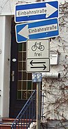 | |||
| oneway:bicycle | yes | no | | Used on ways with oneway=yes where it is legally permitted to cycle in both directions. |  | |||
| overtaking | yes | no | caution | both | forward | backward | Specifying sections of roads where overtaking is legally forbidden. Use overtaking:forward=yes/no/caution and overtaking:backward=yes/no/caution when it depends on driving direction. |  | |||
| parallel | diagonal | perpendicular | marked | no_parking | no_stopping | fire_lane. | Deprecated variant to map parking along streets. See section on street parking above or the street parking page for more details. | |||||
| free | ticket | disc | residents | customers | private | Deprecated variant to map parking conditions along streets. See section on street parking above or the street parking page for more details. |  | ||||
| passing_places | yes | A way which has frequent passing places (See also: highway=passing_place) |  | |||
| priority | forward | backward | Traffic priority for narrow parts of roads, e.g. narrow bridges. |  | |||
| priority_road | designated | yes_unposted | end | Specifying roads signposted as priority roads. |  | |||
| sac_scale | strolling | hiking | mountain_hiking | demanding_mountain_hiking | alpine_hiking | demanding_alpine_hiking | difficult_alpine_hiking | Applies to highway=path and highway=footway. A classification scheme for hiking trails. |  | |||
| service | alley | driveway | parking_aisle etc. | See Key:service for more details. |  | |||
| shoulder | no | yes | right | both | left | Presence of shoulder in highway | ||||
| side_road | yes | A side road. | ||||
| smoothness | excellent | good | intermediate | bad | very_bad | horrible | very_horrible | impassable | Specifies the physical usability of a way for wheeled vehicles due to surface regularity/flatness. See Key:smoothness for more details. | 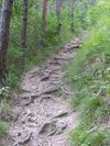 | |||
| surface | paved | unpaved | asphalt | concrete | paving_stones | sett | cobblestone | metal | wood | compacted | fine_gravel | gravel | pebblestone | plastic | grass_paver | grass | dirt | earth | mud | sand | ground | See Key:surface for more details. |  | |||
| tactile_paving | yes | no | A paving in the ground to be followed with a blindman's stick. |  | |||
| tracktype | grade1 | grade2 | grade3 | grade4 | grade5 | To describe the quality of the surface. See Key:tracktype for more information. | 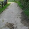 | |||
| traffic_calming | bump | hump | table | island | cushion | yes | etc. | Features used to slow down traffic. See Key:traffic calming for more details. |  | |||
| trail_visibility | excellent | good | intermediate | bad | horrible | no | Applies to highway=path, highway=footway, highway=cycleway and highway=bridleway. A classification for hiking trails visibility |  | |||
| trailblazed | yes | no | poles | cairns | symbols | Applies to highway=*. Describing trail blazing and marking. See Key:trailblazed for more information. | 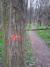 | |||
| trailblazed:visibility | excellent | good | intermediate | bad | horrible | no | Applies to trailblazed=*. A classification for visibility of trailblazing. See Key:trailblazed:visibility for more information. | ||||
| turn | left | slight_left | through | right | slight_right | merge_to_left | merge_to_right | reverse | The key turn can be used to specify the direction in which a way or a lane will lead. |  | |||
| width | <number> | The width of a feature. | 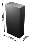 | |||
| winter_road | yes | A highway functions during winter, probably can't be driven in summer. |  | |||
Other highway features | ||||||
| highway | bus_stop | A small bus stop. Optionally one may also use public_transport=stop_position for the position where the vehicle stops and public_transport=platform for the place where passengers wait. |  | |||
| highway | crossing | A.k.a. crosswalk. Pedestrians can cross a street here; e.g., zebra crossing |  | |||
| highway | cyclist_waiting_aid | Street furniture for cyclists that are intended to make waiting at esp. traffic lights more comfortable. |  | |||
| highway | elevator | An elevator or lift, used to travel vertically, providing passenger and freight access between pathways at different floor levels. |  | |||
| highway | emergency_bay | An area beside a highway where you can safely stop your car in case of breakdown or emergency. |  | |||
| highway | emergency_access_point | Sign number which can be used to define your current position in case of an emergency. Use with ref=NUMBER_ON_THE_SIGN. See also emergency=access_point |  | |||
| highway | give_way | A "give way," or "Yield" sign | 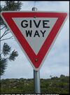 | |||
| emergency | phone | A calling device can be used to tell on your current position in case of an emergency. Use with ref=NUMBER_ON_THE_SIGN |  | |||
| highway | ladder | A vertical or inclined set of steps or rungs intended for climbing or descending of a person with the help of hands. |  | |||
| highway | milestone | Highway location marker | ||||
| highway | mini_roundabout | Similar to roundabouts, but at the center there is either a painted circle or a fully traversable island. In case of an untraversable center island, junction=roundabout should be used.
Rendered as anti-clockwise by default direction=anticlockwise. To render clockwise add the tag direction=clockwise. |
 |
|||
| highway | motorway_junction | Означува излез/влез од автопат. ref=* Потребно е да се додаде бројот на излезот и/или името на излезот. | 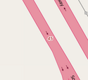 |
 | ||
| highway | passing_place | The location of a passing space |  | |||
| highway | platform | A platform at a bus stop or station. |  |
 | ||
| highway | rest_area | Place where drivers can leave the road to rest, but not refuel. | 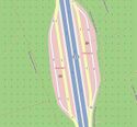 |
 | ||
| highway | services | A service station to get food and eat something, often found at motorways |  |
 | ||
| highway | speed_camera | A fixed road-side or overhead speed camera. |  | |||
| highway | speed_display | A dynamic electronic sign that displays the speed of the passer-by motorist. |  | |||
| highway | stop | A stop sign |  | |||
| highway | street_lamp | A street light, lamppost, street lamp, light standard, or lamp standard is a raised source of light on the edge of a road, which is turned on or lit at a certain time every night |  | |||
| highway | toll_gantry | A toll gantry is a gantry suspended over a way, usually a motorway, as part of a system of electronic toll collection. For a toll booth with any kind of barrier or booth see: barrier=toll_booth |  | |||
| highway | traffic_mirror | Mirror that reflects the traffic on one road when direct view is blocked. |  | |||
| highway | traffic_signals | Семафори за регулација на сообраќајот. |  | |||
| highway | trailhead | Designated place to start on a trail or route |  | |||
| highway | turning_circle | A turning circle is a rounded, widened area usually, but not necessarily, at the end of a road to facilitate easier turning of a vehicle. Also known as a cul de sac. |  |
 | ||
| highway | turning_loop | A widened area of a highway with a non-traversable island for turning around, often circular and at the end of a road. |  | |||
| highway | User Defined | All commonly used values according to Taginfo | ||||


