Template:Et:Map Features:railway
Jump to navigation
Jump to search
Raudtee
| võti | väärtus | element | kirjeldus | renderdus | foto | |
|---|---|---|---|---|---|---|
| ||||||
| railway | abandoned | Endine raudtee, rööpad ja infrastruktuur on nüüd eemaldatud. |  | |||
| railway | construction | ehitatav või remonditav tee. Vaata ka construction=* ja construction=yes |  |
 | ||
| railway | proposed | Railway being proposed but haven't started construction. Please see the proposed page regarding verifiability on the ground of this value. | ||||
| railway | disused | Raudtee, mida enam ei kasutata, aga kus on alles rööpad ja infrastruktuur. Teine võimalik silt: disused=yes |  |
 | ||
| railway | funicular | köisraudtee |  |
 | ||
| railway | light_rail | rongi ja trammi vahepealne kergem raudtee |  |
 | ||
| railway | miniature | Miniature railways are narrower than narrow gauge and carry passengers, frequently at an exact scale of "standard-sized" rail (for example "1/4 scale"). They can often be found in parks. |  |
 | ||
| railway | monorail | monorelss. Ühe relsiga raudtee. Rong võib sõita kas relsi peal või selle all nagu Wuppertal Schwebebahn (Saksamaa) |  |
 | ||
| railway | narrow_gauge | kitsarööpmeline raudtee |  |
 | ||
| Ajalooliste rongide raudtee, enamasti turismiatraktsioon. |  |
 | ||||
| railway | rail | raudtee |  |
 | ||
| railway | subway | metroo |  |
 | ||
| railway | tram | trammitee |  |
 | ||
| ||||||
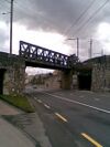
| bridge | yes | Sild Sild, mida mööda raudtee läheb üle tee, veetee või teise raudtee. |  |
 | ||
| cutting | yes | Lõik, millel raudtee on tunduvalt madalamal kui ümbritsev maapind |  | |||
| electrified | contact_line rail yes no |
contact_line (kontaktliin): Toiteliin rongi kohal. rail (relss): Kolmas relss rööpmepaari lähedal, mis tagab rongile toite. |
 | |||
| embankment | yes | Raudteetamm Lõik, millel raudtee on ehitatud tunduvalt kõrgemale kui ümbritsev maapind. |  | |||
| embedded_rails | yes / <type of railway> | Specifies that a highway on which non-railway traffic is also allowed has railway tracks embedded in it but the rails are mapped as separate ways. |  | |||
| frequency | <number> [Hz] | Sagedus Raudtee toitepinge sagedus. Alalispinge tähistamiseks kasuta numbrit 0. Vaata ka voltage=* |  | |||
| passenger_lines | <number> | Used to describe number of tracks of the railway line a certain track segment belongs to. | ||||
| railway:track_ref | <number> | Track number |  | |||
| service | crossover | Relatively short lengths of track which switch traffic from one parallel line to another | ||||
| service | siding | Relatively short lengths of track, running parallel to (and connected to) a main route | 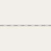 |
|||
| service | spur | Relatively short lengths of track, built to give one company or entity access to a main or branch line. |  |
 | ||
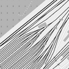
| service | yard | Tracks within railway company operated marshalling or maintenance yards. |  |
 | ||
| tunnel | yes | If the railway goes below ground. Most subways have this tag. |  | |||
| tracks | <number> | Number of parallel tracks in close proximity when mapped as one single way representing all tracks. If not given means unknown and defaults to 1. In many parts of the world the tracks are being drawn out separately so that there is more detail, in which case this tag isn't used. |  | |||
| usage | main branch industrial military tourism scientific test |
main line: heavy traffic branch line: connecting places with a mainline industrial: servicing large plants (iron, chemical etc.), surface mining, … military: servicing military area tourism: most mountain rails (rack-rails, funicular) and preserved railways scientific: rail transport at spaceports, large array telescopes, etc. test: track for testing new wheels, rails, tracks and rail technologies. |
||||
| voltage | <number> | Pinge. Raudtee toitepinge. Vaata ka frequency=* |  | |||
| ||||||
| railway | halt | peatus Väike raudteejaam, kus ei pruugi perrooni olla ning rongid võivad peatuda vaid nõudel. |  | |||
| public_transport | stop_position | The position on the railway track where the train (its centre) stops at a platform. This is useful for routing on long platforms where also short trains stop and on long platforms where multiple trains stop behind each other. See also public_transport=stop_area. |  | |||
| public_transport | platform | This is parallel to the rail line for showing where the actual platforms are. It is also to know where you can change platform and enter the station, so use footpaths to connect them. This is really useful for routing too. Use only if the platform is served by public transport. |  | |||
| railway | platform | This is parallel to the rail line for showing where the actual platforms are. It is also to know where you can change platform and enter the station, so use footpaths to connect them. This is really useful for routing too. Use in addition to public_transport=platform. |  | |||
| public_transport | station | Railway passenger-only station. |  | |||
| railway | station | raudteejaam |  | |||
| railway | stop | Marks the position where trains stop at a station. It should be added as a node on a railway=rail way. |  | |||
| railway | subway_entrance | The entrance to a subway station, usually going from surface to underground. |  | |||
| railway | tram_stop | A tram stop is a place where a passenger can embark / disembark a tram. |  | |||
Infrastructure | ||||||
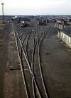
| landuse | railway | Ground used around railways and railwaystations. | 
|
 | ||
| railway | buffer_stop | Stops the train at the end of a track. See buffer stop. |  | |||
| railway | crossing | ülekäigukoht Koht, kus jalakäijad võivad raudteed ületada. |  | |||
| railway | derail | A device used to prevent fouling of a rail track by unauthorized movements of trains or unattended rolling stock. See Derail (railroad). |  | |||
| railway | level_crossing | ülesõidukoht Koht, kus raudtee ja sõidutee ristuvad. |  | |||
| railway | railway_crossing | Crossing rails with no interconnection. |  | |||
| railway | roundhouse | A semicircular building with many stalls for servicing engines. |  | |||
| railway | signal | Any kind of railway signal. |  | |||
| railway | switch | Full connections between railways (aka 'points'). |  | |||
| railway | tram_level_crossing | A point where trams and roads cross. |  | |||
| railway | traverser | These are used for changing trains between railways. Also known as transfer table. |  | |||
| railway | turntable | These are used for changing the direction that part of a train is pointing in. |  | |||
| railway | ventilation_shaft | A structure that allows ventilation in underground tunnels |  | |||
| railway | wash | A railroad carriage/car wash | 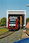 | |||
| railway | water_crane | A structure to deliver water to steam locomotives | 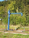 | |||
| railway | user defined | All commonly used values according to Taginfo | ||||
This table is a wiki template with a default description in English. Editable here.


