NL:Kaartelementen
Alles mag, maar ...
Objecten zoals straten, bushokjes en standbeelden krijgen binnen OpenStreetMap een of meer sleutels (keys) met een waarde (value) toegewezen De combinatie van een sleutel met zijn waarde wordt een tag (=label) genoemd. Met deze tags vertel je wat er met het Knooppunt ![]() , de Weg
, de Weg ![]() of Gebied
of Gebied ![]() , kortom een van de kaartelementen (Elements), bedoeld wordt.
OpenStreetMap kent geen beperkingen in het gebruik van sleutels en waarden. Bestaat een tag niet, dan mag je er gerust een toevoegen en gebruiken.
Toch verdient het niet de voorkeur om voor een reeds bestaande tag een synoniem te verzinnen. Ook is het niet handig om een sleutel en/of waarde te gebruiken waarvan niemand de betekenis kent. OSM is leuk omdat met onze gegevens kaarten, toepassingen en apps worden gemaakt. En als een sleutel niet bekend is zal de kaartenmaker of programmeur er niets mee doen en is dus je werk voor niets geweest.
, kortom een van de kaartelementen (Elements), bedoeld wordt.
OpenStreetMap kent geen beperkingen in het gebruik van sleutels en waarden. Bestaat een tag niet, dan mag je er gerust een toevoegen en gebruiken.
Toch verdient het niet de voorkeur om voor een reeds bestaande tag een synoniem te verzinnen. Ook is het niet handig om een sleutel en/of waarde te gebruiken waarvan niemand de betekenis kent. OSM is leuk omdat met onze gegevens kaarten, toepassingen en apps worden gemaakt. En als een sleutel niet bekend is zal de kaartenmaker of programmeur er niets mee doen en is dus je werk voor niets geweest.
Kortom: Voel je vrij om te doen wat je wilt, maar zorg wel dat men later snapt wat je gedaan hebt.
Hoe vind je een geschikt element
Deze pagina bevat een bloemlezing uit de vele sleutels en waardes die ooit door jouw voorgangers zijn verzonnen. Bedenk dat de lijst niet uitputtend is en dat in onze documentatie WikiOSM nog veel meer al lang bekende sleutels verborgen liggen.
Als je na het zoeken op deze pagina (<Ctrl>[F]) nog geen geschikte sleutel voor jouw object hebt gevonden, kun je een aantal stappen nemen om toch je doel te bereiken en wellicht onsterfelijk te worden.
- Vind uit hoe je object in goed Nederlands genoemd wordt
- Zoek het op deze pagina met <Ctrl>[F]
- Zoek het op in WikiOSM. Bij geen resultaat probeer een andere benaming.
- Vraag het op het Nederlandse Forum (Eerst aanmelden)
- Vraag het op de Nederlandse Discussie MailingList (talk-nl@openstreetmap.org) (Aanmelden)
- Zelf een nieuwe Sleutel en/of Waarde verzinnen en beschrijven op een WikiPagina en aanmelden bij Proposed features (Status: Onsterfelijk).
Renderen en kaart maken
Opmerkingen over het renderen
- Door gebruik te maken van de hier beschreven tags zullen de verschillende kaartenmakers (Renderers) naar verwachting het beoogde resultaat laten zien.
- Iedere kaartmaker bepaalt zelf welke sub-set aan waardes en sleutels hij op zijn kaart omzet in een plaatje of beeld. Dat hij jouw sleutels en/of waardes gebruikt kan niemand waarborgen. Alleen als jij het gegeven op een juiste manier invoert en eventueel beschrijft, kan het op een gegeven dag gebruikt worden door een kaartmaker.
Lijst van Elementen
De lijsten zijn gegroepeerd op thema, de meest algemeen gebruikte eerst.
Fysiek
Wegen
De highway=* key is de belangrijkste eigenschap van een weg. Soms is het zelfs de enige key op een weg. In de onderstaande tabel vindt u de meest gebruikelijke waardes van deze key. Op de volgende pagina vindt u op Nederland toegespitste voorbeelden zodat het gebruik wat vereenvoudigd wordt.
Let op: Het gebruik van deze key is niet zwart-wit. Er zijn genoeg uitzonderingen op de regels. Ga uit van uw gezonde verstand en bij twijfel kunt u altijd navraag doen op het Forum of via de Mailinglist (talk-nl@openstreetmap.org).
| Sleutel | Waarde | Element | Omschrijving | Resultaat | Foto | |
|---|---|---|---|---|---|---|
Wegen | ||||||
|
Dit zijn de belangrijkste tags voor het wegennetwerk. Ze zijn geordend van belangrijkste naar minst belangrijke. | ||||||
| highway | motorway | Autosnelweg
Een weg aangeduid met |
 |
|||
| highway | trunk | Autoweg
Een weg aangeduid met een |
 |
|||
| highway | primary | Primaire wegen
Belangrijke regionale wegen (geen autowegen). In Nederland: N-wegen met nummers t/m 399. Daarnaast de N-wegen met nummers groter dan 400 voor zover hun functie belangrijk genoeg is om gelijk gesteld te worden. Soms ook voor belangrijke wegen die een grote stad doorkruisen met een S... -nummer, dan ook ref=S... toevoegen. |
 |
|||
| highway | secondary | Secundaire wegen
Wegen die steden, grotere dorpen of het omliggende wegennet van een hogere orde met elkaar verbinden. Binnen een stad ook gebruikt om wijken (geen buurten) met de belangrijkste verkeersaders te verbinden. Verder ook alle (Nederlandse) N-wegen met nummers groter dan 400, tenzij hun functie zo belangrijk is dat deze reeds als primary geclassificeerd zijn. |
 |
|||
| highway | tertiary | Tertiare wegen
Grotere, nog niet hoger geclassificeerde wegen buiten de bebouwde kom en doorvoerwegen (definitie?) binnen de bebouwde kom. Vaak ook te herkennen als een 50-km-weg door een 30-km-woongebied welke beter geschikt voor verkeer dan de meeste highway=residential wegen. |
 |
|||
| highway | unclassified | Lokale wegen
De lokale wegen vormen de laagste classificatie van het onderling verbonden netwerk van wegen. Hieronder vallen veel straten en wegen in het buitengebied. Wegen zijn voorzien van asfalt of straatstenen. Onverharde wegen: zie highway=track of highway=path. |
 |
|||
| highway | residential | Straat
Wegen in en direct rond woonwijken waarvan verwacht mag worden dat deze alleen gebruik worden door de bewoners uit de buurt. |
 |
|||
Verbindingswegen | ||||||
| highway | motorway_link | Invoegstroken en Afritten van autosnelwegen
De opritten en afritten die autosnelwegen onderling en met andere typen wegen verbinden. Normaal gesproken gelden hiervoor dezelfde restricties als voor de autosnelweg. Ook van toepassing op aansluitingen van verzorgingsplaatsen op autosnelwegen voor de weggedeeltes waar de autosnelwegregels nog gelden. Gebruik bij knooppunten destination:ref=A.. van de bestemmingssnelweg en bij afritten junction:ref=afritnummer en destination=plaats volgens aanduiding. |
 |
 | ||
| highway | trunk_link | Afritten autowegen
De op- en afritten naar een autoweg. |
 |
 | ||
| highway | primary_link | Afritten primaire wegen
De op- en afritten naar een primaire weg (primary road). |
 |
 | ||
| highway | secondary_link | Afslagen Secundaire wegen
Een afslag die een secondary highway verbindt met een andere secondary highway of met een weg van een lagere classificatie. |
 |
 | ||
| highway | tertiary_link | Afslagen Tertiare wegen
Een afslag die een tertiary highway verbindt met een andere tertiary highway of met een weg van een lagere classificatie. |
 |
|||
Bijzondere wegen | ||||||
| highway | living_street | Woonerf
Straat met speciaal verkeersbord waar alleen stapvoets gereden mag worden.
|
 |
 | ||
| highway | service | Toegangswegen
Wegen naar parkeerplaatsen, tankstations, gebouwen, etc. Voor verzorgingsplaatsen langs autosnelwegen, zie ook highway=motorway_link. Voor het gebied zie highway=services. Rijbanen op een parkeerplaats tussen de parkeerplaatsen. Weg van de openbare weg naar een huis of kantoorgebouw. Veelal zijn deze wegen privéterrein. |
 |
 | ||
| highway | pedestrian | Voetgangersgebied
Vaak in binnensteden bij winkelgebieden. Dus niet voor aparte voetpaden. Buiten openingstijden kan ook bevoorradingsverkeer hier gebruik van maken. Voor pleinen kan men area=yes gebruiken. |
 |
 | ||
| highway | track | Veldwegen en boswegen
Onverharde wegen in landelijk of bosgebied. Gebruik ook waar mogelijk tracktype=*. |
 |
|||
| highway | bus_guideway | Geleide bus
Een speciale baan waarin de bus wordt geleid door de baan (echter geen spoorweg), en de baan niet kan worden gebruikt door ander verkeer. |
 |
 | ||
| highway | escape | Noodstopstrook
Bedoeld voor hellingen of stroken voor op hol geslagen vrachtwagens, een helling voor een noodstop, of een grindbak om een vrachtwagen te stoppen. Hierdoor kunnen voertuigen die niet meer kunnen remmen toch op een veilige manier - en meestal zonder schade - tot stilstand komen. |
 | |||
| highway | raceway | Racecircuit
Een (afgesloten) weggedeelte voor auto- of motorraces. |
 |
 | ||
| highway | road | Classificatie onbekend
Deze is bedoeld als tijdelijke tag om een weg te markeren tot deze juist is onderzocht. Wanneer de weg juist is geclassificeerd kan de waarde worden gewijzigd. |
 |
 | ||
| highway | busway | A dedicated roadway for bus rapid transit systems |  | |||
Paden | ||||||
| highway | footway | Voetpad
Belangrijk is dat het pad met borden als ((niet)verplicht)voetpad wordt aangegeven.
|
 |
 | ||
| highway | bridleway | Ruiterpad |  |
 | ||
| highway | steps | Trap
Trap in een voet- of fietspad. |
 |
 | ||
| highway | corridor | Passage
Een passage binnen een gebouw. |
 | |||
| highway | path | (Bos)Pad
Onverharde paden door het veld of bos waar geen sporen zichtbaar zijn van gemotoriseerd verkeer, anders zie highway=track. Voor fotovoorbeelden zie Tag:highway=path/Examples. |
 |
 | ||
| highway | via_ferrata | A via ferrata is a route equipped with fixed cables, stemples, ladders, and bridges in order to increase ease and security for climbers. These via ferrata require equipment : climbing harness, shock absorber and two short lengths of rope, but do not require a long rope as for climbing. | 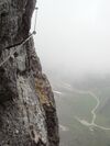 | |||
When sidewalk/crosswalk is tagged as a separate way | ||||||
| footway | sidewalk | Sidewalk that runs typically along residential road. Use in combination with highway=footway or highway=path |  |
 | ||
| footway | crossing | Voetgangersoversteekplaats
Plek waar voetgangers kunnen oversteken, vaak door middel van een zebrapad. |
 |
 | ||
| footway | traffic_island | The way between two crossings, safespot for pedestrians, has micromapping characteristics as a detailed alternative to =*. Use in combination with highway=footway or highway=path. |  |
|||
Trottoirs (als onderdeel van een weg) | ||||||
| sidewalk | both | left | right | no | Specifies that the highways has sidewalks on both sides, on one side or no sidewalk at all |  | |||
(Losliggende) Fietspaden | ||||||
| highway | cycleway | Fietspad
Een apart vrijliggende weg speciaal voor fietsers. Belangrijk is dat het pad met borden als resp. verplicht fietspad, bromfiets/fietspad of niet verplicht fietspad wordt aangegeven: |
 |
 | ||
Fietsstroken (als onderdeel van een weg) | ||||||
| cycleway | lane | Fietsstrook
Een fietspad onderdeel van de hoofdweg, hooguit gescheiden door een stippellijn of een doorgetrokken streep maar dat verder onderdeel uitmaakt van de hoofdrijbaan. De fietsstrook is herkenbaar aan de fietssymbolen. Vaak is het asfalt van een fietsstrook rood. De rode kleur heeft geen wettelijke betekenis. Wanneer de strook alleen rood is, zonder fietssymbool, dan wordt de strook (in Nederland en in België) officieel fietssuggestiestrook genoemd, en kunnen andere voertuigen er ook gebruik van maken. In dat geval wordt de strook getagd met cycleway=shared_lane (zie onder fietssuggestiestrook) |
 | |||
| cycleway | Verouderd, niet meer gebruiken in Nederland
Gebruik voor straten met éénrichtingsverkeer voor auto's, maar verkeer in twee richtingen voor (brom)fietsen oneway:bicycle=no, oneway:mofa=no en (indien ook voor bromfietsen) oneway:moped=no. |
 | ||||
| cycleway | Verouderd, niet meer gebruiken in Nederland
Gebruik voor wegen met een tegengestelde fietsstrook en éénrichtingsverkeer voor auto's, maar verkeer in twee richtingen voor (brom)fietsen cycleway:left=lane of cycleway:left=shared_lane + oneway:bicycle=no |
 | ||||
| cycleway | track | Vrijliggend fietspad
Een fietspad dat duidelijk gescheiden langs een weg loopt en dezelfde naam draagt dient bij voorkeur als aparte weg, highway=cycleway te worden ingetekend. Mocht de afscheiding slechts bestaan uit een verharde afscheiding zijn zoals een betonnen rand of een kleine vluchtheuvel, kan deze strook getagd worden met cycleway=track. |
 | |||
| cycleway | Verouderd, niet meer gebruiken in Nederland
Teken het vrijliggende fietspad apart in. |
 | ||||
| cycleway | share_busway | Gedeelde bus-fiets baan
Op de busbaan is het ook toegestaan om te fietsen. Kan ook met bicycle=yes |
 | |||
| cycleway | Verouderd, niet meer gebruiken in Nederland
Gebruik oneway:bicycle=no met bicycle=yes of cycleway=share_busway. |
 | ||||
| cycleway | shared_lane | Fietssuggestiestrook
Fietsstrook zonder fietssymbool. |
 | |||
Busways tagged on the main roadway or lane (see Bus lanes) | ||||||
| lane | Deprecated variant to tag bus lanes. Replaced by bus/psv lane tagging lanes:bus=* / lanes:psv=*) / bus:lanes=* / psv:lanes=* |  | ||||
| opposite | Deprecated variant for ways with oneway=yes where buses are legally permitted to travel in both directions. Replaced by oneway:bus=no | |||||
| opposite_lane | Deprecated variant for ways with oneway=yes that have a bus lane which go in the opposite direction to normal traffic flow (a "contraflow" bus lane). Replaced by oneway:bus=no and lanes:bus=* / lanes:psv=*) / bus:lanes=* / psv:lanes=* | |||||
Street parking tagged on the main roadway (see Street parking) | ||||||
| parking:left / :right / :both (hereafter: parking:side) |
lane | street_side | on_kerb | half_on_kerb | shoulder | no | separate | yes | Primary key to record parking along the street. Describes the parking position of parked vehicles in the street. |  | |||
| parking:sideorientation=* | parallel | diagonal | perpendicular | To specify the orientation of parked vehicles if there is street parking. | ||||
Toekomstige wegen (see also lifecycle prefixes) | ||||||
| highway | proposed | Geplande weg
Gebruik deze samen met proposed=* Als waarde kun je alle wegtypes benoemen. Je geeft er mee aan welk soort weg na uitvoering gaat ontstaan. Gebruik altijd met highway=proposed. |
||||
| highway | construction | Weg in aanleg
Zie ook construction=* om het type weg aan te geven. Type van een weg in aanbouw De waarden zijn dezelfde als voor highway=* gebruikt worden. Gebruiken in combinatie met highway=construction. |
 |
 | ||
Attributen | ||||||
| abutters | commercial | industrial | mixed | residential | retail etc. | Aangrenzend
Beschrijft het type bebouwing dat zich langs een weg bevindt. Kan bijvoorbeeld gebruikt worden om voor een weg(gedeelte) in een landuse=residential aan te geven dat er winkels langs de weg staan. Zie ook abutters=* voor meer details. |
 | |||
| bicycle_road | yes | Fietsstraat
Een fietsstraat is een straat die is ontworpen voor fietsers. Als woonstraten de status van fietsstraat krijgen, wordt normaal gesproken, door speciale tekens, motorverkeer toegestaan met beperkte snelheid. Vaak alleen voor aanwonenden. |
 | |||
| bus_bay | both | left | right | A bus bay outside the main carriageway for boarding/alighting |  | |||
| change | yes | no | not_right | not_left | only_right | only_left | Specify the allowed/forbidden lane changes |  | |||
| destination | <place name of destination> | Destination when following a linear feature |  | |||
| embankment | yes | dyke | A dyke or a raised bank to carry a road, railway, or canal across a low-lying or wet area. |  | |||
| embedded_rails | yes | <type of railway> | A highway on which non-railway traffic is also allowed has railway tracks embedded in it but the rails are mapped as separate ways. |  | |||
| ford | yes | Doorwaadbare plaats
Plek waar een weg een water kruist en voertuigen door het water moeten rijden om de overkant te bereiken. |
 | |||
| frontage_road | yes | A frontage road. | ||||
| ice_road | yes | IJsweg
Weg over een bevroren wateroppervlak. |
 | |||
| incline | Number % | ° | up | down | (Steile) Helling
Een helling in een weg. U kunt traag rijdende vrachtwagens tegenkomen. |
 | |||
| junction | roundabout | Rotonde
Geef ook het type weg aan met highway=*. Automatisch is ook oneway=yes van toepassing. |
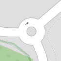 |
 | ||
| lanes | <number> | Rijbanen
Het aantal rijbanen dat door gewoon verkeer gebruikt kan worden. Hieronder worden ook bus-, taxi- en andere banen voor specifieke voertuigen gerekend. |
 | |||
| lane_markings | yes | no | Specifies if a highway has painted markings to indicate the position of the lanes. |  | |||
| lit | yes | no | Straatlamp, Lantaarnpaal, Straatverlichting
De weg is op een of andere manier verlicht. |
 | |||
| maxspeed | <number> | Specifies the maximum legal speed limit on a road, railway or waterway. |  | |||
| motorroad | yes | no | Autoweg
Een weg die door een speciaal bord word gekenmerkt. Veelal ligt de maximumsnelheid hoger dan op een provinciale weg en lager dan op een autosnelweg. |
 | |||
| mountain_pass | yes | Bergpas |  | |||
| mtb:scale | 0-6 | Classificatie MTB trails
Indeling om de moeilijkheidsgraad van een Mountainbike trail aan te geven |
 | |||
| mtb:scale:uphill | 0-5 | Heuvel op
Een classificatieschema voor MTB-trails om heuvel op te gaan als er een significante stijging is. |
 | |||
| mtb:scale:imba | 0-4 | Fietsparken
Het IMBA Trail Difficulty Rating System zal worden gebruikt voor fietsparken. Het is aangepast voor MTB-trails met kunstmatige obstakels. |
||||
| mtb:description | Text | Beschrijving
is van toepassing op highway=path en highway=track. Een sleutel om variabele informatie op een weg in te voeren, gerelateerd aan mountainbiken, in menselijke woorden. |
||||
| oneway | yes | no | reversible | Oneway streets are streets where you are only allowed to drive in one direction. | 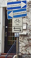 | |||
| oneway:bicycle | yes | no | | Used on ways with oneway=yes where it is legally permitted to cycle in both directions. |  | |||
| overtaking | yes | no | caution | both | forward | backward | Inhaalverbod
Gedeelte van de weg waar het wettelijk verboden is om in te halen. In Nederland over het algemeen aangeduid met een bord en/of een doorgetrokken streep op het wegdek. |
 | |||
| parallel | diagonal | perpendicular | marked | no_parking | no_stopping | fire_lane. | Parkeervakken
Specificeert parkeervakken langs de weg. Bekijk parking=* voor meer details. |
|||||
| free | ticket | disc | residents | customers | private | Voorwaarden parkeren
Specificeert de voorwaarden om te parkeren (termen). Bekijk parking=* voor meer details. |
 | ||||
| passing_places | yes | Gebruik op wegen waar regelmatig passeerstroken zijn aangebracht. |  | |||
| priority | forward | backward | Traffic priority for narrow parts of roads, e.g. narrow bridges. |  | |||
| priority_road | designated | yes_unposted | end | Specifying roads signposted as priority roads. |  | |||
| sac_scale | strolling | hiking | mountain_hiking | demanding_mountain_hiking | alpine_hiking | demanding_alpine_hiking | difficult_alpine_hiking | Classificatie Hiking trail
Indeling om de moeilijkheidsgraad van een Wandel- of Hikingpad aan te geven |
 | |||
| service | alley | driveway | parking_aisle etc. | Brandgang
Een weg die achter huizen of kantoren loopt met als doel toegang te geven tot een gebouw of als vluchtweg dienst te doen. |
 | |||
| shoulder | no | yes | right | both | left | Presence of shoulder in highway | ||||
| side_road | yes | A side road. | ||||
| smoothness | excellent | good | intermediate | bad | very_bad | horrible | very_horrible | impassable | Specifies the physical usability of a way for wheeled vehicles due to surface regularity/flatness. See Key:smoothness for more details. | 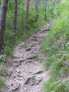 | |||
| surface | paved | unpaved | asphalt | concrete | paving_stones | sett | cobblestone | metal | wood | compacted | fine_gravel | gravel | pebblestone | plastic | grass_paver | grass | dirt | earth | mud | sand | ground | Bestrating, (Bodem)bedekking
Met deze tag kan aangegeven worden uit welk materiaal wegen, bruggen en dergelijke gemaakt zijn. Zie NL:Key:surface voor meer details. |
 | |||
| tactile_paving | yes | no | Ribbelpaden
Speciale paden op de stoep waardoor blinden hun weg kunnen vinden. Met de voet (ribbels) en met de blindenmanstok (materiaal) zijn deze stoeptegels een gids door het verkeer. |
 | |||
| tracktype | grade1 | grade2 | grade3 | grade4 | grade5 | Classificatie Bestrating | 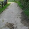 | |||
| traffic_calming | bump | hump | table | island | cushion | yes | etc. | Snelheidsbeperkende maatregelen
Deze wordt gebruikt om aan te geven dat er beperkende maatregelen op een weg zijn aangebracht. Bij verdere definiëring geef je een meer specifiekere waarde aan. |
 | |||
| trail_visibility | excellent | good | intermediate | bad | horrible | no | Zichtbaarheid van het pad |  | |||
| trailblazed | yes | no | poles | cairns | symbols | Applies to highway=*. Describing trail blazing and marking. See Key:trailblazed for more information. | 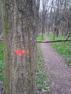 | |||
| trailblazed:visibility | excellent | good | intermediate | bad | horrible | no | Applies to trailblazed=*. A classification for visibility of trailblazing. See Key:trailblazed:visibility for more information. | ||||
| turn | left | slight_left | through | right | slight_right | merge_to_left | merge_to_right | reverse | The key turn can be used to specify the direction in which a way or a lane will lead. |  | |||
| width | <number> | The width of a feature. | 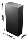 | |||
| winter_road | yes | Winterweg
Weg (op land) die alleen gedurende de winter (vrieskou) gebruikt kan worden. Er mag niet vanuit gegaan worden dat deze ook in de zomer bruikbaar is. |
 | |||
Overige eigenschappen | ||||||
| highway | bus_stop | Bushalte |  | |||
| highway | crossing | A.k.a. crosswalk. Pedestrians can cross a street here; e.g., zebra crossing |  | |||
| highway | cyclist_waiting_aid | Street furniture for cyclists that are intended to make waiting at esp. traffic lights more comfortable. |  | |||
| highway | elevator | An elevator or lift, used to travel vertically, providing passenger and freight access between pathways at different floor levels. |  | |||
| highway | emergency_bay | An area beside a highway where you can safely stop your car in case of breakdown or emergency. |  | |||
| highway | emergency_access_point | Reddingspunt
Bord in bossen en velden waarvan het bordnummer kan gebruikt worden voor het doorgeven van de positie bij noodgevallen. Gebruik samen met ref=Bordcode. |
 | |||
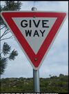
| highway | give_way | Voorrangskruising
Verleen voorrang aan de bestuurders op de kruisende weg. |
 | |||
| emergency | phone | Praatpaal
Communicatiepaal met een gratis en rechtstreekse verbinding met de snelweghulpdiensten. Origineel aangelegd om bij autopech de ANWB te kunnen oproepen. Tegenwoordig zijn alle nooddiensten bereikbaar. Gebruik ref=nummer om de paal te identificeren. |
 | |||
| highway | ladder | A vertical or inclined set of steps or rungs intended for climbing or descending of a person with the help of hands. |  | |||
| highway | milestone | Highway location marker | ||||
| highway | mini_roundabout | Minirotonde
Kleine rotonde wat vaak niet meer is dan een bultje of een stip op een kruising. |
 |
|||
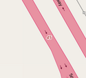
| highway | motorway_junction | Afslag op autosnelweg
Met ref=* kunt u het afslagnummer aangeven. |
 |
 | ||
| highway | passing_place | Passeerstrook
Plaats waar voertuigen elkaar kunnen passeren omdat de weg daarvoor eigenlijk te smal is. |
 | |||
| highway | platform | Perron |  |
 | ||
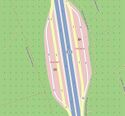
| highway | rest_area | Verzorgingsplaats
Parkeerplaats langs auto(snel) wegen waar chauffeurs tijdelijk de snelweg kunnen verlaten om noodzakelijke rust te nemen. |
 |
 | ||
| highway | services | (Snel)wegdiensten
Een gebied voor diverse diensten langs (voornamelijk) snelwegen waaronder tankstations, winkeltjes en restaurants. |
 |
 | ||
| highway | speed_camera | Flitspaal
Vaste justitiële snelheidsmeetpunten op vaste punten langs of boven de weg. |
 | |||
| highway | speed_display | A dynamic electronic sign that displays the speed of the passer-by motorist. |  | |||
| highway | stop | Stopbord
Stop eerst en verleen voorrang aan de bestuurders op de kruisende weg. |
 | |||
| highway | street_lamp | Straatverlichting
Voor een hele weg kan ook lit=* gebruikt worden. |
 | |||
| highway | toll_gantry | A toll gantry is a gantry suspended over a way, usually a motorway, as part of a system of electronic toll collection. For a toll booth with any kind of barrier or booth see: barrier=toll_booth |  | |||
| highway | traffic_mirror | Mirror that reflects the traffic on one road when direct view is blocked. |  | |||
| highway | traffic_signals | Verkeerslicht |  | |||
| highway | trailhead | Designated place to start on a trail or route |  | |||
| highway | turning_circle | Keerplein
Verkeer kan hier keren (meestal aan het eind van een doodlopende weg.) |
 |
 | ||
| highway | turning_loop | A widened area of a highway with a non-traversable island for turning around, often circular and at the end of a road. |  | |||
| highway | User Defined | All commonly used values according to Taginfo | ||||
Barrière
Barrières worden toegepast op knooppunten langs wegen waar het reizen is beperkt door een obstakel. Het heeft ook betrekking op lijnvormige objecten (bijv. muren), die zelf obstakels zijn.
| Sleutel | Waarde | Element | Omschrijving | Resultaat | Foto | |
|---|---|---|---|---|---|---|
Lijnvormige barrières | ||||||
| barrier | cable_barrier | Also called guard cable. This is a road side or median barrier made of steel wire ropes mounted on weak posts. See also the more extensive Wikipedia description. |  | |||
| barrier | city_wall | Stadsmuur
Historische vooral stenen verdedigingsmuur. |
 |
 | ||
| barrier | ditch | (Slot)Gracht
Een kunstmatig aangebrachte verdieping in het landschap bedoeld ter verdediging of bescherming van een stuk grond. De gracht of greppel hoeft niet noodzakelijkerwijs water te bevatten. Is er ook sprake van een waterbergende of -afvoerende functie kijk dan ook bij waterway=ditch. |
 |
 | ||
| barrier | fence | Omheining
Een lichte afscheiding tussen twee gebieden, bedoeld om doorgang te voorkomen. Wanneer een terrein omgeven is door een omheining als deze, dan kan beter alternatief fenced=yes gebruikt worden. Hiermee geef je aan dat een terrein omheind is en bedoel je niet afzonderlijk het hek. |
 |
 | ||
| barrier | guard_rail | Vangrail
Veelal naast een weg geplaatste constructie om te voorkomen dat voertuigen van de weg af raken. Kan ook gebruikt worden om objecten te beschermen tegen botsschade. |
 |
 | ||
| barrier | handrail | Is designed to be grasped by the hand so as to provide stability or support. |  |
 | ||
| barrier | hedge | Haag of heg
Een rij struiken die regelmatig gesnoeid wordt en dient als afscheiding van een terrein. |
 |
 | ||
| barrier | retaining_wall | Keermuur
Een stenen muurachtige structuur die 'neergezet' is om grond of rots te ondersteunen tegen afglijden langs de helling. |
 |
 | ||
| barrier | wall | Muur
Een stenen of betonnen alleenstaand bouwwerk dat als afscheiding van een terrein dienst doet. |
 |
 | ||
Punt barrières | ||||||
| barrier | block | Blokkade
Afsluiting van een weg door middel van zware betonblokken of rotsblokken die alleen door zware machines kunnen worden verplaatst. De blokkade dient om zware voertuigen de toegang te verhinderen. |
 | |||
| barrier | bollard | Poller
Een of meer vast of mechanisch bedienbaar metalen of betonnen paaltjes op het wegdek. Zij moeten de doorgang voor bepaalde voertuigen verhinderen. Ook worden deze Amsterdammertje, Stoeppaal of Schamppaal genoemd. |
 | |||
| barrier | border_control | Grenspost
Controle post voor grensoverschrijdend verkeer. |
 | |||
| barrier | bump_gate | For description see wikipedia:Bump gate, for another photo see flickr example: [1] . |  | |||
| barrier | bus_trap | Bussluis
Zie bussluis op Wikipedia |
 | |||
| barrier | cattle_grid | Veerooster
Een rooster in het wegdek dat verhindert dat (hoef)dieren een gebied verlaten (of binnengaan), maar toelaat dat voertuigen en/of voetgangers een gebied kunnen binnengaan en verlaten. Dit rooster wordt ook wel wildrooster genoemd. |
 | |||
| barrier | coupure | A cut through a flood protection feature (e.g., (flood)wall, levee, or dyke) for a road or railway, that is readily made flood tight if required. | 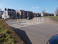 | |||
| barrier | cycle_barrier | Fietshekje, slingerhek
Meestal twee schuin achterelkaar geplaatste hekjes die er voor zorgen dat fietsers moeilijk kunnen passeren, maar een bijna vrije toegang blijft geven aan voetgangers. |
 | |||
| barrier | debris | Aarden wal
Wegen die niet meer gebruikt mogen worden, worden eenvoudig afgesloten door een wal van puin, aarde en ander geschikt materiaal. Voor voetgangers en MTB is het obstakel meestal overkomelijk. |
 | |||
| barrier | entrance | Doorgang
Een vrije doorgang in een lijnvormige barrière. De bevoegdheden om gebruik te maken van deze doorgang zijn gelijk aan de weg die er doorheen loopt. |
 | |||
| barrier | full-height_turnstile | Draaikruis
Een manshoge draaipoort met gelijke werking als een draaipoortje. Het draaikruis kan echter niet met een sprong omzeild worden. |
 | |||
| barrier | gate | Hek |  | |||
| barrier | hampshire_gate | A section of wire fence which can be removed temporarily.
Combine with access=* where appropriate. |
 | |||
| barrier | height_restrictor | Combine with maxheight=*. |  | |||
| barrier | horse_stile | Paardenhek
Voorziening speciaal aangebracht om paarden toegang tot een gebied te verlenen. |
 | |||
| barrier | kent_carriage_gap | Lage paaltjes in het wegdek met de bedoeling auto's tegen te houden, maar paard en wagen toegang te geven. Vrijwel alleen bekend uit het Britse straatbeeld. | 
| |||
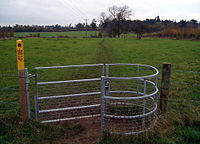
| barrier | kissing_gate | Voetgangershek
Voorziening speciaal aangebracht om alleen voetgangers door te laten. |
 | |||
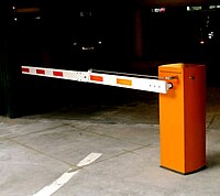
| barrier | lift_gate | Vertikale slagboom
Een al dan niet mechanische slagboom om de doorgang van voertuigen te reguleren. Gebruik access=* waar bekend. |
 | |||
| barrier | motorcycle_barrier | Motorhek
Een hek dat de toegang verspert voor Motorfietsen. |
 | |||
| barrier | planter | A plant box, or simply a planter, is a structure containing plants for decoration, which (in this context) has the primary purpose of preventing large vehicles from passing. |  | |||
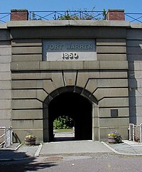
| barrier | sally_port | Stadspoort
Poort bedoeld om door een stadsmuur (barrier=city_wall) te kunnen gaan. |
 | |||
| barrier | sliding_beam | Something between barrier=sliding_gate and barrier=lift_gate: it has a quite thin bar like in lift gate, but the bar slides aside to allow through. |  | |||
| barrier | sliding_gate | Gates open sideways; usually automatic.
Combine with access=* where appropriate. |
 | |||
| barrier | spikes | Spijkerstrip
Oprolbare of uitvouwbare strips voorzien van spijkers om ongeautoriseerd toegang te voorkomen. Mobiele versies worden ook door politieteams gebruikt om vluchtauto's tot stoppen te dwingen. |
 | |||
| barrier | stile | Overstaphek
Voorziening waar wandelaars een muur of hek kunnen kruisen. |
 | |||
| barrier | sump_buster | Carterbreker
Een lage betonnen plaat, stalen constructie of heel kort paaltje op de weg, bedoeld om passeren van auto's (en andere voertuigen met meer dan twee wielen en een lage wegligging) te verhinderen. |
 | |||
| barrier | swing_gate | Horizontale slagboom
Een meestal handmatige slagboom die horizontaal opengedraaid kan worden. Gebruik access=* waar bekend. |
 | |||
| barrier | toll_booth | Tolhuisje
Hier wordt een financiële bijdrage voor het gebruik van een (bepaalde) weg of veerpont geïnd. |
 | |||
| barrier | turnstile | Draaipoortje
Toegangshek dat door een draaiende beweging en door de ruimte tussen de horizontale spijlen er voor zorgt dat er steeds een persoon tegelijk kan passeren. Met een flinke sprong verliest het poortje haar nut. |
 | |||
| barrier | wedge | A wedge-shaped barrier that rises out of the ground to block traffic. |  | |||
| barrier | wicket_gate | A wicket gate, or simply a wicket, is a pedestrian door or gate, particularly one built into a larger door or into a wall or fence. |  | |||
| barrier | yes | A barrier which nature cannot be determined; typically only used in mapping using aerial imagery. Should be replaced by a specific value. |  | |||
Linear barriers or access control on highways (e.g., along or for blocking a path or road) | ||||||
| Sleutel | Waarde | Element | Omschrijving | Photo for along | Resultaat | Foto |
| barrier | bar | A fixed horizontal bar which blocks motor vehicles but can usually be bypassed on foot or bike. Often placed at trailheads. |  | |||
| barrier | barrier_board | A barrier board to restrict the passage of a way or to block off an area. |  | |||
| barrier | bollard | Poller
Een of meer vast of mechanisch bedienbaar metalen of betonnen paaltjes op het wegdek. Zij moeten de doorgang voor bepaalde voertuigen verhinderen. Ook worden deze Amsterdammertje, Stoeppaal of Schamppaal genoemd. |
 |
 | ||
| barrier | chain | Toegangsketting
Een over de weg gespannen ketting met als bedoeling gemotoriseerd verkeer de toegang te belemmeren. |
 |
 | ||
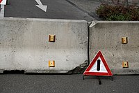
| barrier | jersey_barrier | Jersey blokkade
Geprefabriceerde betonnen of plastic (zandgevulde) blokken om tijdelijk of semi-permanent een toegang af te sluiten. |
 |
 |
 | |
| barrier | kerb | Stoeprand
Speciaal aangebrachte verhoging om er voor te zorgen dat er een (overbrugbare) scheiding ontstaat tussen twee (weg)gedeelten. De stoeprand is daarvan het bekendste voorbeeld. Deze tag moet echter breder gezien worden. de hoogte is voor de toepasbaarheid van groot belang. Geef daarom de hoogte aan met height=hoogte in cm. . |
 | |||
| barrier | log | Boomstam
Vooral in bosgebieden wordt de toegang voor gemotoriseerd verkeer nog wel eens afgesloten door het neerleggen van boomstammen. Toegang is dan niet permanent en kan door voetgangers en fietsers worden overwonnen. |
 | |||
| barrier | rope | Koord
Afsluiting door middel van een tussen palen gehangen koord. Wordt veel gebruikt als publieksvriendelijk middel om het gewenste looppad te markeren. |
 | |||
| barrier | tank_trap | Static anti-tank obstacles that can take various forms, such as Czech hedgehog (barrier=tank_trap; tank_trap=czech_hedgehog). |  | |||
| barrier | tyres | A crash barrier made from tyres stacked on top of each other, commonly found at motor racing circuits. |  | |||
| barrier | delineators | A barrier made of plastic/rubber posts, common on one-way two-lane roads where overtaking is prohibited, or on busy roads to prevent forbidden turns or parking along the curb. | 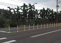 | |||
| barrier | user defined | All commonly used values according to Taginfo | ||||
This table is a wiki template with a default description in English. Editable here.
Waterwegen
This is used to described different types of waterways. When mapping the way of a river, stream, drain, canal, etc. these need to be aligned in the direction of the water flow. See the page titled Waterways for an introduction on its usage. For the water-covered area of a waterway, see natural=water + water=*.
| Key | Waarde | Element | Omschrijving | Resultaat | Foto | |
|---|---|---|---|---|---|---|
Natural watercourses | ||||||
| waterway | river | Rivier
Als richtlijn kan de volgende lijst gebruikt worden. Rivieren in Nederland |
 |
 | ||
| waterway | stream | Beek
Een smalle, natuurlijke stroom. Je kunt er misschien net overheen springen. |
 |
 | ||
| waterway | tidal_channel | A natural tidal waterway within the coastal marine environment with bi-directional flow of salty water which depends on the tides. |  | |||
| waterway | flowline | Slow-moving flow through a water body. |  | |||
Artificial waterways | ||||||
| waterway | canal | Kanaal
Een grote kunstmatige waterweg voor waterverkeer en/of water aan- en afvoer. Als richtlijn kan de volgende lijst gebruikt worden. Kanalen in Nederland. |
 |
 | ||
| waterway | pressurised | A waterway where water is flowing in a fully enclosed conduit and subject to pressure; this includes gravity-driven penstocks and siphons and pump-driven pipelines, for example. |  | |||
| waterway | drain | Sloot, Greppel of Gracht
Kleinste vorm om water te bufferen en/of af te voeren. De waterloop is van kunstmatig materiaal (bv beton of asfalt). Heeft een dergelijke waterloop ook een grote verdedigende functie (Slotgracht) gebruik dan ook barrier=ditch |
 |
 | ||
| waterway | ditch | Sloot, Greppel of Gracht
Kleinste vorm om water te bufferen en/of af te voeren. De waterloop is van natuurlijk materiaal, door de natuur ontstaan of verkregen door graafwerk. Heeft een dergelijke waterloop ook een grote verdedigende functie (Slotgracht) gebruik dan ook barrier=ditch. |
 |
 | ||
| waterway | fairway | A navigable route in a lake or sea marked by buoys. The navigable area marked by the buoys can be mapped with seamark:type=fairway. | ||||
| waterway | fish_pass | A |
 | |||
| waterway | canoe_pass | A canoe pass is a structure on or around artificial barriers (such as dams and locks) to enable whitewater praticants to go through those barriers | ||||
Facilities | ||||||
| waterway | dock | Droogdok
Inrichting, voorzien van sluisdeuren, voor beladen, ontladen, bouwen of repareren van schepen. De inrichting ksn zonodig drooggelegd worden. |
 |
 | ||
| waterway | boatyard | Scheepswerf
Een gebied voor bouwen en repareren van vaartuigen buiten het water. |
 | |||
Barriers on waterways | ||||||
| waterway | dam | Stuwdam
Een dam in de loop van de rivier waardoor water wordt opgestuwd. Het water stroomt niet over de top van de dam, maar wordt veelal via buizen omgeleid om energie op te wekken. |
 | |||
| waterway | weir | Stuw
Een barriere in een rivier om water te bufferen of af te leiden. Het water kan over de bovenzijde van de stuw vloeien. |
 | |||
| waterway | waterfall | A waterfall, use in combination with natural=cliff |  | |||
| waterway | rapids | A natural barrier, formed by a fast-flowing, often turbulent, section of the watercourse. |  | |||
| waterway | lock_gate | Sluisdeur |  | |||
| waterway | sluice_gate | A sluice gate is a movable gate to control water flow. |  | |||
| waterway | floodgate | Floodgate regulates the flow of water from a body of water by shutting out, admitting, or releasing water from a reservoir, river, stream, canal. |  | |||
| waterway | debris_screen | Debris screen (or trash rack (US) prevents water-borne debris (such as logs, boats, etc.) from entering the intake of a water mill, pumping station or water conveyance. |  | |||
| waterway | security_lock | Flood barrier |  | |||
| waterway | check_dam | Flood and debris barrier |  | |||
Other features on waterways | ||||||
| waterway | turning_point | Draaikom
Een segment in een vaarweg waar vaartuigen kunnen keren. Om aan te geven wat de maximum scheepslengte is die kan keren, gebruik dan maxlength=*. |
||||
| waterway | water_point | A place to fill fresh water holding tanks of a boat. |  | |||
| waterway | fuel | A place to get fuel for boats. |  | |||
Extra eigenschappen voor waterwegen | ||||||
| intermittent | yes | Geeft aan dat een waterweg regelmatig droog staat. |  |
|||
| seasonal | yes, spring, summer, autumn, winter, wet_season, dry_season | Indicates that a waterway has a seasonal (yearly cyclic) flow, usually flowing continuously for at least some part of the year. |  | |||
| destination | name | Name of the body of water the linear feature flows into. | ||||
| lock | yes | Schutsluis
Een voorziening om vaartuigen naar een lager of hogere vaarweg te transporteren. Tag hiervoor een node om aan te geven dat hij er is, of tag de sectie tussen twee waterway=lock_gate. |
 | |||
| mooring | yes, private, no | Kade of Aanlegplaats
Een meerplaats voor vaartuigen |
 | |||
| usage | See the key for details | Possible uses of the waterway. Use semicolons to separate. | ||||
| tunnel | culvert | Duiker
Een buis of buisachtige constructie voor de verbinden van watertjes/sloten onder een weg door. |
 | |||
| tunnel | flooded | A long (> 100 m) tunnel where flowing water or other fluid prevent humans from safely walking inside despite its appropriate diameter or size. Water inside can be pressurised or not, used in combination with any waterway=* linear value. waterway=*. |  | |||
| bridge | aqueduct | A bridge which conveys an artificial waterway over a road, valley, or another waterway. |  | |||
| waterway | user defined | Zie ook Taginfo |
||||
The NL template can be edited here.
Spoorwegen
| Key | Waarde | Element | Omschrijving | Resultaat | Foto | |
|---|---|---|---|---|---|---|
Spoorbaan | ||||||
| railway | abandoned | In onbruik geraakte spoorbaan
De rails is verwijderd. Soms in gebruik als fietspad |
 | |||
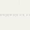
| railway | construction | Spoorbaan in aanbouw
Zie verder construction=*. |
 |
 | ||
| railway | proposed | Railway being proposed but haven't started construction. Please see the proposed page regarding verifiability on the ground of this value. | ||||
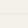
| railway | disused | In onbruik geraakte spoorbaan
De rails is nog aanwezig |
 |
 | ||
| railway | funicular | Kabelspoorweg |  |
 | ||
| railway | light_rail | Sneltram |  |
 | ||
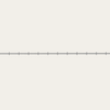
| railway | miniature | Miniatuur spoorbaan
Spoorbaan met op schaal gebouwde locomotieven en spoorwagons, aangepast om kinderen mee rond te rijden. |
 |
 | ||
| railway | monorail | Monorail, Magneetzweefbaan |  |
 | ||
| railway | narrow_gauge | Smalspoorbaan |  |
 | ||
| Museumspoorweg |  |
 | ||||
| railway | rail | Spoorweg |  |
 | ||
| railway | subway | Metro |  |
 | ||
| railway | tram | Trambaan |  |
 | ||
Extra eigenschappen | ||||||
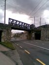
| bridge | yes | Spoorbrug
Extra optie wanneer de spoorbaan over een andere spoorbaan of (water)weg loopt. |
 |
 | ||
| cutting | yes | Verzonken spoorbaan
Extra optie wanneer het spoor duidelijk lager is gelegd dan het bodemniveau. De spoorbaan loopt als het waren in een gleuf. |
 | |||
| electrified | contact_line rail yes no |
Stroomvoorziening
Manier waarop de trein voorzien wordt van elektriciteit.
|
 | |||
| embankment | yes | Spoordijk |  | |||
| embedded_rails | yes / <type of railway> | Specifies that a highway on which non-railway traffic is also allowed has railway tracks embedded in it but the rails are mapped as separate ways. |  | |||
| frequency | <number> [Hz] | Frequentie
De frequentie waarmee de elektriciteit door de lijn wordt gestuurd. Gebruik 0 (nul) voor DC (gelijkspanning). Zie ook voltage=* |
 | |||
| passenger_lines | <number> | Used to describe number of tracks of the railway line a certain track segment belongs to. | ||||
| railway:track_ref | <number> | Track number |  | |||
| service | crossover | Relatively short lengths of track which switch traffic from one parallel line to another | ||||
| service | siding | Kort parallelspoor
Kort stuk parallelspoor aan begin en eind verbonden aan het hoofdspoor. |
 |
|||
| service | spur | Aanrijdspoor
Relatief kort stuk spoor dat aangesloten is op een hoofdspoornet en leidt naar één of meer bedrijven. |
 |
 | ||
| service | yard | Onderhoudsspoor
Spoorbaandelen binnen het onderhoudsgebied of rangeerterrein van een Spoorwegmaatschappij. |
 |
 | ||
| tunnel | yes | Spoortunnel |  | |||
| tracks | <number> | aantal sporen
aanpal paraleel lopende spoorbanen wanneer deze gezamelijk als één way gemapt worden. |
 | |||
| usage | main branch industrial military tourism scientific test |
Gebruik van de spoorlijn
|
||||
| voltage | <number> | Voltage
Stroomsterkte waaarmee het spoor wordt gevoed. Zie ook Frequency=*. yard:desc |
 | |||
Haltes | ||||||
| railway | halt | Halte
Klein station waar treinen kunnen stoppen maar verder geen spoorfuncties aanwezig zijn. |
 | |||
| public_transport | stop_position | The position on the railway track where the train (its centre) stops at a platform. This is useful for routing on long platforms where also short trains stop and on long platforms where multiple trains stop behind each other. See also public_transport=stop_area. |  | |||
| public_transport | platform | Perron
Een verhoogd gedeelte naast het spoor waarvan de passagiers in de trein kunnen stappen. |
 | |||
| railway | platform | This is parallel to the rail line for showing where the actual platforms are. It is also to know where you can change platform and enter the station, so use footpaths to connect them. This is really useful for routing too. Use in addition to public_transport=platform. |  | |||
| public_transport | station | Railway passenger-only station. |  | |||
| railway | station | Spoorwegstation |  | |||
| railway | stop | Marks the position where trains stop at a station. It should be added as a node on a railway=rail way. |  | |||
| railway | subway_entrance | Metro ingang |  | |||
| railway | tram_stop | Tramhalte |  | |||
Infrastructure | ||||||
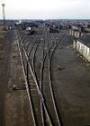
| landuse | railway | Spoorwegemplacement
Het terrein dat behoort tot spoorwegstation en spoorbedding. In het algemeen ontoegankelijk voor het publiek |

|
 | ||
| railway | buffer_stop | Stootblok
Een blokkade dat geplaatst wordt aan het einde van een spoor. |
 | |||
| railway | crossing | Voetgangersoversteekplaats |  | |||
| railway | derail | A device used to prevent fouling of a rail track by unauthorized movements of trains or unattended rolling stock. See Derail (railroad). |  | |||
| railway | level_crossing | Spoorwegovergang
Punt waar verkeer het spoor kan kruisen |
 | |||
| railway | railway_crossing | Crossing rails with no interconnection. |  | |||
| railway | roundhouse | Roundhouse remise
Een halfcirkelvormige remise met plaats voor verschillende treinstellen. |
 | |||
| railway | signal | Any kind of railway signal. |  | |||
| railway | switch | Full connections between railways (aka 'points'). |  | |||
| railway | tram_level_crossing | A point where trams and roads cross. |  | |||
| railway | traverser | These are used for changing trains between railways. Also known as transfer table. |  | |||
| railway | turntable | Draaiplateau |  | |||
| railway | ventilation_shaft | A structure that allows ventilation in underground tunnels |  | |||
| railway | wash | A railroad carriage/car wash | 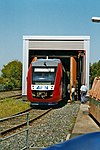 | |||
| railway | water_crane | A structure to deliver water to steam locomotives | 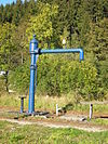 | |||
| railway | user defined | Zie ook Taginfo |
||||
This table is a wiki template with a default description in English. Editable here. The NL version can be edited here.
Luchthaven
These are mainly related to aerodromes, airfields other ground facilities that support the operation of airplanes and helicopters. See the page Aeroways for an introduction on mapping these features.
| Key | Waarde | Element | Omschrijving | Resultaat | Foto |
|---|---|---|---|---|---|
| aeroway | aerodrome | Vliegveld |  | ||
| aeroway | airstrip | A field or area where light aircraft can land and take off from. |  | ||
| aeroway | apron | Parkeerplatform
Apart terrein op de luchthaven waar vliegtuigen geparkeerd worden. |
 |
 | |
| aeroway | control_center |  | |||
| aeroway | fuel | Fuelling station for aircraft. |  | ||
| aeroway | gate | Gate
Plaatsen aan de buitenkant van de terminal waar vliegtuigen kunnen stoppen om passagiers in- en uit te laten stappen. |
 |
 | |
| aeroway | hangar |  | |||
| aeroway | helipad | Helikopterhaven |  | ||
| aeroway | heliport |  | |||
| aeroway | highway_strip |  | |||
| aeroway | holding_position | A point behind which aircraft are considered clear of a crossing way |  | ||
| aeroway | jet_bridge | Passenger boarding bridge |  | ||
| aeroway | model_runway | Take-off and landing runway for model aircraft |  | ||
| aeroway | navigationaid | A facility that supports visual navigation for aircraft |  | ||
| airmark | beacon |  | |||
| aeroway | parking_position | A location where an aeroplane can park |  | ||
| aeroway | runway | Startbaan
Een strook grond bestemd voor opstijgen en landen van vliegtuigen. |
 |
 | |
| aeroway | stopway | Stopway is a rectangular surface beyond the end of a runway used during an aborted takeoff. |  | ||
| aeroway | taxilane | Taxilane is a path in an airport that is part of the aircraft parking area or apron (Proposed feature with low usage as of 2015-10; use with an eye towards the question correct usage). | |||
| aeroway | taxiway | Taxibaan
De weg/baan voor vliegtuigen om van start- en landingsbaan naar terminal of parkeerplatformsgebieden te rijden. |
 |
 | |
| aeroway | terminal | Terminal
Het gebouw voor passagiersafhandeling |
 |
 | |
| aeroway | tower | See also aeroway=control_tower or combination of man_made=tower + service=aircraft_control for similar schemes. |
 | ||
| aeroway | windsock | Windzak |  | ||
| aeroway | User defined | Zie ook de Taginfo |
This table is a wiki template with a default description in English. Editable here. The NL description can be edited here
Kabelbaan
This is used to tag different forms of transportation for people or goods by using aerial wires. For example these may include cable-cars, chair-lifts and drag-lifts. See the page Aerialway for more information on the usage of these tags.
| Key | Waarde | Element | Omschrijving | Resultaat | Foto | Taginfo |
|---|---|---|---|---|---|---|
| Types of aerialway | ||||||
| aerialway | cable_car | Kabelbaan
Grote voorziening waarbij grote gondels (Meer dan 5 a 10 mensen) aan een kabel heen en weer worden vervoerd. |
 |
 |
| |
| aerialway | gondola | Gondelbaan
Kleinere voorziening met gondels voor 4 tot 8 personen. De gondels worden in een cirkel rondbewogen. |
 |
 |
| |
| aerialway | chair_lift | Stoeltjeslift
Kleine voorziening waarbij maximaal twee personen in een open zitplaats via een kabel rond worden bewogen. |
 |
 |
| |
| aerialway | mixed_lift |  |
 |
| ||
| aerialway | drag_lift | Skilift of Sleeplift
Hierbij worden wintersporters op hun eigen skies voortgetrokken. |
 |
 |
| |
| aerialway | t-bar | This automatically implies oneway=yes (drawn upward). |
 |
 |
| |
| aerialway | j-bar | This automatically implies oneway=yes (drawn upward). |
 |
 |
| |
| aerialway | platter | This automatically implies oneway=yes (drawn upward). |
 |
 |
| |
| aerialway | rope_tow | This automatically implies oneway=yes (draw upward). |
 |
 |
| |
| aerialway | magic_carpet | This automatically implies oneway=yes (drawn upward). |
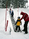 |
| ||
| aerialway | zip_line | This automatically implies oneway=yes (drawn downward). |
 |
 |
| |
| Equipments | ||||||
| aerialway | pylon | Kabelmast
Mast die de kabel van een kabelbaan ondersteunt. |
 |
| ||
| aerialway | station | Kabelstation
Station waar passagiers van een kabelbaan in en/of uit kunnen stappen . |

|
 |
| |
| Others | ||||||
| Obsolete, please use aerialway=zip_line instead. This automatically implies oneway=yes (drawn downward). |
 |
| ||||
| aerialway | goods | Goederenlift
Kabelbaan speciaal toegerust om goederen te vervoeren. |
 |
 |
| |
| aerialway | user defined | Zie ook Taginfo |
||||
This table is a wiki template with a default description in English. Editable here. The NL description can be edited here
Openbaar vervoer
Functies met betrekking tot het openbaar vervoer
| Sleutel | Waarde | Element | Omschrijving | Resultaat | Foto |
|---|---|---|---|---|---|
| public_transport | stop_position | De positie op de straat of rails, waar een bus, tram of trein stopt. |  | ||
| public_transport | platform | De plaats waar passagiers staan te wachten op het transport voertuig. |  |
 | |
| public_transport | station | Een station waar meerdere bussen of treinen hun dienst beëindigen. Gebruikt in combinatie met building=yes or area=yes. |  | ||
| public_transport | stop_area | The stop area is a relation that contains all elements of a train/subway/monorail/tram/bus/trolleybus/aerialway/ferry stop. |  | ||
| public_transport |
This table is a wiki template with a default description in English. Editable here.
Stroomvoorziening
De power=* sleutel wordt gebruikt voor het markeren van een breed scala aan faciliteiten en functies die betrekking hebben op de opwekking en distributie van elektrische energie.
| Sleutel | Waarde | Element | Omschrijving | Resultaat | Foto |
|---|---|---|---|---|---|
| power | cable | Kabel.
Elektriciteitskabel in de grond of onder water. |
 | ||
| power | catenary_mast | A catenary mast supports system of overhead wires used to supply electricity to electricaly powered vehicle equipped with a pantograph. |  | ||
| power | compensator | Several kind of power devices used to insure of power quality and network resilience. |  | ||
| power | connection | A freestanding electrical connection between two or more overhead wires |  | ||
| power | converter | HVDC Converter
Installatie voor de omzetting van wisselstroom naar gelijkstroom en terug. |
 | ||
| power | generator | Elektriciteitsgenerator
Deze installaties genereren in het algemeen de elektriciteit. Verder specificaties geven aan hoe en wat er precies wordt gemaakt. Zie daarvoor bij generator:source=* |
 |
 | |
| power | heliostat | A mirror of a heliostat device. |  | ||
| power | insulator | A device to protect a power line from grounding on supports |  | ||
| power | line | Hoogspanningslijn
Lijn met hoogspanning (50 kilovolt of meer). |
 |
 | |
| line | busbar | Specifies that a power=line is a busbar in a substation. | |||
| line | bay | Specifies a power=line is a bay which connects an incoming circuit to a busbar assembly. | |||
| power | minor_line | Midden- of laagspanningslijn
Lijn met midden- of laagspanning (minder dan 50 kilovolt). |
 |
 | |
| power | plant | Elektriciteitscentrale
Een elektriciteits- of krachtcentrale bevat een of meer generatoren voor de opwekking van elektriciteit. Elke generator moet apart als power=generator in kaart gebracht worden. |
 |
 | |
| power | pole | Elektriciteitspaal
Paal voor ondersteuning van een midden- of laagspanningslijn (power=minor_line). |
 | ||
| power | portal | Power supporting structure composed of vertical legs with cables between them attached to a horizontal crossarm |  | ||
| power | substation | Onderstation
Onderstation of transformatorstation. |
 |
 | |
| power | switch | Schakelaar
Een schakelaar kan een lijn in of uitschakelen bijvoorbeeld bij een kortsluiting. |
 | ||
| power | switchgear | The switchgear comprises one or more busbar assemblies and a number of bays each connecting a circuit to the busbar assembly. |  | ||
| power | terminal | Point of connection between overhead power lines to buildings or walls |  | ||
| power | tower | Hoogspanningsmast
Mast voor ondersteuning van een hoogspanningslijn (power=line) |
 |
 | |
| power | transformer | Transformator |  | ||
| power | zelf gedefinieerd | Zie ook Taginfo[2] voor meer informatie. |
This table is a wiki template with a default description in English. Editable here.
Bouwwerken
| Sleutel | Waarde | Element | Omschrijving | Resultaat | Foto |
|---|---|---|---|---|---|
| man_made | adit | Mijningang
Een horizontale grotachtige mijningang die door mensen is gemaakt. |
 | ||
| man_made | advertising | A generic advertising device. |  | ||
| man_made | antenna | Een antenne om draadloze signalen te zenden en/of ontvangen. | 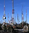 | ||
| man_made | avalanche_protection | A feature to protect from avalanches or to keep them from going off. |  | ||
| man_made | beacon | Baken
Geplaatst voor gebruik bij navigatie. Gebruik naast of in plaats van deze tag seamark=beacon of airmark=beacon om aan te geven waarvoor dit baken wordt gebruikt. |
 | ||
| man_made | beehive | Bijenkorf |  | ||
| man_made | borehole | A bore used for a purpose not covered by man_made=petroleum_well or man_made=water_well. |  | ||
| man_made | breakwater | Golfbreker
Een stenen dam die de kust, een eiland of een havenmond beschermt tegen hevige golfslag. |
 |
 | |
| man_made | bridge | De omtrek van een brug.
Voeg ook bridge=* en layer=* toe aan alle wegen die over de brug gaan. |
 |
 | |
| man_made | bunker_silo | An open-sided structure that can be used with vehicles to fill and empty them. |  | ||
| man_made | cairn | A mound of stones, usually conical or pyramidal, raised as a landmark or to designate a point of importance in surveying. |  | ||
| man_made | carpet_hanger | A construction to hang carpets for cleaning with the help of carpet beaters. |  | ||
| man_made | cellar_entrance | An entrance into artificially created vault. |  | ||
| man_made | charge_point | A device for charging electric vehicles. |  | ||
| man_made | chiller | industrial cooling construction with large diameter fans |  | ||
| man_made | chimney | Hoge schoorsteen voor industrie | 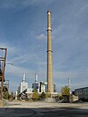 | ||
| man_made | clarifier | A clarifier of a wastewater treatment plant. |  | ||
| man_made | clearcut | An area where all trees have been uniformly cut down. |  | ||
| man_made | column | Een zuil als decoratie of ter ondersteuning van een bouwwerk. |  | ||
| man_made | communications_tower | Een straalverbindingstoren |  | ||
| man_made | compass_rose | A compass rose or wind rose. |  | ||
| man_made | compressor | Industrial equipment used to compress a gas by reducing its volume. | |||
| man_made | cooling | Industrial cooling facility. |  | ||
| man_made | cooling_tower | A cooling tower |  | ||
| man_made | courtyard | An area that is usually enclosed by walls or buildings. |  | ||
| man_made | crane | Kraan
Een vaste hijskraan zoals bijvoorbeeld bij een overslagterminal in een haven. |
 | ||
| man_made | cross | Cross with little historical or religion value, e.g. summit cross. |  | ||
| man_made | cutline | Scheidingslijn in bos
In bossen worden om verschillende reden rechte lijnen gemaakt door bosgrond boomloos te houden. Hierdoor is het bv. duidelijk waar eigendomsgrenzen zijn of worden deze gebruikt als brandgangen. |
 |
 | |
| man_made | dolphin | A marine structure for berthing and mooring of vessels. |  | ||
| man_made | dovecote | A place where doves are farmed or stored. |  | ||
| man_made | dyke | Dijk |  | ||
| man_made | embankment | An artificial steep slope. |  | ||
| man_made | flagpole | Vlaggenmast
Paal om een vlag aan te bevestigen. |
 | ||
| man_made | flare | A tower constructed to burn off excess gas. |  | ||
| man_made | footwear_decontamination | A facility to decontaminate footwear for hikers. |  | ||
| man_made | frost_fan | A device to stop frosts from damaging crops. | 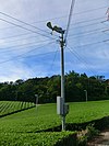 | ||
| man_made | fuel_pump | A fuel pump (petrol pump, gas pump) |  | ||
| man_made | gantry | An overhead structure across a major road usually for holding signs, often variable-message signs. |  | ||
| man_made | gas_well | A natural gas well |  | ||
| man_made | gasometer | A large container in which natural gas or town gas is stored near atmospheric pressure at ambient temperatures. |  | ||
| man_made | geoglyph | A large design or motif (generally longer than 4 metres) produced on the ground |  | ||
| man_made | [[ Too many Data Items entities accessed. | goods_conveyor ]] | Lopende band |  |
 | |
| man_made | groyne | Strekdam
Een structuur in de zee of een rivier, uitstekend vanuit de kust of oever. Dient om stroming te breken en erosie te voorkomen. |
 |

| |
| man_made | guard_stone | A guard stone: a stone built onto or into the corner of a building or wall to prevent carriages from damaging the structure, often found on either side of an entrance to a laneway, or alongside a wall to protect it. |  | ||
| man_made | guy_wire | Guy wire designed to add stability to a freestanding structure. |  |
 | |
| man_made | heap | A large pile of material |  | ||
| man_made | hongsalmun | A gate for entering a sacred place in Korea. The gate indicates entry to a sacred realm. |  | ||
| man_made | iljumun | The first gate at the entrance to many Korean Buddhist temples |  | ||
| man_made | insect_hotel | A structure intended to provide shelter for insects. |  | ||
| man_made | kiln | A kiln: an oven used for industrial processes such as hardening, drying, or smelting | 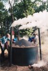 | ||
| man_made | lighthouse | Vuurtoren |  | ||
| man_made | manhole | Hole with a cover that allows access to an underground service location, just large enough for a human to climb through. |  | ||
| man_made | mast | A mast is a vertical structure built to hold, for example, antennas. |  | ||
| man_made | maypole | A tall wooden pole erected as a part of various European folk traditions to celebrate the beginning of summer. |  | ||
| man_made | milk_churn_stand | A current or former collection point for milk churns. |  | ||
| man_made | mineshaft | Mijnschacht
De toegang tot een (bijna) vertikale mijntunnel. Aan de ingang is meestal een lift gebouwd waardoor mijnwerkers met een lift in de mijnschacht kunnen afdalen. |
 | ||
| man_made | monitoring_station | Waarnemingsstation |  | ||
| man_made | nesting_site | A man made nesting aid that is mounted on a support device. |  | ||
| man_made | obelisk | Tall, narrow, four-sided, tapered monument which usually ends in a pyramid-like shape at the top. |  | ||
| man_made | observatory | Sterrenwacht |  | ||
| man_made | offshore_platform | Offshore platform, oil platform or offshore drilling rig |  | ||
| man_made | oil_gas_separator | Industrial equipment used to separate liquid and gaseous components (oil and gas) produced from a petroleum well. |  | ||
| man_made | oxidation_ditch | An oxidation ditch of a wastewater treatment plant. |  | ||
| man_made | paifang | A traditional style of Chinese architectural arch or gateway structure. |  | ||
| man_made | petroleum_well | Olieboorinstallatie
Installatie voor het boren en oppompen van ruwe olie. (voorbeeld: Olieboorplatform, Ja-knikker) |
 | ||
| man_made | pier | Steiger
Een contructie van palen en een wandelplatform in het water. Met een klein gedeelte vast aan de kust of oever dient deze voor recreatiedoeleinden (vooreeld: Aanlegsteiger of zwemsteiger). |
 |
 | |
| man_made | pipeline | Pijp of Buis
Bovengronds aangelegd voor het vervoer van vloeistoffen (voorbeeld: Olie, water, vloeibaar gas). |
 | ||
| man_made | planter | Plantenbak met bloemen of andere planten ter decoratie. |  | ||
| man_made | pump | A device in charge of moving or raising the level of liquids. |  | ||
| A pumping rig for producing oil. Use of this tag is discouraged. See man_made=petroleum_well instead. |  | ||||
| man_made | pumping_station | Een pompstation of gemaal | 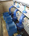 | ||
| man_made | quay | A man-made structure alongside navigable water used for loading and unloading vessels. |  | ||
| man_made | reservoir_covered | Ondergronds stuwmeer |  | ||
| man_made | satellite_dish | Schotelantenne |  | ||
| man_made | silo | A storage container for bulk material, often grains such as corn or wheat |  | ||
| man_made | snow_fence | A solid fence-like structure built across steep slopes to reduce risk and severity of (snow) avalanches. |  | ||
| man_made | spoil_heap | Spoil heap, piles of waste rock removed during mining. |  | ||
| man_made | spring_box | A structure designed for protecting and catching groundwater from a natural spring. |  | ||
| man_made | storage_tank | Opslagtank
Een opslagplaats voor vloeistoffen of vloeibaar gas. |
 | ||
| man_made | street_cabinet | Straatkabinet voor technische apparatuur om bijvoorbeeld het elektriciteitsnet of straatverlichting te onderhouden. |  | ||
| man_made | stupa | A Buddhist dome-shaped structure with a spire on top |  | ||
| man_made | surveillance | Bewakingscamera |  | ||
| man_made | survey_point | Referentiepunt
Gefixeerd punt op de grond dat door topografen gebruikt wordt om metingen uit te voeren. |
 | ||
| man_made | tailings_pond | Tailings pond: A body of liquid or slurry used to store byproducts of mining operations |  | ||
| man_made | telescope | Telescope: an instrument that aids in the observation of remote objects by collecting light or radio waves |  | ||
| man_made | torii | The gate structure found at the entrance of Shinto shrines and (rarely) Japanese Buddhist temples. |  | ||
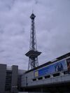
| man_made | tower | Toren
Een hoog gebouw met een relatief klein grondoppervlak. Als de toren van historische waarde is, kijk dan ook bij historic=*. Zie ook tower:type=*. |
 | ||
| man_made | threshing_floor | An open air paved area created to thresh the grain harvest and then winnow it. |  | ||
| man_made | trough | A long, narrow container, open on top, for feeding or watering animals. The water from a trough usually would not be considered drinkable, however, it may be filled from a pipe providing drinkable water. |  | ||
| man_made | utility_pole | A single pole supporting elevation of any of various and unspecified public utilities, such as power transmission, lighting or telephony. | 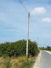 | ||
| man_made | ventilation_shaft | A vertical space in mines, tunnels, or buildings allowing stale air to leave the space underneath and/or fresh air to enter it. |  | ||
| man_made | video_wall | Een groot videoscherm, doorgaans opgebouwd uit kleinere LED-panelen. |  | ||
| man_made | wastewater_plant | Waterzuiveringsinstallatie
Installatie waar rioolwater of industrieel afvalwater zo ver wordt gezuiverd dat het zonder probleem op het oppervlaktewater kan worden geloosd. |
 |
 | |
| man_made | water_tap | Publicly usable water tap, providing access to water and usually equipped with a valve. | 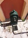 | ||
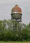
| man_made | water_tower | Watertoren
Toren met een waterreservoir bovenop. De hoogte van de toren dient om een bepaalde vaste waterdruk op de waterleiding te waarborgen. |
 | ||
| man_made | water_well | Waterput
Voorziening waaronder door graven of boren toegang is verkregen tot het grondwater. |
 | ||
| man_made | water_works | Waterwininstallatie
Installatie die water gereed maakt om aan het consumentenwaternet te leveren. |
 |
 | |
| man_made | watermill | Watermolen
Molen die op waterkracht wordt aangedreven. |
 | ||
| man_made | wildlife_crossing | Ecoduct |  | ||
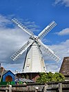
| man_made | windmill | Windmolen
Door wind aangedreven molen |
 | ||
| man_made | windpump | A device that pumps natural gas or water using the wind, typically mass produced. |  | ||
| man_made | works | Fabriek | 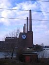 | ||
| man_made | yes | General tag for man-made (artificial) structures. | |||
| man_made | zelf gedefinieerd | Zie ook Taginfo[3]] voor meer informatie. |
This table is a wiki template with a default description in English. Editable here.
Gebouwen
De sleutel building wordt gebruikt voor het identificeren van individuele gebouwen of aaneengeschakelde gebouwen. Zie Gebouwen voor meer informatie over het gebruik van deze tag en man_made=* voor tagging van diverse andere structuren.
| Sleutel | Waarde | Omschrijving | Foto |
|---|---|---|---|
Accommodatie | |||
| building | apartments | Groot gebouw met apartementen. Op de begane grond bevinden zich soms winkels. Gebruik building:levels=* voor het aantal verdiepingen. | 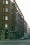 |
| building | barracks | Gebouwen gebouwd om militair personeel of arbeiders te huisvesten. |  |
| building | bungalow | Een vrijstaand huisje van één verdieping. |  |
| building | cabin | Een cabine is een klein, grofweg gebouwd huis meestal met een houten exterieur en doorgaans te vinden op het platteland. |  |
| building | detached | Een vrijstaande eengezinswoning. |  |
| building | annexe | Annexes of secondaire suites zijn zelfstandige appartementen, huisjes of kleine wooneenheden die zich bevinden op een perceel met een aparte eengezinswoning, duplex of andere wooneenheid. |  |
| building | dormitory | Een gedeelde woning, bijv. een studentenhuis van een universiteit. |  |
| building | farm | A residential building on a farm (farmhouse). For other buildings see below building=farm_auxiliary, building=barn, … If in your country farmhouse looks same as general residential house then you can tag as building=house as well. See also landuse=farmyard for the surrounding area |  |
| building | ger | A permanent or seasonal round yurt or ger. |  |
| building | hotel | Een gebouw met aparte kamers waar gasten kunnen overnachten. |  |
| building | house | Een huis waarin een gezin leeft. Generale tag voor building=detached en building=terrace. |  |
| building | houseboat | Een boot die voornamelijk als huis wordt gebruikt. |  |
| building | residential | Een algemene tag voor een voor een gebouw dat hoofdzakelijk als woonruimte wordt gebruikt. Indien je geen nauwkeurigere waarden als 'apartments' ,'terrace' of 'house' wilt opgeven. |  |
| building | semidetached_house | Een duplexwoning is een woning, hetzij een eengezinswoning of een woning in een meergezinshuis, die (al dan niet tijdelijk) gesplitst is in twee deelwoningen. |  |
| building | static_caravan | Een stacaravan is een caravan die zo groot is, dat deze niet zonder meer over de weg vervoerd kan en mag worden. |  |
| building | stilt_house | Een gebouw dat op palen boven het oppervlak van de grond of een waterlichaam staat. |  |
| building | terrace | Een manier die gebruikt wordt om de omtrek van een lineaire rij van residentiële woningen te definiëren, die elk hun eigen ingang hebben en een huizenrij vormen. Overweeg om elke aparte woning te definiëren met 'house'. |  |
| building | tree_house | Een accommodatie, vaak ontworpen als een kleine hut, soms ook als kamer of klein appartement. Gebouwd op boompalen of op een natuurlijke boom. Een boomhut heeft geen contact met de grond. Toegang via ladders, trappen of bruggen. | 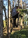 |
| building | trullo | Een trullo is een bouwwerk dat typisch is in delen van Italië. Kenmerkend voor de trullo is het kegelvormige dak, soms versierd met primitieve, christelijke of magische symbolen. |  |
Commercieel | |||
| building | commercial | Een gebouw waar commerciële activiteiten plaatsvinden. Waarschijnlijk in combinatie met office=*. |  |
| building | industrial | Gebruik landuse=industrial voor het omliggende gebied. Botst met building=manufacture? |  |
| building | kiosk | A small one-room retail building. |  |
| building | office | An office building. Use office=* where applicable for the business(es) that use the building. Consider tagging the surrounding area using landuse=commercial if it applies. Prefer landuse=retail if the building consists primarily of shops. | 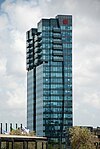 |
| building | retail | Detailhandel. Completeren met shop=*. |  |
| building | supermarket | A building constructed to house a self-service large-area store. |  |
| building | warehouse | Een gebouw voornamelijk gebruikt voor de opslag van goederen of als onderdeel van een distributiesysteem. |  |
Religious | |||
| building | religious | Unspecific building related to religion. Prefer more specific values if possible. |  |
| building | cathedral | Een bouwwerk dat als kathedraal is gebouwd. Dit moet worden aangevuld met amenity=place_of_worship, religion=* en denomination=*, tenzij het niet meer voor dat doel wordt gebruikt. |  |
| building | chapel | Een bouwwerk dat als kapel is gebouwd. Dit moet worden aangevuld met amenity=place_of_worship, religion=* en denomination=*, tenzij het niet meer voor dat doel wordt gebruikt. |  |
| building | church | Een bouwwerk dat als kerk is gebouwd. Dit moet worden aangevuld met amenity=place_of_worship, religion=* en denomination=*, tenzij het niet meer voor dat doel wordt gebruikt. |  |
| building | kingdom_hall | A building that was built as a |
 |
| building | monastery | A building constructed as |
 |
| building | mosque | A building errected as mosque. Used in conjunction with amenity=place_of_worship, religion=*, denomination=* and landuse=religious for the grounds where it is in current use. |  |
| building | presbytery | A building where priests live and work. |  |
| building | shrine | A building that was built as a shrine. Used in conjunction with amenity=place_of_worship, religion=*, denomination=* and landuse=religious for the grounds where it is in current use. Small structures should consider historic=wayside_shrine. |  |
| building | synagogue | A building that was built as a synagogue. Used in conjunction with amenity=place_of_worship, religion=*, denomination=* and landuse=religious for the grounds where it is in current use. |  |
| building | temple | A building that was built as a temple. Used in conjunction with amenity=place_of_worship, religion=*, denomination=* and landuse=religious for the grounds where it is in current use. |  |
Openbare voorzieningen | |||
| building | bakehouse | A building that was built as a bakehouse (i.e. for baking bread). Often used in conjunction with another node amenity=baking_oven and oven=wood_fired. |  |
| building | bridge | Eeen gebouw dat wordt gebruikt als brug. Kan ook een poortgebouw voor ophaalbruggen vertegenwoordigen. |  |
| building | civic | Voor elke maatschappelijke voorziening, bijv. een buurthuis, bibliotheek, openbaar toilet,zwembad, stadhuis etc. Gebruik amenity=* of leisure=* om extra details te verschaffen. |  |
| building | college | A college building. Use amenity=college on the whole college area to represent the college as an institution. |  |
| building | fire_station | A building constructed as fire station, i.e. to house fire fighting equipment and officers, regardless of current use. Add amenity=fire_station on the grounds for an active fire station. |  |
| building | government | For government buildings in general, including municipal, provincial and divisional secretaries, government agencies and departments, town halls, (regional) parliaments and court houses. |  |
| building | gatehouse | An entry control point building, spanning over a highway that enters a city or compound. |  |
| building | hospital | Een gebouw dat onderdeel vormt van een ziekenhuis. Gebruik amenity=hospital voor de omtrek van het ziekenhuisterrein. |  |
| building | kindergarten | For any generic kindergarten buildings. Buildings for specific uses (sports halls etc.) should be tagged for their purpose. If there is currently a kindergarten in the building, use amenity=kindergarten on the perimeter of the kindergarten grounds. |  |
| building | museum | A building which was designed as a museum. |  |
| building | public | A building constructed as accessible to the general public (a town hall, police station, court house, etc.). |  |
| building | school | Schoolgebouw. Gebouwen voor specifieke doeleinden (sporthallen etc) apart taggen voor hun functie. Aanvullen met de tag amenity=school voor de omtrek van het schoolterrein. |  |
| building | toilets | A toilet block. |  |
| building | train_station | Treinstation (Tweeledig: Mapnik rendert met name building=station). |  |
| building | transportation | Transportmaterieel. |  |
| building | university | Een universiteitsgebouw. Completeren met de tag amenity=university voor de omtrek van het gehele universiteitsterrein. |  |
Agricultural/plant production | |||
| building | barn | An agricultural building that can be used for storage and as a covered workplace. |  |
| building | conservatory | A building or room having glass or tarpaulin roofing and walls used as an indoor garden or a sunroom (winter garden). |  |
| building | cowshed | A cowshed (cow barn, cow house) is a building for housing cows, usually found on farms. |  |
| building | farm_auxiliary | Een gebouw op een boerderij dat geen woonhuis is (gebruik 'house' voor de woning). |  |
| building | greenhouse | Een kas, voor het kweken van plantengewassen. Gebruik landuse=greenhouse_horticulture voor het gebied waar de kassen zich bevinden (met inbegrip van de waterbasins). |  |
| building | slurry_tank | A circular building built to hold a liquid mix of primarily animal excreta (also known as slurry). |  |
| building | stable | A building constructed as a stable for horses. |  |
| building | sty | A sty (pigsty, pig ark, pig-shed) is a building for raising domestic pigs, usually found on farms. |  |
| building | livestock | A building for housing/rising other livestock (apart from cows, horses or pigs covered above), or when the livestock changes. | |
Sports | |||
| building | grandstand | The main stand, usually roofed, commanding the best view for spectators at racecourses or sports grounds. |  |
| building | pavilion | A sports pavilion usually with changing rooms, storage areas and possibly an space for functions & events. Avoid using this term for other structures called pavilions by architects (see |
 |
| building | riding_hall | A building that was built as a riding hall. |  |
| building | sports_hall | A building that was built as a sports hall. |  |
| building | sports_centre | A building that was built as a sports centre. |  |
| building | stadium | A building constructed to be a stadium building, including buildings that are abandoned and used nowadays for a different purpose. |  |
Storage | |||
| building | allotment_house | A small outbuilding for short visits in a allotment garden. | |
| building | boathouse | A boathouse is a building used for the storage of boats. |  |
| building | hangar | Wordt gebruikt om goederen op te slaan. Dubbelzinnig? Gebruik in plaats daarvan building=warehouse (pakhuis). |  |
| building | hut | Een hut; een klein, primitief gebouw. |  |
| building | shed | Een schuur is een eenvoudige, gelijkvloerse constructie in een achtertuin of op een volkstuin, dat wordt gebruikt voor opslag, hobby's, of als een werkplaats. |  |
Cars | |||
| building | carport | A carport is a covered structure used to offer limited protection to vehicles, primarily cars, from the elements. Unlike most structures a carport does not have four walls, and usually has one or two. | 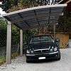 |
| building | garage | Een garagebox. Gebruik landuse=garages voor een gebied met afzonderlijke boxen (tagstat). De tag building=garages wordt ook gebruikt voor aaneengesloten garages, maar minder vaak (tagstat). |  |
| building | garages | Een gebouw dat bestaat uit een aantal afzonderlijke opslagruimtes van verschillende eigenaars/huurders. |  |
| building | parking | Structure purpose-built for parking cars. |  |
Power/technical buildings | |||
| building | digester | A digester is a bioreactor for the production of biogas from biomass. |  |
| building | service | Service building usually is a small unmanned building with certain machinery (like pumps or transformers). |  |
| building | tech_cab | Small prefabricated cabin structures for the air-conditioned accommodation of different technology. |  |
| building | transformer_tower | A transformer tower is a characteristic tall building comprising a distribution transformer and constructed to connect directly to a medium voltage overhead power line. Quite often the power line has since been undergrounded but the building may still serve as a substation. If the building is still in use as a substation it should additionally be tagged as power=substation + substation=minor_distribution. |  |
| building | water_tower | A water tower. |  |
| building | storage_tank | Storage tanks are containers that hold liquids |  |
| building | silo | A silo is a building for storing bulk materials |  |
Overige | |||
| building | beach_hut | A small, usually wooden, and often brightly coloured cabin or shelter above the high tide mark on popular bathing beaches. |  |
| building | bunker | Militair gebouw, gemaakt om zwaar vuur te weerstaan. Aanvullen met military=bunker. |  |
| building | castle | A building constructed as a castle. Can be further specified with historic=castle + castle_type=*. |  |
| building | construction | Constructie wordt gebruikt voor gebouwen in aanbouw. Gebruik construction=* voor het aangeven van de waarde van het voltooide gebouw. |  |
| building | container | For a container used as a permanent building. Do not map containers placed temporarily, for example used in shipping or construction. |  |
| building | guardhouse | Poste de garde. |  |
| building | military | A military building. Also use military=*. | |
| building | outbuilding | A less important building near to and on the same piece of land as a larger building. |  |
| building | pagoda | A building constructed as a pagoda. |  |
| building | quonset_hut | A lightweight prefabricated structure in the shape of a semicircle. |  |
| building | roof | Voor daken die aan de zijkanten open zijn, bijv. tankstations, abri's, ... |  |
| building | ruins | Frequently used for a house or other building that is abandoned and in poor repair. However, some believe this usage is incorrect, and the tag should only be used for buildings constructed as fake ruins (for example sham ruins in an English landscape garden). See also lifecycle tagging. |  |
| building | ship | A decommissioned ship/submarine which stays in one place. |  |
| building | tent | For a permanently placed tent. Do not map tents placed temporarily. |  |
| building | tower | A tower-building. | 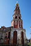 |
| building | triumphal_arch | A free-standing monumental structure in the shape of an archway with one or more arched passageways. |  |
| building | windmill | A building constructed as a traditional windmill, historically used to mill grain with wind power. |  |
| building | yes | Gebruik deze waarde als je het gebouwtype niet kunt of wilt specificeren. | |
| building | zelf gedefinieerd | Zie ook Taginfo[4] voor meer informatie. | |
Aanvullende attributen
| Sleutel | Waarde | Element | Omschrijving | Foto |
|---|---|---|---|---|
| building:architecture | <architectural style> | Architectural style of a building |  | |
| building:colour | <RGB hex triplet> | <W3C colour name> | Indicates colour of the building |  | |
| building:fireproof | yes | no | Fire-resistance information. | ||
| building:flats | <number> | The number of residential units (flats, apartments) in an apartment building (building=apartments), residential building (building=residential), house (building=house), detached house (building=detached) or similar building. | ||
| building:levels | <number> | Het aantal verdiepingen van een gebouw. |  | |
| building:material | <material type> | Outer material for the building façade |  | |
| building:min_level | <number> | For describing number of values, "filling" space between ground level and bottom level of building or part of building |  | |
| building:part | As building | To mark a part of a building, which has attributes, different from such ones at other parts | 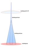 | |
| building:soft_storey | yes | no | reinforced | A building where any one level is significantly more flexible (less stiff) than those above and below it | ||
| construction_date | <date> | The (approximated) date when the building was finished. |  | |
| entrance | yes | main | exit | service | emergency | Ingang van een gebouw. Handig voor routering in combinatie met addr:*. |  | |
| height | <number> | De hoogte van een gebouw in meters. |  | |
| max_level | <number> | Maximum indoor level (floor) in the building as used in the Simple Indoor Tagging scheme | ||
| min_level | <number> | Minimum indoor level (floor) in the building as used in the Simple Indoor Tagging scheme | ||
| non_existent_levels | <number> | List of indoor levels (floors) that do not exists in the building as used in the Simple Indoor Tagging scheme | ||
| start_date | <date> | The (approximated) date when the building was finished. |  |
This table is a wiki template with a default description in English. Editable here.
Vrije tijd
Plaatsen die hoofdzakelijk zijn ingericht voor vrijetijdsbesteding.
| Key | Waarde | Element | Omschrijving | Resultaat | Foto |
|---|---|---|---|---|---|
| leisure | adult_gaming_centre | A venue with gambling machines and other pay-to-play games. With a set age limit, as opposed to leisure=amusement_arcade. |  | ||
| leisure | amusement_arcade | A venue with pay-to-play games, such as video games, driving simulators, pinball machines, merchandisers, etc. Without a set age limit, as opposed to leisure=adult_gaming_centre. |  | ||
| leisure | bandstand | An open structure where musical bands can perform concerts. |  | ||
| leisure | bathing_place | Public place where you can freely bath in nature. |  | ||
| leisure | beach_resort | To mark the boundary of a managed beach. |  | ||
| leisure | bird_hide | A place to observe birds. | 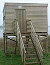 | ||
| leisure | bleachers | Raised, tiered rows of benches found at spectator events |  | ||
| leisure | bowling_alley | A facility that is equipped to play the game of bowling. |  | ||
| leisure | common | Geen heldere functie. Niet gebruiken. | |||
| leisure | dance | Danshal of Discotheek |  | ||
| leisure | disc_golf_course | Disc golf course |  | ||
| leisure | dog_park | Hondenuitlaatgebied
Een stuk grond, met of zonder hek, waar honden zonder riem uitgelaten mogen worden. |
 |
 | |
| leisure | escape_game | A physical adventure game in which players solve a series of puzzles using clues, hints and strategy to complete the objectives at hand. |  | ||
| leisure | firepit | Vuurplaats
Een permanente locatie om kampvuren te maken. |
 | ||
| leisure | fishing | Visplek
Speciaal aangelegde plaats aan het water voor het uitoefenen van de hengelsport. |
 | ||
| leisure | fitness_centre | A place with exercise machines and/or fitness/dance classes. |  | ||
| leisure | fitness_station | A place with exercise machines, single or collection of, outdoor. |  | ||
| leisure | garden | Tuin
Een plaats waar bloemen en andere planten gekweekt worden voor gebruik (een groentetuin), voor de wetenschap (een botanische tuin) of decoratief (een siertuin) |
 |
 | |
| leisure | golf_course | Golfbaan |  |
 | |
| leisure | hackerspace | A place where people with common interests, often in computers, technology, science, digital art or electronic art, can meet, socialize and/or collaborate. |  | ||
| leisure | horse_riding | A facility where people practise horse riding, usually in their spare time, e.g. a riding centre. For a riding arena use leisure=pitch + sport=equestrian. |  | ||
| leisure | ice_rink | IJsbaan
Een plaats waar je kan schaatsen of ijshockey spelen. Voeg seasonal=yes toe om een openlucht ijsbaan aan te geven. Alternatief is leisure=track samen met sport=skating;icehockey. |
 |
 | |
| leisure | marina | Jachthaven
Aanlegplaats voor plezierjachten en motorboten. |
 |
||
| leisure | miniature_golf | Midgetgolfbaan. |  |
 | |
| leisure | nature_reserve | Natuurreservaat |  |
 | |
| leisure | outdoor_seating | Areas for outdoor gastronomy. |  | ||
| leisure | park | Park
Een open, groen gebied te midden of dicht in de buurt van bewoning. Een park is speciaal voor recreatiedoeleinden van de bewoners aangelegd. Bossen rond een stad of dorp worden niet tot parken gerekend. |
 |
 | |
| leisure | picnic_table | Picknicktafel |  | ||
| leisure | pitch | Sportveld
Sportveld zonder een aanzienlijk hoeveelheid tribunes. Anders zie sport=*. |
 |
 | |
| leisure | playground | Speelplaats of Speeltuin
Speciaal voor kinderen aangelegde stukjes grond waarop speeltoestellen zijn geplaatst voor kinderen. |
 | ||
| leisure | resort | A place used for relaxation or recreation, attracting visitors for vacations, tourism and/or going swimming in a pool and/or a nearby body of water. |  | ||
| leisure | sauna | Sauna |  | ||
| leisure | slipway | Botenhelling
Plaats waar boten te water gelaten kunnen worden. |
 | ||
| leisure | sports_centre | Sportcentrum
Gebruik sport=* om aan te geven welke sporten er beoefend kunnen worden. |
 |
 | |
| leisure | sports_hall | A sufficiently large single room that is suitable for practising sports indoors and does not have a "centre" character. |  | ||
| leisure | stadium | Stadion
Een aanzienlijk sportveld dat omringd is door vaste tribunes. Gebruik ook sport=* |
 |
 | |
| leisure | summer_camp | Summer camp is a supervised program for children or teenagers conducted during the summer months in some countries. Children and adolescents who attend summer camp are known as campers. |  | ||
| leisure | swimming_area | A swimming area - place over river, lake or other water reservoir where swimming is allowed. |  | ||
| leisure | swimming_pool | Zwembad |  |
 | |
| leisure | tanning_salon | Place where customers can use UV lamps to tan their skin. |  | ||
| leisure | track | Sportbaan
algemene tag om een baan aan te geven waar een of meer sporten op geoefend kunnen worden (voorbeeld: Atletiekbaan, Wielrenbaan, Hondenrenbaan, Paardenrenbaan etc). Gebruik ook sport=* |
 |
 | |
| leisure | trampoline_park | Trampolinepark |  | ||
| leisure | water_park | Waterpark
Amusementpark met waterglijbanen, zwembaden en kleedruimtes. |
 | ||
| leisure | wildlife_hide | A place to observe wildlife. See also leisure=bird_hide. |  | ||
| leisure | zelf gedefinieerd | Zie ook Taginfo[5] voor meer informatie. |
This table is a wiki template with a default description in English. Editable here.
Voorzieningen
| Sleutel | Waarde | Element | Omschrijving | Resultaat | Foto | |
|---|---|---|---|---|---|---|
Levensonderhoud | ||||||
| amenity | bar | Bar
Een plek waar mensen drinken en praten. Er zijn vaak geen zitplaatsen en er kunnen geen maaltijden besteld worden. Hiervan onderscheid de Bar zich van amenity=cafe en amenity=pub. |
 | |||
| amenity | biergarten | Biergarten
Plaats in de open lucht waar vooral bier (maar ook andere dranken) gedronken worden. Deze plaats ligt veelal naast een andere drinkgelegenheid. |
 | |||
| amenity | cafe | café of Koffiehuis
Een plek waar mensen drinken, praten en soms eenvoudig kunnen eten. Koffie vormt hier een belangrijk aangeboden drank. Indien alcoholische drank (Bier en Wijn) de boventoon voeren is amenity=pub beter. |
 | |||
| amenity | fast_food | Fast-Food restaurant
Plaats waar klaargemaakt (warm) eten kan worden gekocht. Onder deze categorie vallen Snackbars, Cafetaria's en afhaalrestaurant zoals pizzeria, chinees enzovoort. |
 | |||
| amenity | food_court | Plaats waar bij verschillende restaurants eten afgehaald kan worden, en waar dit in een gezamenlijke ruimte genuttigd kan worden. Kan aangetroffen worden in grote winkelcentra en luchthavens. In Nederland ongebruikelijk. |  | |||
| amenity | ice_cream | IJssalon |  | |||
| amenity | pub | café of Kroeg
Een plek waar mensen drinken, praten en soms eenvoudig kunnen eten. Alcoholische dranken zoals Bier en Wijn vormen hier een belangrijk deel van de verkochte drank. |
 | |||
| amenity | restaurant | Restaurant
Eetgelegenheid. Voor fast-food zoals snackbar is amenity=fast_food. |
 | |||
Onderwijs | ||||||
| amenity | college | School voor middelbaar beroepsonderwijs |  | |||
| amenity | dancing_school | A dancing school or dance studio |  | |||
| amenity | driving_school | Rijschool |  | |||
| amenity | first_aid_school | A place where people can go for first aid courses. | ||||
| amenity | kindergarten | Kindercrèche
Gebouw waar kleine kinderen, die nog niet leerplichtig zijn worden opgevangen. |
 | |||
| amenity | language_school | Taalschool |  | |||
| amenity | library | Bibliotheek
Plaats waar lees- en studieboeken uitgeleend worden. Ook wel een Leeszaal. |
 | |||
| amenity | surf_school | A surf school is an establishment that teaches surfing. |  | |||
| amenity | toy_library | A place to borrow games and toys, or play with them on site. |  | |||
| amenity | research_institute | An establishment endowed for doing research. |  | |||
| amenity | training | Public place where you can get training. |  | |||
| amenity | music_school | Muziekschool |  | |||
| amenity | school | School
School voor basis- of voortgezet onderwijs met eventueel het speelplein. |
 | |||
| amenity | traffic_park | Juvenile traffic schools |  | |||
| amenity | university | Universiteit of hogeschool
Gebouwen inclusief eventuele Campus. |
 | |||
Transport, Verkeer | ||||||
| amenity | bicycle_parking | Fietsenstalling |  | |||
| amenity | bicycle_repair_station | Mogelijkheid voor doe-het-zelf reparaties |  | |||
| amenity | bicycle_rental | Fietsenverhuur
Bedrijf waar fietsen gehuurd kunnen worden. |
 | |||
| amenity | bicycle_wash | Clean a bicycle |  | |||
| amenity | boat_rental | Botenverhuur |  | |||
| amenity | boat_sharing | Deel een boot |  | |||
| amenity | bus_station | Busstation
Een verzameling van bushaltes. Gaat het om een enkele bushalte gebruik dan highway=bus_stop. |
 | |||
| amenity | car_rental | Autoverhuur
Bedrijf waar auto's gehuurd kunnen worden. |
||||
| amenity | car_sharing | Deel-auto's
Speciaal autoverhuur bedrijf waar op ideële gronden auto's worden gedeeld onder abonnementhouders. Greenwheels is het grootste en meeste bekende bedrijf in Nederland in die branche. |
 | |||
| amenity | car_wash | Autowasstraat |  | |||
| amenity | compressed_air | A device to inflate tires/tyres (e.g. motorcar, bicycle) |  | |||
| amenity | vehicle_inspection | Government vehicle inspection |  | |||
| amenity | charging_station | Oplaadstation voor elektrische voertuigen |  | |||
| amenity | driver_training | A place for driving training on a closed course |  | |||
| amenity | ferry_terminal | Veerhaven
Een plek waar mensen en voertuigen van of op een veerboot/pont kunnen komen. |
 | |||
| amenity | fuel | Tankstation
Plaats waar benzine, diesel of andere brandstoffen voor motorvoertuigen verkocht worden. Toegangsweg en uitgang kunnen worden aangegeven met highway=service. Bekijk de Wikipagina om brandstofsoorten te specificeren. |
 | |||
| amenity | grit_bin | Gritbak
Opslagbak langs de kant van de weg met een grit dat gebruikt mag worden om bij glad weer te strooien. |
 | |||
| amenity | motorcycle_parking | Parkeerplaats voor motorfietsen |  | |||
| amenity | parking | Parkeerplaats
Toegangswegen naar de parkeerplaats kunnen worden aangegeven met highway=service en rijstroken tussen parkeervakken met service=parking_aisle. |
 | |||
| amenity | parking_entrance | Een in- of uitgang naar een parkeergarage. | Underground |
 | ||
| amenity | parking_space | Eén enkele parkeerplaats.
Groepeer meerdere parkeerplaatsen tezamen met een relatie met behulp van de tags type=site en site=parking. Niet samenvoegen met amenity=parking. |
 |
 | ||
| amenity | taxi | Taxi-standplaats |  | |||
| amenity | weighbridge | A large weight scale to weigh vehicles and goods |  | |||
Financieel | ||||||
| amenity | [[ Too many Data Items entities accessed. | atm ]] | Geldautomaat |  | |||
| amenity | payment_terminal | Self-service payment kiosk/terminal |  | |||
| amenity | bank | Bank
Instituut voor het afhandelen van financiële zaken. |
 | |||
| amenity | bureau_de_change | Geldwisselkantoor
Een instituut speciaal voor het wisselen van vreemde valuta. |
 | |||
| amenity | money_transfer | A place that offers money transfers, especially cash to cash |  | |||
| amenity | payment_centre | A non-bank place, where people can pay bills of public and private services and taxes. |  | |||
Medische verzorging (zie ook healthcare=*) | ||||||
| amenity | baby_hatch | Vondelingenluik
Plaats waar anoniem baby's ter adoptie aangeboden kunnen worden. In Nederland is anoniem aanbieden tegen de wet en zelfs een misdrijf. Deze faciliteit bestaat dus niet in Nederland. |
 | |||
| amenity | clinic | Kliniek
Een doorsnee medisch centrum. |
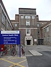 | |||
| amenity | dentist | Tandartsenpraktijk of Tandheelkundig centrum |  | |||
| amenity | doctors | Artsenpraktijk of (klein) gezondheidscentrum
Plaats waar artsen, zoals huisartsen of alternatieve artsen, praktijk houden. |
 | |||
| amenity | hospital | Ziekenhuis
(groot) Medisch centrum. |
 | |||
| amenity | nursing_home | Verzorgingstehuis
Een tehuis voor gehandicapte of oudere personen die permanente zorg nodig hebben. |
 | |||
| amenity | pharmacy | Apotheek
dispensing=yes is wettelijk niet toegestaan in Nederland. |
 | |||
| amenity | social_facility | Sociale voorzieningen
Een instelling die sociale diensten verleend, bijvoorbeeld daklozenopvang, voedselbank, ... |
 | |||
| amenity | veterinary | Dierenartsenpraktijk of Dierenkliniek
Zowel voor gezelschaps- als voor landbouwhuisdieren. |
 | |||
Kunst, Cultuur en Amusement | ||||||
| amenity | arts_centre | Cultureel centrum of Kunst-centrum of Kunstgalerie |  | |||
| amenity | brothel | Bordeel |  | |||
| amenity | casino | Casino
Een gelegenheid waar u kunt gokken, met ten minste één spel met een tafel(bijv. roulette, blackjack), die gokken aannemen op sport- en andere gebeurtenissen tegen vastgestelde kansen. |
 | |||
| amenity | cinema | Bioscoop of Filmhuis |  | |||
| amenity | community_centre | Buurthuis, Gemeenschapshuis of Dorpshuis |  | |||
| amenity | conference_centre | A large building that is used to hold a convention |  | |||
| amenity | events_venue | A building specifically used for organising events |  | |||
| amenity | exhibition_centre | An exhibition centre | ||||
| amenity | fountain | Fontein |  | |||
| amenity | gambling | Gokhal
Een plaats om te gokken, niet zijnde een shop=bookmaker, shop=lottery, amenity=casino, of leisure=adult_gaming_centre. Spellen die onder deze definitie vallen zijn onder andere bingo en pachinko. |
 | |||
| amenity | love_hotel | A love hotel is a type of short-stay hotel operated primarily for the purpose of allowing guests privacy for sexual activities. |  | |||
| amenity | music_venue | An indoor place to hear contemporary live music. |  | |||
| amenity | nightclub | Nachtclub |  | |||
| amenity | planetarium | Planetarium |  | |||
| amenity | public_bookcase | Een kraam op straat met boeken.
Neem er een mee of laat er een achter. |
 | |||
| amenity | social_centre | Buurthuis, Gemeenschapshuis of Dorpshuis |  | |||
| amenity | stage | A raised platform for performers. |  | |||
| amenity | stripclub | Stripclub
Een plaats waar striptease en lapdancing wordt uitgeoefend. Worden er ook seksuele diensten verleend, gebruik dan amenity=brothel. |
 | |||
| amenity | studio | TV- of radio-opnamestudio |  | |||
| amenity | swingerclub | Sexclub
Een club waar bezoekers feest vieren en groepsseks hebben. |
 | |||
| amenity | theatre | Schouwburg, theater of concertgebouw |  | |||
Public Service | ||||||
| amenity | courthouse | Gerechtsgebouw
Dit kunnen zijn: een kantongerecht, een rechtbank, een gerechtshof of het Paleis van justitie. |
 | |||
| amenity | fire_station | Brandweerkazerne |  | |||
| amenity | police | Politiebureau |  | |||
| amenity | post_box | Brievenbus |  | |||
| amenity | post_depot | Post depot or delivery office, where letters and parcels are collected and sorted prior to delivery. |  | |||
| amenity | post_office | Postkantoor |  | |||
| amenity | prison | Gevangenis of Huis van bewaring |  | |||
| amenity | ranger_station | Bezoekerscentrum Nationaal Park |  | |||
| amenity | townhall | Stadhuis, Gemeentekantoor, Raadhuis | 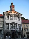 | |||
Facilities | ||||||
| amenity | bbq | Barbecue- of Picknick-plaats
Een buiten-plek waar gegeten en waar soms een vuurveilige plek is aangebracht om te barbecueën. |
 | |||
| amenity | bench | Bank
Buiten zitplaats veelal in bos of park. |
 | |||
| amenity | dog_toilet | Area designated for dogs to urinate and excrete. |  | |||
| amenity | dressing_room | Area designated for changing clothes. |  | |||
| amenity | drinking_water | Drinkwatertap
Openbare plaats waar gratis drinkwater genuttigd kan worden. |
 | |||
| amenity | give_box | A small facility where people drop off and pick up various types of items in the sense of free sharing and reuse. |  | |||
| amenity | lounge | A comfortable waiting area for customers, usually found in airports and other transportation hubs. Typically has extra amenities or sustenance. |  | |||
| amenity | mailroom | A mailroom for receiving packages or letters. |  | |||
| amenity | parcel_locker | Machine for picking up and sending parcels |  | |||
| amenity | shelter | Schuilhut
Plaats in het bos voor wandelaars en fietsers om te schuilen tegen slecht weer. |
 | |||
| amenity | shower | Badhuis
Gemeenschappelijke douche- en badgelegenheid. |
 | |||
| amenity | telephone | Telefooncel of -paal |  | |||
| amenity | toilets | Openbaar toilet, WC of urinoir |  | |||
| amenity | water_point | Plaats waar u water in grote hoeveelheden kunt krijgen |  | |||
| amenity | watering_place | Drinkplaats
Plaats waar (gratis) drinkwater voor dieren wordt aangeboden. Is het een drinkkraan voor mensen, gebruik dan amenity=drinking_water |
 | |||
Waste Management | ||||||
| amenity | sanitary_dump_station | A place for depositing human waste from a toilet holding tank. |  | |||
| amenity | recycling | Recycling inzamelpunt
Plaats waar glas, oud papier, plastic en/of kleding kan worden ingeleverd. |
 | |||
| amenity | waste_basket | Prullenbak | 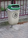 | |||
| amenity | waste_disposal | Afvalcontainer |  | |||
| amenity | waste_transfer_station | A waste transfer station is a location that accepts, consolidates and transfers waste in bulk. | ||||
Overige | ||||||
| amenity | animal_boarding | Dierenpension |  | |||
| amenity | animal_breeding | A facility where animals are bred, usually to sell them |  | |||
| amenity | animal_shelter | Dierenasiel |  | |||
| amenity | animal_training | A facility used for non-competitive animal training |  | |||
| amenity | baking_oven | An oven used for baking bread and similar, for example inside a building=bakehouse. |  | |||
| amenity | clock | Openbare klok |  | |||
| amenity | crematorium | Crematorium |  | |||
| amenity | dive_centre | Duikschool
Een duikschool is de basislocatie waar sportduikers gewoonlijk duiken leren of vanuit waar zij duiktrips naar nieuwe locaties maken. |
 | |||
| amenity | funeral_hall | A place for holding a funeral ceremony, other than a place of worship. |  | |||
| amenity | grave_yard | Begraafplaats
Een kleine begraafplaats, vaak in de buurt van een kerk. Maak bij grotere begraafplaatsen liever gebruik van landuse=cemetery. |
 |
 | ||
| amenity | hunting_stand | Jachthut, Hoogzit
Plaats in het veld waar vandaan jagers hun werk/hobby uitoefenen. |
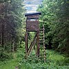 | |||
| amenity | internet_cafe | Een plaats waar mensen tegen betaling een computer met internettoegang kunnen gebruiken. |  | |||
| amenity | kitchen | A public kitchen in a facility to use by everyone or customers |  | |||
| amenity | kneipp_water_cure | Buiten voetbad
Gewoonlijk is dit een bad met koud water en een leuning. Populair in Duits sprekende landen. |
 | |||
| amenity | lounger | An object for people to lie down. |  | |||
| amenity | marketplace | Markt |  | |||
| amenity | monastery | Monastery is the location of a monastery or a building in which monks and nuns live. |  | |||
| amenity | mortuary | A morgue or funeral home, used for the storage of human corpses. |  | |||
| amenity | photo_booth | Fotobox
Een box om direct klaar foto's te maken. |
 | |||
| amenity | place_of_mourning | A room or building where families and friends can come, before the funeral, and view the body of the person who has died. |  | |||
| amenity | place_of_worship | Kerkgebouw, Synagoge, Moskee, Tempel.
Gebruik daarnaast ook:
Zie bijbehorend artikel voor details. |
 | |||
| amenity | public_bath | A location where the public may bathe in common, etc. japanese onsen, turkish bath, hot spring |  | |||
| Niet meer gebruiken. Zie building=public. | ||||||
| amenity | refugee_site | Vluchtenlingenkamp |  | |||
| amenity | vending_machine | Automatiek
Automaten waarmee producten verkocht worden. Hieronder vallen o.a. snoep-, kranten en snackautomaten. |
 | |||
| amenity | zelf gedefinieerd | Zie ook Taginfo[6] voor meer informatie. | ||||
This table is a wiki template with a default description in English. Editable here.
Kantoor
Een kantoor of bureau is een werkplaats waar administratief werk wordt gedaan.
This table is a wiki template with a default description in English. Editable here.
| To add missing translations, go to Template:Map Features:shop/doc, copy missing parameters, paste into your language template and complete translations (the link to edit is at the bottom of the table). |
Winkels
Winkels zijn plaatsen waar goederen en soms diensten verkocht worden.
| Sleutel | Waarde | Omschrijving | Resultaat | Foto | ||
|---|---|---|---|---|---|---|
Food, beverages | ||||||
| shop | alcohol | Slijterij
Een winkel waar legaal alcohol verkocht kan worden. Zie ook shop=beverages. |
 | |||
| shop | bakery | Bakker
Een winkel waar brood etc. en ander deegwaar verkocht wordt. Zie ook shop=pastry. |
 | |||
| shop | beverages | Drankenwinkel
Een winkel waar naast alcoholische ook niet-alcoholische dranken worden verkocht. Zie ook shop=alcohol. |
 | |||
| shop | brewing_supplies | Shop focused on selling supplies for home brewing of beer, wine and spirits (where permitted). |  | |||
| shop | butcher | Slagerij
Een winkel waar vlees, wild en/of gevogelte wordt verkocht. |
 | |||
| shop | cheese | Kaaswinkel
Een winkel waar voornamelijk kaasproducten verkocht worden. |
 | |||
| shop | chocolate | Chocolaterie
Een winkel waar voornamelijk chocolade verkocht wordt. |
 | |||
| shop | coffee | Shop focused on selling coffee. |  | |||
| shop | confectionery | Snoepwinkel |  | |||
| shop | convenience | Buurtsuper
Een kleine winkel die een deel-assortiment van een supermarkt verkoopt. Voor een nog kleinere winkel zie shop=kiosk. |
 | |||
| shop | dairy | Zuivelwinkel
Een winkel waar vooral zuivel wordt verkocht. |
 | |||
| shop | deli | Delicatessenwinkel
Een winkel waar exclusief voedsel (maar ook wijn) wordt verkocht. |
 | |||
| shop | farm | Boerderijwinkel
Een winkel waar producten verkocht worden die direct bij de boer vandaan komen. |
 | |||
| shop | food | Shop focused on selling food, more specific value should be used if possible.
shop=food + food=prepared_meals was also proposed/used for type of shop selling prepared meals, not ready for eating immediately (and requiring for example heating/boiling or other simple preparation). |
 | |||
| shop | frozen_food | Shop focused on selling frozen food. |  | |||
| shop | greengrocer | Groenteboer
Een winkel waar groente en fruit verkochten. |
 | |||
| shop | health_food | A health food shop; selling wholefoods, vitamins, nutrition supplements and meat and dairy alternatives. |  | |||
| shop | ice_cream | IJswinkel
Een winkel waar ijs maar ook milkshakes verkocht worden. |
 | |||
| shop | nuts | Shop selling dried nuts/fruits, edible seeds, etc. Not to be confused with shop=spices. |  | |||
| shop | pasta | Shop focused on selling (fresh) pasta, ravioli, etc. |  | |||
| shop | pastry | Banketbakker (ook suikerbakker of patissier)
Een bakker die gespecialiseerd is in banket, zoals gebak, chocolade, koekjes en marsepein. |
 | |||
| shop | seafood | Visboer |  | |||
| shop | spices | Shop focused on selling spices. |  | |||
| shop | tea | Shop focused on selling tea. |  | |||
| shop | tortilla | Shop focused on selling tortillas. |  | |||
| shop | water | Shop focused on selling drinking water. |  | |||
| shop | wine | Shop selling wine. |  | |||
General store, department store, mall | ||||||
| shop | department_store | Warenhuis
Een grote winkel met vaak meer verdiepingen waar een uitgebreid assortiment aan goederen verkocht worden. Zie ook shop=mall. |
 | |||
| shop | general | Winkel-van-Sinkel
Een winkel waar aller handen zaken verkocht worden. Zie ook shop=convenience. |
 | |||
| shop | kiosk | Kiosk
Een kleine winkel op een plein of hoek van de straat waar sigaretten, kranten, snoep, snacks etc. verkocht worden. Voor een iets grotere winkel zie shop=convenience en voor een winkel die voornamelijk kranten en tijdschriften verkoopt zie shop=newsagent. |
 | |||
| shop | mall | Winkelcentrum
Een meestal overdekt gebied met een groot aantal winkels onder een 'dak'. |
 | |||
| shop | supermarket | Supermarkt |  | |||
| shop | wholesale | Wholesale/warehouse club or cash and carry – a store that sells items in bulk to retailers. The branch of industry can be defined with wholesale=*. |  | |||
Clothing, shoes, accessories | ||||||
| shop | baby_goods | Babywinkel
Een winkel die producten voor baby's verkoopt (kleding, kinderwagens, kinderbedjes, speelgoed). |
 | |||
| shop | bag | Tassenwinkel
Een winkel waar voornamelijk tassen verkocht worden (handtassen, rugtassen etc). |
 | |||
| shop | boutique | Boutique
Een (kleine) winkel waar modieuze kleding en/of accessoire wordt verkocht. Zie ook shop=clothes. |
 | |||
| shop | clothes | Kledingwinkel |  | |||
| shop | fabric | Stoffenwinkel
Een winkel waar stoffen verkocht worden om kleding etc. te maken. |
 | |||
| Shop focused on selling fashion. This is deprecated, please use shop=clothes. |  | |||||
| shop | fashion_accessories | Shop focused on selling fashion accessories. |  | |||
| shop | jewelry | Juwelier |  | |||
| shop | leather | Shop focused on selling products made out of leather. | ||||
| shop | sewing | A shop that sells sewing supplies (fabric, thread, yarn, knitting needles, sewing machines, etc.) |  | |||
| shop | shoes | Schoenenwinkel |  | |||
| shop | shoe_repair | Shop focused on repairing shoes. |  | |||
| shop | tailor | A place where clothing is made, repaired, or altered professionally, especially suits and men's clothing |  | |||
| shop | watches | Shop focused on selling watches. |  | |||
| shop | wool | Shop selling wool for making of clothes or other products. |  | |||
Discount store, charity | ||||||
| shop | charity | Liefdadigheidswinkel
Een winkel van een liefdadigheidsorganisatie, bijvoorbeeld een Kringloopwinkel of Derdewereldwinkel. Zie ook shop=second_hand. |
 | |||
| shop | second_hand | Kringloopwinkel
Een winkel waar tweedehandsspullen verkocht worden. Zie ook shop=pawnbroker en shop=charity. |
 | |||
| shop | variety_store | Euroshop
Een winkel waar verschillende goedkope artikelen verkocht worden. de winkel kent eestal een of meer eenheidsprijzen voor grote groepen artikelen. |
 | |||
Health and beauty | ||||||
| shop | beauty | Schoonheidssalon
Hier onder vallen een Beautysalon, Nagelsalon maar geen Kapper (shop=hairdresser). |
 | |||
| shop | chemist | Drogist
Een winkel waar cosmetica, hygiëne en schoonmaakproducten verkocht wordt. Voor een apotheek zie amenity=pharmacy. |
 | |||
| shop | cosmetics | Shop focused on selling cosmetics |  | |||
| shop | erotic | Sexshop
Een winkel waar erotische spullen verkocht worden. |
 | |||
| shop | hairdresser | Kapper |  | |||
| shop | hairdresser_supply | A shop, where you can buy hairdressing supplies. |  | |||
| shop | hearing_aids | Hoorwinkel
Een winkel waar gehoorapparaten verkocht worden. |
 | |||
| shop | herbalist | Shop focused on selling herbs, often for medical purposes. (See also: healthcare:speciality=herbalism and healthcare=alternative). |  | |||
| shop | massage | Massagesalon |  | |||
| shop | medical_supply | Shop focused on selling medical supplies. |  | |||
| shop | nutrition_supplements | Shops that sells one or more nutritional supplements (of vitamins, minerals and/or herbs) |  | |||
| shop | optician | Opticien
Een winkel waar brillen en contactlenzen verkocht worden. |
 | |||
| shop | perfumery | Shop focused on selling perfumery |  | |||
| shop | tattoo | Tattooshop
Een winkel waar je een tatoeage of piercings kunt laten zetten. |
 | |||
Do-it-yourself, household, building materials, gardening | ||||||
| shop | agrarian | Shop focused on selling agrarian products, like seeds, agricultural machinery, animal feed, etc. |  | |||
| shop | appliance | Shop focused on selling large electrical items (aka white goods) washing machines, fridges, cookers, ovens, fans, etc. |  | |||
| shop | bathroom_furnishing | Badkamer speciaalzaal |  | |||
| shop | country_store | Shop focused on selling rural supplies – a range of goods specifically aimed at country dwellers |  | |||
| shop | doityourself | Bouwmarkten |  | |||
| shop | electrical | Shop focused on selling electrical supplies and devices |  | |||
| shop | energy | Shop focused on selling energy |  | |||
| shop | fireplace | Shop focused on selling electric fireplaces, stoves or masonry heaters and required fuels |  | |||
| shop | florist | Bloemenwinkel
Zie ook shop=garden_centre. |
 | |||
| shop | garden_centre | Tuincentrum
Een veelal grote winkel waar naast binnen- en buitenplanten ook andere tuingerelateerde waren verkocht worden. Voor Bloemenwinkel zie shop=florist. |
 | |||
| shop | garden_furniture | Shop focused on selling garden furniture (sheds, outdoor tables, gates, fences, ...). See shop=garden_centre if also plants are sold. |  | |||
| shop | gas | Een winkel waar allerlei vormen van gas in fles worden verkocht, zoals butaan, argon, zuurstof, acetyleen, stikstof, kooldioxide, enz. |  | |||
| shop | glaziery | Glaswinkel |  | |||
| shop | groundskeeping | Shop focused on selling outdoor groundskeeping equipment (lawnmowers, chainsaws, small tractors, ... |  | |||
| shop | hardware | Bouwmarkt
Een winkel waar schroeven, boutjes en verf verkocht wordt. Meestal is beter om shop=doityourself te gebruiken. |
 | |||
| shop | houseware | Shop focused on selling crockery, cutlery, kitchenware, small household appliances. |  | |||
| shop | locksmith | Shop focused on selling keys, see also craft=locksmith and craft=key_cutter |  | |||
| shop | paint | Verfwinkel |  | |||
| shop | pottery | Shop focused on selling earthenware, stoneware and porcelain and other ceramic ware. |  | |||
| shop | security | Shop focused on selling security items like burglar alarms, vaults, locking systems, video surveillance cameras, firefighting equipment, alarm systems, warning systems, etc. | ||||
| shop | tool_hire | Shop hiring out tools |  | |||
| shop | trade | Grondstoffenhandel
Een winkel waar specifieke bouwbenodigdheden zoals hout, stenen en cement verkocht worden. Zie ook shop=doityourself en shop=garden_centre. |
 | |||
Furniture and interior | ||||||
| shop | antiques | Shop focused on selling antiques. |  | |||
| shop | bed | Beddenwinkel
Een winkel waar matrassen en andere bedbenodigdheden verkocht worden. |
 | |||
| shop | candles | Shop focused on selling candles and candle accessories (holders, etc) |  | |||
| shop | carpet | Tapijtwinkel |  | |||
| shop | curtain | Gordijnenwinkel
Een winkel waar gordijnen etc. verkocht worden. Zie ook shop=fabric. |
 | |||
| shop | doors | Shop focused on selling doors | ||||
| shop | flooring | Shop focused on selling floorings |  | |||
| shop | furniture | Woonwarenhuis
Een winkel waar naast meubilair ook woonaccessoires verkocht worden. Zie ook shop=interior_decoration. |
 | |||
| shop | household_linen | Shop focused on selling household linen. |  | |||
| shop | interior_decoration | Interieurwinkel
Een winkel waar binnenhuis accessoires verkocht worden. Zie ook shop=furniture. |
 | |||
| shop | kitchen | Keukenzaak |  | |||
| shop | lighting | Lampenwinkel |  | |||
| shop | tiles | Shop focused on selling tiles. |  | |||
| shop | window_blind | Een winkel gespecialiseerd in zonwering. |  | |||
Electronics | ||||||
| shop | computer | Computerwinkel
Een winkel waar computers, randapparatuur en software wordt verkocht. |
 | |||
| shop | electronics | Bruingoedwinkel
Een winkel waar consumentenelektronica zoals TV's, DVD's en audioapparatuur verkocht worden. In een grotere winkel kunnen ook computers, koelkasten etc. verkocht worden. |
 | |||
| shop | hifi | Bruingoedwinkel
Een winkel waar HiFi audioappratuur verkocht wordt. |
 | |||
| shop | mobile_phone | Telefoonwinkel
Een winkel waar voornamelijk GSM's/mobiele telefoons verkocht worden. |
 | |||
| shop | printer_ink | A shop that sells or refills printer ink cartridges. |  | |||
| shop | radiotechnics | Electronicazaak
Winkel waar electronische componenten en meetapparatuur verkocht wordt. |
 | |||
| shop | telecommunication | Shop selling internet, television or similar services, and related hardware. |  | |||
| shop | vacuum_cleaner | Stofzuigerhuis. |  | |||
Outdoors and sport, vehicles | ||||||
| shop | atv | Shop focused on selling |
 | |||
| shop | bicycle | Fietsenwinkel of -maker |  | |||
| shop | boat | Shop focused on selling boats, boat equipment and may rent or repair them |  | |||
| shop | car | Auto dealer
Een autoshowroom of autohandelaar eventueel gecombineerd met een garage. Kijk verder op shop=car voor mogelijkheden om met service=* aan te geven wat precies wordt aangeboden. |
 | |||
| shop | car_parts | Winkel voor auto-onderdelen, auto-accessoires, motorolie, enz. |  | |||
| shop | car_repair | Autogarage |  | |||
| shop | caravan | A shop for caravans, motorhomes & similar recreational vehicles. |  | |||
| shop | fishing | Shop focused on selling fishing equipment. |  | |||
| shop | fuel | Shop selling fuels (motor fuel, wood, coal, gas) that can't be considered a amenity=fuel (fuel station). Use fuel:*=yes/no to indicate which fuels are available. |  | |||
| shop | golf | Shop focused on selling golf equipment. |  | |||
| shop | hunting | Wapenhandel voor jacht op dieren. |  | |||
| shop | military_surplus | Shop selling used military equipment |  | |||
| shop | motorcycle | Motorwinkel
Een winkel waar motoren/motorfietsen en daaraan gerelateerde accessoires zoals kleding, onderdelen en reparaties aangeboden worden. |
 | |||
| shop | motorcycle_repair | Shop focused on motorcycle repair. |  | |||
| shop | outdoor | Buitensportzaak |  | |||
| shop | scuba_diving | Shop focused on selling scuba diving equipment. |  | |||
| shop | ski | Shop focused on selling skis, ski equipment and may rent or repair them |  | |||
| shop | snowmobile | Shop focused on selling snowmobiles, snowmobile equipment and may rent or repair them |  | |||
| shop | sports | Sportwinkel
Een winkel waar sportartikelen verkocht worden. |
 | |||
| shop | surf | Shop selling surfboards, sailboards, wakeboards, and other types of surf style boards. and/or related accessories, clothes, parts, repair and rental services. |  | |||
| shop | swimming_pool | A store that sells swimming pool equipment and supplies. |  | |||
| shop | trailer | Shop focused on selling trailers and parts and/or repairing / renting them |  | |||
| shop | truck | Shop focused on selling trucks and other commercial vehicles |  | |||
| shop | tyres | Bandenzaak |  | |||
Art, music, hobbies | ||||||
| shop | art | Gallerie
Een winkel waar kunst verkocht wordt. |
 | |||
| shop | camera | Een winkel waar camera's en lenzen worden verkocht. |  | |||
| shop | collector | A shop for different collector's items like stamps, coins, action figures, etc. |  | |||
| shop | craft | An arts and crafts supply store. Commonly sold items are paper, canvas, paint, pencils, crafting wood, crafting tools, etc. – look at craft=* |  | |||
| shop | frame | Schilderijlijsten atelier |  | |||
| shop | games | Shop focused on selling board games, card games and/or role-playing games. |  | |||
| shop | model | Shop specialising in the sale of scale models. |  | |||
| shop | music | Shop focused on selling recorded music (vinyl/CDs/...) |  | |||
| shop | musical_instrument | Muziekwinkel
Een winkel waar muziekinstrumenten en bladmuziek verkocht wordt. |
 | |||
| shop | photo | Shop focused on selling products or services related with photography. |  | |||
| shop | trophy | Store selling trophies, awards, plaques etc. |  | |||
| shop | video | Videotheek
Een winkel waar video's/DVD's verhuurt en/of verkocht worden. |
 | |||
| shop | video_games | Shop focused on selling video games. |  | |||
Stationery, gifts, books, newspapers | ||||||
| shop | anime | Anime winkel
Een winkel waar specialiteiten verkocht worden op het gebied van de Japanse Animatie kunst Anime. |
 | |||
| shop | books | Boekenwinkel |  | |||
| shop | gift | Cadeauwinkel
Een winkel waar geschenken, ansichtkaarten en souveniers (voor touristen) verkocht worden. |
 | |||
| shop | lottery | A shop of which the main or only purpose is the sale of lottery tickets. |  | |||
| shop | newsagent | Krantenkiosk of Krantenzaak |  | |||
| shop | stationery | Kantoorboekhandel
Een winkel waar kantoorbenodigdheden verkocht worden. |
 | |||
| shop | ticket | Ticketverkoop
Plek waar je tickets kunt kopen voor concerten, evenementen, openbaar vervoer etc. |
 | |||
Others | ||||||
| shop | bookmaker | A shop that takes bets on sporting and other events at agreed upon odds. |  | |||
| shop | cannabis | Coffeeshop
Een winkel waar vooral cannabis wordt verkocht. |
 | |||
| shop | copyshop | Copyshop
Een winkel waar kopieën en afdrukken gemaakt worden. |
 | |||
| shop | dry_cleaning | Stomerij |  | |||
| shop | e-cigarette | Shop focused on selling electronic cigarettes. |  | |||
| shop | funeral_directors | Begrafenisondernemer |  | |||
| shop | laundry | Wasserette
Voor een stomerij zie shop=dry_cleaning. |
 | |||
| shop | money_lender | Een winkel die persoonlijke kredieten/leningen aanbiedt meestal tegen hoge rentes. |  | |||
| shop | [[ Too many Data Items entities accessed. | outpost ]] | Shop primarily used to pick-up items ordered online. |  | |||
| shop | party | Feestwinkel
Een winkel waar feestartikelen verkocht worden. |
 | |||
| shop | pawnbroker | Lommerd
Een winkel waar je een lening kunt krijgen met als onderpand waardevolle artikelen zoals juwelen etc. Zie ook shop=second_hand. |
 | |||
| shop | pest_control | Shop selling pest control goods to exterminate rats, insects etc. |  | |||
| shop | pet | Dierenspeciaalzaak |  | |||
| shop | pet_grooming | A shop offering grooming services for pets (most frequently dogs) |  | |||
| shop | pyrotechnics | Vuurwerkwinkel |  | |||
| shop | religion | Shop focused on selling religious articles, church shop. See also religion=* |  | |||
| shop | rental | Shop that rents different kinds of vehicles or (sport) equipment |  | |||
| shop | storage_rental | self storage |  | |||
| shop | tobacco | Tabakswinkel
Een winkel waar sigaretten, sigaren en tabak verkocht wordt. |
 | |||
| shop | toys | Speelgoedwinkel |  | |||
| shop | travel_agency | Shop focused on selling tickets for travelling. Also known as a tour operator. |  | |||
| shop | vacant | Een leegstaande winkel
zie Proposed_features/vacant maar ook disused=*. |
 | |||
| shop | weapons | Wapenwinkel
Een winkel waar wapens verkocht worden (messen, pistolen etc). |
 | |||
| shop | A shop of unspecified type – it is always better to use another value that gives info about shop type, if possible. Used also as indicator that feature such as fuel station has a shop. | |||||
| shop | zelf gedefinieerd | Zie ook Taginfo[7] voor meer informatie. | ||||
This table is a wiki template with a default description in English. Editable here.
Ambachten
Een plek voor de productie of verwerking van op maat gemaakte goederen
| Sleutel | Waarde | Omschrijving | Resultaat | Foto |
|---|---|---|---|---|
| craft | agricultural_engines | Landbouwwerktuigen |  | |
| craft | atelier | A place where visual artists work |  | |
| craft | bag_repair | A place where bags/luggage are repaired. |  | |
| craft | bakery | A workplace for fresh bakery goods. No shop. |  | |
| craft | basket_maker | Mandenmaker |  | |
| craft | beekeeper | Imker |  | |
| craft | blacksmith | Smid |  | |
| craft | boatbuilder | Botenbouwer |  | |
| craft | bookbinder | Boekbinder |  | |
| craft | brewery | Brouwerij |  | |
| craft | builder | Constructs buildings, streets and other objects. |  | |
| craft | cabinet_maker | A person who makes fine wooden furniture. |  | |
| craft | candlemaker | A person who makes candles or a manufactory where candles were made. |  | |
| craft | carpenter | Timmerman |  | |
| craft | carpet_layer | Tapijtlegger, Vloerbedekkinglegger |  | |
| craft | caterer | Traiteur, cateraar |  | |
| craft | chimney_sweeper | Schoorsteenveger |  | |
| craft | clockmaker | Klokkenmaker |  | |
| craft | confectionery | Banketbakkerij of snoepmaker |  | |
| craft | distillery | Destilleerderij |  | |
| craft | door_construction | A workplace of someone constructing doors. |  | |
| craft | dressmaker | Naaister |  | |
| craft | electrician | Elektricien | 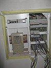 | |
| craft | floorer | Workplace or office of a floorer which is a tradesman specialized in laying floors. See also craft=parquet_layer craft=carpet_layer craft=tiler |
 | |
| craft | gardener | Tuinman |  | |
| craft | glaziery | Glaszetter |  | |
| craft | handicraft | Handwerk |  | |
| craft | hvac | Verwarming, Koeling en Air conditioning, Ventilatie |  | |
| craft | insulation | Isolatie benodigdheden |  | |
| craft | jeweller | Juwelier. Zie ook shop=jewelry voor juwelierszaken die hoofdzakelijk winkels zijn. |  | |
| craft | joiner | An artisan who builds things by joining pieces of wood, particularly furniture or ornamental work. |  | |
| craft | key_cutter | A place where keys can be duplicated from originals. |  | |
| craft | locksmith | A place where locks and keys are created or repaired. |  | |
| craft | metal_construction | A place where handrails, gates, ramps and similar things from metal are made. |  | |
| craft | optician | A place where lenses for the correction of a person's vision are designed, fitted and dispensed. |  | |
| craft | painter | Schilder |  | |
| craft | parquet_layer | Workplace or office of a parquet layer. |  | |
| craft | photographer | Fotograaf |  | |
| craft | photographic_laboratory | A place where photos taken on a film or digital images are transformed into a more permanent form, often on paper or plastic foil. |  | |
| craft | piano_tuner | A piano tuner or technician. A professional that tunes, regulates and makes the maintenance of pianos. Most of them repair simple problems and some restore a whole piano. |  | |
| craft | plasterer | Workplace or office of a tradesman who works with plaster, such as forming a layer of plaster on an interior wall or plaster decorative moldings on ceilings or walls. |  | |
| craft | plumber | Loodgieter |  | |
| craft | pottery | Pottenbakker |  | |
| craft | rigger | Workplace or office of a person who makes masts, yards, sails, and cordage for sailboats and sailing ships. | ||
| craft | roofer | Workplace or office of a tradesman who is specialized in roof construction. |  | |
| craft | saddler | A place where saddles or accessories for cars and boats are produced or repaired. |  | |
| craft | sailmaker | Workplace or office of a person who makes and repairs sails for sailboats and sailing ships, typically working on shore in a sail loft. |  | |
| craft | sawmill | Houtzagerij |  | |
| craft | scaffolder | Workplace or office of a tradesman who builds temporary structure used to support people and material in the construction or repair of buildings and other large structures. |  | |
| craft | sculptor | A place where sculptures are made. |  | |
| craft | shoemaker | Schoenmaker |  | |
| craft | stand_builder | Workplace of a company that builds stands/booths for fairs. |  | |
| craft | stonemason | A place where rough pieces of rock are shaped into accurate geometrical shapes. |  | |
| craft | stove_fitter | A workplace/office of a person/company who designs and builds stoves/tiled stoves. |  | |
| craft | sun_protection | A place where sun protection is made, repaired, or delivered for assembly, especially awnings and shutters. |  | |
| craft | tailor | Kleermaker |  | |
| craft | tiler | Tegelzetter |  | |
| craft | tinsmith | A tinsmith, or tinner or tinker or tinplate worker. Workplace or office of a person who makes and repairs things made of light-coloured metal, particularly tinware. |  | |
| craft | turner | A turner or wood turner. |  | |
| craft | upholsterer | A place where furniture, especially seats are provided with padding, springs, webbing, and fabric or leather covers. |  | |
| craft | watchmaker | Horlogemaker |  | |
| craft | window_construction | Construct windows |  | |
| craft | winery | Produces wine |  | |
| craft | zelf gedefinieerd | Zie ook Taginfo[8] voor meer informatie. |
This table is a wiki template with a default description in English. Editable here.
Emergency (In geval van nood)
Met de sleutel emergency worden de faciliteiten en de hulpmiddelen van hulpdiensten, en de toegankelijkheid voor hulpdiensten, vastgelegd. Zie de pagina Emergency voor een introductie tot het gebruik ervan.
| Sleutel | Waarde | Element | Comment | Weergave op kaart | Foto | |
|---|---|---|---|---|---|---|
Hulpdiensten | ||||||
| emergency | ambulance_station | Een ambulancestation: een bouwwerk of een gebied dat gereserveerd is voor de opslag van ambulancevoertuigen, medische apparatuur, persoonsbeschermingsmiddelen en andere artikelen die van belang zijn voor de ambulancedienst. |  | |||
| emergency | defibrillator | Een defibrillator, ook wel AED (Automated External Defibrillator) genoemd: een toestel waarmee men door het toedienen van een elektrische schok het fibrilleren van het hart van een bewusteloze patiënt kan laten stoppen, waardoor het normale hartritme hersteld wordt. Voorheen getagd als emergency=aed or medical=aed. |  | |||
Brandweer | ||||||
| emergency | fire_extinguisher | Een brandblusser: een apparaat voor het blussen van kleine branden. Een brandblusser wordt veelal in noodsituaties gebruikt. |  | |||
| emergency | fire_flapper | Een vuurzweep: een soort zwabber om een beginnende brand mee te doven. Deze wordt met name ingezet bij het bestrijden van kleine branden in landelijk gebied, zoals heidevelden. |  | |||
| emergency | fire_hose | Een brandslang: een slang van soepele stof waardoor het water, schuim of andere (vloei)stof van een brandspuit geleid wordt naar een brand om deze te bestrijden. |  | |||
| emergency | fire_hydrant | Een brandkraan of hydrant: een grote kraan aan de waterleiding op straat waaraan brandslangen aangesloten kunnen worden. Brandkranen zijn vooral te vinden in stedelijke omgevingen en bieden de brandweer een bron van water om de brandbestrijding te ondersteunen. |  | |||
| emergency | water_tank | Bluswatertank: Een grote (meestal ondergrondse) opslagtank voor water dat bestemd is voor brandbestrijding. |  | |||
| emergency | fire_water_pond | Brandvijver: Een gegraven of natuurlijke vijver die is bestemd voor brandbestrijding. |  | |||
| emergency | suction_point | Opzuigpunt: Een aangewezen punt bij een rivier of andere watergang waar water kan worden opgepompt voor brandbestrijding. | ||||
Reddingsbrigade of strandwacht | ||||||
| emergency | lifeguard_base | De centrale plaats voor voertuigen en hulpmiddelen van de reddingsbrigade, alsmede de communicatie onderling. |  | |||
| emergency | lifeguard_tower | Een wachttoren die wordt gebruikt door de reddingsbridgade om zwemmers in de gaten te houden, teneinde de voorkomen dat zwemmers verdrinken of anderszins in de problemen komen. |  | |||
| emergency | lifeguard_platform | Een platform dat gebruikt wordt door de strandwacht. |  | |||
| emergency | lifeguard_place | De centrale standplaats van de strandwacht. |  | |||
| emergency | life_ring | Een reddingsboei is een hulpmiddel van de reddingsbrigade waarmee een drenkeling ondersteund kan worden bij het blijven drijven. |  | |||
Overige | ||||||
| emergency | assembly_point | Verzamelplaats bij ontruiming, vaak bij een complex waar meerdere personen werkzaam zijn. |  | |||
| emergency | access_point | Een bord met een nummer of code, dat dient om de huidige positie te bepalen in geval van nood. Het kan tevens dienen als verzamelpunt voor hulpdiensten. (vervangt highway=emergency_access_point) |  | |||
| emergency | phone | Een publiek toegankelijke vaste telefoon, die gebruikt kan worden voor noodoproepen aan de hulpdiensten. |  | |||
| emergency | ses_station | State Emergency Service is een Australische organisatie zonder winstoogmerk, die assistentie verleent gedurende en na afloop van nader te bepalen (natuur-)rampen. |  | |||
| emergency | siren | Sirene: Toestel dat in geval van nood scherpe en doordringende geluiden produceert. Een veelvoorkomend gebruik is het luchtalarmsysteem, dat gebruikt wordt voor noodsituaties, zoals acuut gevaar door luchtaanvallen, natuurrampen of verspreiding van gevaarlijke dampen. |  | |||
| emergency | user defined | All commonly used values in base a Taginfo | ||||
Toerisme
| Waarde | Element | Omschrijving | Resultaat | Foto |
|---|---|---|---|---|
| alpine_hut | Berghut |  | ||
| apartment | A holiday or vacation apartment is a furnished apartment or flat with cooking and bathroom facilities that can be rented for holiday vacations. This tag can be applied to a building accommodating one or more holiday flats. |  | ||
| aquarium | A |
 | ||
| artwork | Kunstwerk
(in openbare ruimte). |
 | ||
| attraction | Toeristische attractie |  | ||
| camp_pitch | A camp pitch is a free space used to place a tent or a caravan within a tourism=camp_site or tourism=caravan_site area. |  | ||
| camp_site | Camping |  | ||
| caravan_site | Caravanterrein |  | ||
| chalet | Rent-a-hut
kan ook worden gebruikt voor een Bungalowpark |
 | ||
| gallery | An |
 | ||
| guest_house | Pension, Bed & Breakfast |  | ||
| hostel | Jeugdherberg |  | ||
| hotel | Hotel |  | ||
| information | Toeristisch Informatiepunt
VVV. |
 | ||
| motel | Motel |  | ||
| museum | Museum |  | ||
| picnic_site | Picknick plaats |  | ||
| theme_park | Themapark
(bijvoorbeeld de Efteling). |
 |
 | |
| trail_riding_station | A trail riding station offers temporary accommodation for guest horses and usually also for riders. |  | ||
| viewpoint | Uitzichtpunt |  | ||
| wilderness_hut | A |
 | ||
| zoo | Dierentuin |  |
 | |
| yes | Algemene tag om aan te geven dat het gaat om een toeristisch interessant object. | |||
| zelf gedefinieerd | Zie ook Taginfo[9] voor meer informatie. |
This table is a wiki template with a default description in English. Editable here.
Historie
Gebruik railway=preserved voor oude spoorwegen.
| Sleutel | Waarde | Element | Omschrijving | Rendering | Foto |
|---|---|---|---|---|---|
| historic | aircraft | A decommissioned aircraft which generally remains in one place |  | ||
| historic | aqueduct | A historic structure to convey water |  | ||
| historic | archaeological_site | Archeologische site. Plek met een of meer archeologische relicten of van archeologische opgraving. In NL ondermeer bruikbaar voor archeologische rijksmonumenten. |  | ||
| historic | battlefield | Historisch slagveld
Gebruik ook name=* en date=*. Kan zowel op land als op zee zijn |
 | ||
| historic | bomb_crater | Oude bomkrater |  | ||
| historic | building | Historisch gebouw. Tag om toe te voegen aan geschiedkundig interessante gebouwen waar een andere tag aan is gegeven en voor historische gebouwen waar geen specifiekere historische tag aan is te geven. Zie ook heritage=* en ref:rce=* voor monumentale gebouwen. |  | ||
| historic | cannon | Kanon |  | ||
| historic | castle | Kasteel |  | ||
| historic | castle_wall | Kasteelmuur |  |
 | |
| historic | charcoal_pile | Historic site of a charcoal pile. Often still in good condition in hilly forest areas. |  | ||
| historic | church | A building with historical value for Christian religious activities, particularly for worship services. |  | ||
| historic | city_gate | Stadspoort |  | ||
| historic | citywalls | A |
 |
 | |
| historic | farm | A historical farm, kept in its original state. |  | ||
| historic | fort | Fort
Militair gebouw dat gemaakt is ter verdediging van een object of gebied. Een fort heeft in tegenstelling tot kastelen en vestingen geen woonfunctie. |
 | ||
| historic | gallows | A structure designed for capital punishment by hanging. |  | ||
| historic | highwater_mark | A marker for indicating past flood. |  | ||
| historic | locomotive | A decommissioned locomotive which generally remains in one place. |  | ||
| historic | manor | Een buitenplaats, ook wel landhuis of herenhuis genoemd. |  | ||
| historic | memorial | Gedenkplaats
Monument (van beperkte omvang) of gedenkteken, bijvoorbeeld een oorlogsmonument, kan ook een plaquette of gedenksteen in een muur zijn. (Bijna alle Nederlandse "monumenten" vallen hieronder. Conform het gebruik in het Engels van het woord "monument", wordt historic=monument gereserveerd voor grote bouwwerken.) |
 | ||
| historic | mine | Abandoned underground mine workings for minerals such as coal or lead. |  | ||
| historic | minecart | A cart used to transport coal or ore from a mine. |  | ||
| historic | mine_shaft | Vertical shafts of a historic mine |  | ||
| historic | milestone | A historic marker that shows the distance to important destinations. |  | ||
| historic | monastery | Klooster |  | ||
| historic | monument | Monument.
Conform het (van het Nederlands en andere talen afwijkende) gebruik in de Engelse taal van dit woord, wordt "monument" hier gereserveerd voor grote bouwwerken, zoals waar je in kunt lopen of onder door gaan. In Nederland en België zeldzaam, zie ook historic=memorial. |
 | ||
| historic | optical_telegraph | Historic optical telegraph |  | ||
| historic | pillory | A construction designed to immobilitate and humiliate a person who was convicted in lower courts. |  | ||
| historic | railway_car | A decommissioned railway car which generally remains in one place. |  | ||
| historic | ruins | Ruïne (vervallen bouwwerk). |  | ||
| historic | rune_stone | A |
 | ||
| historic | ship | Een oud schip dat op een vaste locatie tentoongesteld wordt.
Een bekend voorbeeld is de HMS Belfast in Londen. |
 | ||
| historic | stone | A stone shaped or placed by man with historical value. |  | ||
| historic | tank | A decommissioned tank which generally remains in one place. |  | ||
| historic | tomb | Historic tomb |  | ||
| historic | tower | Historic tower | |||
| historic |  | ||||
| historic | vehicle | A decommissioned land-based vehicle which generally remains in one place |  | ||
| historic | wayside_cross | Wegkruis
Een in katholieke streken veel voorkomend gedenkteken, meestal in de vorm van een kruis langs wegen en straten. |
 | ||
| historic | wayside_shrine | Kruisbeeld |  | ||
| historic | wreck | Gezonken vaartuig |  | ||
| historic | yes | Historisch belang
Mogelijkheid om aan een andere tag aan te geven dat het object van historisch belang is, waar er geen specifiekere "historische" tag beschikbaar is. |
|||
| historic | user defined | Zie ook Taginfo |
This table is a wiki template with a default description in English. Editable here.
The NL description can be edited here
Grondgebruik
Gebruik natural=* voor niet door mensen bewerkte oppervlakten.
| Key | Waarde | Element | Omschrijving | Resultaat | Foto | |
|---|---|---|---|---|---|---|
Common landuse key values - developed land | ||||||
| landuse | commercial | Commercieel
Vooral diensten en handel, de tertiaire sector |
 |
 | ||
| landuse | construction | Bouwterrein
Hier wordt gebouwd of wordt een gebied "bouwrijp" gemaakt. Als het bouwen klaar is, krijgt het terrein een andere functie en verdwijnt "construction" als "tag". |
 |
 | ||
| landuse | education | Educatie
Aanvulling op amenity=* tags voor educatieve instellingen; met name nuttig wanneer er meerdere instellingen op eenzelfde locatie zijn. |
 | |||
| landuse | fairground | A site where a fair takes place |  | |||
| landuse | industrial | Industriegebied |  |
 | ||
| landuse | residential | Woningen en appartementen (hoofdzakelijk). |  |
 | ||
| landuse | retail | Winkelgebied |  |
 | ||
| landuse | institutional | Land used for institutional purposes, see The meaning of this tag is ambiguous and unclear by some. Consider using another tag that better describes the object. For instance landuse=civic_admin. |
 | |||
| Key | Waarde | Element | Omschrijving | Resultaat | Foto | |
Common landuse key values - rural and agricultural land | ||||||
| landuse | aquaculture | Aquacultuur |  | |||
| landuse | allotments | Volkstuinen |  |
 | ||
| landuse | farmland | Akker |  |
 | ||
| landuse | farmyard | Boerenerf |  |
 | ||
| landuse | paddy | An area of land where the surface and shape of the land is made suitable for growing rice. |  | |||
| landuse | animal_keeping | An area of land that is used to keep animals, particularly horses and livestock. |  | |||
| landuse | flowerbed | Bloembed |  |
 | ||
| landuse | forest | Bosbouw |  |
 | ||
| landuse | logging | An area where some or all trees have been cut down |  | |||
| landuse | greenhouse_horticulture | Glastuinbouw
Afzonderlijke kassen zijn te labelen met building=greenhouse. |
 |
 | ||
| landuse | meadow | Hooiland of Graasweide |  |
 | ||
| landuse | orchard | Boomgaard |  |
 | ||
| landuse | plant_nursery | Plantenkwekerij |  |
 | ||
| landuse | vineyard | Wijngaard |  |
 | ||
| Key | Waarde | Element | Omschrijving | Resultaat | Foto | |
Common landuse key values - waterbody | ||||||
| landuse | basin | Waterbekken (zie ook water=basin) |  |
 | ||
| Verouderde tag voor een stuwmeer. Zie hiervoor water=reservoir. |  |
 | ||||
| landuse | salt_pond | Zoutwinning |  |
 | ||
| Key | Waarde | Element | Omschrijving | Resultaat | Foto | |
Other landuse key values | ||||||
| landuse | brownfield | Braakliggend terrein |  |
 | ||
| landuse | cemetery | Begraafplaats.
Zie ook amenity=grave_yard voor kerkhoven. |
 |
 | ||
| Protected areas (deprecated) Alternate tagging of same thing: boundary=protected_area, protected_area=* | ||||||
| landuse | depot | An area used as a depot for e.g. vehicles (trains, buses or trams). Consider using rather standard landuse tags like landuse=railway, landuse=commercial, landuse=industrial, with subtag like industrial=depot. |  | |||
| landuse | garages | Garageboxen
Aantal garages op een rij, meestal achter of temidden van huizen en eventueel toegankelijk via een highway=service |
 |
 | ||
| landuse | grass | Grasveld
Met landbouwfunctie (grazen en maaien) eerder landuse=meadow. |
 |
 | ||
| landuse | greenfield | Ontwikkelingsgebied |  |

| ||
| landuse | landfill | Vuilstortplaats |  |
 | ||
| landuse | military | Militair terrein. Zie ook military=* en military_service=*. |  |
 | ||
| landuse | port | coastal industrial area where commercial traffic is handled. Consider using landuse=industrial + industrial=port for this type of industrial area. |  | |||
| landuse | quarry | Groeve /Mijnbouw |  |
 | ||
| landuse | railway | Spoorwegemplacement, spoorbedding
In het algemeen ontoegankelijk voor het publiek. |
 |
 | ||
| landuse | recreation_ground | Recreatiegebied |  |
 | ||
| landuse | religious | Religieus |  |
 | ||
| landuse | village_green | Brink (dorpsplein)
Grasvlakte waar kermis, markt of demonstraties gehouden worden (bijvoorbeeld het Malieveld te Den Haag). Zie forumdiscussies [10][11] |
 |
 | ||
| landuse | greenery | Used for any area covered with landscaping or decorative greenery, regardless of it being on a roundabout, along a street or in a park/garden, This tag has been used for vegetation that is hard to classify, either because its kind or because its diversity. |  | |||
| landuse | winter_sports | An area dedicated to winter sports (e.g. skiing) |  | |||
| landuse | zelf gedefinieerd | Zie ook Taginfo[12] voor meer informatie. | ||||
This table is a wiki template with a default description in English. Editable here.
Militair
military=* is voor gebouwen en land dat wordt gebruikt door de landmacht, marine en luchtmacht. Zie ook landuse=military.
| Key | Waarde | Element | Omschrijving | Resultaat | Foto |
|---|---|---|---|---|---|
| military | airfield | Militair vliegveld |  | ||
| military | ammunition | Munitieopslag | |||
| military | barracks | Barakken |  | ||
| military | bunker | Bunker |  | ||
| military | checkpoint | Militair controlepunt |  | ||
| military | danger_area | Gevaarlijk gebied
Zie ook hazard=*. |

|
 | |
| military | launchpad | Lanceerplatform voor militaire doeleinden. Zie aeroway=launchpad voor civiel gebruik. |  | ||
| military | naval_base | Verouderde tag voor een marinebasis. Vervang door landuse=military + military=base + military_service=navy. |  | ||
| military | nuclear_explosion_site | Testlocatie voor nucleaire wapens. |  | ||
| military | obstacle_course | Obstakelparcours voor militairen |  | ||
| military | office | Kantoren voor bijvoorbeeld officieren, rekrutering etc. |  | ||
| military | range | Schietterrein |  | ||
| military | training_area | An area where soldiers train and weapons or other military technology are experimented with or are tested. |  | ||
| military | trench | Loopgraaf |  | ||
| military | zelf gedefinieerd | Zie ook Taginfo[13]] voor meer informatie. |
This table is a wiki template with a default description in English. Editable here.
Natuur
| Key | Waarde | Element | Omschrijving | Resultaat | Foto |
|---|---|---|---|---|---|
Vegetation | |||||
| natural | fell | Hoog Grasland
Grasland in hooglanden in een bergachtige gebieden. Is alleen geschikt om extensief te laten begrazen. |
No, see #545. |  | |
| natural | grassland | Grassen en kruidachtige planten
Natuurlijke gebieden waar de vegetatie wordt overheerst door grassen en kruidachtige (niet-houtige) planten. |
 |
 | |
| natural | heath | Heide |  |
 | |
| natural | moor | Don't use, see wikipage. Upland areas, characterised by low-growing vegetation on acidic soils. | currently not rendered by OSM Carto |  | |
| natural | scrub | Ruig land
Natuurlijke gebieden waar lagere hout-achtige planten (struiken of onvolgroeide bomen) de vegetatie overheersen. |
 |
 | |
| natural | shrubbery | An area of shrubbery that is actively maintained or pruned by humans. A slightly wilder look is also possible | currently not rendered by OSM Carto |  | |
| natural | tree | Alleenstaande of belangrijke bomen |  | ||
| natural | tree_row | Bomenrij |  |
 | |
| natural | tree_stump | A tree stump, the remains of a cut down or broken tree. |  | ||
| natural | tundra | Habitat above tree line in alpine and subpolar regions, principally covered with uncultivated grass, low growing shrubs and mosses and sometimes grazed. |  | ||
| natural | wood | Oerbos
Voor gewone bossen in bewoonde gebieden gebruik dan landuse=forest. |
 |
 | |
|
| |||||
| natural | bay | Baai of golf |  |
 | |
| natural | beach | Strand |  |
 | |
| natural | blowhole | An opening to a sea cave which has grown landwards resulting in blasts of water from the opening due to the wave action |  | ||
| natural | cape | A piece of elevated land sticking out into the sea or large lake. Includes capes, heads, headlands and (water) promontories. |  | ||
| natural | coastline | Kustlijn |  |
 | |
| natural | crevasse | A large crack in a glacier |  | ||
| natural | geyser | A spring characterized by intermittent discharge of water ejected turbulently and accompanied by steam. |  | ||
| natural | glacier | IJsgletsjer |  |
 | |
| natural | hot_spring | A spring of geothermally heated groundwater |  | ||
| natural | isthmus | A narrow strip of land, bordered by water on both sides and connecting two larger land masses. |  | ||
| natural | mud | Slikgronden
Gebied wat altijd nat of vaak overstroomd is, en waar de grond bestaat uit slik ofwel modder. Voor zoutwater moddergronden onder invloed van het getij, is het meestal aan te raden om natural=wetland met wetland=tidalflat te gebruiken. |
 |
 | |
| natural | peninsula | Schiereiland - Zie ook place=peninsula |  | ||
| natural | reef | A feature (rock, sandbar, coral, etc) lying beneath the surface of the water |  | ||
| natural | shingle | An accumulation of rounded rock fragments on a beach or riverbed |  |
 | |
| natural | shoal | An area of the sea floor near the sea surface (literally, becomes shallow) and exposed at low tide. See natural=sand as well. |  |
 | |
| natural | spring | Bron van een beek of rivier |  | ||
| natural | strait | A narrow area of water surrounded by land on two sides and by water on two other sides. |  |
 | |
| natural | water | Water - Meren, vijvers enz. |  |
 | |
| natural | wetland | Moerassen en waterrijke gebieden
Ook bekend als drasland, gebieden die (regelmatig) door water overstroomd worden. Specificeer het gebied verder met wetland=*, zoals wetland=reedbed voor rietgebieden, wetland=marsh voor moeras (lage, niet-houtachtige beplanting) en wetland=swamp voor broekbos (dichtbegroeide hoge hout-achtige beplanting) . |
 |
 | |
|
| |||||
| natural | arch | A rock arch naturally formed by erosion, with an opening underneath. | currently not rendered by OSM Carto |  | |
| natural | arete | An arête, a thin, almost knife-like, ridge of rock which is typically formed when two glaciers erode parallel U-shaped valleys. |  |
 | |
| natural | bare_rock | An area with sparse/no soil or vegetation, so that the bedrock becomes visible. |  |
 | |
| natural | blockfield | A surface covered with boulders or block-sized rocks, usually the result of volcanic activity or associated with alpine and subpolar climates and ice ages. | Currently not rendered by OSM Carto |  | |
| natural | cave_entrance | Grotingang |  | ||
| natural | cliff | Klif |  |
 | |
| natural | dune | A hill of sand formed by wind, covered with no or very little vegetation. See also natural=sand and natural=beach | currently not rendered by OSM Carto |  | |
| natural | earth_bank | Large erosion gully or steep earth bank |  | ||
| natural | fumarole | A fumarole is an opening in a planet's crust, which emits steam and gases |  | ||
| natural | gully | Small scale cut in relief created by water erosion |  | ||
| natural | hill | Heuvel | currently not rendered by OSM Carto |  | |
| natural | peak | Berg- of heuveltop |  | ||
| natural | ridge | A mountain or hill linear landform with a continuous elevated crest |  |
 | |
| natural | rock | A notable rock or group of rocks attached to the underlying bedrock. | currently not rendered by OSM Carto |  | |
| natural | saddle | The lowest point along a ridge or between two mountain tops |  | ||
| natural | sand | Zandvlakte
Zandgebieden mogen spaarzaam wat vegetatie bevatten, bv Grassen of Vliegdennen. |
 |
 | |
| natural | [[ Too many Data Items entities accessed. | scree ]] | Steenvlakte
Vlakte van kleinere stenen en rotsblokken. Wordt ook wel een steengletsjer genoemd. |
 |
 | |
| natural | sinkhole | A natural depression or hole in the surface topography. | currently not rendered by OSM Carto |  | |
| natural | stone | Alleenstaande grote steen of rotsblok | currently not rendered by OSM Carto |  | |
| natural | valley | Vallei | currently not rendered by OSM Carto |  | |
| natural | volcano | Vulkaan |  | ||
| natural | user defined | Zie ook Taginfo[14]] voor meer informatie. | |||
This table is a wiki template with a default description in English. Editable here.
Geologie
This is used to describe the geological makeup of an area. See the page Geological for an introduction on its usage.
| Key | Waarde | Element | Omschrijving | Resultaat | Foto |
|---|---|---|---|---|---|
| geological | moraine | A moraine is any ice formed accumulation of unconsolidated glacial debris (soil and rock) which can occur in currently glaciated and formerly glaciated regions, such as those areas acted upon by glacial ice. |  | ||
| geological | outcrop | An outcrop site is a place where the bedrock or superficial deposits have become locally exposed and are directly accessible to analysis. |  | ||
| geological | palaeontological_site | Paleontologisch vindplaats
Plaats of gebied waar geconsereveerde overblijfselen van prehistorische levensvormen. |
 | ||
| geological | user defined | Zie Taginfo |
This table is a wiki template with a default description in English. Editable here.
The NL description can be edited here
Niet fysiek
Route
Zie ook Relation:route
| Sleutel | Waarde | Element | Omschrijving | Resultaat | Foto |
|---|---|---|---|---|---|
| route | bicycle | Fietsroute
Zie voor verdere informatie Fietsroutes |
 | ||
| route | bus | Buslijn |  | ||
| route | canoe | Signed route for canoeing through a waterway. |  | ||
| route | detour | Uitwijkroute
Zie voor verdere informatie WikiProject Netherlands/Uitwijkroute |

| ||
| route | ferry | Veerbootroute |  |
 | |
| route | foot | Walking Route - is used for routes which are walkable without any limitations regarding fitness, equipment or weather conditions. |  | ||
| route | hiking | Wandelroute
Zie voor verdere informatie WikiProject Nederland Wandelroutes |
 | ||
| route | horse | Riding routes |  | ||
| route | inline_skates | Inline has more information on the subject. | |||
| route | light_rail | Route of a light rail line. |  | ||
| route | mtb | Moutainbikeroute
Zie voor verdere informatie Mountainbike |
 | ||
| route | piste | Skiroute. Voorstel om allerlei wintersportroutes bijeen te brengen. |  | ||
| route | railway | Treinspoor
Route van een benoemde treinroute bv. Brockenbahn (D) en West Coast Express (USA). |
 | ||
| route | road | Voor grote wegennetwerken bijv. Internationaal E-wegennetwerk |  | ||
| route | running | For running (jogging) routes. |  | ||
| route | ski | Skipiste of Langlaufroute |  | ||
| route | subway | Route of a metro service |  | ||
| route | train | Treinroute
Route als deel van een dienstregeling. |
 | ||
| route | tracks | Railroad track as rail infrastructure. |  | ||
| route | tram | Tramlijn |  | ||
| route | trolleybus | The route of a trolleybus service. |  | ||
| route | zelf gedefinieerd | Zie ook Taginfo |
This table is a wiki template with a default description in English. Editable here.
Grenzen
These are used to describe administrative and other boundaries. See the page Boundaries for an introduction on its usage.
| Key | Waarde | Element | Omschrijving | Resultaat | Foto | |
|---|---|---|---|---|---|---|
Boundary types | ||||||
| boundary | aboriginal_lands | A boundary representing official reservation boundaries of recognized aboriginal / indigenous / native peoples. |  |
 | ||
| boundary | administrative | Grens Provincie of Gemeente |  |
 | ||
| boundary | border_zone | A border zone is an area near the border where special restrictions on movement apply. Usually a permit is required for visiting. |  | |||
| boundary | A census-designated boundary delineating a statistical area, not necessarily observable on the ground. |  | ||||
| boundary | forest | A delimited forest is a land which is predominantly wooded and which is, for this reason, given defined boundaries. It may cover different tree stands, non-wooded areas, highways… but all the area within the boundaries are considered and managed as a single forest. |  | |||
| boundary | forest_compartment | A forest compartment is a numbered sub-division within a delimited forest, physically materialized with visible, typically cleared, boundaries. |  | |||
| boundary | hazard | A designated hazardous area, with a potential source of damage to health, life, property, or any other interest of value. |  | |||
| boundary | health | Health division boundaries. Some mappers use health_level=* instead of admin_level=* to specify level in the health system hierarchy. | ||||
| boundary | historic | A historic administrative boundary (use judiciously). |  | |||
| boundary | local_authority | Describes the territory of a local authority. | ||||
| boundary | low_emission_zone | A geographically defined area which seeks to restrict or deter access by certain polluting vehicles with the aim of improving the air quality. |  | |||
| boundary | maritime | Grens Watergebied.
Bijvoorbeeld Territoriale wateren. |
 | |||
| boundary | marker | A boundary marker, border marker, boundary stone, or border stone is a robust physical marker that identifies the start of a land boundary or the change in a boundary, especially a change in direction of a boundary. See also historic=boundary_stone |  | |||
| boundary | national_park | Nationaal park
Natuurpark met beschermde status (bijvoorbeeld de Hoge Veluwe). |
 |
 | ||
| boundary | place | boundary=place is commonly used to map the boundaries of a place=*, when these boundaries can be defined but these are not administrative boundaries. | ||||
| boundary | political | Grens Kiesdistrict | ||||
| boundary | postal_code | Postal code boundaries. Some mappers use postal_code_level=* instead of admin_level=* to specify level in the postal hierarchy. | ||||
| boundary | protected_area | Beschermd gebied
Voorbeeld "Beschermd Landschaps- of stadsgezicht". |
 | |||
| boundary | religious_administration | A religious administration boundary, eg. of a catholic diocese or parish. Use religion=* and denomination=* to specify the church to which the boundary applies. Some mappers use religious_level=* instead of admin_level=* to specify level in the church hierarchy. | ||||
| boundary | special_economic_zone | A government-defined area in which business and trade laws are different. |  | |||
| boundary | statistical | An official boundary recognised by government for statistical purposes. |
 | |||
| boundary | disputed | An area of landed claimed by two or more parties (use with caution). See also Disputed territories. |  | |||
| boundary | timezone | Boundaries of time zone |  | |||
| boundary | user defined | All commonly used values according to Taginfo | ||||
Attributes | ||||||
| admin_level | (number) | Defines level of the division described by the boundary in the hierarchy system to which the division belongs. Usually in the range 1 to 10 (except for several countries, where it is in the range 1 to 11 – Bolivia, Germany, Mozambique, Netherlands, Philippines, Poland, Turkmenistan, Venezuela – see boundary). |  | |||
| health_level | (number) | Used by some mappers instead of admin_level=* in conjunction with boundary=health and is usually in the range 1 to 10. | ||||
| postal_code_level | (number) | Used by some mappers instead of admin_level=* in conjunction with boundary=postal_code and is usually in the range 1 to 10. | ||||
| religious_level | (number) | Used by some mappers instead of admin_level=* in conjunction with boundary=religious_administration and is usually in the range 1 to 10. | ||||
| border_type | * | To distinguish between types of boundary where admin_level isn't enough. Used in several different ways e.g in maritime contexts. | ||||
| start_date | (date) | Useful if the boundary is very recent (or if it will become effective in a near future). |  | |||
This table is a wiki template with a default description in English. Editable here. The NL description can be edited here
Sport
This is used to provide information about which sports are placed on a facility such as a pitch or stadium. It is intended to be used in conjunction with tags landuse=* or leisure=*. See the page titled Sport for an introduction on its usage.
| Key | Waarde | Element | Omschrijving | Resultaat | Foto |
|---|---|---|---|---|---|
| sport | 9pin | Kegelen |  |
 | |
| sport | 10pin | Bowling |  |
 | |
| sport | aerobics | Aerobics |  | ||
| sport | american_football | Amerikaans voetbal |  |
 | |
| sport | aikido | Useful combination: amenity=dojo See Also: sport=judo;taekwondo |
 |
 | |
| sport | archery | Boogschieten
De verschillende vormen (FITA, Compound,3D) kunnen met type=* worden gespecificeerd. |
 |
 | |
| sport | athletics | Atletiek |  |
 | |
| sport | australian_football | Australisch voetbal |  | ||
| sport | badminton | Useful combination: leisure=pitch;sports_centre See Also: sport=tennis;paddle_tennis;table_tennis |
 |
 | |
| sport | bandy | Useful combination: leisure=pitch;stadium;sports_centre, surface=* See Also: sport=ice_hockey;soccer;field_hockey |
 |
 | |
| sport | base | Useful combination: building=*, man_made=*, bridge=*, natural=cliff See Also: sport=cliff_diving;free_flying |
 | ||
| sport | baseball | Honkbal |  |
 | |
| sport | basketball | Basketbal |  |
 | |
| sport | beachvolleyball | Strandvolleybal |  |
 | |
| sport | biathlon | The biathlon is a winter sport that combines cross-country skiing and rifle shooting. |  |
 | |
| sport | billiards | Useful combination: leisure=bowling_alley, amenity=bar;pub;restaurant See Also: sport=darts;10pin;horseshoes |
 |
 | |
| sport | bmx | Fietscross |  |
 | |
| sport | bobsleigh | Useful combination: leisure=track;sports_centre, surface=* See Also: sport=toboggan, Piste Maps, Winter sports |
  |
 | |
| sport | boules | Petanque, Jeu de boule |  |
 | |
| sport | bowls | Bowlen |  |
 | |
| sport | boxing | Useful combination: leisure=stadium;sports_centre;pitch, surface=* See Also: sport=aikido;fencing;athletics |
 |
 | |
| sport | bullfighting | Useful combination: leisure=stadium;pitch |
 | ||
| sport | canadian_football | Canadees Voetbal |  |
 | |
| sport | canoe | Kanovaren |  |
 | |
| sport | chess | Schaken |  |
 | |
| sport | cliff_diving | Useful combination: natural=cliff, height=*, depth=*, tidal=*, surface=*, note=* See Also: sport=climbing;swimming |
 |
 | |
| sport | climbing | Klimsport |  |
 | |
| sport | climbing_adventure | Useful combination: landuse=recreation_ground, leisure=sports_centre See Also: sport=climbing |
 | ||
| sport | cockfighting | Useful combination: leisure=pitch for informal rings. |
 | ||
| sport | cricket | Cricket |  |
 | |
| Cricket oefenbaan |  | ||||
| sport | crossfit | CrossFit, a branded fitness regimen |  | ||
| sport | croquet | Croquet |  |
 | |
| sport | curling | Useful combination: leisure=pitch;stadium;sports_centre See Also: sport=ice_stock;bowls;boules, surface=* |
 |
 | |
| sport | cycle_polo | A cycle polo |  | ||
| sport | cycling | Wielrennen, Fietsen |  |
 | |
| sport | dance | Generic dance sport. |  | ||
| sport | darts | Useful combination: amenity=bar;pub;restaurant, leisure=bowling_alley See Also: sport=billiards;10pin;horseshoes |
 |
 | |
| Sportduiken | |||||
| sport | dog_agility | Dog agility is a dog sport in which a handler directs a dog through an obstacle course in a race for both time and accuracy. |  | ||
| sport | dog_racing | Windhondenrennen |  | ||
| sport | dragon_boat | Ancient Chinese boat | |||
| sport | equestrian | Manege, Recreatief Paardrijden. |  |
 | |
| sport | fencing | Useful combination: leisure=pitch;stadium;sports_centre, surface=* See Also: sport=boxing;wrestling |
 |
 | |
| sport | field_hockey | Useful combination: leisure=pitch;sports_centre;stadium See Also: sport=ice_hockey;ice_skating |
 |
 | |
| sport | fitness | To develop physical fitness |  | ||
| sport | five-a-side | A variation of soccer with only 5 persons per team on a smaller pitch |  | ||
| sport | floorball | Floorball is a type of floor hockey with five players and a goalkeeper in each team. |  | ||
| sport | four_square | A hand ball game played on a square court. | |||
| Football (voor voetbal, zie sport=soccer). | |||||
| sport | free_flying |   |
 | ||
| sport | futsal | Futsal is a sport played by two teams of five players on a rectangular court. |  |
 | |
| sport | gaelic_games | Gaelic Games
Traditioneel Ierse Sporten. De belangrijksten zijn: Gaelic football en Hurling |
 | ||
| sport | gaga | Gaga (or gaga ball) is a variant of dodgeball that is played in a gaga "pit" |  | ||
| sport | golf | Golf |  |
 | |
| sport | gymnastics | Turnen |  |
 | |
| sport | handball |  |
 | ||
| sport | hapkido | Useful combination: amenity=dojo See Also: sport=aikido;judo;taekwondo |
 | ||
| sport | hiking | Going for a long, vigorous walk, usually on trails or footpaths in the countryside. |  | ||
| Hockey | |||||
| sport | horseshoes | Hoefijzergooien |  | ||
| sport | horse_racing | Paardenrennen |  |
 | |
| sport | ice_hockey | Useful combination: Lua error in mw.title.lua at line 230: too many expensive function calls. See Also: sport=field_hockey;ice_skating |
 |
 | |
| sport | ice_skating | Useful combination: Lua error in mw.title.lua at line 230: too many expensive function calls. See Also: Lua error in mw.title.lua at line 230: too many expensive function calls. The disambiguous Lua error in mw.title.lua at line 230: too many expensive function calls. tag is sometimes confused with this one. |
  |
 | |
| sport | ice_stock | Eisstockschiessen |  | ||
| sport | judo |  |
 | ||
| sport | karate | Karate. |  |
 | |
| sport | karting | See also Lua error in mw.title.lua at line 230: too many expensive function calls. |
 | ||
| sport | kickboxing | Kickboxing is a group of stand-up combat sports based on kicking and punching. |  | ||
| sport | kitesurfing |  | |||
| sport | korfball | Korfbal |  |
 | |
| sport | krachtbal | Team sport played with a heavy ball on a rectangular pitch, originating in West-Flanders, Belgium | |||
| sport | lacrosse | A team sport played with a lacrosse stick and a lacrosse ball. Players use the head of the lacrosse stick to carry pass, catch, and shoot the ball into the goal. |  | ||
| sport | laser_tag | Laser tag is a tag game played in an arena. |  | ||
| sport | martial_arts |  | |||
| sport | miniature_golf | Miniature golf, also known as minigolf, mini-putt, crazy golf, or putt-putt, is an offshoot of the sport of golf focusing solely on the putting aspect of its parent game. |  | ||
| sport | model_aerodrome |  | |||
| sport | motocross | See also Lua error in mw.title.lua at line 230: too many expensive function calls. |
 | ||
| sport | motor | Motorrace |  | ||
| sport | multi | Meervoudige sporten
Deze tag kan gebruikt worden dat er veel sporten uitgeoefend kunnen worden. Alternatief is uiteraard om alle sporten in kwestie te noemen. |
 | ||
| sport | netball |  |
 | ||
| sport | obstacle_course |  | |||
| sport | orienteering | Oriëntatieloop |  |
 | |
| sport | paddle_tennis | Paddle Tennis |  | ||
| sport | padel | A racket sport played in pairs. It consists of bouncing the ball in the opponent's court, with the possibility of bouncing it off the walls. |  | ||
| sport | paintball | A game in which players mark their opponents with colored paint capsules shot out of an air gun. |  | ||
| sport | parachuting |  | |||
| Parapente |   |
 | |||
| sport | parkour | Parkour is a training discipline using movement that developed from military obstacle course training. |  | ||
| sport | pelota | Pelota |   |
 | |
| sport | pesäpallo | Pesäpallo, sometimes known as Finnish baseball, is a fast-moving bat-and-ball sport where the offense tries to score by hitting the ball successfully and running through the bases, while the defense tries to put the batter and runners out. |  |
 | |
| sport | pickleball | Pickleball, a tennis-like game played with a slower ball on a smaller court. |  | ||
| sport | pilates | Pilates is a physical fitness system developed in the early 20th century by Joseph Pilates. |  | ||
| sport | pole_dance | Pole dance as kind of sport |  | ||
| sport | powerlifting |  |
 | ||
| sport | racquet | Racquet |  |
 | |
| sport | rc_car |  | |||
| sport | roller_skating | See Also: Lua error in mw.title.lua at line 230: too many expensive function calls. The disambiguous Lua error in mw.title.lua at line 230: too many expensive function calls. tag is sometimes confused with this one. |
  |
 | |
| sport | rowing | Roeien |  |
 | |
| sport | rugby_league | Rugby League |  |
 | |
| sport | rugby_union | Rugby Union |  |
 | |
| sport | running |  |
 | ||
 | |||||
| sport | sailing |  |
 | ||
| sport | scuba_diving |  |
 | ||
| sport | shooting | Schietsport |  |
 | |
| sport | shot-put | Shot-put is a sport involving throwing a heavy spherical object as far as possible. |  | ||
| Skaten | |||||
| sport | skateboard | Skateboarden |  |
 | |
| sport | ski_jumping | Ski jumping is a winter sport in which competitors aim to achieve the longest jump after descending from a specially designed ramp on their skis. |  |
 | |
| Skiën |  |
 | |||
| sport | snooker | Snooker is a cue sport that is played on a rectangular table covered with a green cloth with pockets at each of the four corners and in the middle of each long side. |  | ||
| sport | soccer | Voetbal |  |
 | |
| sport | softball | A bat-and-ball game similar to baseball. |  |
 | |
| sport | speedway | Motorcycle speedway, usually referred to as speedway, is a motorcycle sport involving four and sometimes up to six riders competing over four anti-clockwise laps of an oval circuit. |  | ||
| sport | squash | Squash is a racket and ball sport played by two or four players in a four-walled court with a small, hollow rubber ball. |  |
 | |
| sport | sumo |  | |||
| sport | surfing | Surfen |  |
 | |
| sport | swimming | Zwemmen |  |
 | |
| sport | table_tennis | Tafeltennis |  |
 | |
| sport | table_soccer | Useful combination: amenity=pub;bar;restaurant See Also: sport=soccer;table_tennis;billiards, leisure=amusement_arcade;adult_gaming_centre, Lua error in mw.title.lua at line 230: too many expensive function calls. |
 |
 | |
| sport | taekwondo |  |
 | ||
| sport | tennis | Tennis |  |
 | |
| sport | teqball | Place for playing teqball. |  | ||
| sport | toboggan | Toboggan |  | ||
| sport | trampoline | Trampoline sport is a sport that is carried on large trampolines indoor or outdoors |  | ||
| sport | ultimate | Ultimate, also known as ultimate frisbee, is a team sport played with a flying disc (frisbee). |  | ||
| sport | ultralight_aviation |  | |||
| sport | volleyball | Volleybal |  |
 | |
| sport | wakeboarding | Wakeboarding is a water sport in which the rider, standing on a wakeboard, is towed behind a motorboat in order to perform aerial maneuvers. |  |
 | |
| sport | water_polo |  |
 | ||
| sport | water_ski | Waterskiën |  |
 | |
| sport | weightlifting |  |
 | ||
| sport | windsurfing | Wind powered board on water. |  | ||
| sport | wrestling |  |
 | ||
| sport | yoga |  | |||
| sport | Lua error in mw.title.lua at line 230: too many expensive function calls. | A traditional system of athletics. |  | ||
| sport | user defined | All commonly used values according to Taginfo |
This table is a wiki template with a default description in English. Editable here. The NL description can be edited here
(Lijnvormig)landgebruik (abutters)
Deze opties geven aan waaronder de Aanwononden vallen. Alleen gebruiken wanneer landuse=* niet goed mogelijk is (bijvoorbeeld door ontbreken van luchtfoto's) of om bijvoorbeeld een weg extra te specificeren.
| Key | Waarde | Element | Omschrijving | Foto |
|---|---|---|---|---|
| abutters | commercial | Kantoren | 
| |
| abutters | industrial | Industrie | 
| |
| abutters | mixed | Gemixed | ||
| abutters | residential | Woningen en Appartementen | 
| |
| abutters | retail | Winkels | ||
| abutters | user defined | All commonly used values according to Taginfo |
This table is a wiki template with a default description in English. Editable here. The NL description can be edited here
Eigenschappen (properties)
Properties are those keys and tags which, in contrast to top-level tags, are used to give additional information of a general nature about another element.
| Key | Waarde | Element | Omschrijving | Foto |
|---|---|---|---|---|
| area | yes | Gebied
Kleurt een gesloten weg in. (Bijvoorbeeld voor pleinen Lua error in mw.title.lua at line 230: too many expensive function calls.) |
 | |
| brand | user defined | Brand of the feature. |  | |
| bridge | yes / aqueduct / viaduct / cantilever / movable / covered / … | Brug.
Gebruik samen met layer=* en Lua error in mw.title.lua at line 230: too many expensive function calls.. maxheight=* moet ook gebruikt worden op het weggedeelte onder een brug. ('aqueduct' is Engels voor 'aquaduct'). |
 | |
| capacity | amount | Used for specifying capacity of a facility. |  | |
| charge | amount | Used for specifying how much is charged for use/access to a facility. See Lua error in mw.title.lua at line 230: too many expensive function calls. or Lua error in mw.title.lua at line 230: too many expensive function calls.. | ||
| clothes | see key's page | Tagged on shops and other features to denote if they sell clothes or not and what type of clothes they sell. |  | |
| covered | yes | Used to denote that a node, way or area is covered by another entity (or in some cases the ground), when the use of layers is inappropriate, or additional clarification is needed. |  | |
| crossing | no / traffic_signals / uncontrolled / island / unmarked | Soort Oversteekplaats.
Te gebruiken met Lua error in mw.title.lua at line 230: too many expensive function calls. of Lua error in mw.title.lua at line 230: too many expensive function calls.. |
 | |
| crossing:island | yes / no | Specifies whether a pedestrian crossing has a refuge island |  | |
| cutting | yes / left / right | Landuitsnijding
Een uitsnijding uit een terrein ten behoeve van een weg of spoorlijn. Vaak in heuvels of bergachtige gebieden. bron. |
 | |
| disused | yes | In onbruik geraakt
Wanneer het object nog wel zichtbaar is, maar duidelijk zijn functie niet meer vervult. Voorbeeld is een watertoren. |
 | |
| drinking_water | yes / no | Describes whether a drinking water is available |  | |
| drive_through | yes / no | Used to indicate if a pharmacy, bank, atm, or fast_food, or post_box offers drive_thru service. Lua error in mw.title.lua at line 230: too many expensive function calls. is different than Lua error in mw.title.lua at line 230: too many expensive function calls.} |  | |
| drive_in | yes / no | Used to indicate if a cinema is a drive-in cinema or a restaurant offers drive-in service. Lua error in mw.title.lua at line 230: too many expensive function calls. is different than Lua error in mw.title.lua at line 230: too many expensive function calls. |  | |
| electrified | contact_line / rail | Indicates infrastructure to supply vehicles with electricity on rail tracks |  | |
| ele | Number | Hoogte
Hoogte in meters boven zeeniveau. |
 | |
| embankment | yes | Dijk.
Een opgehoogd stuk land ten behoeve van een weg, spoorlijn of kanaal door een laag-liggend of nat gebied. In Nederland te gebruiken voor het aangeven van dijken. bron. |
 | |
| end_date | Date | Verwijderingsdatum
Datum waarop het object was verwijderd. Let op: Omdat OSM alleen de werkelijkheid registreerd is deze tag onbruikbaar. |
 | |
| est_width | Number | Geschatte breedte
Geschatte (straat)Breedte in meters |
 | |
| fee | yes / no | Used for specifying whether fee is charged for use/access to a facility. See also Lua error in mw.title.lua at line 230: too many expensive function calls.. |  | |
| fire_object:type | poo / szo | Potentially dangerous and socially significant objects | ||
| fire_operator | Name | Fire station, which serves the object | ||
| fire_rank | 1bis / 2 to 5 | Rank fire, defined for a particular object | ||
| frequency | Number | Frequency in Hz |  | |
| hazard | see hazard | Indicates of the hazards. |  | |
| hot_water | yes / no | Describes whether a hot water is available | ||
| inscription | User Defined | The full text of inscriptions, which can be found on buildings, memorials and other objects. |  | |
| internet_access | yes / wired / wlan / terminal / no | This tag is for indication that a map entity such as a building, a shop, restaurant, etc. offers internet access to the public, either as a paid service or even for free. |  | |
| layer | -5 to 5 | Laag
Bepaalt de verticale plaats ten opzichte van andere objecten wanneer deze overlappen of elkaar kruisen (bepaalt de afhandelvolgorde bij renderen).
|
 | |
| leaf_cycle | evergreen / deciduous / semi_evergreen / semi_deciduous / mixed | Describes the phenology of leaves |  | |
| leaf_type | broadleaved / needleleaved / mixed / leafless | Describes the type of leaves |  | |
| location | underground / overground / underwater / roof / indoor | Location |  | |
| narrow | yes | Smaller wordend
Geeft aan dat (een deel van) de betrokken (water)weg hinderlijk smal is. |
 | |
| nudism | yes / obligatory / designated / no / customary / permissive | Indicates if the described object provides the possibility of nudism |  | |
| opening_hours | 24/7 or mo md hh:mm-hh:mm. (read described syntax) | Openingstijden
Zie in de taginfo voor manieren van noteren. |
 | |
| opening_hours:drive_through | 24/7 or mo md hh:mm-hh:mm. (read described syntax) | opening_hours describes when something is open for drive-through services. |  | |
| operator | User Defined | Verantwoordelijke instantie
De naam van de instelling of het bedrijf welke verantwoordelijk is voor het object. |
||
| power_supply | yes / no | Describes whether a power supply is available |  | |
| produce | User Defined | Describes a feature's agricultural output produced though a natural process of growing or breeding. |  | |
| rental | see key's page | Tagged on shops and other features to denote if they rent something or not and what they rent. |  | |
| sauna | yes / no | Describes whether a sauna is available |  | |
| service_times | see opening_hours | Times of service of a given feature e.g. church service |  | |
| shower | yes / no | Describes whether a shower is available |  | |
| sport | soccer / tennis / basketball / baseball / multi / ... | Describes which sports are placed on a facility such as a pitch or stadium. |  | |
| start_date | Date | Aanvangsdatum
Datum waarop het object (gebouw, standbeeld etc) was opgericht. |
 | |
| tactile_paving | yes /no | Tactiele tegels
Voelbare (tactiel) tegels voor het creeeren van geleide paden voor blinden. |
 | |
| tidal | yes | Area is flooded by the tide |  | |
| toilets | yes / no | Describes whether a toilets is available |  | |
| topless | yes / no | Indicates if the described object provides the possibility of female topless practice |  | |
| tunnel | yes | Tunnel. |  | |
| toilets:wheelchair | yes / no | States if a location has a wheelchair accessible toilet or not. |  | |
| wheelchair | yes / no / limited | Geschikt voor rolstoelgebruikers |  | |
| width | Number | Breedte
(Straat)Breedte in meters. |
 | |
| Applies to landuse=forest and Lua error in mw.title.lua at line 230: too many expensive function calls. detailing the sort of trees found within each landuse. Makes most sense when applied to areas. Be careful : this tag is now deprecated, please use instead Lua error in mw.title.lua at line 230: too many expensive function calls. |
 |
Toegangsrechten of toegangsbeperking (Restrictions)
This is used to define restrictions that apply to the associated element. See the page titled Restrictions for an introduction on its usage.
| Key | Waarde | Element | Omschrijving | Foto | ||
|---|---|---|---|---|---|---|
| Vehicle types | ||||||
| access | Lua error in mw.title.lua at line 230: too many expensive function calls. Lua error in mw.title.lua at line 230: too many expensive function calls. Lua error in mw.title.lua at line 230: too many expensive function calls. Lua error in mw.title.lua at line 230: too many expensive function calls. Lua error in mw.title.lua at line 230: too many expensive function calls. Lua error in mw.title.lua at line 230: too many expensive function calls. Lua error in mw.title.lua at line 230: too many expensive function calls. Lua error in mw.title.lua at line 230: too many expensive function calls. Lua error in mw.title.lua at line 230: too many expensive function calls. Lua error in mw.title.lua at line 230: too many expensive function calls. |
Toegangsrechten algemeen
yes / / official / private / permissive / destination / delivery / agricultural / forestry / unknown / no |
||||
| agricultural | yes / no | Access permission for agricultural vehicles, e.g. tractors. | ||||
| atv | For values see access above | Access restricted to wheeled vehicles 1.27m (50 inches) or less in width, for example |
||||
| bdouble | For values see access above | Access permission for |
||||
| bicycle | For values see access above + dismount | Toegangsrechten voor rijwiel zonder verbrandingsmotor
Voor mogelijke waarden zie boven. |
||||
| boat | For values see access above | Toegangsrechten voor pleziervaart (geen motorschepen)??. Voor mogelijke waarden zie boven. | ||||
| bus | For values see access above | Access permission for buses acting as public transport vehicles | ||||
| carriage | For values see access above | Access permission for carriage drawn by horse(s) or other animals | ||||
| cycle_rickshaw | For values see access above | Access permission for two-tracked human powered pedal vehicles | ||||
| electric_bicycle | For values see access above | Access permission for electric bicycles (mostly defined as having a maximum speed of 25 km/h) | ||||
| emergency | yes | Toegangsrechten voor gemotoriseerde hulpdiensten; bv. ambulance, brandweer en politie. |  | |||
| foot | For values see access above | Toegangsrechten voor voetgangers. Voor mogelijke waarden zie boven. | ||||
| forestry | yes / no | Access permission for forestry vehicles, e.g. tractors. | ||||
| golf_cart | For values see access above | Access permission for golf carts and similar small, low-speed electric vehicles | ||||
| goods | For values see access above | Toegangsrechten voor vrachtverkeer. Voor mogelijke waarden zie boven. | ||||
| hand_cart | For values see access above | Access permission for human-pulled/pushed hand carts | ||||
| hazmat | For values see access above | Access permission for vehicles carrying hazardous materials. |  | |||
| hgv | For values see access above | Toegangsrechten voor zwaar vrachtverkeer. Voor mogelijke waarden zie boven. | ||||
| horse | For values see access above | Toegangsrechten voor ruiters. Voor mogelijke waarden zie boven. | ||||
| hov | For values see access above | Access permission for high-occupancy vehicles | ||||
| inline_skates | yes / no | Access permission for |
||||
| lhv | For values see access above | Access permission for |
||||
| mofa | For values see access above | Access permission for |
||||
| moped | For values see access above | Access permission for |
||||
| motorboat | For values see access above | Toegangsrechten voor motorboten. Voor mogelijke waarden zie boven. | ||||
| motorcar | For values see access above | Toegangsrechten voor gemotoriseerd (auto) verkeer. Voor mogelijke waarden zie boven. | ||||
| motorcycle | For values see access above | Toegangsrechten voor motorfietsen. Voor mogelijke waarden zie boven. | ||||
| motor_vehicle | For values see access above | Access permission for any motorized vehicle |  | |||
| psv | For values see access above | Toegangsrechten voor openbaar vervoer. Voor mogelijke waarden zie boven. | ||||
| roadtrain | For values see access above | Access permission for |
 | |||
| ski | For values see access above | Access permission for |
||||
| speed_pedelec | For values see access above | Access permission for electric bicycles (mostly defined as having a maximum speed of 45 km/h) | ||||
| tank | For values see access above | Access permission for (military) tanks | ||||
| taxi | For values see access above | Access permission for taxis | ||||
| trailer | For values see access above | Access permission for vehicles with trailers | ||||
| tourist_bus | For values see access above | Access permission for buses that are not acting as public transport vehicles | ||||
| vehicle | For values see access above | Access permission for all vehicles | ||||
| 4wd_only | yes | A road signed as only suitable for 4WD (offroad) vehicles | ||||
| Other | ||||||
| alcohol | yes / no | Whether alcohol is allowed, or what type of alcohol may be served, at a location. | ||||
| dog | yes / no | Describes if dogs are allowed. | ||||
| drinking_water:legal | yes / no | Indication whether a feature is officially considered as a drinking water. | ||||
| female | yes | Female-only or gender segregated (with Lua error in mw.title.lua at line 230: too many expensive function calls.) feature | ||||
| gender_segregated | yes/no | Used for indicating whether a feature has separated male and female facilities. | ||||
| male | yes | Male-only or gender segregated (with Lua error in mw.title.lua at line 230: too many expensive function calls.) feature | ||||
| max_age | age | The legal maximum age | ||||
| maxaxleload | Weight | The legal maximum axleload – units other than tonnes should be explicit | ||||
| maxheight | Height | Maximaal toegestane hoogte in meters. | ||||
| maxlength | Length | Maximaal toegestane lengte in meters. | ||||
| maxspeed | Speed | Maximaal toegestane snelheid in km/h. | ||||
| maxstay | Duration | Maximum stay – units other than minutes should be explicit) |  | |||
| maxweight | Weight | Maximaal toegestaan gewicht in tonnen. | ||||
| maxwidth | Width | Maximaal toegestane breedte in meters. | ||||
| min_age | age | The legal minimum age | ||||
| minspeed | Speed | Manimale toegestane snelheid in km/h. | ||||
| noexit | yes | Een doodlopende weg. | ||||
| oneway | yes / no / -1 | De toegestane rijrichting voor een weg wordt aangegeven ten opzichte van de OSM tekenrichting, oftewel de volgorde van de knopen in de weg (kies voor draadmodel (wireframe) in JOSM). Kies -1 voor eenrichtingsverkeer in tegengestelde richting van de knoopvolgorde, indien het omdraaien van een way niet mogelijk is. | ||||
| openfire | yes / no | This property specifies whether open fires are allowed at a feature. | ||||
| Relation:restriction | Used for a set of tags and members to represent a turn restriction. | |||||
| smoking | yes / no | For marking applicable smoking rules. However, if a law mandates a given smoking rule, that need not be mapped. | ||||
| toll | yes | Er moet tol worden betaald om deze weg te kunnen gebruiken. Zie ook Lua error in mw.title.lua at line 230: too many expensive function calls.. | ||||
| traffic_sign | city_limit | Start/end sign of city limits, in most countries implies a specific "city maxspeed". | ||||
| unisex | yes | Unisex feature | ||||
This table is a wiki template with a default description in English. Editable here.
The NL description can be edited here
Namen
Naam
| Sleutel | Waarde | Element | Omschrijving |
|---|---|---|---|
| name | zelf gedefinieerd | De algemeen gebruikelijke naam (bijvoorbeeld: Den Haag) | |
| name:<xx> | zelf gedefinieerd | Naam in een andere taal: zie de lijst van ISO 639-codes. bijvoorbeeld: name:fr="La Haye", name:en="Brussels", name:de="Lüttich". Zie ook: Multilingual names | |
| name:left[:<xx>], name:right[:<xx>] | zelf gedefinieerd | Gebruiken wanneer een weg niet aan beide zijden dezelfde naam heeft (b.v. een straat die de grens vormt tussen twee gemeenten). | |
| int_name[:<xx>] | zelf gedefinieerd | De internationaal gebruikelijke naam (bijv.: The Hague) | |
| loc_name[:<xx>] | zelf gedefinieerd | Een plaatselijk gebruikte naam | |
| nat_name[:<xx>] | zelf gedefinieerd | De nationaal gebruikte naam (bijv.: 's Gravenhage) | |
| official_name[:<xx>] | zelf gedefinieerd | Dit is ingevoerd voor namen van landen maar we moeten onderscheid aanbrengen voor andere gevallen tussen "name", "int_name", "loc_name" and "official_name". Voorbeeld: Lua error in mw.title.lua at line 230: too many expensive function calls. (waar "name" is name=Andorra) | |
| old_name[:<xx>] | zelf gedefinieerd | Een historische naam (bijv.: Nimwegen) | |
| ref_name[:<xx>] | User defined | Unique, human-readable name of this object in an external data management system. | |
| reg_name[:<xx>] | zelf gedefinieerd | Een regionaal (bijv. provinciaal) gebruikte naam (bijv.: Ljouwert) | |
| short_name[:<xx>] | zelf gedefinieerd | Een herkenbare, vaak gebruikte korte versie van de naam, geen bijnaam (daarvoor kan alt_name gebruikt worden), nuttig om op te kunnen zoeken (herkend door Nominatim). | |
| sorting_name[:<xx>] | zelf gedefinieerd | Naam die gebruikt kan worden om namen correct te sorteren — Dit is alleen nodig wanneer de sortering niet alleen gebaseerd kan worden op de spelling (door gebruik te maken van het Unicode Collation Algorithm met taal- en schriftspecifieke sorteertabellen, of als er in de gesorteerde namenlijst namen voorkomen in meerdere talen en/of schriften) en het noodzakelijk is om delen van de naam te negeren zoals:
die allemaal genegeerd worden op het eerste sorteerniveau en die niet eenvoudig zijn af te leiden door een voorbewerkingsalgoritme. | |
| alt_name[:<xx>] | zelf gedefinieerd | Een andere / alternatieve naam (maar, alvorens alt_name te gebruiken, kijk eerst of er niet een specifiekere omschrijving is, zoals: old_name / reg_name etc.) | |
| nickname[:<xx>] | User defined | Nickname (e.g. "Warschauer Allee" for BAB 2 in Germany 3140168 | |
| Tag niet gebruiken, een suffix gebruiken om meerdere waarden in te voeren is verouderd. |
This table is a wiki template with a default description in English. Editable here.
Nummering (Referenties)
| Sleutel | Waarde | Element | Omschrijving | Resultaat | Foto |
|---|---|---|---|---|---|
| iata | zelf gedefinieerd | Plaats-/luchthaven-code volgens de IATA, bijvoorbeeld 'BRU' voor Brussel. | |||
| icao | zelf gedefinieerd | Plaats-/luchthaven-code volgens de ICAO | |||
| int_ref | zelf gedefinieerd | Internationale nummering (bijv.: wegnummer E19) | |||
| lcn_ref | zelf gedefinieerd | Lokale fietsroute | |||
| loc_ref | zelf gedefinieerd | Plaatselijke nummering of codering (bijvoorbeeld de brugnummers van Amsterdam) | |||
| nat_ref | zelf gedefinieerd | Nationaal wegnummer (bijv.: N471) | |||
| ncn_ref | zelf gedefinieerd | Nationale fietsroute | |||
| old_ref | zelf gedefinieerd | Historische referentie | |||
| rcn_ref | zelf gedefinieerd | Regionale fietsroute | |||
| ref | zelf gedefinieerd | Nationale nummering (bijvoorbeeld: wegnummer A13) | |||
| reg_ref | zelf gedefinieerd | Regionale referentie | |||
| source_ref | zelf gedefinieerd | Het registreren van de URI, bron verwijzing (bv Landsat) of andere link naar fysieke bronnen. |
This table is a wiki template with a default description in English. Editable here.
Template:NL:Map Features:place Template:NL:Map Features:addr Template:NL:Map Features:annotation Template:NL:Map Features:editor keys


